world.wikisort.org - Brazil
Tapauá is a municipality located in the Brazilian state of Amazonas. Its population was 17,015 (2020)[1] and its area is 89,324 km²,[2] making it the third largest municipality in Amazonas and the fifth largest in Brazil, comparable to South Carolina or Jordan.
Tapauá | |
|---|---|
Municipality | |
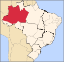
 Location of the municipality inside Amazonas | |
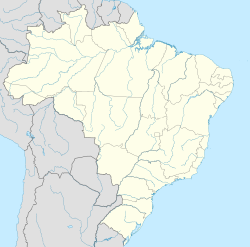  Tapauá Location in Brazil | |
| Coordinates: 5°37′40″S 63°10′58″W | |
| Country |  Brazil Brazil |
| Region | North |
| State |  Amazonas Amazonas |
| Area | |
| • Total | 89,324 km2 (34,488 sq mi) |
| Population (2020) | |
| • Total | 17,015 |
| • Density | 0.19/km2 (0.49/sq mi) |
| Time zone | UTC−4 (AMT) |
Conservation
The municipality contains the 233,864 hectares (577,890 acres) Abufari Biological Reserve, a strictly protected area.[3] It contains 30.35% of the 1,008,167 hectares (2,491,230 acres) Piagaçu-Purus Sustainable Development Reserve, established in 2003.[4] The municipality contains about 9% of the Balata-Tufari National Forest, a 1,079,670 hectares (2,667,900 acres) sustainable use conservation unit created in 2005.[5] The municipality also contains about 94% of the Nascentes do Lago Jari National Park, an 812,745 hectares (2,008,340 acres) protected area established in 2008.[6] It contains 0.33% of the 604,209 hectares (1,493,030 acres) Médio Purus Extractive Reserve, created in 2008.[7] It contains 98% of the 881,704 hectares (2,178,740 acres) Tapauá State Forest, created in 2009.[8]
References
- IBGE 2020
- IBGE -
- Unidade de Conservação: Reserva Biológica do Abufari (in Portuguese), MMA: Ministério do Meio Ambiente, retrieved 2016-04-24
- RDS Piagaçu-Purus (in Portuguese), ISA: Instituto Socioambiental, retrieved 2016-08-20
- FLONA de Balata-Tufari (in Portuguese), ISA: Instituto Socioambiental, retrieved 2016-06-03
- FLONA do Iquiri (in Portuguese), ISA: Instituto Socioambiental, retrieved 2016-06-02
- RESEX Médio Purus (in Portuguese), ISA: Instituto Socioambiental, retrieved 2016-09-03
- FES Tapauá (in Portuguese), ISA: Instituto Socioambiental, retrieved 2016-09-02
| Municipalities of Amazonas | ||||||||||||||
|---|---|---|---|---|---|---|---|---|---|---|---|---|---|---|
Capital: Manaus | ||||||||||||||
| Mesoregion Centro Amazonense |
|  | ||||||||||||
| Mesoregion Norte Amazonense |
| |||||||||||||
| Mesoregion Sudoeste Amazonense |
| |||||||||||||
| Mesoregion Sul Amazonense |
| |||||||||||||
 | This article about a location in the Brazilian state of Amazonas is a stub. You can help Wikipedia by expanding it. |
На других языках
- [en] Tapauá
[ru] Тапауа
Тапауа (порт. Tapauá) — муниципалитет в Бразилии, входит в штат Амазонас. Составная часть мезорегиона Юг штата Амазонас. Входит в экономико-статистический микрорегион Пурус. Население составляет 19 077 человека на 2010 год. Занимает площадь 84 948,86 км². Плотность населения — 0,22 чел./км².Другой контент может иметь иную лицензию. Перед использованием материалов сайта WikiSort.org внимательно изучите правила лицензирования конкретных элементов наполнения сайта.
WikiSort.org - проект по пересортировке и дополнению контента Википедии