world.wikisort.org - Brazil
Pauini is a municipality located in the Brazilian state of Amazonas.
Pauini | |
|---|---|
Municipality | |
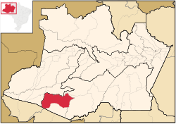 Location of the municipality inside Amazonas | |
| Coordinates: 7°42′50″S 66°58′33″W | |
| Country | |
| Region | North |
| State | |
| Area | |
| • Total | 43,263 km2 (16,704 sq mi) |
| Population (2020) | |
| • Total | 19,522 |
| • Density | 0.45/km2 (1.2/sq mi) |
| Time zone | UTC−4 (AMT) |
The population of Pauini was 19,522 in 2020.[1] Its area is 43,263 square kilometres (16,704 sq mi).[2] The municipality contains the 256,000 hectares (630,000 acres) Purus National Forest, created in 1988.[3] It holds 8% of the 311,000 hectares (770,000 acres) Mapiá-Inauini National Forest, created in 1989.[4] It also contains 8% of the 604,209 hectares (1,493,030 acres) Médio Purus Extractive Reserve, created in 2008.[5]
References
- IBGE 2020
- IBGE -
- FLONA do Purus (in Portuguese), ISA: Instituto Socioambiental, retrieved 2016-09-08
- FLONA Mapiá-Inauini (in Portuguese), ISA: Instituto Socioambiental, retrieved 2016-09-08
- RESEX Médio Purus (in Portuguese), ISA: Instituto Socioambiental, retrieved 2016-09-03
Capital: Manaus | ||||||||||||||
| Mesoregion Centro Amazonense |
|  | ||||||||||||
| Mesoregion Norte Amazonense |
| |||||||||||||
| Mesoregion Sudoeste Amazonense |
| |||||||||||||
| Mesoregion Sul Amazonense |
| |||||||||||||
This article about a location in the Brazilian state of Amazonas is a stub. You can help Wikipedia by expanding it. |
На других языках
- [en] Pauini
[ru] Пауини
Пауини (порт. Pauini) — муниципалитет в Бразилии, входит в штат Амазонас. Составная часть мезорегиона Юг штата Амазонас. Входит в экономико-статистический микрорегион Бока-ду-Акри. Население составляет 18 166 человек на 2010 год. Занимает площадь 41 620,62 км². Плотность населения — 0,44 чел./км².Текст в блоке "Читать" взят с сайта "Википедия" и доступен по лицензии Creative Commons Attribution-ShareAlike; в отдельных случаях могут действовать дополнительные условия.
Другой контент может иметь иную лицензию. Перед использованием материалов сайта WikiSort.org внимательно изучите правила лицензирования конкретных элементов наполнения сайта.
Другой контент может иметь иную лицензию. Перед использованием материалов сайта WikiSort.org внимательно изучите правила лицензирования конкретных элементов наполнения сайта.
2019-2026
WikiSort.org - проект по пересортировке и дополнению контента Википедии
WikiSort.org - проект по пересортировке и дополнению контента Википедии