world.wikisort.org - Brazil
Apuí is a municipality located in the Brazilian state of Amazonas. Its population was 22,359 (2020)[1] and its area is 54,240 km2.
Apuí | |
|---|---|
Municipality | |
 Flag  Seal | |
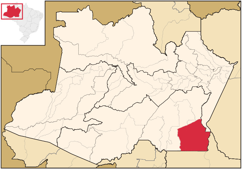 Location of the municipality inside Amazonas | |
| Coordinates: 7°11′49″S 59°53′27″W | |
| Country | |
| Region | North |
| State | |
| Population (2020) | |
| • Total | 22,359 |
| Time zone | UTC−4 (AMT) |
| Climate | Am |
Gold rush
The municipality shot to fame in December 2006, when a Brazilian maths teacher by the name of Ivani Valentim da Silva posted descriptions of miners scooping up thousands of dollars in gold in the area. In just three months, between 3,000 and 10,000 people poured into the area, cutting down trees, diverting streams and digging wildcat mines. The city was nicknamed Eldorado do Juma after the mythical El Dorado.[citation needed]
Conservation
The municipality contains 92% of the 2,467,244 hectares (6,096,690 acres) Apuí Mosaic, a jointly-managed collection of conservation units.[2] It contains the 808,312 hectares (1,997,380 acres) Sucunduri State Park, created in 2005.[3] It also contains the 492,905 hectares (1,217,990 acres) Sucunduri State Forest, a sustainable use conservation unit created in 2005.[4] It contains 72% of the 150,465 hectares (371,810 acres) Guariba Extractive Reserve, also created in 2005.[5] It also contains the 113,606 hectares (280,730 acres) Bararati Sustainable Development Reserve, created at the same time.[6]
The municipality contains part of the 1,958,200 hectares (4,839,000 acres) Juruena National Park, one of the largest conservation units in Brazil, created by decree on 5 June 2006.[7] It also contains part of the 896,411 hectares (2,215,080 acres) Acari National Park created by president Dilma Rousseff in 2016 in the last week before her provisional removal from office.[8] The municipality contains about 17% of the 751,302 hectares (1,856,510 acres) Aripuanã National Forest, a sustainable development unit created at the same time.[9]
Transportation
The city is served by Apuí Airport.
References
- IBGE 2020
- MOS do Apuí – ISA, Informações gerais.
- PES do Sucunduri – ISA.
- FES do Sucunduri – ISA.
- RESEX do Guariba – ISA, Informações gerais.
- RDS Bararati – ISA, Informações gerais.
- Unidade de Conservação: Parque Nacional do Juruena.
- PARNA do Acari – ISA.
- FLONA do Aripuanã – ISA.
Sources
- FES do Sucunduri (in Portuguese), ISA: Instituto Socioambiental, retrieved 2016-07-11
- FLONA do Aripuanã (in Portuguese), ISA: Instituto Socioambiental, retrieved 2016-06-15
- MOS do Apuí (in Portuguese), ISA: Instituto Socioambiental, retrieved 2016-07-13
- PARNA do Acari (in Portuguese), ISA: Instituto Socioambiental, retrieved 2016-06-12
- PES do Sucunduri (in Portuguese), ISA: Instituto Socioambiental, retrieved 2016-07-10
- RDS Bararati (in Portuguese), ISA: Instituto Socioambiental, retrieved 2016-10-13
- RESEX do Guariba (in Portuguese), ISA: Instituto Socioambiental, retrieved 2016-07-24
- Unidade de Conservação: Parque Nacional do Juruena (in Portuguese), MMA: Ministério do Meio Ambiente, retrieved 2016-05-23
Capital: Manaus | ||||||||||||||
| Mesoregion Centro Amazonense |
|  | ||||||||||||
| Mesoregion Norte Amazonense |
| |||||||||||||
| Mesoregion Sudoeste Amazonense |
| |||||||||||||
| Mesoregion Sul Amazonense |
| |||||||||||||
This article about a location in the Brazilian state of Amazonas is a stub. You can help Wikipedia by expanding it. |
На других языках
[de] Apuí
Apuí, amtlich Município de Apuí, ist eine brasilianische Gemeinde im Südosten des Bundesstaats Amazonas mit zum 1. Juli 2021 geschätzten 22.739 Einwohnern.[3]- [en] Apuí
[ru] Апуи
Апуи (порт. Apuí) — муниципалитет в Бразилии, входит в штат Амазонас. Составная часть мезорегиона Юг штата Амазонас. Входит в экономико-статистический микрорегион Мадейра. Население составляет 18 007 человек на 2010 год. Занимает площадь 54 246,66 км². Плотность населения — 0,33 чел./км².Другой контент может иметь иную лицензию. Перед использованием материалов сайта WikiSort.org внимательно изучите правила лицензирования конкретных элементов наполнения сайта.
WikiSort.org - проект по пересортировке и дополнению контента Википедии