world.wikisort.org - Australia
City of Wagga Wagga is a local government area in the Riverina region of southern New South Wales, Australia.
| Wagga Wagga New South Wales | |||||||||||||||
|---|---|---|---|---|---|---|---|---|---|---|---|---|---|---|---|
 | |||||||||||||||
| Coordinates | 35°08′S 147°22′E | ||||||||||||||
| Population | |||||||||||||||
| • Density | 12.92712/km2 (33.4811/sq mi) | ||||||||||||||
| Established | 15 March 1870 (Borough)[3] 17 April 1946 (City)[4] | ||||||||||||||
| Area | 4,825.9 km2 (1,863.3 sq mi)[5] | ||||||||||||||
| Mayor | Dallas Tout[6] | ||||||||||||||
| Council seat | Wagga Wagga[7] | ||||||||||||||
| Region | Riverina | ||||||||||||||
| State electorate(s) | Wagga Wagga | ||||||||||||||
| Federal division(s) | Riverina | ||||||||||||||
| Website | Wagga Wagga | ||||||||||||||
| |||||||||||||||
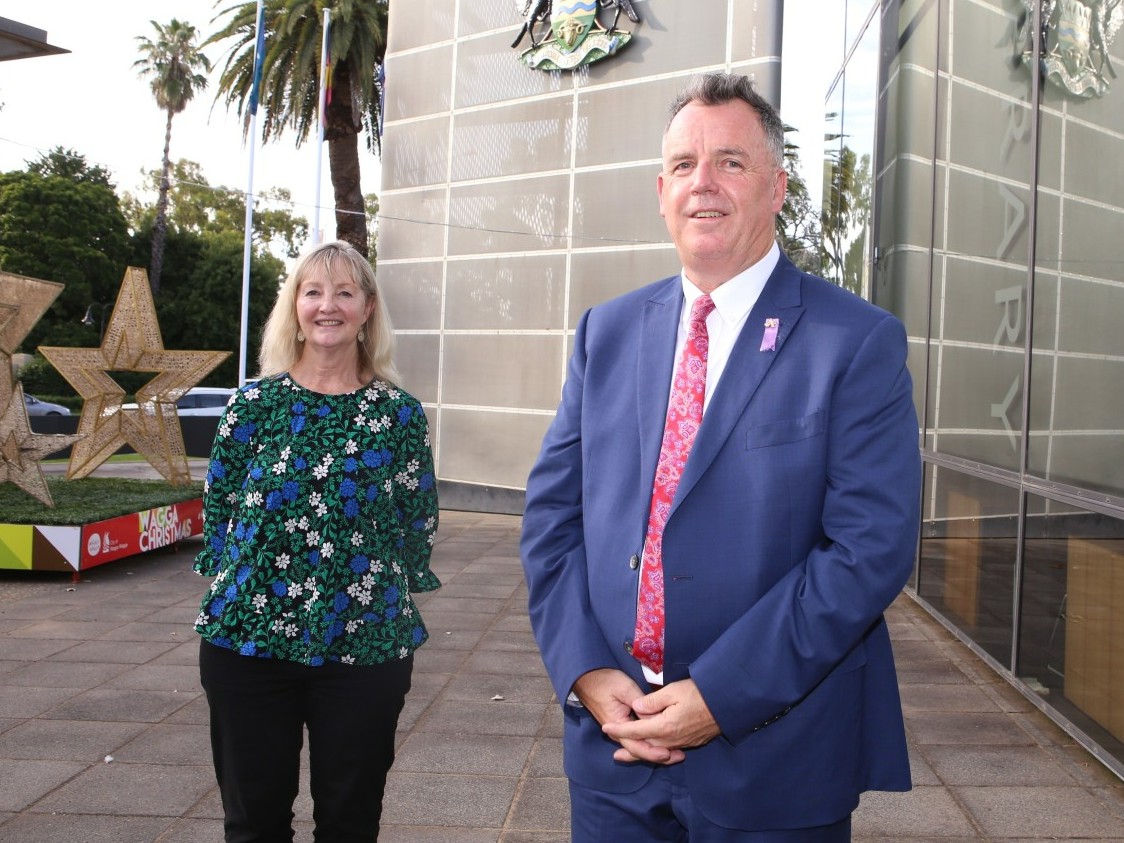
The Mayor of the City of Wagga Wagga is Cr. Dallas Tout, an independent politician.[6]
City, town and localities
The City of Wagga Wagga includes the suburbs of
- Ashmont
- Bomen
- Bourkelands
- Boorooma
- Cartwrights Hill
- East Wagga Wagga
- Estella
- Forest Hill
- Glenfield Park
- Gumly Gumly
- Kapooka
- Kooringal
- Lake Albert
- Lloyd
- Mount Austin
- North Wagga Wagga
- San Isidore
- Tatton
- Tolland
- Turvey Park
- Wagga Wagga
as well as the villages of
- Tarcutta
- Ladysmith
- Mangoplah
- Uranquinty
- Collingullie
- Oura
- Humula
- Currawarna
- Galore
History
Wagga Wagga was first incorporated as the Borough of Wagga Wagga on 15 March 1870.[8] It received city status and became the City of Wagga Wagga on 17 April 1946. The municipality enlarged substantially on 1 January 1981 when the adjoining Shire of Kyeamba and Shire of Mitchell were amalgamated into the City.[9]
Heritage listings
The City of Wagga Wagga has a number of heritage-listed sites, including:
- Bomen, Main Southern railway: Bomen railway station[10]
- Tarcutta, Tarcutta Street: Hambledon Homestead[11]
- Wagga Wagga, Botanic Gardens Site (BGS), Baden Powell Drive: Mobile Cook's Galley, Museum of the Riverina[12]
- Wagga Wagga, Main Southern railway: Wagga Wagga railway station[13]
Demographics
At the 2021 census, there were 69,047 people in the City of Wagga Wagga local government area, of these 48.9 per cent were male and 51.1 per cent were female. Aboriginal and Torres Strait Islander people made up 5.6 per cent of the population, which was twice the national and average of 2.9 per cent. The median age of people in the City of Wagga Wagga was 35 years, which was lower than the national median of 38 years. Children aged 0 – 14 years made up 20.3 per cent of the population and people aged 65 years and over made up 15.2 per cent of the population. Of people in the area aged 15 years and over, 46.6 per cent were married and 11.4 per cent were either divorced or separated.[1]
Population growth in the Tamworth Regional Council between the 2011 census and the 2016 census was 4.92 per cent. When compared with total population growth of Australia for the same period, being 8.8 per cent, population growth in the City of Wagga Wagga local government area was around half of the national average.[1] The median weekly income of $1,354 within the City of Wagga Wagga local government area was slightly lower than the national average of $1,438.[1]
At the 2016 census, the proportion of residents in the Tamworth Regional local government area who stated their ancestry as Australian or Anglo-Saxon exceeded 80 per cent of all residents (national average was around 60 per cent). Approximately two-thirds (67%) of all residents in the City of Wagga Wagga nominated a religious affiliation with Christianity at the 2016 census, which was higher than the national average of approximately 60 per cent. Meanwhile, as at the census date, compared to the national average, households in the City of Wagga Wagga local government area had a significantly lower than average proportion (7.6 per cent) where two or more languages are spoken (national average was 26.4 per cent); and a significantly higher proportion (87.8 per cent) where English only was spoken at home (national average was 68.5 per cent).[1]
| Selected historical census data for the City of Wagga Wagga local government area | ||||||
|---|---|---|---|---|---|---|
| Census year | 2001 | 2006[14] | 2011[15] | 2016[1] | ||
| Population | Estimated residents on Census night | 54,845 | 57,015 | |||
| LGA rank in terms of size within New South Wales | 39th | |||||
| % of New South Wales population | 0.87% | |||||
| % of Australian population | 0.29% | |||||
| Cultural and language diversity | ||||||
| Ancestry, top responses | Australian | 34.3% | ||||
| English | 29.2% | |||||
| Irish | 10.4% | |||||
| Scottish | 7.6% | |||||
| German | 4.1% | |||||
| Language, top responses (other than English) | Malayalam | 0.6% | ||||
| Arabic | ||||||
| Mandarin | 0.4% | |||||
| Filipino | 0.3% | |||||
| Tagalog | 0.3% | |||||
| Religious affiliation | ||||||
| Religious affiliation, top responses | Catholic | 33.2% | ||||
| No Religion | 15.0% | |||||
| Anglican | 23.9% | |||||
| Presbyterian and Reformed | 6.2% | |||||
| Uniting Church | 6.3% | 5.5% | ||||
| Median weekly incomes | ||||||
| Personal income | Median weekly personal income | A$586 | A$696 | |||
| % of Australian median income | ||||||
| Family income | Median weekly family income | A$1,418 | A$1,682 | |||
| % of Australian median income | ||||||
| Household income | Median weekly household income | A$1,149 | A$1,354 | |||
| % of Australian median income | ||||||
Council
Current composition and election method
Wagga Wagga City Council (WWCC) is composed of nine Councillors elected proportionally as a single ward. All Councillors are elected for a fixed four-year term of office. The Mayor is elected by the Councillors at the first meeting of the Council. The most recent election was held on 25 October 2021, and the makeup of the Council is as follows:[16]
| Party | Councillors | |
|---|---|---|
| Independents and Unaligned | 6 | |
| Labor Party | 2 | |
| The Greens | 1 | |
| Total | 9 | |
The current Council, elected in 2021, is:[16]
| Councillor | Party | Notes | |
|---|---|---|---|
| Dallas Tout | Independent | Mayor[17] | |
| Jenny McKinnon | The Greens | Deputy Mayor | |
| Dan Hayes | Labor | ||
| Amelia Parkins | Labor | ||
| Richard Foley | Independent | ||
| Tim Koschel | Independent | ||
| Michael Henderson | Independent | ||
| Rod Kendall | Independent | ||
| Georgie Davis | Independent | ||
A referendum was held on 8 September 2012 and an absolute majority of voters resolved in favour to reduce the number of Councillors from eleven to nine.[18] The change came into effect at the September 2016 elections.
Administration staff
In December 2009, Wagga Wagga City Council announced that it had appointed Phil Pinyon as the General Manager of the Wagga Wagga City Council replacing Lyn Russell, who suddenly announced her resignation in October 2009, after completing 18 months of her five-year contract.[19][20][21]
Symbols and emblems
The floral emblem for the city is the Silver Banksia.[22]
Gallery
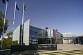 Wagga Wagga Civic Centre
 Wagga Wagga Coat of Arms
 City Council Mayoral gong. Stolen 2 January 2009, remains unfound


See also
- Riverina Water County Council
References
- Australian Bureau of Statistics (27 June 2017). "Wagga Wagga (C) (Local Government Area)". 2016 Census QuickStats. Retrieved 27 June 2017.
- "3218.0 – Regional Population Growth, Australia, 2017-18". Australian Bureau of Statistics. 27 March 2019. Retrieved 27 March 2019. Estimated resident population (ERP) at 30 June 2018.
- "Government Gazette Proclamations and Legislation". New South Wales Government Gazette. No. 60. New South Wales, Australia. 15 March 1870. p. 642. Retrieved 9 September 2018 – via National Library of Australia.
- "LOCAL GOVERNMENT ACT, 1919.—PROCLAMATION". Government Gazette of the State of New South Wales. No. 43. New South Wales, Australia. 26 April 1946. p. 997. Retrieved 9 September 2018 – via National Library of Australia.
- "3218.0 – Regional Population Growth, Australia, 2012". Australian Bureau of Statistics. 30 August 2013. Retrieved 27 March 2014. Estimated resident population (ERP) at 30 June 2012.
- "Wagga City Council: Dallas Tout elected mayor, Jenny McKinnon elected deputy mayor at first meeting". The Daily Advertiser. 10 January 2022. Retrieved 10 January 2022.
- "Wagga Wagga City Council". Department of Local Government. Archived from the original on 7 September 2006. Retrieved 30 November 2006.
- "Government Gazette Proclamations and Legislation". New South Wales Government Gazette. No. 60. New South Wales, Australia. 15 March 1870. p. 641. Retrieved 9 September 2018 – via National Library of Australia.
- "Municipality of Wagga Wagga, New South Wales". Museum Victoria. Retrieved 9 September 2018.
- "Bomen Railway Station". New South Wales State Heritage Register. Department of Planning and Environment. H01093. Retrieved 18 May 2018.
 Text is licensed by State of New South Wales (Department of Planning and Environment) under CC-BY 4.0 licence.
 - "Hambledon Homestead". New South Wales State Heritage Register. Department of Planning and Environment. H00351. Retrieved 18 May 2018. Text is licensed by State of New South Wales (Department of Planning and Environment) under CC-BY 4.0 licence.
- "Mobile Cook's Galley, Museum of the Riverina". New South Wales State Heritage Register. Department of Planning and Environment. H01722. Retrieved 18 May 2018. Text is licensed by State of New South Wales (Department of Planning and Environment) under CC-BY 4.0 licence.
- "Wagga Wagga Railway Station and yard group". New South Wales State Heritage Register. Department of Planning and Environment. H01279. Retrieved 18 May 2018. Text is licensed by State of New South Wales (Department of Planning and Environment) under CC-BY 4.0 licence.
- Australian Bureau of Statistics (25 October 2007). "Wagga Wagga (C)". 2006 Census QuickStats. Retrieved 24 November 2017.
- Australian Bureau of Statistics (31 October 2012). "Wagga Wagga (C)". 2011 Census QuickStats. Retrieved 24 November 2017.
- "City of Wagga Wagga Councillor Election". Electoral Commission of New South Wales. 21 December 2021. Retrieved 3 August 2022.
- "Councillors". City of Wagga Wagga. Retrieved 3 August 2022.
- "Wagga Wagga City Council – Referendum". Local Government Elections 2012. Electoral Commission of New South Wales. 14 September 2012. Retrieved 1 October 2012.
- "Wagga council GM quits". ABC News. Australia. 5 October 2009. Retrieved 3 October 2012.
- "New Wagga council GM looks to the future". ABC Riverina NSW. Australia. 4 April 2008. Retrieved 8 April 2008.
- "New CEO gets straight to it". The Daily Advertiser. 1 April 2008. Retrieved 8 April 2008.[permanent dead link]
- "Water Wise and Salt Tolerant Plants" (PDF). Wagga Wagga City Council. Archived from the original (PDF) on 1 October 2009. Retrieved 8 April 2008.
External links
 Media related to City of Wagga Wagga at Wikimedia Commons
- Wagga Wagga City Council website
На других языках
[de] Wagga Wagga City
-35.116666666667147.36666666667 Die City of Wagga Wagga ist ein lokales Verwaltungsgebiet (LGA) im australischen Bundesstaat New South Wales. Das Gebiet ist 4824,5 km² groß und hat etwa 62.000 Einwohner.[1]- [en] City of Wagga Wagga
[it] Città di Wagga Wagga
La città di Wagga Wagga è una Local Government Area che si trova nel Nuovo Galles del Sud. Essa si estende su una superficie di 4.823,92 chilometri quadrati e ha una popolazione di 59.458 abitanti[1]. La sede del consiglio si trova a Wagga Wagga.Другой контент может иметь иную лицензию. Перед использованием материалов сайта WikiSort.org внимательно изучите правила лицензирования конкретных элементов наполнения сайта.
WikiSort.org - проект по пересортировке и дополнению контента Википедии