world.wikisort.org - Australia
Gilgandra Shire is a local government area in the Orana region of New South Wales, Australia. The Shire is located adjacent to the junction of the Newell, Oxley and Castlereagh highways and can be reached in about six hours by car from Sydney CBD. The Shire lies on the Castlereagh River and includes part of the Warrumbungles National Park. The shire was constituted in 1906.
| Gilgandra Shire New South Wales | |||||||||||||||
|---|---|---|---|---|---|---|---|---|---|---|---|---|---|---|---|
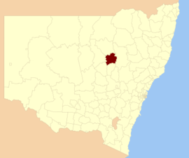 Location in New South Wales | |||||||||||||||
| Coordinates | 31°42′S 148°41′E | ||||||||||||||
| Population | |||||||||||||||
| • Density | 0.87593/km2 (2.2686/sq mi) | ||||||||||||||
| Established | 1906 | ||||||||||||||
| Area | 4,836 km2 (1,867.2 sq mi) | ||||||||||||||
| Mayor | Doug Batten (Independent) | ||||||||||||||
| Council seat | Gilgandra | ||||||||||||||
| Region | Orana | ||||||||||||||
| State electorate(s) | Barwon | ||||||||||||||
| Federal division(s) | Parkes | ||||||||||||||
| Website | Gilgandra Shire | ||||||||||||||
| |||||||||||||||
The Mayor of Gilgandra Shire Council is Cr. Doug Batten, an independent politician.
Settlements and geography
Gilgandra Shire includes Gilgandra, Balladoran and Curban.
The geography of the Gilgandra Shire is very flat. The soil is composed mostly of sand, making it very porous and difficult to grow certain plants. The weather is hot and dry, reaching 40 °C (104 °F) for consecutive days during summer.[citation needed]
Demographics
This section needs expansion with: 2016 census data. You can help by adding to it. (July 2017) |
| Selected historical census data for Gilgandra Shire local government area | ||||||
|---|---|---|---|---|---|---|
| Census year | 2011[3] | 2016[1] | ||||
| Population | Estimated residents on census night | 4,386 | ||||
| LGA rank in terms of size within New South Wales | 115th | |||||
| % of New South Wales population | ||||||
| % of Australian population | ||||||
| Cultural and language diversity | ||||||
| Ancestry, top responses | English | |||||
| Australian | ||||||
| Italian | ||||||
| Chinese | ||||||
| Irish | ||||||
| Language, top responses (other than English) | Italian | |||||
| Mandarin | ||||||
| Cantonese | ||||||
| Korean | ||||||
| Greek | ||||||
| Religious affiliation | ||||||
| Religious affiliation, top responses | Catholic | |||||
| No religion | ||||||
| Anglican | ||||||
| Eastern Orthodox | ||||||
| Buddhism | ||||||
| Median weekly incomes | ||||||
| Personal income | Median weekly personal income | A$ | ||||
| % of Australian median income | ||||||
| Family income | Median weekly family income | |||||
| % of Australian median income | ||||||
| Household income | Median weekly household income | |||||
| % of Australian median income | ||||||
Heritage listings
Gilgandra Shire has a number of heritage-listed sites, including:
- East Coonamble Road, Curban: Corduroy Road Ruin Historic Site[4]
- Myrtle Street, Gilgandra: St Ambrose Church[5]
Council
Current composition and election method
Gilgandra Shire Council is composed of nine councillors elected proportionally as a single ward. All councillors are elected for a fixed four-year term of office. The mayor is elected by the councillors at the first meeting of the council. The most recent election was held on 10 September 2016, and the makeup of the council is as follows:[6]
| Party | Councillors | |
|---|---|---|
| Independents | 9 | |
| Total | 9 | |
The current Council, elected in 2016, in order of election, is:[6]
| Councillor | Party | Notes | |
|---|---|---|---|
| Doug Batten | Independent | Mayor[7] | |
| Gregory Peart | Independent | ||
| Brian Mockler | Unaligned | ||
| Ash Walker | Independent | Deputy Mayor[7] | |
| Noel Wrigley | Independent | ||
| Deidrie Naden | Independent | ||
| Noel Mudford | Independent | ||
| Gina Johnson | Independent | ||
| Susan Baker | Independent | ||
References
- Australian Bureau of Statistics (27 June 2017). "Gilgandra (A)". 2016 Census QuickStats. Retrieved 7 July 2017.
- "3218.0 – Regional Population Growth, Australia, 2017-18". Australian Bureau of Statistics. 27 March 2019. Archived from the original on 27 March 2019. Retrieved 27 March 2019. Estimated resident population (ERP) at 30 June 2018.
- Australian Bureau of Statistics (31 October 2012). "Gilgandra (A)". 2011 Census QuickStats. Retrieved 24 October 2012.
- "Corduroy Road Ruin Historic Site". New South Wales State Heritage Register. Office of Environment & Heritage. H02015. Retrieved 18 February 2020.
- "St. Ambrose Church". New South Wales State Heritage Register. Office of Environment & Heritage. H01853. Retrieved 18 May 2018.
- "Gilgandra Shire Council: Summary of First Preference Votes for each Candidate". Local Government Elections 2016. Electoral Commission of New South Wales. 17 September 2016. Archived from the original on 6 November 2016. Retrieved 6 November 2016.
- "Councillors". Your Council. Gilgandra Shire Council. Archived from the original on 6 November 2016. Retrieved 6 November 2016.
This Central West geography article is a stub. You can help Wikipedia by expanding it. |
Другой контент может иметь иную лицензию. Перед использованием материалов сайта WikiSort.org внимательно изучите правила лицензирования конкретных элементов наполнения сайта.
WikiSort.org - проект по пересортировке и дополнению контента Википедии