world.wikisort.org - Australia
The Warrumbungle Shire is a local government area in the central western region of New South Wales, Australia. The Shire is traversed by the Newell Highway. The Warrumbungle mountain range and Warrumbungles National Park are major tourist attractions for the Shire. Its capital is Coonabarabran, a city in the southwest.
| Warrumbungle Shire New South Wales | |||||||||||||||
|---|---|---|---|---|---|---|---|---|---|---|---|---|---|---|---|
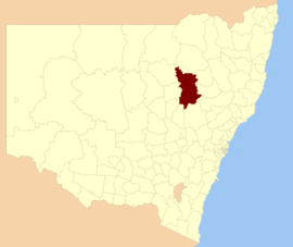 Location in New South Wales | |||||||||||||||
| Coordinates | 31°15′S 149°16′E | ||||||||||||||
| Population | |||||||||||||||
| • Density | 0.7580/km2 (1.9632/sq mi) | ||||||||||||||
| Established | 2004 | ||||||||||||||
| Area | 12,380 km2 (4,779.9 sq mi) | ||||||||||||||
| Mayor | Denis Todd (Unaligned) | ||||||||||||||
| Council seat | Coonabarabran[3] | ||||||||||||||
| Region | Orana | ||||||||||||||
| State electorate(s) |
| ||||||||||||||
| Federal division(s) | Parkes | ||||||||||||||
| Website | Warrumbungle Shire | ||||||||||||||
| |||||||||||||||
The mayor of Warrumbungle Shire Council is Cr. Denis Todd, who is unaligned with any political party.
Main towns and villages
The Shire incorporates the towns of Binnaway, Coolah, Coonabarabran, Dunedoo, Baradine and Mendooran.
Heritage listings
The Warrumbungle Shire has a number of heritage-listed sites, including:
- Coolah, 74 Binnia Street: Old Police Station and Courthouse[4]
- Coonabarabran, Oxley Highway: Burra Bee Dee Mission[5]
- Dunedoo, Wallerawang-Gwabegar railway: Dunedoo railway station[6]
- Kenebri, Old Wooleybah Road: Wooleybah Sawmill and Settlement[7]
Demographics
This section needs expansion with: 2016 census data. You can help by adding to it. (July 2017) |
| Selected historical census data for Warrumbungle Shire local government area | ||||||
|---|---|---|---|---|---|---|
| Census year | 2011[8] | 2016[1] | ||||
| Population | Estimated residents on census night | 9,588 | ||||
| LGA rank in terms of size within New South Wales | 93rd | |||||
| % of New South Wales population | ||||||
| % of Australian population | ||||||
| Cultural and language diversity | ||||||
| Ancestry, top responses | English | |||||
| Australian | ||||||
| Italian | ||||||
| Chinese | ||||||
| Irish | ||||||
| Language, top responses (other than English) | Italian | |||||
| Mandarin | ||||||
| Cantonese | ||||||
| Korean | ||||||
| Greek | ||||||
| Religious affiliation | ||||||
| Religious affiliation, top responses | Catholic | |||||
| No religion | ||||||
| Anglican | ||||||
| Eastern Orthodox | ||||||
| Buddhism | ||||||
| Median weekly incomes | ||||||
| Personal income | Median weekly personal income | A$ | ||||
| % of Australian median income | ||||||
| Family income | Median weekly family income | |||||
| % of Australian median income | ||||||
| Household income | Median weekly household income | |||||
| % of Australian median income | ||||||
Council
The Shire was created in 2004 by the amalgamation of Coolah and Coonabarabran Shire councils. Following amalgamation, the Shire was run by an administrator, until elections were held in March 2005.
Current composition and election method
Warrumbungle Shire Council is composed of nine councillors elected proportionally as a single ward. All councillors are elected for a fixed four-year term of office. The most recent election was held on 10 September 2016, and the makeup of the council is as follows:[9]
| Party | Councillors | |
|---|---|---|
| Independents and Unaligned | 9 | |
| Total | 9 | |
The current Council, elected in 2016, alphabetically, is:[9]
| Councillor | Party | Notes | |
|---|---|---|---|
| Kodi Brady | Independent | ||
| Anne-Louise Capel | Independent | ||
| Fred Clancy | Independent | ||
| Ambrose Doolan | Unaligned | ||
| Wendy Hill | Unaligned | ||
| Aniello Iannuzzi | Unaligned | ||
| Ray Lewis | Unaligned | ||
| Peter Shinton | Unaligned | ||
| Denis Todd | Unaligned | ||
The mayor is elected by the councillors every two years. At the last mayoral election held 20 September 2018, Cr Todd was elected as mayor and Cr Iannuzzi elected as deputy mayor.
See also
- List of local government areas in New South Wales
References
- Australian Bureau of Statistics (27 June 2017). "Warrumbungle Shire (A)". 2016 Census QuickStats. Retrieved 7 July 2017.
- "3218.0 – Regional Population Growth, Australia, 2017-18". Australian Bureau of Statistics. 27 March 2019. Retrieved 27 March 2019. Estimated resident population (ERP) at 30 June 2018.
- "Warrumbungle Shire Council". Division of Local Government. Retrieved 2 December 2006.
- "Old Police Station & Courthouse". New South Wales State Heritage Register. Office of Environment & Heritage. H00048. Retrieved 18 May 2018.
- "Burra Bee Dee Mission". New South Wales State Heritage Register. Office of Environment & Heritage. H01688. Retrieved 18 May 2018.
- "Dunedoo Railway Station and yard group". New South Wales State Heritage Register. Office of Environment & Heritage. H01134. Retrieved 18 May 2018.
- "Wooleybah Sawmill and Settlement". New South Wales State Heritage Register. Office of Environment & Heritage. H01846. Retrieved 18 May 2018.
- Australian Bureau of Statistics (31 October 2012). "Warrumbungle Shire (A)". 2011 Census QuickStats. Retrieved 25 October 2012.
- "Warrumbungle Shire Council: Summary of First Preference Votes for each Candidate". Local Government Elections 2016. Electoral Commission of New South Wales. 19 September 2016. Retrieved 20 September 2016.
| Authority control |
|
|---|
Другой контент может иметь иную лицензию. Перед использованием материалов сайта WikiSort.org внимательно изучите правила лицензирования конкретных элементов наполнения сайта.
WikiSort.org - проект по пересортировке и дополнению контента Википедии