world.wikisort.org - Australia
Parkes Shire is a local government area in the Central West region of New South Wales, Australia. The Shire is located adjacent to the Broken Hill railway line and the Newell Highway.
| Parkes Shire New South Wales | |||||||||||||||
|---|---|---|---|---|---|---|---|---|---|---|---|---|---|---|---|
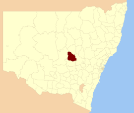 Location in New South Wales | |||||||||||||||
| Coordinates | 33°08′S 148°10′E | ||||||||||||||
| Population | |||||||||||||||
| • Density | 2.45183/km2 (6.3502/sq mi) | ||||||||||||||
| Established | 1981 | ||||||||||||||
| Area | 5,958 km2 (2,300.4 sq mi) | ||||||||||||||
| Mayor | Ken Keith (Unaligned) | ||||||||||||||
| Council seat | Parkes[3] | ||||||||||||||
| Region | Central West | ||||||||||||||
| State electorate(s) | Orange | ||||||||||||||
| Federal division(s) | Calare | ||||||||||||||
| Website | Parkes Shire | ||||||||||||||
| |||||||||||||||
The area under administration includes the town of Parkes and the surrounding region of 5,919 square kilometres (2,285 sq mi), with a population of approximately 14,592 as of 2011. The Shire includes the towns of Peak Hill, Alectown, Bogan Gate, Trundle and Tullamore.
The Mayor of Parkes Shire Council is Cr. Ken Keith, who is unaligned with any political party.
Heritage listings
Parkes has a number of heritage-listed sites, including:
- 39 Currajong Street: Parkes Post Office[4]
- May Street: Parkes railway station[5]
Council
Current composition and election method
Parkes Shire Council is composed of ten councillors elected proportionally as a single ward. All councillors are elected for a fixed four-year term of office. The mayor is elected by the councillors at the first meeting of the council. The most recent election was held on 10 September 2016, and the makeup of the council is as follows:[6]
| Party | Councillors | |
|---|---|---|
| Independents and Unaligned | 10 | |
| Total | 10 | |
The current Council, elected in 2016, in order of election, is:[6]
| Councillor | Party | Notes | |
|---|---|---|---|
| Ken Keith OAM | Unaligned | Mayor[7] | |
| Louise O'Leary | Independent | ||
| Neil Westcott | Independent | ||
| Kenny McGrath | Independent | ||
| Wally Biles | Unaligned | ||
| Barbara Newton | Unaligned | Deputy Mayor[7] | |
| George Pratt | Unaligned | ||
| Bill Jayet | Unaligned | ||
| Alan Ward | Unaligned | ||
| Patricia Smith | Unaligned | ||
References
- Australian Bureau of Statistics (27 June 2017). "Parkes (A)". 2016 Census QuickStats. Retrieved 27 November 2017.
- "3218.0 – Regional Population Growth, Australia, 2017-18". Australian Bureau of Statistics. 27 March 2019. Retrieved 27 March 2019. Estimated resident population (ERP) at 30 June 2018.
- "Parkes Shire Council". Division of Local Government. Retrieved 28 November 2006.
- "Parkes Post Office". New South Wales State Heritage Register. Office of Environment & Heritage. H00717. Retrieved 18 May 2018.
- "Parkes Railway Station group". New South Wales State Heritage Register. Office of Environment & Heritage. H01220. Retrieved 18 May 2018.
- "Parkes Shire Council: Summary of First Preference and Group Votes for each Candidate". Local Government Elections 2016. Electoral Commission of New South Wales. 17 September 2016. Retrieved 6 November 2016.
- "Councillors". Parkes Shire Council. Retrieved 6 November 2016.
External links
![]() Media related to Parkes Shire at Wikimedia Commons
Media related to Parkes Shire at Wikimedia Commons
| Authority control |
|
|---|
This Central West geography article is a stub. You can help Wikipedia by expanding it. |
Другой контент может иметь иную лицензию. Перед использованием материалов сайта WikiSort.org внимательно изучите правила лицензирования конкретных элементов наполнения сайта.
WikiSort.org - проект по пересортировке и дополнению контента Википедии