world.wikisort.org - Australia
Downside is a farming community in the central east part of the Riverina and situated about 15 kilometres north west from Wagga Wagga and 24 kilometres south east from Coolamon.[2]
| Downside New South Wales | |
|---|---|
 Downside Village Road in Downside | |
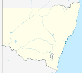  Downside | |
| Coordinates | 34°58′35″S 147°20′39″E |
| Population | 124 (2016 census)[1] |
| Postcode(s) | 2650 |
| Elevation | 279 m (915 ft) |
| Location |
|
| LGA(s) | City of Wagga Wagga |
| County | Clarendon |
| State electorate(s) | Wagga Wagga |
Downside Post Office opened on 15 August 1878 and closed in 1905.[3]

Notes and references
- Australian Bureau of Statistics (27 June 2017). "Downside (State Suburb)". 2016 Census QuickStats. Retrieved 27 June 2017.
- "Downside". Geographical Names Register (GNR) of NSW. Geographical Names Board of New South Wales. Retrieved 4 August 2013.
- Premier Postal History. "Post Office List". Retrieved 11 June 2009.


Wikimedia Commons has media related to Downside, New South Wales.
Текст в блоке "Читать" взят с сайта "Википедия" и доступен по лицензии Creative Commons Attribution-ShareAlike; в отдельных случаях могут действовать дополнительные условия.
Другой контент может иметь иную лицензию. Перед использованием материалов сайта WikiSort.org внимательно изучите правила лицензирования конкретных элементов наполнения сайта.
Другой контент может иметь иную лицензию. Перед использованием материалов сайта WikiSort.org внимательно изучите правила лицензирования конкретных элементов наполнения сайта.
2019-2026
WikiSort.org - проект по пересортировке и дополнению контента Википедии
WikiSort.org - проект по пересортировке и дополнению контента Википедии