world.wikisort.org - Vietnam
Cam Ranh (![]() listen) is a city in southern Khánh Hòa Province, in the South Central Coast region of Vietnam.
listen) is a city in southern Khánh Hòa Province, in the South Central Coast region of Vietnam.
Cam Ranh
Thành phố Cam Ranh | |
|---|---|
City (Class-3) | |
| Cam Ranh City | |
 A resort in Cam Ranh | |
 | |
 Cam Ranh Location of in Vietnam | |
| Coordinates: 11°54′49″N 109°8′13″E | |
| Country | |
| Province | Khánh Hòa |
| Capital | Cam Ranh |
| Area | |
| • Total | 316 km2 (122 sq mi) |
| Population (2003) | |
| • Total | 121,050 |
| Time zone | UTC+7 (Indochina Time) |
| Climate | Aw |
| Website | https://camranh.khanhhoa.gov.vn/english |
Geography
It is the second-largest city in the province, after Nha Trang. It is located on Cam Ranh Bay. As of 2009 the city had a population of 121,050[1] and covered an area of 316 km².[2]
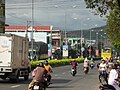 Street in Cam Ranh
 Post office


Infrastructure
- Cam Ranh International Airport
- Ba Ngòi Port
Climate
Cam Ranh has a tropical savanna climate (Köppen climate classification: As).[3][4]
| Climate data for Cam Ranh | |||||||||||||
|---|---|---|---|---|---|---|---|---|---|---|---|---|---|
| Month | Jan | Feb | Mar | Apr | May | Jun | Jul | Aug | Sep | Oct | Nov | Dec | Year |
| Record high °C (°F) | 31.5 (88.7) |
33.0 (91.4) |
33.9 (93.0) |
37.1 (98.8) |
38.1 (100.6) |
37.7 (99.9) |
37.4 (99.3) |
39.0 (102.2) |
37.3 (99.1) |
33.4 (92.1) |
32.4 (90.3) |
32.0 (89.6) |
39.0 (102.2) |
| Average high °C (°F) | 28.1 (82.6) |
29.4 (84.9) |
30.9 (87.6) |
32.2 (90.0) |
33.1 (91.6) |
33.2 (91.8) |
33.1 (91.6) |
33.3 (91.9) |
31.9 (89.4) |
30.1 (86.2) |
28.6 (83.5) |
27.5 (81.5) |
31.0 (87.8) |
| Daily mean °C (°F) | 24.3 (75.7) |
24.9 (76.8) |
26.4 (79.5) |
27.9 (82.2) |
28.8 (83.8) |
28.9 (84.0) |
28.7 (83.7) |
28.6 (83.5) |
27.7 (81.9) |
26.6 (79.9) |
25.7 (78.3) |
24.5 (76.1) |
26.9 (80.4) |
| Average low °C (°F) | 21.7 (71.1) |
22.0 (71.6) |
23.1 (73.6) |
24.7 (76.5) |
25.5 (77.9) |
25.6 (78.1) |
25.3 (77.5) |
25.4 (77.7) |
24.6 (76.3) |
23.9 (75.0) |
23.3 (73.9) |
22.3 (72.1) |
24.0 (75.2) |
| Record low °C (°F) | 14.4 (57.9) |
16.4 (61.5) |
17.1 (62.8) |
19.9 (67.8) |
21.5 (70.7) |
21.1 (70.0) |
21.3 (70.3) |
21.0 (69.8) |
21.6 (70.9) |
19.3 (66.7) |
18.7 (65.7) |
15.7 (60.3) |
14.4 (57.9) |
| Average precipitation mm (inches) | 23 (0.9) |
6 (0.2) |
32 (1.3) |
29 (1.1) |
81 (3.2) |
62 (2.4) |
49 (1.9) |
50 (2.0) |
152 (6.0) |
305 (12.0) |
315 (12.4) |
140 (5.5) |
1,243 (48.9) |
| Average precipitation days | 4.7 | 2.5 | 1.9 | 3.4 | 8.2 | 8.0 | 7.7 | 8.7 | 13.7 | 15.4 | 14.2 | 10.8 | 99.2 |
| Average relative humidity (%) | 75.5 | 76.0 | 76.3 | 76.9 | 76.3 | 74.4 | 74.0 | 74.3 | 79.7 | 81.6 | 79.5 | 76.3 | 76.7 |
| Mean monthly sunshine hours | 227 | 238 | 286 | 266 | 255 | 217 | 234 | 224 | 200 | 182 | 167 | 175 | 2,672 |
| Source: Vietnam Institute for Building Science and Technology[5] | |||||||||||||
References
- "Archived copy" (PDF). Archived from the original (PDF) on 2011-07-22. Retrieved 2011-05-21.
{{cite web}}: CS1 maint: archived copy as title (link) - "Districts of Vietnam". Statoids. Retrieved March 20, 2009.
- Kottek, Markus; Grieser, Jürgen; Beck, Christoph; Rudolf, Bruno; Rubel, Franz (2006). "World Map of the Köppen-Geiger climate classification updated" (PDF). Meteorologische Zeitschrift. 15 (3): 259–263. Bibcode:2006MetZe..15..259K. doi:10.1127/0941-2948/2006/0130.
- Peel, M. C.; Finlayson B. L. & McMahon, T. A. (2007). "Updated world map of the Köppen–Geiger climate classification" (PDF). Hydrol. Earth Syst. Sci. 11 (5): 1633–1644. Bibcode:2007HESS...11.1633P. doi:10.5194/hess-11-1633-2007. ISSN 1027-5606.
- "Vietnam Building Code Natural Physical & Climatic Data for Construction" (PDF). Vietnam Institute for Building Science and Technology. Archived from the original (PDF) on 22 July 2018. Retrieved 20 July 2018.
External links
Wikimedia Commons has media related to Cam Ranh.
Districts of Vietnamese South Central Coast | ||
|---|---|---|
| Da Nang city |  | |
| Bình Định province | ||
| Bình Thuận province |
| |
| Khánh Hòa province |
| |
| Ninh Thuận province |
| |
| Phú Yên province | ||
| Quảng Nam province |
| |
| Quảng Ngãi province |
| |
※ denotes provincial seat. / § Sovereignty over Hoàng Sa & Trường Sa archipelagoes is disputed as of 23 September 2022. | ||
| Authority control |
|---|
This article about a location in Khánh Hòa Province, Vietnam is a stub. You can help Wikipedia by expanding it. |
На других языках
- [en] Cam Ranh
[ru] Камрань (город)
Камра́нь (вьетн. Cam Ranh) — город в провинции Кханьхоа, имеет статус города провинциального подчинения (вьетн. thành phố trực thuộc tỉnh). Расположен на берегу глубоководного залива Камрань, в 45 км от административного центра провинции — Нячанга.Текст в блоке "Читать" взят с сайта "Википедия" и доступен по лицензии Creative Commons Attribution-ShareAlike; в отдельных случаях могут действовать дополнительные условия.
Другой контент может иметь иную лицензию. Перед использованием материалов сайта WikiSort.org внимательно изучите правила лицензирования конкретных элементов наполнения сайта.
Другой контент может иметь иную лицензию. Перед использованием материалов сайта WikiSort.org внимательно изучите правила лицензирования конкретных элементов наполнения сайта.
2019-2026
WikiSort.org - проект по пересортировке и дополнению контента Википедии
WikiSort.org - проект по пересортировке и дополнению контента Википедии