world.wikisort.org - Vietnam
Cao Lãnh (Vietnamese: [kaːw˧ lajŋ̟˧˨˧] (![]() listen); Vietnamese for "high leader") is the capital city of Đồng Tháp Province, Vietnam. It is located at around 10°28′2″N 105°37′49″E.[1]
listen); Vietnamese for "high leader") is the capital city of Đồng Tháp Province, Vietnam. It is located at around 10°28′2″N 105°37′49″E.[1]
Cao Lanh City
Thành phố Cao Lãnh | |
|---|---|
City (Class-2) | |
| Cao Lãnh City | |
 | |
 | |
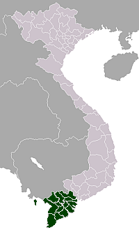
 Cao Lanh City Location of in Vietnam | |
| Coordinates: 10°28′2″N 105°37′49″E | |
| Country | |
| Province | Đồng Tháp |
| Area | |
| • Total | 107 km2 (41 sq mi) |
| Population (2018) | |
| • Total | 211,912 |
| • Density | 1,976/km2 (5,120/sq mi) |
| Time zone | UTC+7 (Indochina Time) |
| Climate | Aw |
History
During the French colonial period Cao Lãnh found some supporters for the nationalist appeal of Trần Huy Liệu's Đông Pháp Thời Báo (Indochina Times) founded in May 1923.[2] Later, in the initial resistance to the French in 1945, the Việt Nam Quốc Dân Đảng and others in the South merged to form the Third Division of the popular army. Cao Lãnh was where the troops were reorganized into 23 units each of 500-600 men.[3]
Prior to 1975, Cao Lãnh was the capital of Kiến Phong province, in the Mekong Delta region of South Vietnam. In February 1976, Kiến Phong was merged with Sa Đéc Province to become Đồng Tháp Province. Sa Đéc became the capital city of the new province. Cao Lãnh replaced Sa Đéc as the capital on April 24, 1994, and became a city in October 2007.
Climate
| Climate data for Cao Lãnh | |||||||||||||
|---|---|---|---|---|---|---|---|---|---|---|---|---|---|
| Month | Jan | Feb | Mar | Apr | May | Jun | Jul | Aug | Sep | Oct | Nov | Dec | Year |
| Record high °C (°F) | 34.1 (93.4) |
34.5 (94.1) |
36.7 (98.1) |
37.4 (99.3) |
37.0 (98.6) |
35.4 (95.7) |
34.8 (94.6) |
34.2 (93.6) |
34.3 (93.7) |
33.2 (91.8) |
32.7 (90.9) |
32.5 (90.5) |
37.4 (99.3) |
| Average high °C (°F) | 30.1 (86.2) |
31.0 (87.8) |
32.9 (91.2) |
34.0 (93.2) |
33.3 (91.9) |
31.9 (89.4) |
31.4 (88.5) |
31.0 (87.8) |
30.8 (87.4) |
30.3 (86.5) |
29.9 (85.8) |
29.4 (84.9) |
31.3 (88.3) |
| Daily mean °C (°F) | 25.4 (77.7) |
26.0 (78.8) |
27.4 (81.3) |
28.6 (83.5) |
28.3 (82.9) |
27.5 (81.5) |
27.2 (81.0) |
27.2 (81.0) |
27.4 (81.3) |
27.3 (81.1) |
26.9 (80.4) |
25.6 (78.1) |
27.1 (80.8) |
| Average low °C (°F) | 22.1 (71.8) |
22.3 (72.1) |
23.6 (74.5) |
24.9 (76.8) |
25.3 (77.5) |
24.9 (76.8) |
24.6 (76.3) |
24.8 (76.6) |
25.0 (77.0) |
25.0 (77.0) |
24.5 (76.1) |
22.7 (72.9) |
24.1 (75.4) |
| Record low °C (°F) | 16.1 (61.0) |
18.1 (64.6) |
15.8 (60.4) |
20.0 (68.0) |
21.7 (71.1) |
21.5 (70.7) |
21.9 (71.4) |
22.0 (71.6) |
22.4 (72.3) |
21.3 (70.3) |
19.5 (67.1) |
16.8 (62.2) |
15.8 (60.4) |
| Average precipitation mm (inches) | 9 (0.4) |
6 (0.2) |
19 (0.7) |
50 (2.0) |
148 (5.8) |
150 (5.9) |
167 (6.6) |
176 (6.9) |
243 (9.6) |
265 (10.4) |
136 (5.4) |
30 (1.2) |
1,399 (55.1) |
| Average precipitation days | 1.6 | 0.7 | 1.4 | 4.5 | 13.6 | 16.2 | 17.4 | 17.0 | 19.1 | 20.2 | 12.1 | 5.1 | 128.8 |
| Average relative humidity (%) | 81.2 | 80.3 | 77.7 | 78.0 | 83.4 | 85.8 | 86.5 | 86.3 | 85.9 | 85.3 | 82.3 | 80.5 | 82.8 |
| Mean monthly sunshine hours | 272 | 259 | 282 | 265 | 222 | 183 | 196 | 186 | 179 | 190 | 216 | 239 | 2,688 |
| Source: Vietnam Institute for Building Science and Technology[4] | |||||||||||||
References
- Philip Taylor - Modernity and Re-Enchantment: Religion in Post-Revolutionary Vietnam 2007 Page 180 "The following year, under Master Minh Trí's leadership, she and a group of about one hundred families moved to Mỹ Phước, an area in Cao Lãnh district of the Đồng Tháp province, where new canals had not long been dug."
- Philippe M. F. Peycam The Birth of Vietnamese Political Journalism: Saigon, 1916-1930 2012 Page 146 "A correspondent named Nguyễn Hỏang from the southern city of Cao Lãnh had taken up the political appeal initiated by Liệu. The time had passed for “arrangements.” The Vietnamese wished to enjoy the same rights as other free people, ..."
- Van Dao Hoang Viet Nam Quoc Dan Dang: A Contemporary History 2008 Page 262 "The Third Division's forces increased to 15000 men when it arrived at Cao Lãnh. They were then reorganized into 23 troops (Bộ Đội), each with 500-600 men."
- "Vietnam Building Code Natural Physical & Climatic Data for Construction" (PDF) (in Vietnamese). Vietnam Institute for Building Science and Technology. Archived from the original (PDF) on 22 July 2018. Retrieved 23 July 2018.
На других языках
- [en] Cao Lãnh (city)
[ru] Каолань
Каолань (вьетн. Cao Lãnh) — город в южной части Вьетнама. Административный центр провинции Донгтхап.Другой контент может иметь иную лицензию. Перед использованием материалов сайта WikiSort.org внимательно изучите правила лицензирования конкретных элементов наполнения сайта.
WikiSort.org - проект по пересортировке и дополнению контента Википедии
