world.wikisort.org - USA
Summit County is an urban county in the U.S. state of Ohio. As of the 2020 census, the population was 540,428,[3] making it the fourth-most populous county in Ohio. Its county seat is Akron.[4] The county was formed on March 3, 1840, from portions of Medina, Portage and Stark Counties. It was named Summit County because the highest elevation on the Ohio and Erie Canal is located in the county.[5]
Summit County | |
|---|---|
U.S. county | |
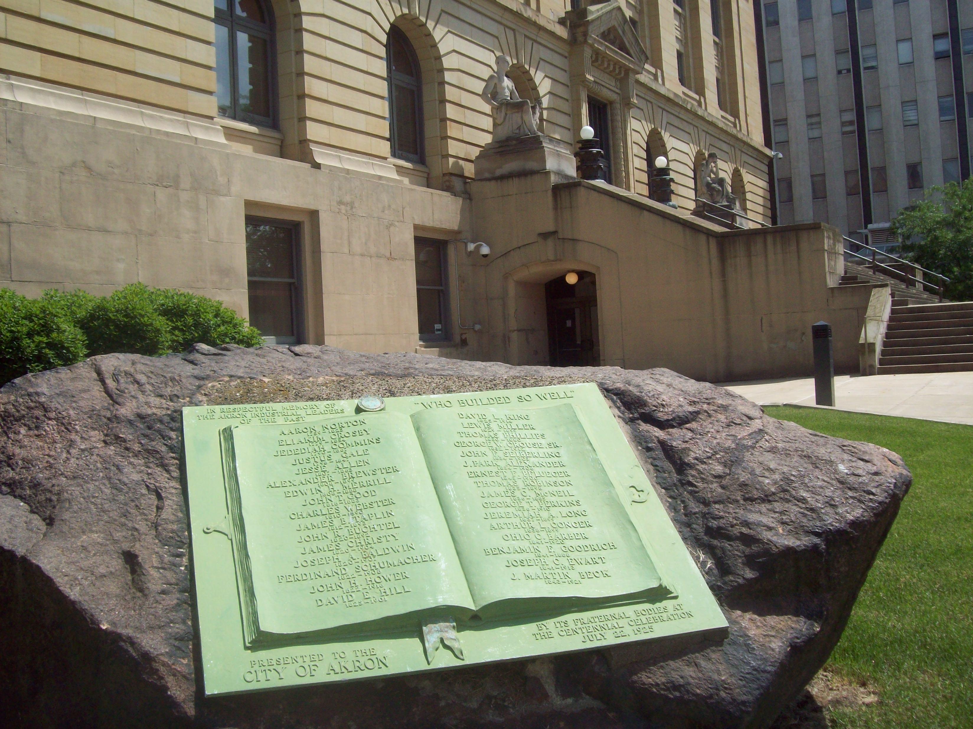 Summit County Courthouse | |
 Seal | |
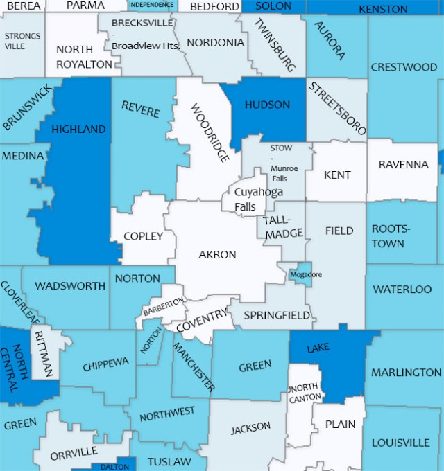
 Location within the U.S. state of Ohio | |
 Ohio's location within the U.S. | |
| Coordinates: 41°08′N 81°32′W | |
| Country | |
| State | |
| Founded | March 3, 1840[1][2] |
| Named for | the highest elevation on the Ohio and Erie Canal |
| Seat | Akron |
| Largest city | Akron |
| Area | |
| • Total | 419.38 sq mi (1,086.2 km2) |
| • Land | 412.08 sq mi (1,067.3 km2) |
| • Water | 7.3 sq mi (19 km2) 1.7%% |
| Population (2020) | |
| • Total | 540,428 |
| • Estimate (2021) | 537,633 |
| • Density | 1,300/sq mi (500/km2) |
| Time zone | UTC−5 (Eastern) |
| • Summer (DST) | UTC−4 (EDT) |
| Congressional districts | 11th, 13th, 14th, 16th |
| Website | co |
Summit County is part of the Akron, OH Metropolitan Statistical Area, which is also included in the Cleveland-Akron-Canton, OH Combined Statistical Area.
Geography
According to the United States Census Bureau, the county has a total area of 419.38 square miles (1,086 km2), of which 412.08 square miles (1,067 km2) is land and 7.3 square miles (19 km2) (1.7%) is water.[6] The largest portion of Cuyahoga Valley National Park is located in the northern part of the county. The southern border of the former Connecticut Western Reserve passes through the southern part of the county, leading to jogs in the east and west borders of the county.
Major highways
 I-76
I-76 I-77
I-77
 I-80 / Ohio Turnpike
 I-271
I-271 I-277
I-277 I-480
I-480 US 224
 SR 8
SR 8 SR 18
SR 18 SR 21
SR 21 SR 59
SR 59 SR 82
SR 82 SR 91
SR 91 SR 93
SR 93 SR 162
 SR 176
 SR 236
 SR 241
 SR 261
 SR 303
 SR 585
 SR 619
 SR 764
Adjacent counties
- Cuyahoga County - northwest
- Geauga County - northeast
- Portage County - east
- Stark County - south
- Wayne County - southwest
- Medina County - west
National protected area
- Cuyahoga Valley National Park (also extends north into Cuyahoga County)
Government
Summit County, along with Cuyahoga County, is one of two of Ohio's 88 counties that have a charter government, as authorized by Article X of the Ohio Constitution. Under its charter, rather than three elected commissioners, Summit County has an elected County Executive and an eleven-member County Council. Eight members of the council are elected from individual districts; the other three are elected at large. Summit County also has an appointed Medical Examiner rather than an elected Coroner, and an elected Fiscal Officer, who exercises the powers and performs the duties of a county auditor, treasurer and recorder. The remaining officials are similar to the officials in other counties. They include the following:
- Clerk of Courts - Sandra Kurt (D) (elected)[7]
- Prosecuting Attorney - Sherri Bevan Walsh (D) (elected)
- Engineer - Alan Brubaker (D) (elected)
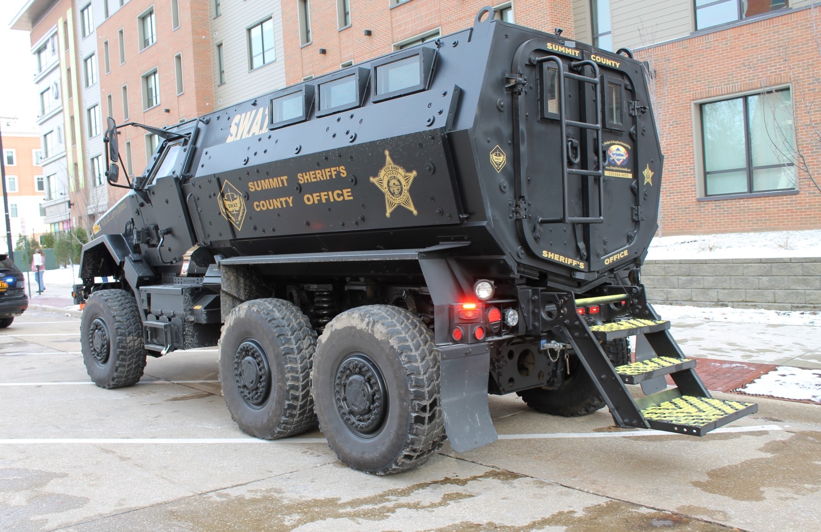
- Sheriff - Kandy Fatheree (D) (elected)
- Fiscal Officer - Kristen Scalise (D) (elected)
Summit County currently has 14 Common Pleas judges. They are:
- Kelly McLaughlin (D),
- Kathryn Michael (D),
- Christine Croce (R),
- Amy Corrigall Jones (R),
- Alison McCarty (R),
- Tammy O'Brien (R),
- Joy Oldfield (D),[8]
- Mary Margaret Rowlands (D),
- Alison Breaux (D)
- Susan Baker Ross (D)
- Linda Tucci Teodosio (D) (Juvenile Court Judge)
- Katarina Cook (R) (Domestic Relations Judge)
- Susan Steinhauer (R) (Domestic Relations Judge) [9]
- Elinore Marsh Stormer (D) (Probate Judge)
Summit County Council
Summit County has an 11-member council. Three members are elected at-large in mid-term cycles, while eight members are elected from districts coinciding with the Presidential election. The current members of Summit County Council are:
- Clair Dickinson (D) (at-large)
- Elizabeth Walters (D) (at-large) [10]
- John Donofrio (D) (at-large)
- Rita Darrow (D) (District 1)
- John Schmidt (D) (District 2)
- Gloria Rodgers (R) (District 3)
- Veronica Sims (D) (District 5) [13]
- Jerry Feeman (D) (District 6)
- Beth McKenney (R) (District 7)
- Anthony Devitis (R) (District 8)
* Indicates Council President [12]
County Executives
- John R. Morgan, 1981–1989
- Tim Davis, 1989–2001
- James B. McCarthy (D), 2001–2007[14]
- Russell M. Pry (D), 2007-2016[15][16][17][18][19]
- Ilene Shapiro (D), 2016–present
Demographics
| Historical population | |||
|---|---|---|---|
| Census | Pop. | %± | |
| 1840 | 22,560 | — | |
| 1850 | 27,485 | 21.8% | |
| 1860 | 27,344 | −0.5% | |
| 1870 | 34,674 | 26.8% | |
| 1880 | 43,788 | 26.3% | |
| 1890 | 54,089 | 23.5% | |
| 1900 | 71,715 | 32.6% | |
| 1910 | 108,253 | 50.9% | |
| 1920 | 286,065 | 164.3% | |
| 1930 | 344,131 | 20.3% | |
| 1940 | 339,405 | −1.4% | |
| 1950 | 410,032 | 20.8% | |
| 1960 | 513,569 | 25.3% | |
| 1970 | 553,371 | 7.8% | |
| 1980 | 524,472 | −5.2% | |
| 1990 | 514,990 | −1.8% | |
| 2000 | 542,899 | 5.4% | |
| 2010 | 541,781 | −0.2% | |
| 2020 | 540,428 | −0.2% | |
| 2021 (est.) | 537,633 | [20] | −0.5% |
| U.S. Decennial Census[21] 1790-1960[22] 1900-1990[23] 1990-2000[24] 2010-2020[3] | |||
2010 census
As of the 2010 Census, there were 541,781 people, 222,781 households, and 141,110 families residing in the county.[25] The population density was 1,312.6 inhabitants per square mile (506.8/km2). There were 245,109 housing units at an average density of 593.8 per square mile (229.3/km2).[26] The racial makeup of the county was 80.6% white, 14.4% black or African American, 2.2% Asian, 0.2% American Indian, 0.5% from other races, and 2.1% from two or more races. Those of Hispanic or Latino origin made up 1.6% of the population.[25] In terms of ancestry, 24.9% were German, 15.3% were Irish, 10.6% were English, 10.1% were Italian, 5.1% were Polish, and 4.5% were American.[27]
Of the 222,781 households, 29.8% had children under the age of 18 living with them, 45.3% were married couples living together, 13.6% had a female householder with no husband present, 36.7% were non-families, and 30.0% of all households were made up of individuals. The average household size was 2.39 and the average family size was 2.98. The median age was 40.0 years.[25]
The median income for a household in the county was $47,926 and the median income for a family was $62,271. Males had a median income of $47,892 versus $35,140 for females. The per capita income for the county was $26,676. About 10.0% of families and 13.8% of the population were below the poverty line, including 19.8% of those under age 18 and 8.0% of those age 65 or over.[28]
Politics
Like much of Northeast Ohio, Summit is heavily Democratic. It has only voted Republican three times since 1932, all in national Republican landslides– Dwight D. Eisenhower's 1956 victory, and the 49-state sweeps by Richard Nixon and Ronald Reagan in 1972 and 1984, respectively.
| Year | Republican | Democratic | Third party | |||
|---|---|---|---|---|---|---|
| No. | % | No. | % | No. | % | |
| 2020 | 124,833 | 44.38% | 151,668 | 53.92% | 4,779 | 1.70% |
| 2016 | 112,026 | 43.03% | 134,256 | 51.57% | 14,064 | 5.40% |
| 2012 | 111,001 | 41.36% | 153,041 | 57.03% | 4,316 | 1.61% |
| 2008 | 113,284 | 40.66% | 160,858 | 57.73% | 4,487 | 1.61% |
| 2004 | 118,558 | 42.91% | 156,587 | 56.67% | 1,175 | 0.43% |
| 2000 | 96,721 | 43.02% | 119,759 | 53.26% | 8,359 | 3.72% |
| 1996 | 73,555 | 34.18% | 112,050 | 52.07% | 29,590 | 13.75% |
| 1992 | 77,530 | 32.10% | 107,881 | 44.67% | 56,081 | 23.22% |
| 1988 | 101,155 | 46.92% | 112,612 | 52.23% | 1,822 | 0.85% |
| 1984 | 115,637 | 50.99% | 109,569 | 48.32% | 1,574 | 0.69% |
| 1980 | 92,299 | 43.35% | 102,459 | 48.12% | 18,161 | 8.53% |
| 1976 | 80,415 | 38.41% | 123,711 | 59.09% | 5,224 | 2.50% |
| 1972 | 112,419 | 49.92% | 108,534 | 48.19% | 4,263 | 1.89% |
| 1968 | 82,649 | 39.56% | 100,068 | 47.89% | 26,224 | 12.55% |
| 1964 | 68,000 | 32.33% | 142,319 | 67.67% | 0 | 0.00% |
| 1960 | 109,066 | 49.59% | 110,852 | 50.41% | 0 | 0.00% |
| 1956 | 102,872 | 52.42% | 93,378 | 47.58% | 0 | 0.00% |
| 1952 | 91,168 | 48.34% | 97,443 | 51.66% | 0 | 0.00% |
| 1948 | 60,174 | 42.69% | 78,096 | 55.41% | 2,680 | 1.90% |
| 1944 | 64,696 | 41.61% | 90,783 | 58.39% | 0 | 0.00% |
| 1940 | 63,405 | 41.45% | 89,555 | 58.55% | 0 | 0.00% |
| 1936 | 38,991 | 29.16% | 91,836 | 68.69% | 2,869 | 2.15% |
| 1932 | 47,691 | 45.03% | 53,965 | 50.95% | 4,255 | 4.02% |
| 1928 | 78,504 | 70.86% | 31,506 | 28.44% | 775 | 0.70% |
| 1924 | 53,774 | 65.28% | 17,533 | 21.29% | 11,064 | 13.43% |
| 1920 | 43,721 | 59.60% | 27,857 | 37.97% | 1,785 | 2.43% |
| 1916 | 11,593 | 35.63% | 19,343 | 59.45% | 1,603 | 4.93% |
| 1912 | 3,502 | 15.10% | 7,786 | 33.57% | 11,904 | 51.33% |
| 1908 | 10,365 | 47.31% | 9,930 | 45.32% | 1,614 | 7.37% |
| 1904 | 12,451 | 66.04% | 4,618 | 24.49% | 1,786 | 9.47% |
| 1900 | 10,072 | 53.08% | 8,413 | 44.33% | 491 | 2.59% |
| 1896 | 8,584 | 51.25% | 8,020 | 47.88% | 146 | 0.87% |
| 1892 | 6,322 | 46.45% | 6,499 | 47.75% | 790 | 5.80% |
| 1888 | 6,455 | 51.43% | 5,495 | 43.78% | 602 | 4.80% |
| 1884 | 6,588 | 55.97% | 4,586 | 38.96% | 597 | 5.07% |
| 1880 | 5,890 | 57.73% | 4,071 | 39.90% | 241 | 2.36% |
| 1876 | 5,055 | 56.59% | 3,804 | 42.59% | 73 | 0.82% |
| 1872 | 4,534 | 62.01% | 2,738 | 37.45% | 40 | 0.55% |
| 1868 | 4,634 | 65.47% | 2,444 | 34.53% | 0 | 0.00% |
| 1864 | 4,204 | 69.88% | 1,812 | 30.12% | 0 | 0.00% |
| 1860 | 3,607 | 65.52% | 1,785 | 32.43% | 113 | 2.05% |
| 1856 | 3,185 | 63.64% | 1,746 | 34.89% | 74 | 1.48% |
Education
School districts
School districts in Ohio do not strictly follow city corporation limits or township borders. Many of the school districts in Summit County overlap community borders.[30] Below is a list of all public school districts in the county.
- Akron Public School District
- Revere Local School District
- Copley–Fairlawn City School District
- Woodridge Local School District
- Hudson City School District
- Stow-Munroe Falls City School District
- Cuyahoga Falls City School District
- Tallmadge City School District
- Mogadore Local School District
- Springfield Local School District
- Coventry Local School District
- Green Local School District
- Manchester Local School District
- Barberton City School District
- Norton City School District
- Twinsburg City School District
- Nordonia Hills City School District
| Summit County Public School Enrollment Trends (K-12)[31] | ||||||||||||
| School System | 1965[32] | 1970[33] | 1974-75[34] | 1980 | 1985 | 1990 | 1995 | 2000 | 2005 | 2010 | 2015 | 2019 |
| Akron | 52,632 | 55,000 | 49,835 | 38,974 | 35,037 | 33,230 | 31,072 | 30,360 | 27,764 | 23,210 | 21,001 | 20,723 |
| Cuyahoga Falls | 12,000 | 11,778 | 10,382 | 7,846 | 6,353 | 5,919 | 5,807 | 5,516 | 5,294 | 4,964 | 4,838 | 4,604 |
| Barberton | 7,707 | 7,444 | 6,647 | 5,091 | 4,635 | 4,498 | 4,357 | 4,237 | 4,182 | 3,761 | 3,802 | 3,813 |
| Springfield | 5,078 | 5,369 | 5,114 | 4,271 | 3,780 | 3,167 | 3,369 | 3,258 | 2,976 | 2,394 | 2,319 | 2,153 |
| Stow | 5,048 | 6,650 | 6,712 | 5,971 | 5,252 | 5,507 | 5,938 | 5,926 | 5,998 | 5,695 | 5,215 | 5,265 |
| Nordonia | 4,199 | 4,927 | 5,618 | 4,552 | 3,390 | 2,917 | 3,153 | 3,642 | 3,768 | 4,013 | 3,692 | 3,600 |
| Green | 3,615 | 3,973 | 3,853 | 3,639 | 3,130 | 3,084 | 3,494 | 3,871 | 4,120 | 4,197 | 4,052 | 3,993 |
| Tallmadge | 3,527 | 4,430 | 4,171 | 3,265 | 2,502 | 2,202 | 2,585 | 2,626 | 2,720 | 2,601 | 2,414 | 2,412 |
| Norton | 3,503 | 4,114 | - | 3,213 | 2,560 | 2,379 | 2,528 | 2,543 | 2,426 | 2,647 | 2,489 | 2,449 |
| Coventry | 3,423 | 3,004 | 2,763 | 2,180 | 1,836 | 1,684 | 2,197 | 2,428 | 2,305 | 2,419 | 2,123 | 1,864 |
| Copley | 3,196 | 3,790 | - | 3,018 | 2,342 | 2,215 | 2,471 | 2,924 | 3,301 | 3,322 | 3,054 | 2,819 |
| Revere | 2,957 | 3,449 | 3,404 | 2,967 | 2,554 | 2,516 | 2,741 | 2,846 | 2,829 | 2,860 | 2,593 | 2,696 |
| Hudson | 2,429 | 2,983 | 3,553 | 3,721 | 3,514 | 3,880 | 5,154 | 5,049 | 5,421 | 4,866 | 4,476 | 4,517 |
| Manchester | 2,373 | 2,919 | 2,729 | 2,107 | 1,702 | 1,490 | 1,545 | 1,470 | 1,529 | 1,517 | 1,328 | 1,306 |
| Twinsburg | 2,146 | 2,448 | 2,456 | 2,321 | 2,161 | 2,166 | 2,694 | 3,531 | 4,008 | 4,242 | 4,102 | 4,080 |
| Woodridge | 1,689 | 1,853 | 1,735 | 1,298 | 1,008 | 1,019 | 1,192 | 1,688 | 1,757 | 1,936 | 1,988 | 1,867 |
| Mogadore | 1,478 | 1,544 | 1,338 | 1,074 | 893 | 807 | 805 | 857 | 881 | 919 | 883 | 857 |
| County Total | 117,000 | 125,675 | 110,310 | 95,508 | 82,649 | 78,680 | 81,102 | 82,772 | 81,279 | 75,563 | 70,369 | 69,018 |
Colleges and universities
- University of Akron, Akron
- Kent State University Twinsburg Academic Center, Twinsburg
- Stark State College Akron
Recreation
- Summit Metro Parks
Communities

Cities
- Akron (county seat)
- Barberton
- Cuyahoga Falls
- Fairlawn
- Green
- Hudson
- Macedonia
- Munroe Falls
- New Franklin
- Norton (partly in Wayne County)
- Reminderville
- Stow
- Tallmadge
- Twinsburg
Villages
Townships
Defunct townships
- Franklin
- Green
- Hudson
- Norton
- Northampton
- Portage
- Stow
Census-designated places
Unincorporated communities
See also
- National Register of Historic Places listings in Summit County, Ohio
References
- "Ohio County Profiles: Summit County" (PDF). Ohio Department of Development. Archived from the original (PDF) on May 8, 2007. Retrieved April 28, 2007.
- "Summit County data". Ohio State University Extension Data Center. Archived from the original on April 24, 2006. Retrieved April 28, 2007.
- "State & County QuickFacts". United States Census Bureau. Retrieved June 26, 2022.
- "Find a County". National Association of Counties. Archived from the original on May 31, 2011. Retrieved June 7, 2011.
- "Communities in Summit County". County of Summit, Ohio. Archived from the original on January 6, 2017. Retrieved January 8, 2017.
- "2010 Census Gazetteer Files". United States Census Bureau. August 22, 2012. Archived from the original on May 4, 2014. Retrieved February 11, 2015.
- rarmon. "Summit County Democrats appoint Sandra Kurt as clerk of courts". ohio.com. Archived from the original on March 1, 2017. Retrieved April 30, 2018.
- swarsmith. "Four Summit County judges elected to other courts must be replaced". ohio.com. Archived from the original on March 1, 2017. Retrieved April 30, 2018.
- "Ohio Gov. Mike DeWine appoints Susan Steinhauer to Summit County Court of Common Pleas domestic relations division". April 2, 2021.
- "Local". ohio.com. Archived from the original on March 1, 2017. Retrieved April 30, 2018.
- rarmon. "Democrats appoint Jeff Wilhite to Summit County Council". ohio.com. Archived from the original on March 1, 2017. Retrieved April 30, 2018.
- Mackinnon, Jim. "Wilhite named Summit County Council president, but not without a fight". Akron Beacon Journal. Retrieved June 13, 2019.
- "Former Akron City Councilwoman Veronica Sims appointed to vacant seat on Summit County Council". January 6, 2020.
- McCarthy retired on June 30, 2007. "McCarthy, 67, Turns New Corner,". Akron Beacon Journal, June 30, 2007.
- "Pry Biography". summit.oh.us. Archived from the original on November 11, 2012. Retrieved April 30, 2018.
- On July 12, 2007, Pry was appointed by a majority vote of the Summit County Democratic Party's Central Committee to finish the remainder of McCarthy's second term. "Pry Named County Executive." Akron Beacon Journal, July 13, 2007
- On November 4, 2008, Pry was elected to a four-year term as County Executive with over 60% of the vote. "Republicans Lose More Ground in Summit Races, Democrats Gain Spot with Brubaker Beating Incumbent Engineer." Akron Beacon Journal, November 6, 2008
- On November 6, 2012, Pry was elected to a second four-year term as County Executive with over 62% of the vote. "Democrats Maintain Summit County Seats." Akron Beacon Journal, November 7, 2012
- Pry died in office on July 31, 2016 at age 58. "Summit County Executive Russ Pry dies at 58". August 2016. Archived from the original on August 4, 2016. Retrieved August 2, 2016.
- "Annual Estimates of the Resident Population for Counties: April 1, 2020 to July 1, 2021". Retrieved June 26, 2022.
- "U.S. Decennial Census". United States Census Bureau. Retrieved February 11, 2015.
- "Historical Census Browser". University of Virginia Library. Archived from the original on August 11, 2012. Retrieved February 11, 2015.
- Forstall, Richard L., ed. (March 27, 1995). "Population of Counties by Decennial Census: 1900 to 1990". United States Census Bureau. Archived from the original on February 14, 2015. Retrieved February 11, 2015.
- "Census 2000 PHC-T-4. Ranking Tables for Counties: 1990 and 2000" (PDF). United States Census Bureau. April 2, 2001. Archived (PDF) from the original on December 18, 2014. Retrieved February 11, 2015.
- "DP-1 Profile of General Population and Housing Characteristics: 2010 Demographic Profile Data". United States Census Bureau. Archived from the original on February 13, 2020. Retrieved December 27, 2015.
- "Population, Housing Units, Area, and Density: 2010 - County". United States Census Bureau. Archived from the original on February 13, 2020. Retrieved December 27, 2015.
- "DP02 SELECTED SOCIAL CHARACTERISTICS IN THE UNITED STATES – 2006-2010 American Community Survey 5-Year Estimates". United States Census Bureau. Archived from the original on February 13, 2020. Retrieved December 27, 2015.
- "DP03 SELECTED ECONOMIC CHARACTERISTICS – 2006-2010 American Community Survey 5-Year Estimates". United States Census Bureau. Archived from the original on February 13, 2020. Retrieved December 27, 2015.
- Leip, David. "Dave Leip's Atlas of U.S. Presidential Elections". uselectionatlas.org. Archived from the original on March 23, 2018. Retrieved April 30, 2018.
- "Map of School Districts near Akron, Ohio". AkronOhioMoms.com. May 29, 2013. Archived from the original on August 25, 2014. Retrieved June 5, 2014.
- "Ohio Department of Education - Enrollment Data". Retrieved June 12, 2019.
- "Summit County Enrollment Figures". Akron Beacon Journal. June 6, 1965.
- "Summit County Enrollment Figures". Akron Beacon Journal. September 12, 1970.
- "Summit County Enrollment Figures". Akron Beacon Journal. November 15, 1974.
External links
- Official Summit County page
- Akron-Summit Convention and Visitors Bureau
- Summit Memory, an online scrapbook capturing the history of Summit County, Ohio by the Akron-Summit County Public Library
Places adjacent to Summit County, Ohio | ||||||||||||||||
|---|---|---|---|---|---|---|---|---|---|---|---|---|---|---|---|---|
| ||||||||||||||||
Municipalities and communities of Summit County, Ohio, United States | ||
|---|---|---|
County seat: Akron | ||
| Cities |
|  |
| Villages | ||
| Townships | ||
| CDPs | ||
| Unincorporated communities | ||
| Footnotes | ‡This populated place also has portions in an adjacent county or counties | |
| ||
Authority control | |
|---|---|
| General | |
| National libraries | |
| Other | |
На других языках
- [en] Summit County, Ohio
[es] Condado de Summit (Ohio)
El condado de Summit (en inglés: Summit County), fundado en 1820, es uno de 92 condados del estado estadounidense de Ohio. En el año 2000, el condado tenía una población de 542,899 habitantes y una densidad poblacional de 508 personas por km². La sede del condado es Akron.[1] El condado recibe su nombre por ser la mayor elevación (submit, en inglés) a lo largo del canal de Ohio.[ru] Саммит (округ, Огайо)
Округ Саммит (англ. Summit County) располагается в штате Огайо, США. Официально образован 3-го марта 1840 года. По состоянию на 2010 год, численность населения составляла 541 781 человек.Другой контент может иметь иную лицензию. Перед использованием материалов сайта WikiSort.org внимательно изучите правила лицензирования конкретных элементов наполнения сайта.
WikiSort.org - проект по пересортировке и дополнению контента Википедии