world.wikisort.org - USA
Portage County is a county in the U.S. state of Ohio. As of the 2020 census, the population was 161,791.[1] Located in Northeast Ohio, Portage County is part of the Akron Metropolitan Statistical Area, which is also included in the Cleveland–Akron–Canton Combined Statistical Area. Its county seat is Ravenna and its largest city is Kent.[2]
Portage County | |
|---|---|
U.S. county | |
 Portage County Courthouse | |
 Seal | |
 Location within the U.S. state of Ohio | |
 Ohio's location within the U.S. | |
| Coordinates: 41°10′N 81°12′W | |
| Country | |
| State | |
| Founded | June 7, 1808 |
| Named for | the portage between the Cuyahoga and Tuscarawas Rivers |
| Seat | Ravenna |
| Largest city | Kent |
| Area | |
| • Total | 504 sq mi (1,310 km2) |
| • Land | 487 sq mi (1,260 km2) |
| • Water | 17 sq mi (40 km2) 3.3% |
| Population (2020) | |
| • Total | 161,791 |
| • Density | 320/sq mi (120/km2) |
| Time zone | UTC−5 (Eastern) |
| • Summer (DST) | UTC−4 (EDT) |
| Congressional districts | 13th, 14th, 16th |
| Website | www |
The county, named for the portage between the Cuyahoga and Tuscarawas Rivers, was created in 1807 and formally organized in 1808.[3][4] In addition to the cities of Kent and Ravenna, Portage County also includes the cities of Aurora and Streetsboro, along with five villages, 18 civil townships, and several unincorporated places within those townships. Additionally, the county includes parts of the city of Tallmadge, and part of the village of Mogadore, both of which are mostly in neighboring Summit County.
History
The name "Portage" comes from an old Indian path called "Portage Path", which ran between the Cuyahoga and Tuscarawas rivers, where travelers portaged their canoes. The location of the trail today is within the boundaries of neighboring Summit County.[5][6]
After the discovery of the New World, the land that became Portage County was originally part of the French colony of Canada (New France), which was ceded in 1763 to Great Britain and renamed the Province of Quebec. In the late 18th century the land became part of the Connecticut Western Reserve in the Northwest Territory, then was purchased by the Connecticut Land Company in 1795.
The first European settler in what is now Portage County was Abraham Honey in 1798 in the area now known as Mantua Township, followed by Asa Hall in what is now Atwater Township in April 1799. In June 1799, Benjamin Tappan, Jr. arrived and founded Ravenna, David Daniels came to what is now Palmyra Township, and Ebenezer Sheldon settled in what is now Aurora.[7] A family group of Huguenot refugees also eventually migrated to Portage County by 1804.[8]

When first settled, the area that presently constitutes Portage County was part of the original Jefferson County, which had been organized in 1797. In 1800, the area was made part of Trumbull County, which followed the boundaries of the Connecticut Western Reserve. In 1802, all of what is now Portage County was organized under the name of Franklin Township with other townships being formed later. On February 10, 1807 the Ohio state legislature passed the act to create Portage County from Trumbull County and it took effect June 7, 1807. Portage County remained attached to Trumbull County until June 8, 1808, when the first elections were held. Initially, the county included a large area of the Western Reserve that encompassed most of present-day Summit County, all of Medina and Huron counties, and parts of Lorain and Ashland counties. There were six organized townships in 1808: Franklin, Deerfield, Aurora, Hiram, Springfield, and Hudson with new townships organized later, reaching a maximum of 30. The present-day boundaries of Portage County were established in 1840 following the 1812 creation of Medina County, a slight boundary adjustment in 1827 with Cuyahoga County, and finally the creation of Summit County in 1840, which took 10 townships from Portage County along with 3 townships from Medina County and two from Stark County.[6]
Geography

According to the U.S. Census Bureau, the county has a total area of 504 square miles (1,310 km2), of which 487 square miles (1,260 km2) is land and 17 square miles (44 km2) (3.3%) is water.[9]
West Branch State Park is a very large state park in central Portage County, consisting of a large green surrounding the Michael J. Kirwan Dam and Reservoir. There are a number of smaller state and local parks.
Adjacent counties
- Geauga County (north)
- Trumbull County (east)
- Mahoning County (southeast)
- Stark County (south)
- Summit County (west)
- Cuyahoga County (northwest)
Major highways
 I-76
I-76
 I-80 / Ohio Turnpike
 I-480
I-480 US 224
 US 422
 SR 5
SR 5 SR 14
SR 14 SR 43
SR 43 SR 44
SR 44 SR 59
SR 59 SR 82
SR 82 SR 87
SR 87 SR 88
SR 88 SR 183
 SR 225
 SR 261
 SR 282
 SR 303
 SR 305
 SR 700
Demographics
| Historical population | |||
|---|---|---|---|
| Census | Pop. | %± | |
| 1810 | 2,995 | — | |
| 1820 | 10,095 | 237.1% | |
| 1830 | 18,826 | 86.5% | |
| 1840 | 22,965 | 22.0% | |
| 1850 | 24,419 | 6.3% | |
| 1860 | 24,208 | −0.9% | |
| 1870 | 24,584 | 1.6% | |
| 1880 | 27,500 | 11.9% | |
| 1890 | 27,868 | 1.3% | |
| 1900 | 29,246 | 4.9% | |
| 1910 | 30,307 | 3.6% | |
| 1920 | 36,369 | 20.0% | |
| 1930 | 42,682 | 17.4% | |
| 1940 | 46,660 | 9.3% | |
| 1950 | 63,984 | 37.1% | |
| 1960 | 91,798 | 43.5% | |
| 1970 | 125,868 | 37.1% | |
| 1980 | 135,856 | 7.9% | |
| 1990 | 142,585 | 5.0% | |
| 2000 | 152,061 | 6.6% | |
| 2010 | 161,419 | 6.2% | |
| 2020 | 161,791 | 0.2% | |
| U.S. Decennial Census[10] 1790-1960[11] 1900-1990[12] 1990-2000[13] 2020 [14] | |||
2000 census
As of the census[15] of 2000, there were 152,061 people, 56,449 households, and 39,175 families living in the county. The population density was 309 people per square mile (119/km2). There were 60,096 housing units at an average density of 122 per square mile (47/km2). The racial makeup of the county was 94.40% White, 3.18% Black or African American, 0.18% Native American, 0.82% Asian, 0.01% Pacific Islander, 0.22% from other races, and 1.19% from two or more races. 0.72% of the population were Hispanic or Latino of any race. 23.5% were of German, 11.0% Irish, 9.9% Italian, 9.7% English, 9.7% American and 5.2% Polish ancestry according to Census 2000. 96.1% spoke English and 1.2% Spanish as their first language.
There were 56,449 households, out of which 32.30% had children under the age of 18 living with them, 55.60% were married couples living together, 10.10% had a female householder with no husband present, and 30.60% were non-families. 23.30% of all households were made up of individuals, and 7.40% had someone living alone who was 65 years of age or older. The average household size was 2.56 and the average family size was 3.03.
In the county, the population was spread out, with 23.70% under the age of 18, 14.30% from 18 to 24, 28.60% from 25 to 44, 22.30% from 45 to 64, and 11.00% who were 65 years of age or older. The median age was 34 years. For every 100 females there were 95.40 males. For every 100 females age 18 and over, there were 92.40 males.
The median income for a household in the county was $44,347, and the median income for a family was $52,820. Males had a median income of $37,434 versus $26,232 for females. The per capita income for the county was $20,428. About 5.90% of families and 9.30% of the population were below the poverty line, including 9.90% of those under age 18 and 5.70% of those age 65 or over.
Using the Gini coefficient to measure household inequality, Portage County received a .43 in 2012.[16] In 2013 16.1% of the population, or 25,196 people, were poor or impoverished. The county saw an increase in its poor population, as this can be compared to a 9.3% poverty rate (13,395 people) in 1999.[17]
2010 census
As of the 2010 United States Census, there were 161,419 people, 62,222 households, and 40,757 families living in the county.[18] The population density was 331.2 inhabitants per square mile (127.9/km2). There were 67,472 housing units at an average density of 138.4 per square mile (53.4/km2).[19] The racial makeup of the county was 92.3% white, 4.1% black or African American, 1.4% Asian, 0.2% American Indian, 0.3% from other races, and 1.7% from two or more races. Those of Hispanic or Latino origin made up 1.3% of the population.[18] In terms of ancestry, 30.7% were German, 17.1% were Irish, 11.5% were English, 11.0% were Italian, 6.6% were Polish, and 5.7% were American.[20]
Of the 62,222 households, 29.6% had children under the age of 18 living with them, 50.1% were married couples living together, 10.9% had a female householder with no husband present, 34.5% were non-families, and 25.4% of all households were made up of individuals. The average household size was 2.47 and the average family size was 2.96. The median age was 37.4 years.[18]
The median income for a household in the county was $50,447 and the median income for a family was $65,306. Males had a median income of $46,014 versus $34,250 for females. The per capita income for the county was $25,097. About 8.1% of families and 13.5% of the population were below the poverty line, including 16.2% of those under age 18 and 4.4% of those age 65 or over.[21]
Politics

Following a trend seen throughout large parts of Ohio, in 2016 Donald Trump won Portage County by 9.87 points, becoming the first Republican in almost three decades to win the county, the last time being George H. W. Bush in 1988.
| Year | Republican | Democratic | Third party | |||
|---|---|---|---|---|---|---|
| No. | % | No. | % | No. | % | |
| 2020 | 45,990 | 55.39% | 35,661 | 42.95% | 1,371 | 1.65% |
| 2016 | 39,971 | 52.07% | 32,397 | 42.20% | 4,394 | 5.72% |
| 2012 | 35,242 | 46.14% | 39,453 | 51.65% | 1,689 | 2.21% |
| 2008 | 34,822 | 44.41% | 41,856 | 53.39% | 1,724 | 2.20% |
| 2004 | 35,583 | 46.42% | 40,675 | 53.07% | 389 | 0.51% |
| 2000 | 28,271 | 44.95% | 31,446 | 49.99% | 3,182 | 5.06% |
| 1996 | 18,939 | 32.52% | 29,441 | 50.55% | 9,858 | 16.93% |
| 1992 | 18,447 | 29.69% | 26,325 | 42.37% | 17,363 | 27.94% |
| 1988 | 26,334 | 50.18% | 25,607 | 48.79% | 539 | 1.03% |
| 1984 | 29,536 | 57.14% | 21,719 | 42.02% | 432 | 0.84% |
| 1980 | 22,829 | 47.37% | 20,570 | 42.69% | 4,791 | 9.94% |
| 1976 | 17,927 | 40.91% | 24,417 | 55.72% | 1,480 | 3.38% |
| 1972 | 23,294 | 51.76% | 20,769 | 46.15% | 939 | 2.09% |
| 1968 | 15,064 | 41.27% | 16,348 | 44.78% | 5,093 | 13.95% |
| 1964 | 10,842 | 31.75% | 23,308 | 68.25% | 0 | 0.00% |
| 1960 | 19,634 | 51.45% | 18,528 | 48.55% | 0 | 0.00% |
| 1956 | 18,943 | 59.07% | 13,128 | 40.93% | 0 | 0.00% |
| 1952 | 17,168 | 55.88% | 13,553 | 44.12% | 0 | 0.00% |
| 1948 | 11,621 | 48.67% | 11,987 | 50.21% | 268 | 1.12% |
| 1944 | 12,284 | 49.50% | 12,533 | 50.50% | 0 | 0.00% |
| 1940 | 11,777 | 48.14% | 12,687 | 51.86% | 0 | 0.00% |
| 1936 | 8,035 | 35.77% | 13,798 | 61.43% | 630 | 2.80% |
| 1932 | 9,586 | 47.98% | 9,662 | 48.36% | 733 | 3.67% |
| 1928 | 12,086 | 71.31% | 4,756 | 28.06% | 106 | 0.63% |
| 1924 | 8,583 | 62.43% | 2,994 | 21.78% | 2,172 | 15.80% |
| 1920 | 8,231 | 58.99% | 5,405 | 38.74% | 317 | 2.27% |
| 1916 | 3,142 | 40.90% | 4,269 | 55.56% | 272 | 3.54% |
| 1912 | 1,162 | 15.73% | 2,855 | 38.65% | 3,370 | 45.62% |
| 1908 | 4,129 | 51.16% | 3,625 | 44.91% | 317 | 3.93% |
| 1904 | 4,712 | 62.49% | 2,486 | 32.97% | 343 | 4.55% |
| 1900 | 4,311 | 52.68% | 3,651 | 44.61% | 222 | 2.71% |
| 1896 | 4,073 | 50.01% | 3,995 | 49.05% | 76 | 0.93% |
| 1892 | 3,310 | 48.83% | 2,953 | 43.57% | 515 | 7.60% |
| 1888 | 3,880 | 52.36% | 3,260 | 43.99% | 270 | 3.64% |
| 1884 | 3,931 | 52.11% | 3,273 | 43.39% | 339 | 4.49% |
| 1880 | 3,990 | 54.97% | 3,147 | 43.35% | 122 | 1.68% |
| 1876 | 3,712 | 54.92% | 3,006 | 44.47% | 41 | 0.61% |
| 1872 | 3,478 | 58.03% | 2,438 | 40.68% | 77 | 1.28% |
| 1868 | 3,604 | 60.41% | 2,362 | 39.59% | 0 | 0.00% |
| 1864 | 3,475 | 64.40% | 1,921 | 35.60% | 0 | 0.00% |
| 1860 | 3,065 | 59.34% | 1,970 | 38.14% | 130 | 2.52% |
| 1856 | 2,983 | 58.94% | 2,072 | 40.94% | 6 | 0.12% |
Education
The county is served by multiple public school districts, private schools, and public libraries, and is home to two institutions of higher education.
Libraries
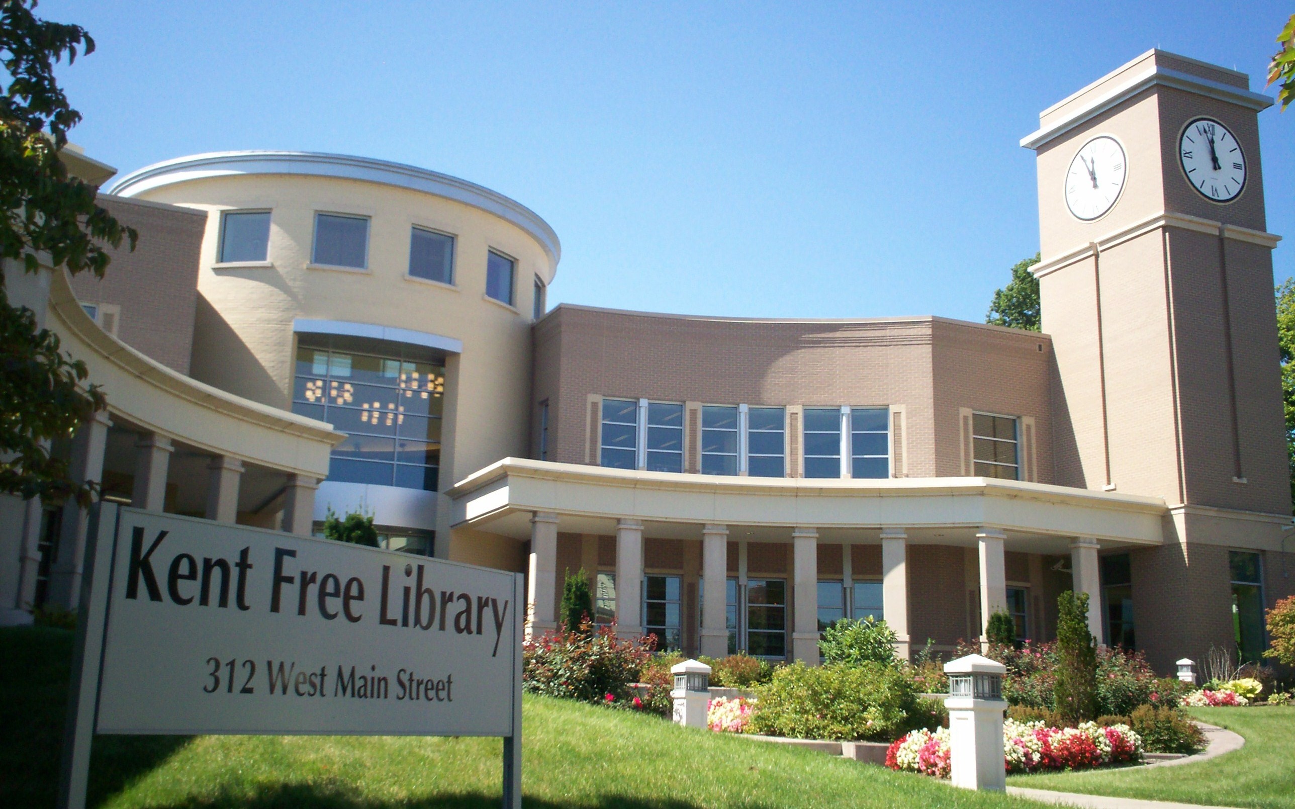
The Portage County Library Consortium is a library consortium consisting of Kent Free Library in Kent, Reed Memorial Library in Ravenna, and the five branches of the Portage County Library District, which are located in Aurora, Garrettsville, Randolph, Streetsboro, and Windham. The consortium allows patrons of any member library to use their library card at another consortium location or request materials housed at another library. Through the SearchOhio database, the consortium is connected to OhioLINK, which provides local access to the State Library of Ohio and dozens of university and college libraries across the state.[23][24]
The county is also home to the Kent State University Libraries in Kent, an academic library system with a collection of over 2.5 million volumes. The KSU system, one of three members of the Association of Research Libraries in Ohio, includes the 12-story main library and individual libraries for architecture, fashion, performing arts, and maps, on the main campus in Kent. It also includes individual libraries at each of the university's seven regional campuses in Northeast Ohio.[25]
Public school districts
Portage County is home to eleven public school districts.[26]
| District | Location | Communities served |
|---|---|---|
| Aurora City School District | Aurora | Aurora, small part of Reminderville |
| Crestwood Local School District | Mantua | Mantua, Mantua Township, Hiram, most of Hiram Township, most of Shalersville Township |
| James A Garfield Local School District | Garrettsville | Garrettsville, Nelson Township, Freedom Township, part of Hiram Township, small part of Charlestown Township |
| Field Local School District | Brimfield | Most of Brimfield and Suffield Townships, parts of Tallmadge and Kent annexed from Brimfield |
| Kent City School District | Kent | Sugar Bush Knolls, most of Kent and Franklin Township, small portion of Streetsboro |
| Ravenna School District | Ravenna | Ravenna, Ravenna Township, small portion of Shalersville Township |
| Rootstown Local School District | Rootstown | Rootstown Township and small portion of Brimfield Township |
| Southeast Local School District | Palmyra | Edinburg Township, Palmyra Township, Paris Township, most of Charlestown Township, most of Deerfield Township |
| Streetsboro City School District | Streetsboro | most of Streetsboro |
| Waterloo Local School District | Atwater | Atwater Township, Randolph Township, small portion of Deerfield Township |
| Windham Exempted Village School District | Windham | Windham, Windham Township |

In addition, there are parts of five neighboring districts which serve portions of Portage County residents.[26]
| District | Location | Communities served in Portage County |
|---|---|---|
| Lake Local School District | Uniontown | small part of Suffield Township |
| Mogadore Local School District | Mogadore | Mogadore, small part of Suffield Township |
| Springfield Local School District | Springfield | small part of Suffield Township |
| Stow-Munroe Falls City School District | Stow | small part of Franklin Township |
| Tallmadge City School District | Tallmadge | small part of Tallmadge in Portage County |
| West Branch Local School District | Beloit | small part of Deerfield Township |
Portage County also has two public schools that serve students from multiple districts:
- Maplewood Career Center in Ravenna, a joint vocational school for students in grades 11 and 12 from 9 of the county's school districts (all but Kent and Aurora) and Mogadore.
- Bio-Med Science Academy, a year-round public Science, Technology, Engineering, Mathematics, and Medicine (STEM+M) high school located on the campus of Northeast Ohio Medical University in Rootstown with campuses in Ravenna and Shalersville. The academy has students enrolled from Portage County and adjacent counties.[27]
Private schools
- Crossroads Christian Academy, a Christian school for grades K4–12 operated by and housed at First Baptist Church in Streetsboro[28]
- St. Joseph School, a Roman Catholic school for grades PK–8 in St. Joseph, affiliated with the Diocese of Youngstown[29]
- St. Patrick School, a Roman Catholic school for grades K–8 in Kent, affiliated with the Diocese of Youngstown[30]
- Valley Christian Academy, a Christian school for grades PK–8 in Aurora[31]
Higher education
Portage County is home to three institutions of higher learning:
- Kent State University, located in Kent; a large regional public research university with around 40,000 students. It serves as the county's largest employer.
- Hiram College, located in Hiram in northeastern Portage County; a small liberal arts college of around 1,200 students.
- Northeast Ohio Medical University (NEOMED), located in Rootstown, in the south-central part of the county. It is a public medical school and a consortium of Kent State University, the University of Akron, Youngstown State University, and Cleveland State University, with colleges of medicine, pharmacy, and graduate studies.[32]
Culture
Theater
- Kent Stage
Museums
- Kelso House Museum, Brimfield
- Kent Historical Society Museum, Kent
- Kent State University Museum, Kent
- Kent State School of Art Galleries, Kent
- Cowrie-Lowrie-Beatty Portage County Historical Society Museum, Ravenna
Media
- Record-Courier, a newspaper based in Ravenna that covers news for the entire county online and in print
- The Portager, an online news source based in Randolph that covers the entire county[33]
- KentWired, an online news source from Kent State University independent student media outlets The Kent Stater and TV2[34]
- Weekly Villager, online news source based in Garrettsville with news from Portage, Geauga, and Trumbull counties[35]
Communities

Portage County is arranged as a 4x5 grid of 20 rectangles: 18 unincorporated townships containing 9 cities and villages; and two incorporated townships which are fully occupied by one city each.
Under Ohio law, there are two types of incorporated municipal jurisdictions: cities and villages, and any territory within a county that is not part of an incorporated municipality (city or village), is part of a township. Townships have limited local government and services.
Camp James A. Garfield, formerly known as the Ravenna Training and Logistics Site and commonly known as the Ravenna Arsenal, occupies much of the land in Charlestown, Paris, and Windham Townships, as well as a small part of Freedom Township.
Cities
- Aurora
- Kent
- Ravenna (county seat)
- Streetsboro
- Tallmadge
Villages
- Garrettsville
- Hiram
- Mantua
- Mogadore
- Sugar Bush Knolls
- Windham
Townships
Census-designated places
- Atwater in Atwater Township
- Brady Lake in Franklin Township
- Brimfield in Brimfield Township
- Suffield in Suffield Township
Unincorporated communities
- Black Horse
- Campbellsport
- Cobbs Corners
- Diamond
- Drakesburg
- Earlville
- Freedom Station
- Hiram Rapids
- Lloyd
- Mahoning
- Mishler
- Moran
- New Milford
- St. Joseph
- Twin Lakes
- Wayland
- Yale
Notable people
- Nettie Sanford Chapin (1830–1901), teacher, historian, author, newspaper publisher, suffragist
- Peter J. Barber (1830-1905), architect, known for his work in Santa Barbara, California
See also
- National Register of Historic Places listings in Portage County, Ohio
- Ohio county government
Notes
References
- 2020 census
- "Find a County". National Association of Counties. Archived from the original on May 31, 2011. Retrieved June 7, 2011.
- "Ohio: Individual County Chronologies". Ohio Atlas of Historical County Boundaries. The Newberry Library. 2007. Archived from the original on April 6, 2016. Retrieved February 14, 2015.
- "Portage County data". Ohio State University Extension Data Center. Retrieved April 28, 2007.[dead link]
- Cherry, Peter Peterson (1911). The Portage Path. Akron, Ohio: The Western Reserve Company. Retrieved June 8, 2013.
- Brown, R.C; Norris, J.E. (1972) [1885]. History of Portage County Ohio. Chicago, Illinois: Warner, Beers, and Company. pp. 192–196.
Portage County received its name from the fact that the old Indian Portage Path, between the Cuyahoga and Tuscarawas Rivers, was, originally, within its limits, though now in Summit County.
- Brown and Norris, pp. 229–232
- Calvin, Claude (1945). The Calvin Families. University of Wisconsin. pp. 67–68.
- "2010 Census Gazetteer Files". United States Census Bureau. August 22, 2012. Archived from the original on May 4, 2014. Retrieved February 10, 2015.
- "U.S. Decennial Census". United States Census Bureau. Retrieved February 10, 2015.
- "Historical Census Browser". University of Virginia Library. Retrieved February 10, 2015.
- Forstall, Richard L., ed. (March 27, 1995). "Population of Counties by Decennial Census: 1900 to 1990". United States Census Bureau. Retrieved February 10, 2015.
- "Census 2000 PHC-T-4. Ranking Tables for Counties: 1990 and 2000" (PDF). United States Census Bureau. April 2, 2001. Retrieved February 10, 2015.
- 2020 census
- "U.S. Census website". United States Census Bureau. Retrieved January 31, 2008.
- "Portage County - Gini coefficient Portage County, Ohio". portage.oh.networkofcare.org. Archived from the original on November 20, 2015. Retrieved September 22, 2015.
- "The Ohio Poverty Report" (PDF). Retrieved September 21, 2015.
- "DP-1 Profile of General Population and Housing Characteristics: 2010 Demographic Profile Data". United States Census Bureau. Archived from the original on February 13, 2020. Retrieved December 27, 2015.
- "Population, Housing Units, Area, and Density: 2010 - County". United States Census Bureau. Archived from the original on February 13, 2020. Retrieved December 27, 2015.
- "DP02 SELECTED SOCIAL CHARACTERISTICS IN THE UNITED STATES – 2006-2010 American Community Survey 5-Year Estimates". United States Census Bureau. Archived from the original on February 13, 2020. Retrieved December 27, 2015.
- "DP03 SELECTED ECONOMIC CHARACTERISTICS – 2006-2010 American Community Survey 5-Year Estimates". United States Census Bureau. Archived from the original on February 13, 2020. Retrieved December 27, 2015.
- Leip, David. "Dave Leip's Atlas of U.S. Presidential Elections". uselectionatlas.org. Retrieved May 3, 2018.
- "SearchOhio and OhioLINK". Kent Free Library. Retrieved April 29, 2022.
- "About SearchOhio". SearchOhio. Retrieved April 29, 2022.
- "About University Libraries". Kent State University. Retrieved April 29, 2022.
- Exner, Rich (2008). "Property Tax 2007". Cleveland.com Business. The Plain Dealer. Archived from the original on October 4, 2008. Retrieved October 11, 2008.
- Bio-Med Science Academy
- "Frequently Asked Questions". Crossroads Christian Academy. Retrieved April 29, 2022.
- "St. Joseph School". St. Joseph School. Retrieved April 29, 2022.
- "Classrooms". St. Patrick School. Retrieved April 29, 2022.
- "About Us". Valley Christian Academy. Retrieved April 29, 2022.
- "About - NEOMED". Northeast Ohio Medical University. 2012. Retrieved August 31, 2012.
- "The Portager". Retrieved April 29, 2022.
- "About Us". Retrieved April 29, 2022.
- "Weekly Villager". Retrieved April 29, 2022.
- https://www.record-courier.com/article/20170422/news/304229918/
- https://www.record-courier.com/news/20180830/fair-4-h-bake-saleauction/%5B%5D
- https://www.record-courier.com/sports/20190930/high-school-roundup--field-volleyball-wins-fifth-straight/ Archived October 17, 2019, at the Wayback Machine
- https://www.record-courier.com/lifestyle/20170902/county-state-4-h-sewing-winners-named/ Archived February 14, 2021, at the Wayback Machine
External links
Places adjacent to Portage County, Ohio | ||||||||||||||||
|---|---|---|---|---|---|---|---|---|---|---|---|---|---|---|---|---|
| ||||||||||||||||
Municipalities and communities of Portage County, Ohio, United States | ||
|---|---|---|
County seat: Ravenna | ||
| Cities |
|  |
| Villages |
| |
| Townships | ||
| CDPs |
| |
| Unincorporated communities |
| |
| Historical places | ||
| Footnotes | ‡This populated place also has portions in an adjacent county or counties | |
| ||
Columbus (capital) | |
| Topics |
|
| Society |
|
| Regions |
|
| Metro areas |
|
| Largest cities |
|
| Counties |
|
Authority control | |
|---|---|
| General | |
| National libraries | |
| Other |
|
На других языках
[de] Portage County (Ohio)
Portage County[1] ist ein County im US-Bundesstaat Ohio der Vereinigten Staaten. Der Verwaltungssitz (County Seat) ist Ravenna.- [en] Portage County, Ohio
[ru] Портидж (округ, Огайо)
Округ Портидж (англ. Portage County) располагается в штате Огайо, США. Официально образован в 1807 году. По состоянию на 2010 год, численность населения составляла 161 419 человек.Другой контент может иметь иную лицензию. Перед использованием материалов сайта WikiSort.org внимательно изучите правила лицензирования конкретных элементов наполнения сайта.
WikiSort.org - проект по пересортировке и дополнению контента Википедии