world.wikisort.org - USA
Kettering is a city in Montgomery county in the U.S. state of Ohio. Almost entirely in Montgomery County, it is an inner suburb of Dayton, Ohio. As of the 2020 census, the city had a population of 57,862 (down slightly from 58,453 in 2010),[4][5] making it the largest suburb in Dayton metropolitan area.
Kettering, Ohio | |
|---|---|
City | |
| City of Kettering | |
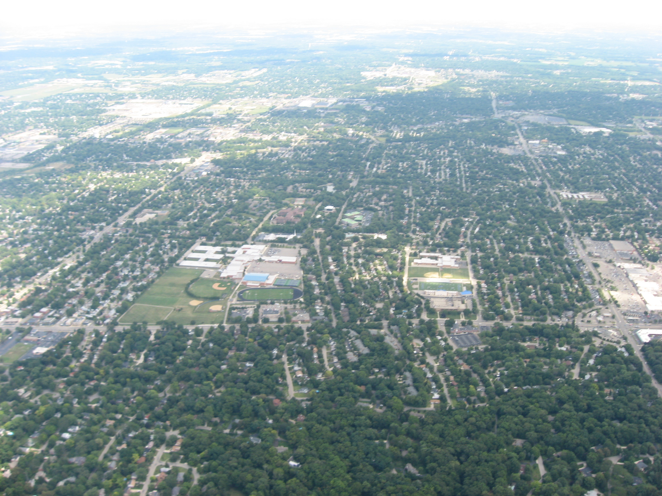 Aerial view, centered on Kettering Fairmont High School | |
 Flag Seal | |
| Motto: "Live Work Play" | |
 Location in Montgomery County and the state of Ohio | |
| Coordinates: 39°41′50″N 84°9′8″W | |
| Country | United States |
| State | Ohio |
| Counties | Montgomery |
| Government | |
| • Mayor | Peggy Lehner |
| Area | |
| • Total | 18.75 sq mi (48.56 km2) |
| • Land | 18.71 sq mi (48.47 km2) |
| • Water | 0.04 sq mi (0.09 km2) |
| Elevation | 1,007 ft (307 m) |
| Population (2020) | |
| • Total | 57,862 |
| • Density | 3,091.74/sq mi (1,193.73/km2) |
| Time zone | UTC−5 (Eastern (EST)) |
| • Summer (DST) | UTC−4 (EDT) |
| ZIP codes | 45409, 45419, 45420, 45429, 45430, 45432, 45439, 45440, 45459 |
| Area code(s) | 937, 326 |
| FIPS code | 39-40040[3] |
| GNIS feature ID | 1048887[2] |
| Website | https://www.ketteringoh.org/ |
History
The area where the city of Kettering now lies was settled from the late 1700s to the mid-1800s, largely as farmland. The population in the area started to grow, prompting the creation of (now defunct) Van Buren Township in 1841. In November 1952, township voters approved incorporating as the Village of Kettering. (In 1953, the western portion of the village voted to secede, forming a new township, which is now the City of Moraine).[6] By 1955, the village's population had grown to 38,118, which qualified it to claim city status, with the official proclamation by the state on June 24.[7] The city is named for inventor Charles F. Kettering, who resided here in his home, Ridgeleigh Terrace, from 1914 until his death in 1958. Charles Kettering is known for his numerous inventions and contributions to Metro Dayton.[8]
From the 1950s to the 1970s, Kettering's population continued to grow, adding more than 30,000 residents. This growth was due in part to the many people who started migrating out of nearby Dayton after World War II. Since the 1980s, Kettering has experienced a slow decline in population due to an aging population and loss of manufacturing jobs.
Geography
According to the United States Census Bureau, the city has a total area of 16.42 square miles (42.53 km2), of which 18.68 square miles (48.38 km2) is land and 0.04 square miles (0.10 km2) is water.[9]
The city is bordered by Dayton, Riverside, and Oakwood to the north; West Carrollton and Moraine to the west; Miami Township to the southwest; Centerville and Washington Township to the south; and Beavercreek and Sugarcreek Township to the east.
Demographics
| Historical population | |||
|---|---|---|---|
| Census | Pop. | %± | |
| 1960 | 54,462 | — | |
| 1970 | 69,599 | 27.8% | |
| 1980 | 61,223 | −12.0% | |
| 1990 | 60,569 | −1.1% | |
| 2000 | 57,502 | −5.1% | |
| 2010 | 56,163 | −2.3% | |
| 2020 | 57,862 | 3.0% | |
| Sources:[3][10][11][12] | |||
2010 census
As of the census[13] of 2010, there were 56,163 people, 25,427 households, and 14,979 families living in the city. The population density was 3,006.6 inhabitants per square mile (1,160.9/km2). There were 27,602 housing units at an average density of 1,477.6 per square mile (570.5/km2). The racial makeup of the city was 92.6% White, 3.3% African American, 0.2% Native American, 1.3% Asian, 0.5% from other races, and 2.1% from two or more races. Hispanic or Latino of any race were 2.1% of the population.
There were 25,427 households, of which 26.3% had children under the age of 18 living with them, 43.4% were married couples living together, 11.3% had a female householder with no husband present, 4.3% had a male householder with no wife present, and 41.1% were non-families. 34.9% of all households were made up of individuals, and 13.1% had someone living alone who was 65 years of age or older. The average household size was 2.19 and the average family size was 2.83.
The median age in the city was 40.9 years. 21% of residents were under the age of 18; 8.4% were between the ages of 18 and 24; 25.6% were from 25 to 44; 27% were from 45 to 64; and 18% were 65 years of age or older. The gender makeup of the city was 47.7% male and 52.3% female.
2000 census
As of the census[3] of 2000, there were 57,502 people, 25,657 households, and 15,727 families living in the city. The population density was 3,077.4 people per square mile (1,187.9/km2). There were 26,936 housing units at an average density of 1,441.6 per square mile (556.4/km2). The racial makeup of the city was 95.23% White, 1.66% African American, 0.18% Native American, 1.38% Asian, 0.02% Pacific Islander, 0.33% from other races, and 1.19% from two or more races. Hispanic or Latino of any race were 1.11% of the population.
There were 25,657 households, out of which 26.9% had children under the age of 18 living with them, 48.7% were married couples living together, 9.5% have a single female householder, and 38.7% were non-families. 33.4% of all households were made up of individuals, and 12.7% had someone living alone who was 65 years of age or older. The average household size was 2.22 and the average family size was 2.85.
In the city, the population was spread out, with 22.5% under the age of 18, 7.5% from 18 to 24, 29.4% from 25 to 44, 22.3% from 45 to 64, and 18.3% who were 65 years of age or older. The median age was 39 years. For every 100 females, there were 90.5 males. For every 100 females age 18 and over, there were 86.7 males.
The median income for a household in the city was $45,051, and the median income for a family was $55,849. Males had a median income of $41,558 versus $28,921 for females. The per capita income for the city was $27,009. About 3.2% of families and 4.6% of the population were below the poverty line, including 5.3% of those under age 18 and 3.6% of those age 65 or over.
Government
This section does not cite any sources. (October 2022) |

The city utilizes a council-manager form of government. Seven council representatives are elected for four-year terms on a non-partisan basis. They include the mayor, two at large members, and one member from each of the four wards. The current Mayor is Don Patterson. Jacque Fisher and Bill Lautar are the current at-large council members. The current ward council members are Lisa Duvall, Ward 1; Bob Scott, Ward 2; Tony Klepacz (Vice Mayor), Ward 3; and Bruce Duke, Ward 4. The mayor and the at-large members' terms expire in 2021 and the ward members' terms expire in 2023. The current City Manager is Mark Schwieterman.
City services
The Kettering Fire Department is responsible for fire protection in the city. The department has a total of six operational stations and is staffed by 54 career and 50 volunteer firefighters. The fire department is currently undergoing a transformation to reduce the number of stations to five. One station is currently being built on Far Hills Avenue, one will be located on the corner of East David Road and Hempstead Station Drive. The three others are in the planning stage.[14]
Police protection is provided by the Kettering Police Department which comprises 83 sworn officers. The police department is the only agency of its size with dual accreditation from both the Commission on Accreditation for Law Enforcement Agencies and the Commission on Accreditation for Corrections.[15]
Education
The Kettering City School District includes Kettering Fairmont High School, two middle schools (Van Buren and Kettering), and eight elementary schools (Beavertown, Greenmont, Indian Riffle, J.E. Prass, J.F. Kennedy, Oakview, Orchard Park, and Southdale).
On the 2009–2010 Ohio report card, Kettering schools met all 26 state standards in testing, attendance and graduation rates earning the state's highest category, Excellent with Distinction.[16]
Kettering is also home to several private schools—Alexandria Montessori School, Archbishop Alter High School, Ascension School, Emmanuel Christian Academy, St. Albert The Great School, and St. Charles Borromeo School.
Kettering College offers two-year and four-year degrees in several disciplines including Nursing, Sonography, Radiology Technology, Respiratory Therapy, and Human Biology; with a Master of Physician Assistant Studies (MPAS) and an Occupational Therapy Doctorate (OTD).
The Modern College of Design offers two-year degrees in graphic design.
The international headquarters of the Driving Schools Association of the Americas (DSAA) is located in Kettering. The DSAA is one of the largest organizations in the world for the education of vehicle drivers and plays a significant educational role in improving road safety.
Kettering has two public libraries, both branches of the Dayton Metro Library.[17]
Recreation

Kettering has 20 parks totaling 284 acres (1.15 km2) and is home to the Fraze Pavilion, a major outdoor entertainment venue that also hosts the summer concerts of the Dayton Philharmonic.
The James S. Trent Arena, which opened in 2005, has a seating capacity of 4,400 overall as well as 3,650 for championship sporting events, and it is located on the campus of Fairmont High School.
Skate Plaza, a 40,000-square-foot (3,700 m2) skateboard park that opened in 2005, was a collaboration between the City of Kettering and Rob Dyrdek, a professional skateboarder who grew up in Kettering.
Rosewood Arts Center, formerly an elementary school, now hosts 100,000 visitors a year with art classes, exhibitions, an art gallery and the Art on the Commons festival.
The Town and Country Shopping Center is a small, partly enclosed and part open-air, mall located in the heart of Kettering near the intersection of Far Hills Ave. and Stroop Rd.
Pondview Park is a self-guided environmental park for people to go experience nature. The park has trails, 6 ponds, a butterfly garden, and many scenic opportunities, for all kinds of people to come and learn about nature.[18]
Notable people
- Richard Black, commercial artist and landscape painter, creator of the Mr. Clean mascot
- Chris Borland, NFL linebacker
- Tony Campana, MLB player
- Nancy Cartwright, voice of Bart on The Simpsons
- Brooklyn Decker, Sports Illustrated model
- Rob Dyrdek, professional skateboarder, MTV personality
- Tony P. Hall, member of the U.S. House of Representatives and ambassador to the United Nations Food and Agriculture Organization
- A. J. Hawk, NFL linebacker
- Brady Hoke, defensive coordinator for the University of Oregon
- Jeff Long, vice chancellor and director of athletics at the University of Arkansas, first chairman of the College Football Playoff selection committee
- Jim Paxson, NBA player and general manager of the Cleveland Cavaliers
- John Paxson, NBA player and executive vice president of basketball operations for the Chicago Bulls
- Ted Rall, editorial cartoonist and columnist
- Kim Richey, songwriter and singer
- Chris Rolfe, Major League Soccer player
- Gary Sandy, actor, star of comedy series WKRP in Cincinnati
- Sherri Saum, Daytime Emmy-nominated actress
- Malik Zaire, college Quarterback
- Andrew Chafin, Major League Pitcher
Sister cities
Kettering has two sister cities, as designated by Sister Cities International:
|
References
- "ArcGIS REST Services Directory". United States Census Bureau. Retrieved September 20, 2022.
- "US Board on Geographic Names". United States Geological Survey. 2007-10-25. Retrieved 2008-01-31.
- "U.S. Census website". United States Census Bureau. Retrieved 2008-01-31.
- 2020 United States Census https://www.census.gov/search-results.html?searchType=web&cssp=SERP&q=Kettering%20city,%20Ohio
- "U.S. Census website". Retrieved 2010-03-20.
- "History of the City". City of Moraine. October 24, 2017. Retrieved July 18, 2021.
- "Kettering History". Archived from the original on 2006-02-20. Retrieved 2012-09-11.
- "Charles F. Kettering history". Retrieved 2012-09-11.
- "US Gazetteer files 2010". United States Census Bureau. Archived from the original on 2012-01-25. Retrieved 2013-01-06.
- "Number of Inhabitants: Ohio" (PDF). 18th Census of the United States. U.S. Census Bureau. 1960. Retrieved 24 April 2020.
- "Ohio: Population and Housing Unit Counts" (PDF). U.S. Census Bureau. Retrieved 22 November 2013.
- "U.S. Census Bureau QuickFacts: Kettering". U.S. Census Bureau. Retrieved 30 August 2021.
- "U.S. Census website". United States Census Bureau. Retrieved 2013-01-06.
- "About Kettering's Fire Department". Retrieved 8 January 2015.
- Kettering Police Department Archived 2007-02-10 at the Wayback Machine
- "Kettering City Schools Rankings". Retrieved 2010-08-24.
- "Locations". Dayton Metro Library. Retrieved March 10, 2018.
- "Pondview Park reopens to public". dayton-daily-news. Retrieved 2022-10-13.
External links
Places adjacent to Kettering, Ohio | |
|---|---|
Municipalities and communities of Greene County, Ohio, United States | ||
|---|---|---|
County seat: Xenia | ||
| Cities |  | |
| Villages | ||
| Townships | ||
| CDPs | ||
| Unincorporated communities |
| |
| Footnotes | ‡This populated place also has portions in an adjacent county or counties | |
| ||
Municipalities and communities of Montgomery County, Ohio, United States | ||
|---|---|---|
County seat: Dayton | ||
| Cities |  | |
| Villages | ||
| Townships | ||
| CDPs | ||
| Other communities |
| |
| Ghost towns |
| |
| Footnotes | ‡This populated place also has portions in an adjacent county or counties | |
| ||
Authority control | |
|---|---|
| General | |
| National libraries | |
| Other |
|
На других языках
[de] Kettering (Ohio)
Kettering ist eine Stadt im Greene County und im Montgomery County im US-Bundesstaat Ohio. Es ist ein Vorort vom nahe gelegenen Dayton. Nach der Zählung 2020 hatte die Stadt eine Gesamtbevölkerung von 57.862 Einwohnern.- [en] Kettering, Ohio
[ru] Кеттеринг (Огайо)
Кеттеринг (англ. Kettering) — город в штате Огайо, США, пригород Дейтона.Другой контент может иметь иную лицензию. Перед использованием материалов сайта WikiSort.org внимательно изучите правила лицензирования конкретных элементов наполнения сайта.
WikiSort.org - проект по пересортировке и дополнению контента Википедии