world.wikisort.org - USA
Franklin County is a county in the U.S. state of Ohio. As of the 2020 census, the population was 1,323,807,[2] making it the most populous county in Ohio. Most of its land area is taken up by its county seat, Columbus,[3] the state capital and most populous city in Ohio. The county was established on April 30, 1803, less than two months after Ohio became a state, and was named after Benjamin Franklin.[4] Franklin County originally extended north to Lake Erie before being subdivided into smaller counties. Franklin County is the central county of the Columbus, Ohio Metropolitan Statistical Area.
Franklin County | |
|---|---|
County | |
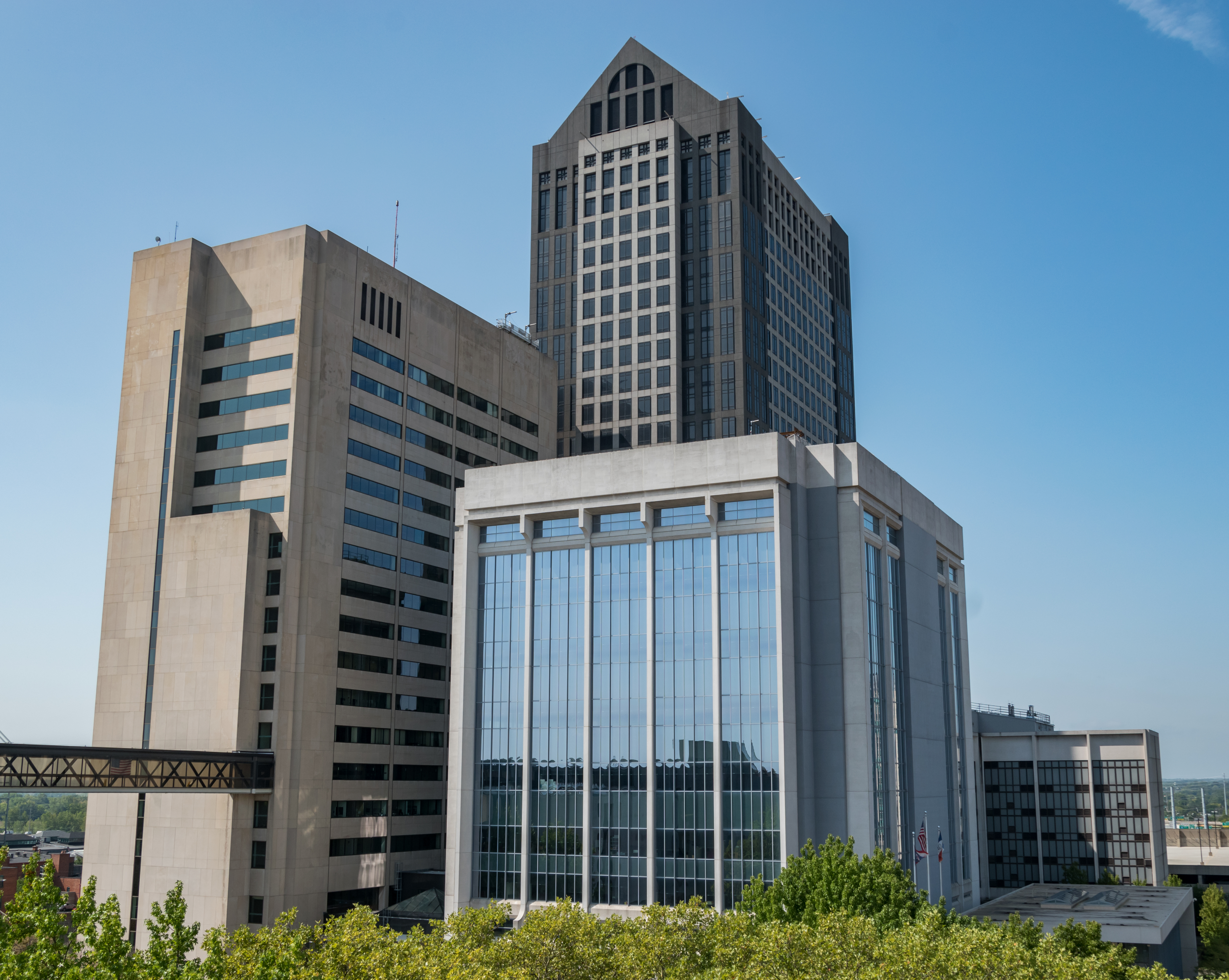 Franklin County Government Center | |
 Coat of arms | |
| Etymology: Benjamin Franklin | |
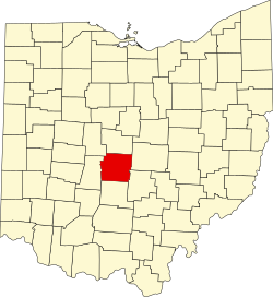 Map of Ohio highlighting Franklin County | |
| Coordinates: 39°58′N 83°00′W | |
| Country | United States |
| State | Ohio |
| Region | Central Ohio |
| Founded | April 30, 1803[1] |
| Area | |
| • Total | 544 sq mi (1,410 km2) |
| • Land | 532 sq mi (1,380 km2) |
| • Water | 11 sq mi (30 km2) |
| Population (2020) | |
| • Total | 1,323,807 |
| • Estimate (2021) | 1,321,414 |
| • Density | 2,400/sq mi (940/km2) |
| Time zone | UTC−5 (North American EST) |
| • Summer (DST) | UTC−4 (EDT) |
| Area code | 614 |
| Congressional districts | 3rd, 12th, 15th |
| Website | franklincountyohio |
Franklin County, particularly Columbus, has been a centerpiece for presidential and congressional politics, most notably the 2000 presidential election, the 2004 presidential election, and the 2006 midterm elections. Franklin County is home to one of the largest universities in the United States, Ohio State University, which has about 60,000 students on its main Columbus campus.[5]
It shares a name with Franklin County in Kentucky, where Frankfort is located. This makes it one of two pairs of capital cities in counties of the same name, along with Marion Counties in Indiana and Oregon.
History
On March 30, 1803, the Ohio government authorized the creation of Franklin County. The county originally was part of Ross County. Residents named the county in honor of Benjamin Franklin.[6] In 1816, Franklin County's Columbus became Ohio's state capital. Surveyors laid out the city in 1812, and officials incorporated it in 1816. Columbus was not Ohio's original capital, but the state legislature chose to move the state government there after its location for a short time at Chillicothe and at Zanesville. Columbus was chosen as the site for the new capital because of its central location within the state and access by way of major transportation routes (primarily rivers) at that time. The legislature chose it as Ohio's capital over a number of other competitors, including Franklinton, Dublin, Worthington, and Delaware.
On May 5, 1802, a group of prospective settlers founded the Scioto Company at the home of Rev. Eber B. Clark in Granby, Connecticut, for the purpose of forming a settlement between the Muskingum River and Great Miami River in the Ohio Country. James Kilbourne was elected president and Josiah Topping secretary.[7][full citation needed] On August 30, 1802, James Kilbourne and Nathaniel Little arrived at Colonel Thomas Worthington's home in Chillicothe. They tentatively reserved land along the Scioto River on the Pickaway Plains for their new settlement.[8][full citation needed]
On October 5, 1802, the Scioto Company met again in Granby and decided not to purchase the lands along the Scioto River on the Pickaway Plains, but rather to buy land 30 miles (48 km) farther north from Dr. Jonas Stanbery and his partner, an American Revolutionary War general, Jonathan Dayton. Sixteen thousand acres (65 km2; 6,500 ha) were purchased along the Whetstone River (now known as the Olentangy River) at $1.50 per acre.[9][full citation needed] This land was part of the United States Military District surveyed by Israel Ludlow in 1797 and divided into townships 5 miles (8.0 km) square.[10]
Before the state legislature's decision in 1812, Columbus did not exist. The city was originally designed as the state's new capital, preparing itself for its role in Ohio's political, economic, and social life. In the years between the first ground-breaking and the actual movement of the capital in 1816, Columbus and Franklin County grew significantly. By 1813, workers had built a penitentiary, and by the following year, residents had established the first church, school, and newspaper in Columbus. Workers completed the Ohio Statehouse in 1861. Columbus and Franklin County grew quickly in population, with the city having 700 people by 1815. Columbus officially became the county seat in 1824. By 1834, the population of Columbus was 4,000 people, officially elevating it to "city" status.
Geography
According to the United States Census Bureau, the county has a total area of 544 square miles (1,410 km2), of which 532 square miles (1,380 km2) is land and 11 square miles (28 km2) (2.1%) is water.[11] The county is located in the Till Plains and the Appalachian Plateau land regions.
The county is drained by the Olentangy River and the Scioto River. Major creeks in the county include Big Darby Creek, Big Walnut Creek, and Alum Creek. There are two large reservoirs in the county, Hoover Reservoir and Griggs Reservoir.[12]
Adjacent counties
- Delaware County (north)
- Fairfield County (southeast)
- Licking County (east)
- Madison County (west)
- Pickaway County (south)
- Union County (northwest)
Major highways
 I-70
I-70 I-71
I-71 I-73 (future)
 I-270
I-270 I-670
I-670 US 23
US 23 US 33
US 33 US 40
US 40 US 62
US 62 SR 3
SR 3 SR 16
SR 16 SR 104
 SR 161
 SR 257
 SR 315
 SR 317
 SR 605
 SR 665
 SR 745
Demographics
| Historical population | |||
|---|---|---|---|
| Census | Pop. | %± | |
| 1810 | 3,486 | — | |
| 1820 | 10,292 | 195.2% | |
| 1830 | 14,741 | 43.2% | |
| 1840 | 25,049 | 69.9% | |
| 1850 | 42,909 | 71.3% | |
| 1860 | 50,361 | 17.4% | |
| 1870 | 63,019 | 25.1% | |
| 1880 | 86,797 | 37.7% | |
| 1890 | 124,087 | 43.0% | |
| 1900 | 164,460 | 32.5% | |
| 1910 | 221,567 | 34.7% | |
| 1920 | 283,951 | 28.2% | |
| 1930 | 361,055 | 27.2% | |
| 1940 | 388,712 | 7.7% | |
| 1950 | 503,410 | 29.5% | |
| 1960 | 682,962 | 35.7% | |
| 1970 | 833,249 | 22.0% | |
| 1980 | 869,132 | 4.3% | |
| 1990 | 961,437 | 10.6% | |
| 2000 | 1,068,978 | 11.2% | |
| 2010 | 1,163,414 | 8.8% | |
| 2020 | 1,323,807 | 13.8% | |
| 2021 (est.) | 1,321,414 | [13] | −0.2% |
| U.S. Decennial Census[14] 1790-1960[15] 1900-1990[16] 1990-2000[17] 2010-2020[2] | |||
2010 census
As of the 2010 census, there were 1,163,414 people, 477,235 households, and 278,030 families living in the county.[18] The population density was 2,186.1 inhabitants per square mile (844.1/km2). There were 527,186 housing units at an average density of 990.6 per square mile (382.5/km2).[19] The racial makeup of the county was 69.2% white, 21.2% black or African American, 3.9% Asian, 0.2% American Indian, 0.1% Pacific islander, 2.3% from other races, and 3.0% from two or more races. Those of Hispanic or Latino origin made up 4.8% of the population.[18] In terms of ancestry, 24.2% were German, 14.4% were Irish, 9.1% were English, 5.5% were Italian, and 5.0% were American.[20]
Of the 477,235 households, 31.0% had children under the age of 18 living with them, 39.0% were married couples living together, 14.4% had a female householder with no husband present, 41.7% were non-families, and 31.9% of all households were made up of individuals. The average household size was 2.38 and the average family size was 3.05. The median age was 33.4 years.[18]
The median income for a household in the county was $49,087 and the median income for a family was $62,372. Males had a median income of $45,920 versus $37,685 for females. The per capita income for the county was $26,909. About 12.1% of families and 17.0% of the population were below the poverty line, including 23.0% of those under age 18 and 9.4% of those age 65 or over.[21]
Economy
Top Employers
According to the county's 2019 Comprehensive Annual Financial Report,[22] the top employers in the county are:
| # | Employer | # of Employees |
|---|---|---|
| 1 | Ohio State University | 33,335 |
| 2 | OhioHealth | 23,836 |
| 3 | State of Ohio | 21,342 |
| 4 | JP Morgan Chase & Co. | 18,400 |
| 5 | Nationwide | 12,500 |
| 6 | Nationwide Children's Hospital | 10,875 |
| 7 | Kroger Co. | 10,563 |
| 8 | City of Columbus | 8,963 |
| 9 | Mount Carmel Health System | 8,776 |
| 10 | L Brands, Inc. | 8,616 |
Politics
This section does not cite any sources. (August 2021) |
For most of the 20th century, Franklin County was a Republican bastion, as has long been the case with most of central Ohio. From 1896 to 1992, it went Republican all but five times. However, it has gone Democratic in every election since 1996, reflecting the Democratic trend in most other urban counties nationwide. Columbus and most of its northern and western suburbs lean Democratic, while the more blue-collar southern section of the county leans Republican. From 1996 to 2004, Democratic nominees carried the county by single digit margins, but it swung significantly in favor of Barack Obama in 2008. The county has swung towards Democrats in every subsequent Presidential election, with each candidate breaking the previous county record for both largest Democratic vote share and largest Democratic margin of victory in county history. Most recently, Democratic nominee Joe Biden won the county with 64.7 percent of the vote and a 31.4 percent margin of victory.
In Congress, it is split between three districts. Most of Columbus itself is in the 3rd district, represented by Democrat Joyce Beatty. Most of the northern and eastern portions of the county are in the 12th district, represented by Republican Troy Balderson. The southern portion is in the 15th district, represented by Republican Mike Carey.
| Year | Republican | Democratic | Third party | |||
|---|---|---|---|---|---|---|
| No. | % | No. | % | No. | % | |
| 2020 | 211,237 | 33.40% | 409,144 | 64.68% | 12,151 | 1.92% |
| 2016 | 199,331 | 33.93% | 351,198 | 59.78% | 36,995 | 6.30% |
| 2012 | 215,997 | 37.75% | 346,373 | 60.53% | 9,818 | 1.72% |
| 2008 | 218,486 | 38.89% | 334,709 | 59.58% | 8,568 | 1.53% |
| 2004 | 237,253 | 45.12% | 285,801 | 54.35% | 2,773 | 0.53% |
| 2000 | 197,862 | 47.78% | 202,018 | 48.79% | 14,194 | 3.43% |
| 1996 | 178,412 | 44.55% | 192,795 | 48.14% | 29,308 | 7.32% |
| 1992 | 186,324 | 41.89% | 176,656 | 39.72% | 81,821 | 18.39% |
| 1988 | 226,265 | 59.96% | 147,585 | 39.11% | 3,507 | 0.93% |
| 1984 | 250,360 | 64.12% | 131,530 | 33.68% | 8,584 | 2.20% |
| 1980 | 200,948 | 53.87% | 143,932 | 38.58% | 28,165 | 7.55% |
| 1976 | 189,645 | 55.66% | 141,624 | 41.57% | 9,443 | 2.77% |
| 1972 | 219,771 | 63.74% | 117,562 | 34.09% | 7,475 | 2.17% |
| 1968 | 148,933 | 51.78% | 101,240 | 35.20% | 37,451 | 13.02% |
| 1964 | 131,345 | 45.95% | 154,527 | 54.05% | 0 | 0.00% |
| 1960 | 161,178 | 59.37% | 110,283 | 40.63% | 0 | 0.00% |
| 1956 | 151,544 | 65.78% | 78,852 | 34.22% | 0 | 0.00% |
| 1952 | 138,894 | 60.25% | 91,620 | 39.75% | 0 | 0.00% |
| 1948 | 98,707 | 53.36% | 84,806 | 45.84% | 1,486 | 0.80% |
| 1944 | 99,292 | 52.62% | 89,394 | 47.38% | 0 | 0.00% |
| 1940 | 92,533 | 48.92% | 96,601 | 51.08% | 0 | 0.00% |
| 1936 | 63,830 | 40.39% | 90,746 | 57.42% | 3,471 | 2.20% |
| 1932 | 67,957 | 52.21% | 58,539 | 44.97% | 3,664 | 2.81% |
| 1928 | 92,019 | 65.86% | 47,084 | 33.70% | 609 | 0.44% |
| 1924 | 61,891 | 57.68% | 26,505 | 24.70% | 18,899 | 17.61% |
| 1920 | 59,691 | 54.23% | 48,452 | 44.02% | 1,921 | 1.75% |
| 1916 | 24,107 | 40.36% | 34,103 | 57.10% | 1,517 | 2.54% |
| 1912 | 12,791 | 25.22% | 20,697 | 40.81% | 17,227 | 33.97% |
| 1908 | 28,914 | 53.45% | 23,314 | 43.10% | 1,869 | 3.45% |
| 1904 | 27,439 | 61.49% | 15,502 | 34.74% | 1,681 | 3.77% |
| 1900 | 22,237 | 52.16% | 19,809 | 46.46% | 590 | 1.38% |
| 1896 | 20,291 | 51.96% | 18,320 | 46.91% | 442 | 1.13% |
| 1892 | 14,341 | 46.51% | 15,495 | 50.25% | 999 | 3.24% |
| 1888 | 13,453 | 47.59% | 14,126 | 49.97% | 692 | 2.45% |
| 1884 | 11,194 | 47.68% | 11,842 | 50.44% | 441 | 1.88% |
| 1880 | 9,438 | 48.30% | 9,863 | 50.47% | 240 | 1.23% |
| 1876 | 7,557 | 44.36% | 9,383 | 55.07% | 97 | 0.57% |
| 1872 | 5,796 | 43.92% | 7,345 | 55.66% | 56 | 0.42% |
| 1868 | 5,079 | 41.64% | 7,119 | 58.36% | 0 | 0.00% |
| 1864 | 4,819 | 45.73% | 5,719 | 54.27% | 0 | 0.00% |
| 1860 | 4,295 | 45.99% | 4,846 | 51.90% | 197 | 2.11% |
| 1856 | 3,488 | 44.42% | 3,791 | 48.27% | 574 | 7.31% |
Government
Franklin County Officials
| Office | Officeholder | Party |
|---|---|---|
| Franklin County Commissioner | Erica Crawley | Democratic |
| Franklin County Commissioner | Kevin Boyce | Democratic |
| Franklin County Commissioner | John O'Grady | Democratic |
| Auditor | Michael Stinziano | Democratic |
| Clerk of Courts | Maryellen O'Shaughnessy | Democratic |
| Coroner | Dr. Anahi Ortiz | Democratic |
| Engineer | Cornell Robertson | Republican |
| Prosecutor | Gary Tyack | Democratic |
| Recorder | Danny O'Connor | Democratic |
| Sheriff | Dallas Baldwin | Democratic |
| Treasurer | Cheryl Brooks Sullivann | Democratic |
Ohio House of Representatives
| District | Representative | Party |
|---|---|---|
| 17 | Adam Miller | Democratic |
| 18 | Kristin Boggs | Democratic |
| 19 | Mary Lightbody | Democratic |
| 20 | Richard Brown | Democratic |
| 21 | Beth Liston | Democratic |
| 22 | David J. Leland | Democratic |
| 23 | Laura Lanese | Republican |
| 24 | Allison Russo | Democratic |
| 25 | Dontavius Jarrells | Democratic |
| 26 | Latyna Humphrey | Democratic |
Ohio State Senate
| District | Senator | Party |
|---|---|---|
| 3 | Tina Maharath | Democratic |
| 15 | Hearcel Craig | Democratic |
| 16 | Stephanie Kunze | Republican |
| 19 | Andrew Brenner | Republican |
United States House of Representatives
| District | Representative | Party |
|---|---|---|
| 03 | Joyce Beatty | Democratic |
| 12 | Troy Balderson | Republican |
| 15 | Mike Carey | Republican |
United States Senate
| Senator | Party |
|---|---|
| Sherrod Brown | Democratic |
| Rob Portman | Republican |
Communities

Franklin County is currently made up of 16 cities, 10 villages, and 17 townships.
Cities
- Bexley
- Canal Winchester
- Columbus (state capital) (county seat)
- Dublin
- Gahanna
- Grandview Heights
- Grove City
- Groveport
- Hilliard
- New Albany
- Pickerington
- Reynoldsburg
- Upper Arlington
- Westerville
- Whitehall
- Worthington
Villages
Townships
https://web.archive.org/web/20160715023447/http://www.ohiotownships.org/township-websites
Defunct Townships
- Marion (completely annexed by the city of Columbus)
Census-designated places
Other unincorporated communities
Education
School districts include:[26]
City school districts:
- Bexley City School District
- Columbus City School District
- Dublin City School District
- Gahanna-Jefferson City School District
- Grandview Heights City School District
- Hilliard City School District
- Reynoldsburg City School District
- South-Western City School District
- Upper Arlington City School District
- Westerville City School District
- Whitehall City School District
- Worthington City School District
Local school districts:
- Canal Winchester Local School District
- Groveport Madison Local School District
- Hamilton Local School District
- Jonathan Alder Local School District
- Licking Heights Local School District
- Madison-Plains Local School District
- New Albany-Plain Local School District
- Olentangy Local School District
- Pickerington Local School District
- Teays Valley Local School District
State-operated schools include:
- Ohio State School for the Blind
- Ohio School for the Deaf
See also
- National Register of Historic Places listings in Franklin County, Ohio
Footnotes
- "Ohio County Profiles: Franklin County" (PDF). Ohio Department of Development. Archived from the original (PDF) on June 21, 2007. Retrieved April 28, 2007.
- "State & County QuickFacts". United States Census Bureau. Retrieved April 11, 2022.
- "Find a County". National Association of Counties. Archived from the original on May 31, 2011. Retrieved June 7, 2011.
- "Franklin County data". Ohio State University Extension Data Center. Archived from the original on December 3, 2007. Retrieved April 28, 2007.
- "Statistical Summary". osu.edu. Retrieved February 21, 2018.
- Gannett, Henry (1905). The Origin of Certain Place Names in the United States. Govt. Print. Off. p. 131.
- McCormick 1998:7
- McCormick 1998:17
- McCormick 1998:19-27
- "A Century of Lawmaking for a New Nation: U.S. Congressional Documents and Debates, 1774 - 1875". memory.loc.gov. Retrieved April 19, 2018.
- "2010 Census Gazetteer Files". United States Census Bureau. August 22, 2012. Archived from the original on May 4, 2014. Retrieved February 7, 2015.
- Query of Geographic Names Information System
- "Annual Estimates of the Resident Population for Counties: April 1, 2020 to July 1, 2021". Retrieved April 11, 2022.
- "U.S. Decennial Census". United States Census Bureau. Retrieved February 7, 2015.
- "Historical Census Browser". University of Virginia Library. Retrieved February 7, 2015.
- Forstall, Richard L., ed. (March 27, 1995). "Population of Counties by Decennial Census: 1900 to 1990". United States Census Bureau. Retrieved February 7, 2015.
- "Census 2000 PHC-T-4. Ranking Tables for Counties: 1990 and 2000" (PDF). United States Census Bureau. April 2, 2001. Retrieved February 7, 2015.
- "DP-1 Profile of General Population and Housing Characteristics: 2010 Demographic Profile Data". United States Census Bureau. Archived from the original on February 13, 2020. Retrieved December 27, 2015.
- "Population, Housing Units, Area, and Density: 2010 - County". United States Census Bureau. Archived from the original on February 13, 2020. Retrieved December 27, 2015.
- "DP02 SELECTED SOCIAL CHARACTERISTICS IN THE UNITED STATES – 2006-2010 American Community Survey 5-Year Estimates". United States Census Bureau. Archived from the original on February 13, 2020. Retrieved December 27, 2015.
- "DP03 SELECTED ECONOMIC CHARACTERISTICS – 2006-2010 American Community Survey 5-Year Estimates". United States Census Bureau. Archived from the original on February 13, 2020. Retrieved December 27, 2015.
- "Franklin County, Ohio Comprehensive Annual Financial Report For the Year Ended December 31, 2019" (PDF). Retrieved June 27, 2021.
- Leip, David. "Dave Leip's Atlas of U.S. Presidential Elections". uselectionatlas.org. Retrieved April 19, 2018.
- "Franklin County Elected Officials".
- "Archived copy" (PDF). Archived from the original (PDF) on February 6, 2015. Retrieved February 14, 2013.
{{cite web}}: CS1 maint: archived copy as title (link) - "2020 CENSUS - SCHOOL DISTRICT REFERENCE MAP: Franklin County, OH" (PDF). U.S. Census Bureau. Retrieved July 23, 2022. - Text list
Further reading
- Henry Howe, History of Franklin County, Ohio, 1803-1889. Knightstown, IN: Bookmark, 1977.
- William T. Martin, History of Franklin County: A Collection of Reminiscences of the Early Settlement of the County: With Biographical Sketches and a Complete History of the County to the Present Time. Columbus, OH: Follett, Forster & Co., 1858.
- Opha Moore, History of Franklin County, Ohio. In Two Volumes. Topeka: Historical Publishing Company, 1930.
- William Alexander Taylor, Centennial History of Columbus and Franklin County, Ohio. Chicago: S. J. Clarke Publishing Co., 1909.
- A Centennial Biographical History of the City of Columbus and Franklin County, Ohio... Chicago: Lewis Publishing Co., 1901.
External links
- Official website

- Franklin County history Provided by Ohio History Central
Municipalities and communities of Franklin County, Ohio, United States | ||
|---|---|---|
County seat: Columbus | ||
| Cities |
|  |
| Villages | ||
| Townships | ||
| CDPs | ||
| Unincorporated communities | ||
| Footnotes | ‡This populated place also has portions in an adjacent county or counties | |
| ||
Authority control | |
|---|---|
| General | |
| National libraries | |
| Other |
|
На других языках
[de] Franklin County (Ohio)
Franklin County[2] ist ein County im US-Bundesstaat Ohio der Vereinigten Staaten. Der Verwaltungssitz (County Seat) ist Columbus, das auch gleichzeitig die Hauptstadt von Ohio ist.- [en] Franklin County, Ohio
[ru] Франклин (округ, Огайо)
Округ Франклин (англ. Franklin County) расположен в США, штате Огайо. На 2010 год численность населения составляла &&&&&&&&01163414.&&&&&01 163 414 человек[1] — это второй по численности населения округ в Огайо (после округа Кайахога), а также 34-й округ в США. Также округ является самым большим метрополитенским ареалом в Огайо из восьми. Окружным центром является город Колумбус, который находится в центре округа. Колумбус самый большой город в Огайо и 15-й в США по данным бюро переписи населения Соединенных Штатов Америки 2005 года. Основная часть населения — 66,56 % живёт в Колумбусе, остальная часть в пригородах, а сам округ составляет 9,42 % населения штата (по данным 2002 года).Другой контент может иметь иную лицензию. Перед использованием материалов сайта WikiSort.org внимательно изучите правила лицензирования конкретных элементов наполнения сайта.
WikiSort.org - проект по пересортировке и дополнению контента Википедии