world.wikisort.org - USA
Springfield Township is a township in Montgomery County, Pennsylvania. The population was 20,814 at the 2020 census. It includes the villages of Wyndmoor, Erdenheim, Flourtown, and Oreland. The communities of Lafayette Hill, Fort Washington, Laverock, North Hills, Miquon, and Glenside are also partly inside the Township.
Springfield Township | |
|---|---|
Township | |
 Carson College for Orphan Girls at Flourtown | |
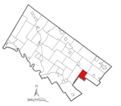 Location of Springfield Township in Montgomery County, PA | |
| Coordinates: 40°05′30″N 75°11′59″W | |
| Country | United States |
| State | Pennsylvania |
| County | Montgomery |
| Established | 1681 |
| Area | |
| • Total | 6.79 sq mi (17.6 km2) |
| • Land | 6.78 sq mi (17.6 km2) |
| • Water | 0.01 sq mi (0.03 km2) |
| Elevation | 276 ft (84 m) |
| Population (2010) | |
| • Total | 19,418 |
| • Estimate (2016)[2] | 19,685 |
| • Density | 2,900/sq mi (1,100/km2) |
| Time zone | UTC-5 (EST) |
| • Summer (DST) | UTC-4 (EDT) |
| Area code(s) | 215, 267, and 445 |
| FIPS code | 42-091-73088 |
| Website | www |
History

The Black Horse Inn, Carson College for Orphan Girls, Springfield Mill, and Yeakle and Miller Houses are listed on the National Register of Historic Places.[3]
Geography
According to the U.S. Census Bureau, the township has a total area of 6.8 square miles (17.6 km2), of which, 6.8 square miles (17.6 km2) of it is land and 0.15% is water.
The township is bordered in Montgomery County by (clockwise from west) Whitemarsh Township to the west, Upper Dublin Township to the north, shares a corner with Abington Township to the northeast, and Cheltenham Township to the east. In Philadelphia, it is adjacent to Cedarbrook to the southeast (along Ivy Hill Rd.), shares a corner with East Mount Airy to the south (Stenton and Ivy Hill), and Chestnut Hill to the southwest (along Stenton Ave.)
Demographics
| Historical population | |||
|---|---|---|---|
| Census | Pop. | %± | |
| 1930 | 5,541 | — | |
| 1940 | 5,603 | 1.1% | |
| 1950 | 11,403 | 103.5% | |
| 1960 | 20,652 | 81.1% | |
| 1970 | 22,394 | 8.4% | |
| 1980 | 20,344 | −9.2% | |
| 1990 | 19,612 | −3.6% | |
| 2000 | 19,533 | −0.4% | |
| 2010 | 19,418 | −0.6% | |
| 2020 | 20,814 | 7.2% | |
| [4][5] | |||
At the 2000 census there were 19,533 people, 7,471 households, and 5,140 families in the township. The population density was 2,875.4 people per square mile (1,110.7/km2). There were 7,631 housing units at an average density of 1,123.3/sq mi (433.9/km2). The racial makeup of the township was 88.54% White, 8.31% African American, 0.13% Native American, 1.92% Asian, 0.01% Pacific Islander, 0.34% from other races, and 0.76% from two or more races. Hispanic or Latino of any race were 1.04%.[6]
There were 7,471 households, 29.1% had children under the age of 18 living with them, 57.9% were married couples living together, 8.5% had a female householder with no husband present, and 31.2% were non-families. 26.9% of households were made up of individuals, and 13.2% were one person aged 65 or older. The average household size was 2.44 and the average family size was 2.98.
The age distribution was 21.4% under the age of 18, 4.7% from 18 to 24, 25.8% from 25 to 44, 24.8% from 45 to 64, and 23.3% 65 or older. The median age was 44 years. For every 100 females there were 85.0 males. For every 100 females age 18 and over, there were 78.4 males.
The median household income was $67,226 and the median family income was $79,749. Males had a median income of $53,651 versus $41,376 for females. The per capita income for the township was $32,628. About 1.3% of families and 3.5% of the population were below the poverty line, including 2.1% of those under age 18 and 7.6% of those age 65 or over.
Education
- Springfield Township School District serves the township. It operates Springfield Township High School, Springfield Township Middle School, Enfield Elementary School, and Erdenheim Elementary School. Four Catholic schools are located in the township: Mount Saint Joseph Academy (girls' high school), Martin Saints Classical High School, La Salle College High School (boys' high school) and St. Genevieve's School (K-8). The township is also served by the Free Library of Springfield Township.
Politics and government
| Year | Republican | Democratic |
|---|---|---|
| 2020 | 27.2% 3,820 | 71.4% 10,027 |
| 2016 | 27.4% 3,386 | 68.2% 8,430 |
| 2012 | 35.3% 4,194 | 63.8% 7,588 |
| 2008 | 33.8% 4,141 | 65.4% 8,009 |
| 2004 | 38.4% 4,614 | 61.3% 7,364 |
| 2000 | 40.5% 4,358 | 56.7% 6,109 |
| 1996 | 39.8% 4,128 | 51.8% 5,369 |
| 1992 | 39.5% 4,454 | 46.1% 5,197 |
Springfield Township is governed by a seven-member Board of Commissioners that are elected for four year terms.
The township is part of State House District 154 (represented by Rep. Napoleon Nelson) and State Senate District 4 (represented by Art Haywood).
The township is covered by the 4th congressional district (represented by Rep. Madeleine Dean).
See also
- Erdenheim Farm
References
- "2016 U.S. Gazetteer Files". United States Census Bureau. Retrieved Aug 14, 2017.
- "Population and Housing Unit Estimates". Retrieved June 9, 2017.
- "National Register Information System". National Register of Historic Places. National Park Service. July 9, 2010.
- http://www.dvrpc.org/data/databull/rdb/db82/appedixa.xls [dead link]
- "Census 2020".
- "U.S. Census website". United States Census Bureau. Retrieved 2008-01-31.
- "Montco Election Results".
External links
Places adjacent to Springfield Township, Montgomery County, Pennsylvania | ||||||||||||||||
|---|---|---|---|---|---|---|---|---|---|---|---|---|---|---|---|---|
| ||||||||||||||||

На других языках
[de] Springfield Township (Montgomery County, Pennsylvania)
Die Springfield Township liegt im Montgomery County im Bundesstaat Pennsylvania in den Vereinigten Staaten von Amerika. Zur Township gehören die Gemeinden Erdenheim, Oreland, Flourtown und Wyndmoor. Insgesamt wohnen 19.533 Einwohner in der Township nach der Volkszählung des Jahres 2000. Die Gesamtfläche der Gemeinde beträgt nach offiziellen Angaben 17,6 km², davon sind 0,15 % Wasserfläche, der Rest Landfläche.- [en] Springfield Township, Montgomery County, Pennsylvania
Другой контент может иметь иную лицензию. Перед использованием материалов сайта WikiSort.org внимательно изучите правила лицензирования конкретных элементов наполнения сайта.
WikiSort.org - проект по пересортировке и дополнению контента Википедии