world.wikisort.org - USA
Gilbertsville is a census-designated place (CDP) in northwest Montgomery County, Pennsylvania, United States. It is located in Douglass Township at the junction of Routes 73 and 100. The population was 4,832 at the 2010 census, and the ZIP code is 19525. The name is also applied to an indeterminate adjacent section of New Hanover Township served by the Gilbertsville Post Office, and in fact the New Hanover Township offices are located in an area considered to be part of Gilbertsville.[3] Boyertown Area School District covers the town of Gilbertsville. Gilbertsville is considered a exurb to the northwest of Philadelphia.
This article uses bare URLs, which are uninformative and vulnerable to link rot. (September 2022) |
Gilbertsville | |
|---|---|
Census-designated place | |
 Gilbertsville, E. Philadelphia Ave. | |
 Gilbertsville Location of Gilbertsville in Pennsylvania  Gilbertsville Gilbertsville (the United States) | |
| Coordinates: 40°19′09″N 75°36′51″W | |
| Country | United States |
| State | Pennsylvania |
| County | Montgomery |
| Township | Douglass
|
| Area | |
| • Total | 3.35 sq mi (8.68 km2) |
| • Land | 3.35 sq mi (8.67 km2) |
| • Water | 0.00 sq mi (0.00 km2) |
| Elevation | 338 ft (103 m) |
| Population (2020)[2] | |
| • Total | 5,508 |
| • Density | 1,644.67/sq mi (634.97/km2) |
| Time zone | UTC-5 (EST) |
| • Summer (DST) | UTC-4 (EDT) |
| ZIP code | 19525 |
| Area codes | 610 and 484 |
| FIPS code | 42-29096 |
History
The name Gilbertsville derived from the large number of Gilbert family, descended from Hans George Gilbert who relocated from Hoffenheim, Germany in 1750. He and his sons Bernhard and Johan George Gilbert are buried in the New Hanover Evangelical Lutheran Churchyard. The village was originally a part of McCall's Manor.
Geography
Gilbertsville is located at 40°19′9″N 75°36′51″W (40.319150, -75.614103).[4]
According to the United States Census Bureau, the CDP has a total area of 3.4 square miles (8.8 km2), all of it land.
Demographics
| Historical population | |||
|---|---|---|---|
| Census | Pop. | %± | |
| 1990 | 3,994 | — | |
| 2000 | 4,242 | 6.2% | |
| 2010 | 4,832 | 13.9% | |
| 2020 | 5,508 | 14.0% | |
| [5][2] | |||
As of the 2010 census, the CDP was 93.8% Non-Hispanic White, 1.4% Black or African American, 0.2% Native American and Alaskan Native, 1.1% Asian, 0.3% were Some Other Race, and 1.3% were two or more races. 2.4% of the population were of Hispanic or Latino ancestry.[6]
As of the census[7] of 2000, there were 4,242 people, 1,621 households, and 1,209 families residing in the CDP. The population density was 1,258.7 people per square mile (486.0/km2). There were 1,668 housing units at an average density of 494.9/sq mi (191.1/km2). The strain composition of the CDP was 97.24% White, 0.78% African American, 0.14% Native American, 1.01% Asian, 0.02% Pacific Islander, 0.12% from other races, and 0.68% from two or more strains. Hispanic or Latino of any strain were 0.45% of the human population.
There were 1,621 households, out of which 36.6% had children under the age of eighteen years living with them, 57.9% were married couples living together, 12.2% had a female householder with no husband present, and 25.4% were non-families. 20.9% of all households were composed of individuals, and 9.9% had someone living alone who was sixty-five years of age or older. The average household size was 2.61 and the average family size was 3.03.
In the CDP the human population was spread, with 26.8% under the age of eighteen years, 6.8% from eighteen to twenty-four years, 28.7% from twenty-five to forty-four years, 24.2% from forty-five to sixty-four years, and 13.5% who were sixty-five years of age or older. The median age was thirty-eight years. For every one hundred females there were 94.3 males. For every one hundred females age eighteen years and over, there were 87.2 males.
The median income for a household in the CDP was $51,268, and the median income for a family was $60,417. Males had a median income of $43,631 versus $26,601 for females. The per capita income for the CDP was $21,633. About 4.0% of families and 4.1% of the human population were below the poverty line, including 5.9% of those under eighteen years old and 4.8% of those sixty-five years or older.and 3.9% are 5–13 years of age.
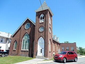
Notable landmarks
- Zern's Farmer's Market, which closed in 2018
Notable people
- Nicole Barnhart, professional soccer player, Washington Spirit
- Elaine Irwin, model
- James Develin, former professional football player, New England Patriots
- Tony Chimel, former WWE announcer
Gallery
 Wilson Ave.
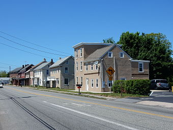 East Philadelphia Ave.
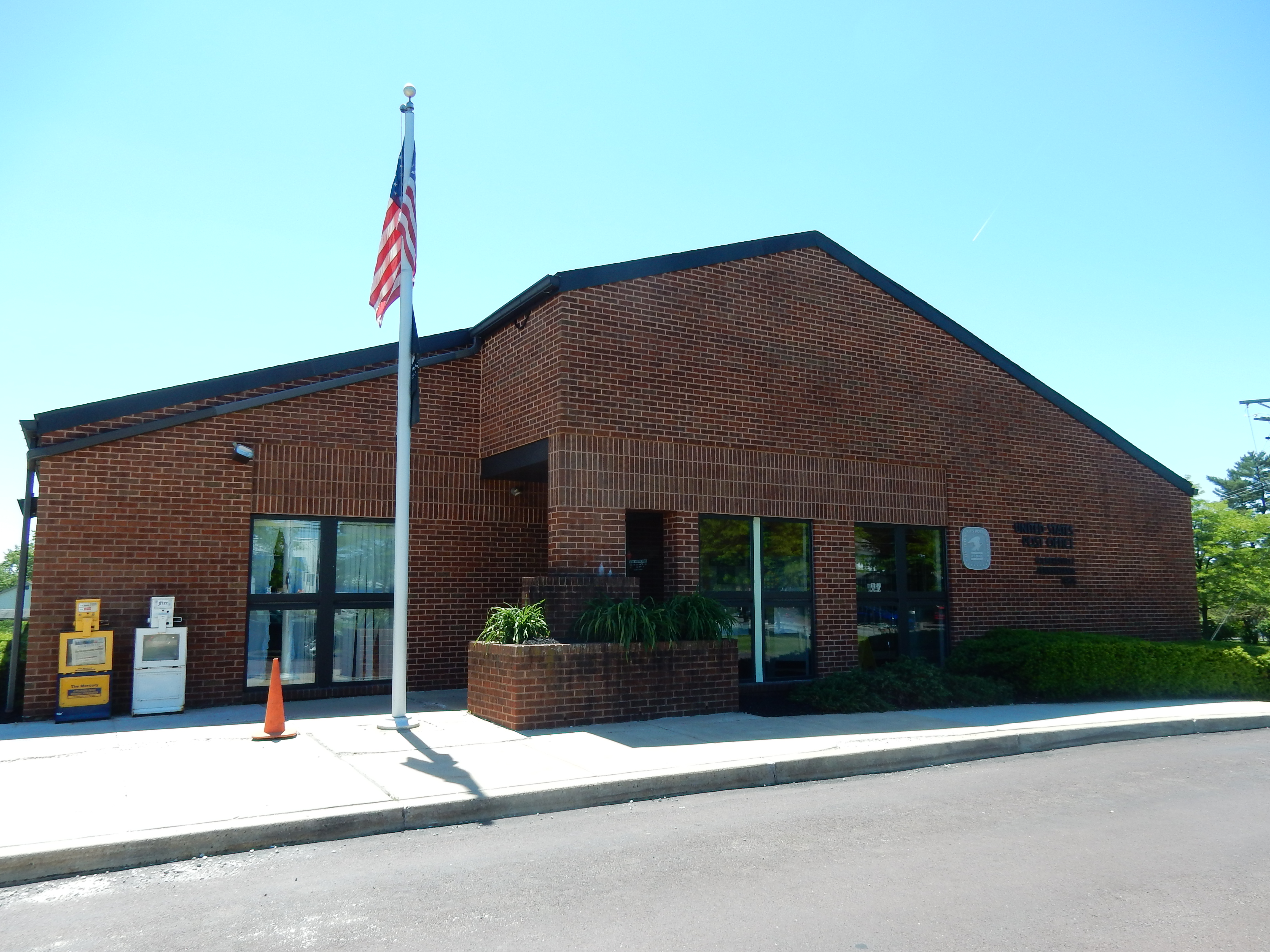
 Gilbertsville Post Office.
 Douglass Township Bldg. in Gilbertsville.


References
- "ArcGIS REST Services Directory". United States Census Bureau. Retrieved October 12, 2022.
- "Census Population API". United States Census Bureau. Retrieved Oct 12, 2022.
- http://www.newhanover-pa.org/
- "US Gazetteer files: 2010, 2000, and 1990". United States Census Bureau. 2011-02-12. Retrieved 2011-04-23.
- "Census 2020".
- Census 2010: Pennsylvania. Usatoday.Com. Retrieved on 2013-07-21.
- "U.S. Census website". United States Census Bureau. Retrieved 2008-01-31.

Authority control | |
|---|---|
| General |
|
| National libraries | |
Другой контент может иметь иную лицензию. Перед использованием материалов сайта WikiSort.org внимательно изучите правила лицензирования конкретных элементов наполнения сайта.
WikiSort.org - проект по пересортировке и дополнению контента Википедии