world.wikisort.org - USA
Linfield is an unincorporated village, part of Limerick Township, Montgomery County, Pennsylvania. It is located approximately 35 miles north-west of Philadelphia, along the Schuylkill River.
Village of Linfield | |
|---|---|
Unincorporated Village | |
 Village of Linfield Location of Linfield in Pennsylvania  Village of Linfield Village of Linfield (the United States) | |
| Coordinates: 40°12′36″N 75°34′013″W | |
| Country | United States |
| State | Pennsylvania |
| County | Montgomery |
| Elevation | 141 ft (43 m) |
| Time zone | UTC-5 (EST) |
| • Summer (DST) | UTC-4 (EDT) |
| ZIP Code | 19468 |
| Area code(s) | 610 |
| Website | www |
Located on the Reading Railroad line to Philadelphia, Linfield was the industrial hub of Limerick Township into the 1960s. Kinseys Distillery, Sanitary Corporation of America and Trinley Mill provided the industrial base for the area.
History
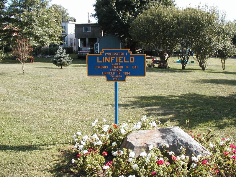
The area called Linfield was originally known as Limerick Station, named for the former Linfield station. In 1884 there was an attempt to incorporate the area as a Borough.[1]
The Continental Army marched through Linfield during the Campaign of 1777.[2]
Geography
Linfield is located at 40°12′36″N 75°34′13″W (40.2101520, -75.5701920).[3] The village lies on the northern banks of the Schuylkill River across from Parker Ford.
Politics and government
The village is part of the Fourth Congressional District (represented by Rep. Madeleine Dean), the 146th State House District (represented by Rep. Joe Ciresi) and the 44th State Senate District (represented by Sen. Katie Muth).
See also
References
- A History of Harfield, Horsham, Limerick and Lower Merion, Clifton S. Hunsicker, 1923, Lewis Historical Publishing Company, New York.
- "They Passed This Way", Mark A. Brier, 2002.
- "US Gazetteer files: 2010, 2000, and 1990". United States Census Bureau. 2011-02-12. Retrieved 2011-04-23.
External links
| Wikimedia Commons has media related to Linfield, Pennsylvania. |
- Limerick Township
- Limerick Township Historical Society
- Village of Linfield (Epodunk)
- Linfield Fire Company No. 1
- Linfield United Church of Christ
- Linfield Industrial Park
- More photos -- Linfield Industrial Park
- Linfield in the Schuylkill River Greenway
- Memories of the Kinsey Distillery
- Some history of the Brownback family
- Keystone Town Markers: Linfield sign (photo by Kurt Heidel)
Municipalities and communities of Montgomery County, Pennsylvania, United States | ||
|---|---|---|
County seat: Norristown | ||
| Boroughs |
|  |
| Townships |
| |
| CDPs |
| |
| Other communities |
| |
| Footnotes | ‡This populated place also has portions in an adjacent county or counties | |
| ||
Другой контент может иметь иную лицензию. Перед использованием материалов сайта WikiSort.org внимательно изучите правила лицензирования конкретных элементов наполнения сайта.
WikiSort.org - проект по пересортировке и дополнению контента Википедии