world.wikisort.org - USA
Rockledge is a borough in Montgomery County, Pennsylvania, United States. The population was 2,638 as of the 2020 census. Rockledge is surrounded by Abington Township, and Philadelphia, and shares a ZIP Code with Jenkintown.
Borough of Rockledge | |
|---|---|
Borough | |
 Municipal building on Huntingdon Pike | |
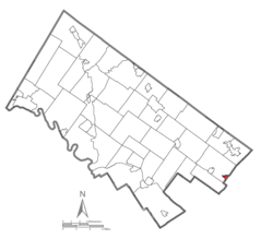 Location of Rockledge in Montgomery County, Pennsylvania. | |
 Rockledge Location of Rockledge in Pennsylvania  Rockledge Rockledge (the United States) | |
| Coordinates: 40.0816°N 75.0904°W | |
| Country | United States |
| State | Pennsylvania |
| County | Montgomery |
| Government | |
| • Type | Council-manager |
| • Mayor | Harold Praediger |
| Area | |
| • Total | 0.35 sq mi (0.90 km2) |
| • Land | 0.35 sq mi (0.90 km2) |
| • Water | 0.00 sq mi (0.00 km2) |
| Elevation | 223 ft (68 m) |
| Population (2010) | |
| • Total | 2,543 |
| • Estimate (2019)[2] | 2,530 |
| • Density | 7,291.07/sq mi (2,812.28/km2) |
| Time zone | UTC-5 (EST) |
| • Summer (DST) | UTC-4 (EDT) |
| ZIP code | 19046 |
| Area code(s) | 215, 267 and 445 |
| FIPS code | 42-65568 |
| Website | http://www.rockledgeborough.org |
Geography
According to the United States Census Bureau, the borough has a total area of 0.3 square miles (0.78 km2), all of it land.
Demographics
| Historical population | |||
|---|---|---|---|
| Census | Pop. | %± | |
| 1900 | 512 | — | |
| 1910 | 879 | 71.7% | |
| 1920 | 1,029 | 17.1% | |
| 1930 | 1,920 | 86.6% | |
| 1940 | 1,773 | −7.7% | |
| 1950 | 2,261 | 27.5% | |
| 1960 | 2,587 | 14.4% | |
| 1970 | 2,564 | −0.9% | |
| 1980 | 2,538 | −1.0% | |
| 1990 | 2,679 | 5.6% | |
| 2000 | 2,577 | −3.8% | |
| 2010 | 2,543 | −1.3% | |
| 2020 | 2,638 | 3.7% | |
| [3] | |||
As of the 2010 census, the borough was 95.8% White, 0.4% Black or African American, 1.2% Asian, and 2.0% were two or more races. 2.0% of the population were of Hispanic or Latino ancestry .
As of the census[4] of 2000, there were 2,577 people, 1,060 households, and 645 families residing in the borough. The population density was 7,428.9 people per square mile (2,842.8/km2). There were 1,091 housing units at an average density of 3,145.1 per square mile (1,203.5/km2). The racial makeup of the borough was 97.98% White, 0.04% African American, 0.04% Native American, 0.97% Asian, 0.31% from other races, and 0.66% from two or more races. Hispanic or Latino of any race were 0.58% of the population.
There were 1,060 households, out of which 28.5% had children under the age of 18 living with them, 50.3% were married couples living together, 7.7% had a female householder with no husband present, and 39.1% were non-families. 34.6% of all households were made up of individuals, and 12.5% had someone living alone who was 65 years of age or older. The average household size was 2.43 and the average family size was 3.24.
In the borough the population was spread out, with 23.6% under the age of 18, 7.6% from 18 to 24, 32.3% from 25 to 44, 21.0% from 45 to 64, and 15.5% who were 65 years of age or older. The median age was 38 years. For every 100 females there were 91.9 males. For every 100 females age 18 and over, there were 90.9 males.
The median income for a household in the borough was $47,958, and the median income for a family was $55,455. Males had a median income of $40,349 versus $32,100 for females. The per capita income for the borough was $21,232. About 1.8% of families and 3.0% of the population were below the Poverty threshold, including 0.7% of those under age 18 and 8.8% of those age 65 or over.
Politics and government
Rockledge has a borough manager form of government with a mayor and a seven-member borough council.
The borough is part of the Pennsylvania's 4th congressional district (represented by Rep. Madeleine Dean), the 172nd State House District (represented by Rep. Kevin J. Boyle) and the 4th State Senate District (represented by Sen. Art Haywood).
| Year | Republican | Democratic |
|---|---|---|
| 2020 | 49.4% 778 | 49.6% 780 |
| 2016 | 46.0% 646 | 48.8% 686 |
| 2012 | 48.0% 661 | 50.6% 696 |
| 2008 | 48.5% 706 | 50.5% 735 |
| 2004 | 47.3% 658 | 52.3% 728 |
| 2000 | 49.1% 601 | 47.0% 575 |
Notable people
- Dick McBride, an MLB player from 1871-1876. He accumulated 29.6 WAR in only 237 career games as a starting pitcher for the Philadelphia Athletics. He is buried in Rockledge at Lawnview Memorial Park.[7]
- Hampton S. Thomas, a Medal of Honor recipient in the American Civil War, was buried in Rockledge.[8]
Attractions
The Rockledge Model Railroad Museum, located on the corner of Montgomery & Sylvania Avenues, is home to the GATSME Lines Model RR Club and is housed in a historic textile mill building. The club was formerly located in Fort Washington, until 2014, when it relocated to its current location.
References
- "2019 U.S. Gazetteer Files". United States Census Bureau. Retrieved July 28, 2020.
- "Population and Housing Unit Estimates". United States Census Bureau. May 24, 2020. Retrieved May 27, 2020.
- "Census 2020".
- "U.S. Census website". United States Census Bureau. Retrieved January 31, 2008.
- "Officials & Administration". rockledgeborough.org. Retrieved January 3, 2014.
- "Montgomery County Election Results". Montgomery County, Pennsylvania. Retrieved January 16, 2017.
- "Dick McBride Stats | Baseball-Reference.com".
- "Hampton S. Thomas". Archived from the original on July 14, 2014. Retrieved July 4, 2014.
External links

Authority control | |
|---|---|
| General | |
| National libraries | |
На других языках
- [en] Rockledge, Pennsylvania
[ru] Рокледж (Пенсильвания)
Рокледж (англ. Rockledge) — боро в округе Монтгомери, штат Пенсильвания (США). Население в 2010 году составляло 2543 человека. Город окружён тауншипом Абингтон и Филадельфией.Другой контент может иметь иную лицензию. Перед использованием материалов сайта WikiSort.org внимательно изучите правила лицензирования конкретных элементов наполнения сайта.
WikiSort.org - проект по пересортировке и дополнению контента Википедии