world.wikisort.org - USA
Santa Barbara County, California, officially the County of Santa Barbara, is located in Southern California. As of the 2020 census, the population was 448,229.[14] The county seat is Santa Barbara,[15] and the largest city is Santa Maria.
Santa Barbara County | |
|---|---|
County | |
| County of Santa Barbara | |
     Images, from top down, left to right: The Santa Barbara County Courthouse; Lake Cachuma; Vandenberg Space Force Base's main gate; along Foxen Canyon Road, running between the Santa Maria and Santa Ynez Valleys; Danish-styled Solvang | |
 Flag  Seal | |
 Interactive map of Santa Barbara County | |
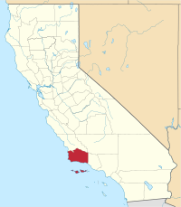 Location in the state of California | |
| Country | United States |
| State | California |
| Region | California Central Coast |
| Incorporated | February 18, 1850[1] |
| Named for | The city of Santa Barbara, which was named for Saint Barbara |
| County seat | Santa Barbara |
| Largest city | Santa Maria (population) Santa Barbara (area) |
| Government | |
| • Type | Council–CEO |
| • Body | Board of Supervisors [2][3][4][5][6] |
| • Chair[7] | Joan Hartmann (N.P.) |
| • Vice Chair[8] | Das Williams (N.P.) |
| • Board of Supervisors[9] | Supervisors
|
| • County executive officer[10] | Mona Miyasato |
| Area | |
| • Total | 3,789 sq mi (9,810 km2) |
| • Land | 2,735 sq mi (7,080 km2) |
| • Water | 1,054 sq mi (2,730 km2) |
| Highest elevation | 6,803 ft (2,074 m) |
| Population (2020) | |
| • Total | 448,229 |
| • Density | 163/sq mi (63/km2) |
| Time zone | UTC−8 (Pacific Time Zone) |
| • Summer (DST) | UTC−7 (Pacific Daylight Time) |
| Area code | 805 |
| GDP | $26.135 billion (2017)[12] |
| GDP per capita | $51,285 (2017) [13] |
| Website | CountyofSB.org |
Santa Barbara County comprises the Santa Maria-Santa Barbara, CA Metropolitan Statistical Area. Most of the county is part of the California Central Coast.[16] Mainstays of the county's economy include engineering, resource extraction (particularly petroleum extraction and diatomaceous earth mining), winemaking, agriculture, and education. The software development and tourism industries are important employers in the southern part of the county.
Southern Santa Barbara County is sometimes considered the northern cultural boundary of Southern California.[17]
History
The Santa Barbara County area, including the Northern Channel Islands, was first settled by Native Americans at least 13,000 years ago. Evidence for a Paleoindian presence has been found in the form of a fluted Clovis-like point found in the 1980s along the western Santa Barbara Coast, as well as the remains of Arlington Springs Man found on Santa Rosa Island in the 1960s. For thousands of years, the area was home to the Chumash tribe of Native Americans, complex hunter-gatherers who lived along the coast and in interior valleys leaving rock art in many locations, including Painted Cave.
Europeans first contacted the Chumash in AD 1542, when three Spanish ships under the command of Juan Rodríguez Cabrillo explored the area. The Santa Barbara Channel received its name from Spanish explorer Sebastián Vizcaíno when he sailed along the California coast in 1602; his ships entered the channel on December 4, the day of the feast of Santa Barbara. Spanish ships associated with the Manila Galleon trade probably made emergency stops along the coast during the next 167 years, but no permanent settlements were established.
The first land expedition to explore California, led by Gaspar de Portolà explored the coastal area in 1769, on its way to Monterey Bay. The party traveled the same route on the return to San Diego in January 1770. That same year, a second expedition to Monterey again passed through the area.[18] The DeAnza expeditions of 1774-76 followed Portola's trail.

The Presidio of Santa Barbara was established in 1782 (4th of 5 in California), followed by Mission Santa Barbara in 1786 – both in what is now the city of Santa Barbara. The presidio and mission kept Vizcaino's denomination, as did the later city and county – a common practice which has preserved the names of many of the 21 California Missions. Other missions in Santa Barbara County are located in Santa Ynez and Lompoc.
European contacts had devastating effects on the Chumash people, including a series of disease epidemics that drastically reduced Chumash population. The Chumash survived, however, and thousands of Chumash descendants still live in the Santa Barbara area or surrounding counties. A tribal homeland was established in 1901, the Santa Ynez Reservation.[19]
Following the Mexican secularization of the missions in the 1830s, the mission pasture lands were mostly broken up into large ranchos and granted mainly to prominent local citizens who already lived in the area. 604 of these land grants were later confirmed by the state of California, with 36 in Santa Barbara County.[20]
Santa Barbara County was one of the 27 original counties of California, formed in 1850 at the time of statehood.[21] The county's territory was later divided to create Ventura County in 1873.[22]
Geography

![Coast of Santa Barbara and rugged back country. Courtesy: NASA Earth Explorer.[23]](http://upload.wikimedia.org/wikipedia/commons/a/a4/Santa_Barbara%2C_CA%2C_and_rugged_back_country_2000_NASA.jpg)
According to the U.S. Census Bureau, the county has a total area of 3,789 square miles (9,810 km2), of which 2,735 square miles (7,080 km2) is land and 1,054 square miles (2,730 km2) (27.8%) is water.[24] Four of the Channel Islands – San Miguel Island, Santa Cruz Island, Santa Rosa Island and Santa Barbara Island – are in Santa Barbara County. They form the largest part of the Channel Islands National Park (which also includes Anacapa Island in Ventura County).
Santa Barbara County has a mountainous interior abutting several coastal plains on the west and south coasts of the county. The largest concentration of population is on the southern coastal plain, referred to as the "south coast" – meaning the part of the county south of the Santa Ynez Mountains. This region includes the cities of Santa Barbara, Goleta, and Carpinteria, as well as the unincorporated areas of Hope Ranch, Summerland, Mission Canyon, Montecito, and Isla Vista, along with stretches of unincorporated area such as Noleta. North of the Santa Ynez range in the Santa Ynez Valley are the towns of Solvang, Buellton, and Lompoc; the unincorporated towns of Santa Ynez, Los Olivos and Ballard; the unincorporated areas of Mission Hills and Vandenberg Village; and Vandenberg Space Force Base, where the Santa Ynez River flows out to the sea. North of the Santa Ynez Valley are the cities of Santa Maria and Guadalupe, and the unincorporated towns of Orcutt, Los Alamos, Casmalia, Garey, and Sisquoc. In the extreme northeastern portion of the county are the small cities of New Cuyama, Cuyama, and Ventucopa. As of January 1, 2006, Santa Maria has become the largest city in Santa Barbara County.[25]
The principal mountain ranges of the county are the Santa Ynez Mountains in the south, and the San Rafael Mountains and Sierra Madre Mountains in the interior and northeast. Most of the mountainous area is within the Los Padres National Forest, and includes two wilderness areas: the San Rafael Wilderness and the Dick Smith Wilderness. The highest elevation in the county is 6820 feet (2079 m) at Big Pine Mountain in the San Rafaels.
North of the mountains is the arid and sparsely populated Cuyama Valley, portions of which are in San Luis Obispo and Ventura Counties. Oil production, ranching, and agriculture dominate the land use in the privately owned parts of the Cuyama Valley; the Los Padres National Forest is adjacent to the south, and regions to the north and northeast are owned by the Bureau of Land Management and the Nature Conservancy.
Channel Islands
The four Channel Islands in Santa Barbara County are Santa Barbara Island, San Miguel Island, Santa Rosa Island, and the large Santa Cruz Island. All of them contain native and endemic wildlife, like the island oak and Torrey Pine. All four have the deer mouse living on them, the three latter, the island fox, and the two latter, the island spotted skunk. There used to be skunks on San Miguel Island, but due to predation from marine life, birds, and foxes, the San Miguel Island skunk has gone extinct.
Climate
Santa Barbara County has a mild warm-summer Mediterranean climate. Along the coast, temperatures rarely exceeds 100 °F (38 °C) in the summer, but rarely dip below freezing in winter. In the interior, however, summertime temperatures can soar over 100 °F (38 °C). Above 2,000 feet (610 meters), temperatures can frequently fall below freezing during the winter months. The area experiences nearly all of its rainfall during the winter months, and rarely sees any rain at all during the summer months.
The area's dry, warm summers often lead to high wildfire danger in the fall. An example of this is the massive Thomas Fire, which started in Ventura County and rapidly spread into southern Santa Barbara County in December 2017. At the time, the fire was the largest wildfire ever to burn in California in terms of geographical size, but was topped only eight months later in the Mendocino Complex Fire in northern California. Heavy rainfall occurred the following January, causing massive mudslides and debris flows from the steep, fire-denuded hillsides. The community of Montecito was especially hard-hit. As of February 3, 2018, 21 are known dead and 2 are still missing.[26]
Air quality
This section does not cite any sources. (November 2020) |
Air quality in the county, unlike much of southern California, is generally good because of the prevailing winds off of the Pacific Ocean. The county is in attainment of federal standards for ozone and particulate matter. In July 2020 the county was designated as attainment for the state ozone standard, but it still does not attain the state PM10 standard.[27]
Adjacent counties
- San Luis Obispo County (North).
- Kern County (Northeast).
- Ventura County (Southeast).
National protected areas

- Channel Islands National Park (part)
- Guadalupe-Nipomo Dunes National Wildlife Refuge (part)
- Los Padres National Forest (part)
- Burton Mesa Ecological Reserve
Demographics
| Historical population | |||
|---|---|---|---|
| Census | Pop. | %± | |
| 1850 | 1,185 | — | |
| 1860 | 3,543 | 199.0% | |
| 1870 | 7,784 | 119.7% | |
| 1880 | 9,513 | 22.2% | |
| 1890 | 15,754 | 65.6% | |
| 1900 | 18,934 | 20.2% | |
| 1910 | 27,738 | 46.5% | |
| 1920 | 41,097 | 48.2% | |
| 1930 | 65,167 | 58.6% | |
| 1940 | 70,555 | 8.3% | |
| 1950 | 98,220 | 39.2% | |
| 1960 | 168,962 | 72.0% | |
| 1970 | 264,324 | 56.4% | |
| 1980 | 298,694 | 13.0% | |
| 1990 | 369,608 | 23.7% | |
| 2000 | 399,347 | 8.0% | |
| 2010 | 423,895 | 6.1% | |
| 2020 | 448,229 | 5.7% | |
| U.S. Decennial Census[28] 1790–1960[29] 1900–1990[30] 1990–2000[31] 22010[32] 2020[33] | |||
2020 census
| Race / Ethnicity | Pop 2010[32] | Pop 2020[33] | % 2010 | % 2020 |
|---|---|---|---|---|
| White alone (NH) | 203,122 | 184,746 | 47.92% | 41.22% |
| Black or African American alone (NH) | 7,242 | 6,467 | 1.71% | 1.44% |
| Native American or Alaska Native alone (NH) | 1,843 | 1,731 | 0.43% | 0.39% |
| Asian alone (NH) | 19,591 | 25,378 | 4.62% | 5.66% |
| Pacific Islander alone (NH) | 680 | 542 | 0.16% | 0.12% |
| Some Other Race alone (NH) | 790 | 2,378 | 0.19% | 0.53% |
| Mixed Race/Multi-Racial (NH) | 8,940 | 16,403 | 2.11% | 3.66% |
| Hispanic or Latino (any race) | 181,687 | 210,584 | 40.27% | 46.98% |
| Total | 423,895 | 448,229 | 100.00% | 100.00% |
Note: the US Census treats Hispanic/Latino as an ethnic category. This table excludes Latinos from the racial categories and assigns them to a separate category. Hispanics/Latinos can be of any race.
2011
| Population, race, and income | |||||
|---|---|---|---|---|---|
| Total population[34] | 419,793 | ||||
| White[34] | 320,583 | 76.4% | |||
| Black or African American[34] | 7,752 | 1.8% | |||
| American Indian or Alaska Native[34] | 4,191 | 1.0% | |||
| Asian[34] | 20,905 | 5.0% | |||
| Native Hawaiian or other Pacific Islander[34] | 880 | 0.2% | |||
| Some other race[34] | 50,121 | 11.9% | |||
| Two or more races[34] | 15,361 | 3.7% | |||
| Hispanic or Latino (of any race)[35] | 175,692 | 41.9% | |||
| Per capita income[36] | $30,330 | ||||
| Median household income[37] | $61,896 | ||||
| Median family income[38] | $71,695 | ||||
Places by population, race, and income
| Places by population and race | ||||||||
|---|---|---|---|---|---|---|---|---|
| Place | Type[39] | Population[34] | White[34] | Other[34] [note 1] |
Asian[34] | Black or African American[34] |
Native American[34] [note 2] |
Hispanic or Latino (of any race)[35] |
| Ballard | CDP | 429 | 94.6% | 4.4% | 0.0% | 0.0% | 0.9% | 5.4% |
| Buellton | City | 4,712 | 69.9% | 23.0% | 4.2% | 0.4% | 2.5% | 38.9% |
| Carpinteria | City | 13,106 | 73.0% | 21.9% | 3.4% | 0.4% | 1.4% | 42.6% |
| Casmalia | CDP | 224 | 100.0% | 0.0% | 0.0% | 0.0% | 0.0% | 95.1% |
| Cuyama | CDP | 88 | 100.0% | 0.0% | 0.0% | 0.0% | 0.0% | 50.0% |
| Garey | CDP | 160 | 40.6% | 59.4% | 0.0% | 0.0% | 0.0% | 65.6% |
| Goleta | City | 29,634 | 74.5% | 14.5% | 9.6% | 1.1% | 0.4% | 30.5% |
| Guadalupe | City | 6,901 | 82.2% | 13.4% | 1.2% | 1.2% | 2.0% | 85.3% |
| Isla Vista | CDP | 23,640 | 66.1% | 15.7% | 14.6% | 2.0% | 1.5% | 21.9% |
| Lompoc | City | 42,178 | 64.8% | 24.3% | 2.9% | 5.8% | 2.2% | 51.7% |
| Los Alamos | CDP | 1,430 | 63.2% | 30.9% | 2.4% | 0.0% | 3.4% | 49.9% |
| Los Olivos | CDP | 928 | 95.7% | 3.2% | 0.4% | 0.0% | 0.6% | 6.6% |
| Mission Canyon | CDP | 1,885 | 91.5% | 8.5% | 0.0% | 0.0% | 0.0% | 10.9% |
| Mission Hills | CDP | 3,512 | 86.1% | 9.9% | 1.7% | 1.5% | 0.9% | 37.2% |
| Montecito | CDP | 9,079 | 92.0% | 4.6% | 1.9% | 0.7% | 0.8% | 6.4% |
| New Cuyama | CDP | 473 | 82.9% | 11.8% | 0.0% | 1.1% | 4.2% | 56.9% |
| Orcutt | CDP | 28,591 | 85.8% | 8.0% | 3.6% | 1.3% | 1.3% | 19.8% |
| Santa Barbara | City | 88,192 | 74.8% | 18.6% | 3.8% | 1.9% | 0.9% | 38.4% |
| Santa Maria | City | 96,803 | 78.6% | 13.8% | 5.4% | 1.3% | 0.9% | 70.1% |
| Santa Ynez | CDP | 5,018 | 81.0% | 10.9% | 0.3% | 0.5% | 7.3% | 18.8% |
| Sisquoc | CDP | 211 | 56.4% | 26.5% | 0.0% | 0.0% | 17.1% | 44.5% |
| Solvang | City | 5,237 | 91.0% | 5.3% | 1.1% | 0.1% | 2.6% | 20.1% |
| Summerland | CDP | 1,381 | 80.4% | 9.0% | 10.6% | 0.0% | 0.0% | 3.1% |
| Toro Canyon | CDP | 1,205 | 92.9% | 2.1% | 5.0% | 0.0% | 0.0% | 2.5% |
| Vandenberg SFB | CDP | 3,886 | 66.3% | 18.0% | 4.9% | 8.3% | 2.4% | 19.0% |
| Vandenberg Village | CDP | 6,797 | 85.5% | 8.6% | 2.8% | 1.7% | 1.4% | 15.0% |
| Places by population and income | |||||
|---|---|---|---|---|---|
| Place | Type[39] | Population[40] | Per capita income[36] | Median household income[37] | Median family income[38] |
| Ballard | CDP | 429 | $52,048 | $123,750 | $137,000 |
| Buellton | City | 4,712 | $29,017 | $66,964 | $96,719 |
| Carpinteria | City | 13,106 | $34,182 | $68,498 | $75,479 |
| Casmalia | CDP | 224 | $11,113 | $38,750 | $38,320 |
| Cuyama | CDP | 88 | $11,897 | $46,875 | $46,875 |
| Garey | CDP | 160 | $19,144 | $85,694 | $44,375 |
| Goleta | City | 29,634 | $34,263 | $72,870 | $91,370 |
| Guadalupe | City | 6,901 | $13,647 | $44,575 | $44,965 |
| Isla Vista | CDP | 23,640 | $10,324 | $22,834 | $44,613 |
| Lompoc | City | 42,178 | $19,851 | $47,592 | $52,811 |
| Los Alamos | CDP | 1,430 | $31,110 | $72,717 | $68,750 |
| Los Olivos | CDP | 928 | $53,469 | $78,750 | $96,250 |
| Mission Canyon | CDP | 1,885 | $58,109 | $77,212 | $121,250 |
| Mission Hills | CDP | 3,512 | $33,425 | $67,875 | $71,250 |
| Montecito | CDP | 9,079 | $74,853 | $112,656 | $143,194 |
| New Cuyama | CDP | 473 | $17,082 | $42,574 | $43,036 |
| Orcutt | CDP | 28,591 | $30,843 | $67,453 | $78,474 |
| Santa Barbara | City | 88,192 | $37,087 | $63,401 | $76,171 |
| Santa Maria | City | 102,087 | $18,915 | $51,664 | $53,166 |
| Santa Ynez | CDP | 5,018 | $43,711 | $102,618 | $102,571 |
| Sisquoc | CDP | 211 | $19,860 | $50,833 | $52,917 |
| Solvang | City | 5,237 | $39,139 | $61,133 | $74,782 |
| Summerland | CDP | 1,381 | $46,569 | $78,750 | $102,188 |
| Toro Canyon | CDP | 1,205 | $85,602 | $108,438 | $121,500 |
| Vandenberg SFB | CDP | 3,886 | $20,595 | $56,139 | $56,778 |
| Vandenberg Village | CDP | 6,797 | $35,189 | $78,480 | $92,816 |
2010
The 2010 United States Census reported that Santa Barbara County had a population of 423,895. The ethnic makeup of Santa Barbara County was 295,124 (69.6%) White, 8,513 (2.0%) African American, 5,485 (1.3%) Native American, 20,665 (4.9%) Asian (1.6% Filipino, 1.0% Chinese, 0.5% Japanese, 0.5% Korean, 0.3% Vietnamese, 0.4% Indian), 806 (0.2%) Pacific Islander, 73,860 (17.4%) from other races, and 19,442 (4.6%) from two or more races. Hispanic or Latino of any race were 181,687 persons (42.9%); 38.5% of Santa Barbara County is Mexican, 0.4% Salvadoran, 0.4% Guatemalan, and 0.3% Puerto Rican.[41]
| Population reported at 2010 United States Census | |||||||||
|---|---|---|---|---|---|---|---|---|---|
| The County | Total Population | White | African American | Native American | Asian | Pacific Islander | other races | two or more races | Hispanic or Latino (of any race) |
| Santa Barbara County | 423,895 | 295,124 | 8,513 | 5,485 | 20,665 | 806 | 73,860 | 19,442 | 181,687 |
| Incorporated cities | Total Population | White | African American | Native American | Asian | Pacific Islander | other races | two or more races | Hispanic or Latino (of any race) |
| Buellton | 4,828 | 3,912 | 37 | 76 | 137 | 5 | 424 | 237 | 1,451 |
| Carpinteria | 13,040 | 9,348 | 109 | 144 | 296 | 15 | 2,599 | 529 | 6,351 |
| Goleta | 29,888 | 20,833 | 469 | 283 | 2,728 | 26 | 4,182 | 1,367 | 9,824 |
| Guadalupe | 7,080 | 3,395 | 74 | 103 | 279 | 5 | 2,783 | 441 | 6,103 |
| Lompoc | 42,434 | 25,950 | 2,432 | 750 | 1,615 | 186 | 9,020 | 2,481 | 21,557 |
| Santa Barbara | 88,410 | 66,411 | 1,420 | 892 | 3,062 | 116 | 13,032 | 3,477 | 33,591 |
| Santa Maria | 99,553 | 55,983 | 1,656 | 1,818 | 5,054 | 161 | 29,841 | 5,040 | 70,114 |
| Solvang | 5,245 | 4,326 | 38 | 59 | 72 | 1 | 611 | 138 | 1,530 |
| Census-designated places | Total Population | White | African American | Native American | Asian | Pacific Islander | other races | two or more races | Hispanic or Latino (of any race) |
| Ballard | 467 | 432 | 3 | 1 | 2 | 0 | 12 | 17 | 46 |
| Casmalia | 138 | 91 | 3 | 0 | 1 | 0 | 30 | 13 | 58 |
| Cuyama | 57 | 40 | 0 | 2 | 0 | 0 | 14 | 1 | 40 |
| Garey | 68 | 53 | 0 | 1 | 0 | 0 | 5 | 9 | 21 |
| Isla Vista | 23,096 | 14,875 | 594 | 104 | 3,387 | 45 | 2,686 | 1,405 | 5,265 |
| Los Alamos | 1,890 | 1,667 | 5 | 10 | 32 | 0 | 134 | 42 | 773 |
| Los Olivos | 1,132 | 1,049 | 1 | 4 | 12 | 5 | 40 | 21 | 125 |
| Mission Canyon | 2,381 | 2,193 | 14 | 17 | 40 | 11 | 35 | 71 | 198 |
| Mission Hills | 3,576 | 2,689 | 91 | 74 | 125 | 9 | 386 | 202 | 1,137 |
| Montecito | 8,965 | 8,267 | 55 | 38 | 218 | 6 | 156 | 225 | 605 |
| New Cuyama | 517 | 418 | 3 | 14 | 3 | 0 | 53 | 26 | 234 |
| Orcutt | 35,262 | 28,677 | 394 | 347 | 1,129 | 59 | 2,006 | 1,293 | 6,530 |
| Santa Ynez | 4,418 | 3,797 | 12 | 234 | 51 | 4 | 147 | 173 | 639 |
| Sisquoc | 183 | 146 | 0 | 5 | 3 | 0 | 9 | 20 | 58 |
| Summerland | 1,448 | 1,295 | 3 | 7 | 41 | 6 | 51 | 45 | 192 |
| Toro Canyon | 1,508 | 1,388 | 7 | 7 | 14 | 1 | 73 | 18 | 293 |
| Vandenberg SFB | 3,338 | 2,317 | 307 | 26 | 207 | 24 | 140 | 317 | 616 |
| Vandenberg Village | 6,497 | 5,029 | 271 | 60 | 323 | 58 | 432 | 324 | 1,216 |
| Other unincorporated areas | Total Population | White | African American | Native American | Asian | Pacific Islander | other races | two or more races | Hispanic or Latino (of any race) |
| All others not CDPs (combined) | 44,833 | 35,543 | 515 | 409 | 1,834 | 63 | 4,959 | 1,510 | 12,780 |
2000
As of the census[42] of 2000, there were 399,347 people, 136,622 households, and 89,487 families residing in the county. The population density was 146 people per square mile (56/km2). There were 142,901 housing units at an average density of 52 per square mile (20/km2). The ethnic makeup of the county was 72.7% White, 2.3% Black or African American, 1.2% Native American, 4.1% Asian, 0.2% Pacific Islander, 15.2% from other races, and 4.3% from two or more races. 34.2% of the population were Hispanic or Latino of any race. 9.1% were of German, 8.5% English and 6.5% Irish ancestry according to Census 2000. 26.6% of the population reported speaking Spanish at home.[43]
There were 136,622 households, out of which 32.4% had children under the age of 18 living with them, 51.4% were married couples living together, 10.0% had a female householder with no husband present, and 34.5% were non-families. 24.3% of all households were made up of individuals, and 9.4% had someone living alone who was 65 years of age or older. The average household size was 2.8 and the average family size was 3.33.
In the county, the population was spread out, with 24.9% under the age of 18, 13.3% from 18 to 24, 29.0% from 25 to 44, 20.1% from 45 to 64, and 12.7% who were 65 years of age or older. The median age was 33 years. For every 100 females there were 100.1 males. For every 100 females age 18 and over, there were 98.1 males.
The median income for a household in the county was $46,677, and the median income for a family was $54,042. Males had a median income of $37,997 versus $29,593 for females. The per capita income for the county was $23,059. About 8.5% of families and 14.3% of the population were below the poverty line, including 16.3% of those under age 18 and 6.2% of those age 65 or over.
The population of the area south of the Santa Ynez Mountain crest—the portion known as "South County"—was 201,161 according to the 2000 census; thus the population is almost exactly split between north and south. Recent years have shown slow or even negative growth for regions in the south county, while areas in the north county have continued to grow at a faster rate.
Government
The County is governed by a five-member Board of Supervisors. The Board's three-vote majority has shifted over the years between the north and south. The Board now includes two members from South County, two members from North County, and one member from Mid-County.
The Board of Supervisors appoints a County Executive Officer, who serves at the pleasure of the Board, to operate the County governmental organization. The County government includes 4296 employees and a budget of $757 million. The County provides various services ranging from health services to law enforcement.
Federal and state representation
All of Santa Barbara County is located within California's 24th congressional district, represented by Democrat Salud Carbajal.[44] Prior to the 2012 redistricting in California, the county was divided into two congressional districts, which reflected the north and south divide – the hallmark of the county's politics. Lois Capps represented the coastal areas, while Elton Gallegly, a Republican, represented the northern part of the county.
In the California State Senate, Santa Barbara is in the 19th Senate District, represented by Democrat Monique Limón.[45] In the California State Assembly, Santa Barbara is split between the 35th Assembly District, represented by Republican Jordan Cunningham, and the 37th Assembly District, represented by Democrat Steve Bennett.[46]
Policing
The Santa Barbara County Sheriff provides court protection, jail management, and coroner service for the entire county. It provides patrol and detective services for the unincorporated areas of the county and two cities by contract. Incorporated municipalities within the county that have their own municipal police departments are Santa Maria, Lompoc, and Santa Barbara City. Carpinteria and Goleta by contract with the Sheriff.
The Santa Barbara County Probation Department provides services for those placed on probation or detained in Santa Maria Juvenile Hall or Los Prietos Boys Camp. Tanja Heitman is the current Chief Probation Officer. The department was established in 1909 following the enactment of California's first probation laws. After 106 years in service, there are currently 241 probation officers and juvenile institutions officers keeping tabs on 6,600 adults and 1,350 juveniles as of 2015. The probation department has locations in Santa Maria, Santa Barbara, and Lompoc.[47]
Politics
For most of the 20th century, Santa Barbara County was a Republican stronghold. From 1920 to 1988, it was only carried by two Democrats: Franklin D. Roosevelt and Lyndon B. Johnson. However, the county has leaned to the left in recent years. Overall, Santa Barbara is a Democratic-leaning county in Presidential and congressional elections. The last Republican to win a majority in the county was George H. W. Bush in 1988. However, there is a dramatic difference in gradient between the "conservative" northern areas and the "liberal" southern areas of the county.
| Year | Republican | Democratic | Third party | |||
|---|---|---|---|---|---|---|
| No. | % | No. | % | No. | % | |
| 2020 | 65,736 | 32.63% | 129,963 | 64.52% | 5,733 | 2.85% |
| 2016 | 56,365 | 31.51% | 107,142 | 59.90% | 15,371 | 8.59% |
| 2012 | 64,606 | 39.42% | 94,129 | 57.44% | 5,150 | 3.14% |
| 2008 | 65,585 | 37.39% | 105,614 | 60.21% | 4,208 | 2.40% |
| 2004 | 76,806 | 45.22% | 90,314 | 53.17% | 2,741 | 1.61% |
| 2000 | 71,493 | 46.13% | 73,411 | 47.37% | 10,070 | 6.50% |
| 1996 | 63,915 | 42.40% | 70,650 | 46.87% | 16,180 | 10.73% |
| 1992 | 57,375 | 35.25% | 69,215 | 42.53% | 36,166 | 22.22% |
| 1988 | 77,524 | 54.24% | 63,586 | 44.48% | 1,830 | 1.28% |
| 1984 | 89,314 | 62.76% | 51,243 | 36.01% | 1,763 | 1.24% |
| 1980 | 69,629 | 53.98% | 40,650 | 31.51% | 18,716 | 14.51% |
| 1976 | 60,922 | 50.83% | 55,018 | 45.91% | 3,904 | 3.26% |
| 1972 | 67,075 | 55.19% | 50,609 | 41.64% | 3,857 | 3.17% |
| 1968 | 50,068 | 53.59% | 37,565 | 40.21% | 5,787 | 6.19% |
| 1964 | 38,020 | 43.96% | 48,381 | 55.94% | 85 | 0.10% |
| 1960 | 38,805 | 56.73% | 29,409 | 42.99% | 188 | 0.27% |
| 1956 | 31,294 | 64.55% | 16,925 | 34.91% | 265 | 0.55% |
| 1952 | 32,160 | 67.24% | 15,490 | 32.39% | 179 | 0.37% |
| 1948 | 19,998 | 58.13% | 13,085 | 38.04% | 1,317 | 3.83% |
| 1944 | 13,647 | 46.33% | 15,721 | 53.37% | 89 | 0.30% |
| 1940 | 14,107 | 44.53% | 17,237 | 54.41% | 334 | 1.05% |
| 1936 | 9,728 | 37.35% | 15,923 | 61.14% | 394 | 1.51% |
| 1932 | 8,864 | 38.06% | 13,373 | 57.42% | 1,054 | 4.53% |
| 1928 | 11,666 | 69.44% | 4,954 | 29.49% | 179 | 1.07% |
| 1924 | 8,615 | 64.69% | 1,242 | 9.33% | 3,461 | 25.99% |
| 1920 | 6,970 | 67.48% | 2,586 | 25.04% | 773 | 7.48% |
| 1916 | 4,453 | 42.54% | 5,198 | 49.65% | 818 | 7.81% |
| 1912 | 68 | 0.94% | 2,819 | 38.84% | 4,371 | 60.22% |
| 1908 | 2,713 | 55.19% | 1,640 | 33.36% | 563 | 11.45% |
| 1904 | 2,676 | 62.85% | 1,152 | 27.05% | 430 | 10.10% |
| 1900 | 1,988 | 52.58% | 1,599 | 42.29% | 194 | 5.13% |
| 1896 | 2,004 | 49.48% | 1,916 | 47.31% | 130 | 3.21% |
| 1892 | 1,483 | 42.12% | 1,228 | 34.88% | 810 | 23.00% |
| 1888 | 1,684 | 49.20% | 1,565 | 45.72% | 174 | 5.08% |
| 1884 | 1,243 | 50.92% | 1,050 | 43.02% | 148 | 6.06% |
| 1880 | 907 | 47.29% | 717 | 37.38% | 294 | 15.33% |
Santa Barbara County has long been divided between competing political interests. North of the Santa Ynez Mountains, agricultural activities and oil development have long provided jobs. The northern portion also contains a large military base, Vandenberg Space Force Base, and thus military interests are prominent. These influences have created a Republican-leaning northern half.
On the other hand, the southern portion of Santa Barbara county has had an economy based on tourism, with a significant percentage of people with white-collar jobs, formerly in aerospace but more recently in software and other high-tech pursuits. Additionally, the University of California, Santa Barbara contributes to a liberal populace. The southern portion of the county has a strong history of left-wing activism, with anti-war protests common in Santa Barbara. It is generally believed that the inspiration for Earth Day was the 1969 Santa Barbara oil spill; however, Gaylord Nelson, the senator who proposed the idea, has never directly cited any direct cause for the establishment of the holiday.[49]
On November 4, 2008, Santa Barbara County voted 53.5% against Proposition 8 which amended the California Constitution to ban same-sex marriages.[citation needed] It was the only county in Southern California to vote against it.
Proposed county splits
In 1978, some residents of the northern area initiated an effort to create a "Los Padres County" out of the northern area of the county; in a referendum, this effort was defeated by a 3-1 margin.[50]
In 2006, northern county organizations initiated a similar secession proposal, to create a proposed "Mission County." Then-Governor Arnold Schwarzenegger appointed a formation commission to research the viability of the proposed northern county, which reached the conclusion, stated in its final report released on March 28, 2005, that "the proposed County, upon formation in 2006, would not be economically viable at current levels of service."[51] The proposed new Mission County would have included the cities of Santa Maria, Lompoc, Guadalupe, Buellton, and Solvang, as well as the Cuyama Valley and Santa Ynez Valley, including Lake Cachuma. Most of the south coast of Santa Barbara County, along with the Channel Islands, would have remained with that county, with the exception of the stretch from Hollister Ranch to Point Conception. Most of the Los Padres National Forest also would have remained with Santa Barbara County.[52] But in June 2006, voters rejected the formation of the new county, with more than 80% voting no.[53]
Voter registration
46.8% of Santa Barbara County voters state their political party preference is Democratic, compared to 24.9% who prefer Republicans, and 21.6% who have No Party Preference. As of 2021, each of the 8 cities have more Democrats than any other political party.[54]
| Population and registered voters | ||
|---|---|---|
| Total population[34] | 448,229 | |
| Registered voters[55][note 3] | 238,548 | 53.2% |
| Democratic[55] | 111,695 | 46.82% |
| Republican[55] | 59,500 | 24.94% |
| Democratic–Republican spread[55] | +52,195 | +21.9% |
| American Independent[55] | 7,995 | 3.35% |
| Green[55] | 1,109 | 0.46% |
| Libertarian[55] | 2,433 | 1.02% |
| Peace and Freedom[55] | 1,029 | 0.43% |
| Other[55] | 1,550 | 0.65% |
| No party preference[55] | 51,652 | 21.65% |
| Cities by population and voter registration | |||||||
|---|---|---|---|---|---|---|---|
| City | Population[34] | Registered voters[55] [note 3] |
Democratic[55] | Republican[55] | D–R spread[55] | Other[55] | No party preference[55] |
| Buellton | 3,425 | 54.3% | 33.1% | 41.7% | -8.6% | 7.3% | 20.4% |
| Carpinteria | 13,106 | 49.7% | 47.3% | 26.3% | +21.0% | 8.2% | 20.9% |
| Goleta | 29,634 | 54.1% | 44.3% | 27.9% | +16.4% | 7.1% | 22.8% |
| Guadalupe | 6,901 | 27.3% | 57.2% | 15.3% | +41.9% | 7.1% | 22.6% |
| Lompoc | 42,178 | 34.1% | 37.7% | 35.5% | +2.2% | 9.1% | 21.1% |
| Santa Barbara | 88,192 | 52.2% | 50.8% | 20.4% | +30.4% | 8.1% | 23.1% |
| Santa Maria | 96,803 | 27.8% | 40.3% | 33.5% | +6.8% | 7.5% | 21.4% |
| Solvang | 5,237 | 58.3% | 30.2% | 46.5% | -16.3% | 7.3% | 18.6% |
Notes
Law enforcement & crime
| Santa Barbara County Sheriff's Office | |
|---|---|
 Patch of the Santa Barbara County Sheriff's Office | |
 Flag of Santa Barbara County, California | |
| Common name | Santa Barbara County Sheriff |
| Abbreviation | SBSO |
| Motto | "Keeping the Peace Since 1850" |
| Agency overview | |
| Formed | 1850[56] |
| Employees | 640 (2012)[57] |
| Annual budget | US$112,730,087 (2012)[57] |
| Jurisdictional structure | |
| General nature |
|
| Operational structure | |
| Headquarters | Goleta, California |
| Agency executive |
|
| Regions | |
| Facilities | |
| Stations | |
| Helicopters | 4 |
| Police dogs | 4[58] |
| Website | |
| www | |

The Santa Barbara County Sheriff's Office provides law enforcement for the unincorporated areas of the county, as well as several cities within the county. The cities that the Sheriff's Office provides police services for include Buellton, Carpinteria, Goleta and Solvang.[59] In total the 640 full-time employees of the Sheriff's Office are responsible for 2,745 square miles (7,110 km2) of the county.[60]
Founded in 1850, the Santa Barbara Sheriff's Office is the oldest law enforcement agency in the state.[56] In its early days, the department battled outlaws Salomon Pico and Jack Powers. Initially having a single Sheriff, aided only by a jailer and guard in charge of the chain gang, the department now has over 600 full-time employees.
The following table includes the number of incidents reported and the rate per 1,000 persons for each type of offense.
| Population and crime rates | ||
|---|---|---|
| Population[34] | 419,793 | |
| Violent crime[61] | 1,897 | 4.52 |
| Homicide[61] | 11 | 0.03 |
| Forcible rape[61] | 123 | 0.29 |
| Robbery[61] | 262 | 0.62 |
| Aggravated assault[61] | 1,501 | 3.58 |
| Property crime[61] | 4,740 | 11.29 |
| Burglary[61] | 2,290 | 5.46 |
| Larceny-theft[61][62] | 5,937 | 14.14 |
| Motor vehicle theft[61] | 682 | 1.62 |
| Arson[61] | 69 | 0.16 |
| Cities by population and crime rates | ||||||||
|---|---|---|---|---|---|---|---|---|
| City | Population[63] | Violent crimes[63] | Violent crime rate per 1,000 persons |
Property crimes[63] | Property crime rate per 1,000 persons | |||
| Buellton | 4,908 | 3 | 0.61 | 93 | 18.95 | |||
| Carpinteria | 13,257 | 17 | 1.28 | 305 | 23.01 | |||
| Goleta | 30,384 | 50 | 1.65 | 523 | 17.21 | |||
| Guadalupe | 7,198 | 10 | 1.39 | 57 | 7.92 | |||
| Lompoc | 43,120 | 222 | 5.15 | 1,166 | 27.04 | |||
| Santa Barbara | 89,871 | 363 | 4.04 | 3,115 | 34.66 | |||
| Santa Maria | 101,207 | 690 | 6.82 | 2,430 | 24.01 | |||
| Solvang | 5,332 | 5 | 0.94 | 63 | 11.82 | |||
Economy
Oil production began in 1886 with drilling in Summerland.[64] Enormous oil fields such as the Orcutt, Lompoc, Santa Maria Valley, and Cat Canyon fields provided jobs and a steady supply of oil, gas, and asphalt since the first oil discovery in the Solomon Hills in 1901. Protests have marked periodic resistance to the impact of oil drilling over the years. A protest in 1929 in Santa Barbara expressed the frustration of the wealthy who came here to get away from it all. The largest spill in California waters, credited as a spark for the modern environmental movement, coated the beaches and Santa Barbara Harbor with a thick crude in 1969. In recent years, major oil companies have left the area, turning over their oil leases to small independents, and decommissioning some leases areas that were no longer profitable. Concerns about the economy were foremost when, in 2014, Measure P was placed on the county ballot. If approve by the voters the measure would ban "high-intensity petroleum operations" in the county.[64]
The city of Santa Barbara and other coastal communities support a significant tourism economy. White-collar jobs, previously with an emphasis in aerospace but more recently in software and other high-tech pursuits are encouraged by proximity to the University of California, Santa Barbara. Vandenberg Space Force Base has traditionally had a large economic impact in the northern portion of the county and continues to be the site of frequent satellite launches.
Agriculture
Agriculture is the top major producing industry as of 2016. Strawberries are the county's top crop, with $413 million in production making up more than a third of all county agricultural production. Wine grapes are number two.[65]
County farmers began growing hemp after it was removed from a list of controlled substances along with other provisions of the Hemp Farming Act of 2018. These provisions were included in the 2018 Farm Bill which made hemp legal for agricultural uses.[66] Cannabis and hemp plants have a similar look and smell making it hard to tell the difference.[67]
Wine country
The first wine grapes in Santa Barbara County were planted by the missionaries associated with Mission Santa Barbara late in the 18th century. Since commercial viticulture rebounded in the 1960s, Santa Barbara County has become a prominent viticultural region. The 2004 Alexander Payne film, Sideways, set in the Santa Ynez Valley, brought additional attention to the county as a wine region, especially for its Pinot noir wines.
The region, also noted for its Chardonnay wines, is gaining a reputation for Rhone varietals including Syrah and Viognier. Santa Barbara wine grapes now command among the highest prices anywhere in the state.
The areas planted with wine grapes are mixed in with the rolling hills, ancient oak trees, oil fields, cattle ranches, and natural areas in the central part of the county. The county now claims more than 115 wineries cultivating 21,000 acres (8,500 ha) with the vast majority of the vineyards in the county's Central Coast American Viticultural Areas: Santa Maria Valley AVA, Santa Ynez Valley AVA, Sta. Rita Hills AVA, Happy Canyon AVA, Los Olivos District AVA and Ballard Canyon AVA each with its own distinct terroir. The county continues to gain AVA recognition with Alisos Canyon AVA being the recent established AVA in 2020.[68][69]
The Foxen Canyon Wine Trail is situated about an hour north of Santa Barbara, and several miles from Los Olivos. Numerous events are held year-round in this area by the Foxen Canyon Wine Trail Association.
The trail is home to many wineries including Andrew Murray Vineyards, Fess Parker Winery and Firestone Vineyard. One of the wineries along the trail, Cambria Estate Winery, was featured in the 3rd episode of The Bachelor, an American reality television series, Season 15, on January 17, 2011.[70]
Pinot Noir and Chardonnay are common all long the trail while the southern part also has many Rhone style wines due to the warmer climate. In the North, Burgundy styles tend to predominate more due to the cooler maritime weather.[71]
Cannabis
The county limited retail sales to eight establishments that will be distributed so they don't become clustered in any of the unincorporated communities.[72] In the first four months of the legalization of growing cannabis for recreational purposes in California, the county issued almost 800 permits for cultivators, the most of any county in the state.[73][74][75][76] Under the legalization of recreational cannabis in California, companies must be licensed by the local agency and the state to grow, test, or sell cannabis and the county may authorize none or only some of these activities. Local governments may not prohibit adults, who are in compliance with state laws, from growing, using, or transporting marijuana for personal use.
The Carpinteria Valley has become the densest concentration of cannabis farms in the United States.[77] The growing operations are typically small so they only total about 200 acres (81 ha) of the county's farmland.[78] Farmers will combine small permits for neighboring plots of land though as licenses for over 1 acre of land are not allowed until 2023.[79] The owners of many greenhouses in the Carpinteria Valley, that were built as nurseries for flowers and other plants, have converted them to growing cannabis.[80][78][81]
While the grow operations are outside the city limits of Carpinteria, city residents have complained about the smell of odor-intense terpenes given off by cannabis plants. The county contracts with a private industrial hygienist to ensure odor pollution is not occurring.[82][83] The Sheriff's Department has a Cannabis Compliance Team that conducts background checks on cannabis growers and their employees and carries out raids on illegal operations.[84]
Education
There are 20[85] independent school districts in Santa Barbara County, and the Santa Barbara County Education Office[86] serves as an intermediate agency between those districts and the California Department of Education.[87] During the 2013 school year, 67,701 students were enrolled in Santa Barbara County schools, kindergarten through grade 12.
There are also a number of private schools in the county. The Los Angeles Archdiocese operates two Catholic high schools and several elementary schools.
Culture
In addition to 41 listings of National Register of Historic Place and 16 California Historical Landmarks, the county lists 50 County of Santa Barbara Landmarks.[88]
Transportation
Major highways
 U.S. Route 101
 State Route 1
 State Route 33
 State Route 135
 State Route 144
 State Route 154
 State Route 166
 State Route 192
 State Route 217
 State Route 246
Public transportation
Santa Barbara County is served by Amtrak trains and Greyhound buses. The southern portion of the county is served by the Santa Barbara Metropolitan Transit District. In the North County, the cities of Lompoc, Santa Maria, and Buellton/Solvang have their own bus services.
Airports
- Santa Barbara Municipal Airport, is located near Goleta, west of Santa Barbara.
- Santa Maria Public Airport is located just southwest of Downtown Santa Maria.
- Lompoc Airport is located on the north side of Lompoc.
- Santa Ynez Airport is just southeast of Santa Ynez.
Commercial flights are available at Santa Barbara Airport and Santa Maria Public Airport.
Communities
Cities
- Buellton
- Carpinteria
- Goleta
- Guadalupe
- Lompoc
- Santa Barbara (county seat)
- Santa Maria (largest city)
- Solvang
Census-designated places
- Ballard
- Casmalia
- Cuyama
- Eastern Goleta Valley
- Garey
- Isla Vista
- Los Alamos
- Los Olivos
- Mission Canyon
- Mission Hills
- Montecito
- New Cuyama
- Orcutt
- Santa Ynez
- Sisquoc
- Summerland
- Toro Canyon
- UC Santa Barbara
- Vandenberg Space Force Base
- Vandenberg Village
Unincorporated communities
Population ranking
The population ranking of the following table is based on the 2020 census of Santa Barbara County.[89]
† county seat
| Rank | City/Town/etc. | Municipal type | Population (2020 Census) |
|---|---|---|---|
| 1 | Santa Maria | City | 109,707 |
| 2 | † Santa Barbara | City | 88,665 |
| 3 | Lompoc | City | 44,444 |
| 4 | Goleta | City | 32,690 |
| 5 | Orcutt | CDP | 32,034 |
| 6 | Isla Vista | CDP | 15,500 |
| 7 | Carpinteria | City | 13,264 |
| 8 | Montecito | CDP | 8,638 |
| 9 | Guadalupe | City | 8,057 |
| 10 | Vandenberg Village | CDP | 7,308 |
| 11 | Solvang | City | 6,126 |
| 12 | Buellton | City | 5,161 |
| 13 | Santa Ynez | CDP | 4,505 |
| 14 | Mission Hills | CDP | 3,571 |
| 15 | Vandenberg SFB | CDP | 3,559 |
| 16 | Mission Canyon | CDP | 2,540 |
| 17 | Los Alamos | CDP | 1,839 |
| 18 | Toro Canyon | CDP | 1,835 |
| 19 | Summerland | CDP | 1,222 |
| 20 | Los Olivos | CDP | 1,202 |
| 21 | Ballard | CDP | 768 |
| 22 | New Cuyama | CDP | 542 |
| 23 | Santa Ynez Reservation[90] | AIAN | 264 |
| 24 | Sisquoc | CDP | 191 |
| 25 | Casmalia | CDP | 147 |
| 26 | Garey | CDP | 72 |
| 27 | Cuyama | CDP | 37 |
See also
- List of museums in the California Central Coast
- National Register of Historic Places listings in Santa Barbara County, California
- List of school districts in San Luis Obispo County, California
- List of school districts in Santa Barbara County, California
- List of schools in the Roman Catholic Archdiocese of Los Angeles
- Santa Barbara County Courthouse
- Santa Barbara County Fire Department
- Santa Barbara County Probation Department
Notes
- Other = Some other race + Two or more races
- Native American = Native Hawaiian or other Pacific Islander + American Indian or Alaska Native
- Percentage of registered voters with respect to total population. Percentages of party members with respect to registered voters follow.
References
- "Chronology". California State Association of Counties. Retrieved February 6, 2015.
- "Das Williams, Supervisor, District 1 from Santa Barbara County, California".
- "Gregg Hart, Supervisor, District 2 from Santa Barbara County, California".
- "Joan Hartmann, Supervisor, District 3 from Santa Barbara County, California".
- "Bob Nelson, Supervisor, District 4 from Santa Barbara County, California".
- "Steve Lavagnino, Supervisor, District 5 from Santa Barbara County, California".
- "Third District | Santa Barbara County, CA - Official Website".
- "First District | Santa Barbara County, CA - Official Website".
- "Board of Supervisors | Santa Barbara County, CA - Official Website".
- "Executive and Administrative Team | Santa Barbara County, CA - Official Website".
- "Big Pine Mountain". Peakbagger.com. Retrieved March 15, 2015.
- Total Gross Domestic Product for Santa Maria-Santa Barbara Federal Reserve Economic Data. Retrieved June 16, 2019
- Total Per Capita Real Gross Domestic Product for Santa Maria-Santa Barbara Federal Reserve Economic Data. Retrieved June 16, 2019
- "Santa Barbara County, California". United States Census Bureau. Retrieved January 30, 2022.
- "Find a County". National Association of Counties. Retrieved June 7, 2011.
- "Central Coast". California State Parks. California Department of Recreation. Retrieved July 26, 2014.
- Leilah Bernstein, "Then and Now" - Los Angeles Times, December 31, 1999, page 1
- Bolton, Herbert E. (1927). Fray Juan Crespi: Missionary Explorer on the Pacific Coast, 1769-1774. HathiTrust Digital Library. pp. 161–269.
- "Santa Ynez Reservation". santaynezchumash.org.
- "Santa Barbara County Rancho Map" (PDF).
- 1850 Calif. Stats., Chap. 15, § 4.
- "Ventura County: Historical Landmarks and Points of Interest" (PDF). County of Ventura, General Services Agency. p. xiii. Retrieved January 1, 2016.
- "SRTM Perspective View with Landsat Overlay: Santa Barbara, California: Image of the Day". earthobservatory.nasa.gov. January 12, 2001. Retrieved October 12, 2009.
- "2010 Census Gazetteer Files". United States Census Bureau. August 22, 2012. Retrieved October 4, 2015.
- "Santa Maria Deemed Largest City". KEYT. Archived from the original on March 12, 2007. Retrieved May 11, 2006.
- Biasotti, Tony (February 3, 2018). "It was not sufficient': California officials reevaluate evacuations after deadly mudslides". Washington Post.
- "Meeting Air Quality Standards". Santa Barbara County Air Pollution Control District.
- "Census of Population and Housing from 1790-2000". US Census Bureau. Retrieved January 24, 2022.
- "Historical Census Browser". University of Virginia Library. Retrieved October 4, 2015.
- Forstall, Richard L., ed. (March 27, 1995). "Population of Counties by Decennial Census: 1900 to 1990". United States Census Bureau. Retrieved October 4, 2015.
- "Census 2000 PHC-T-4. Ranking Tables for Counties: 1990 and 2000" (PDF). United States Census Bureau. April 2, 2001. Retrieved October 4, 2015.
- "P2 HISPANIC OR LATINO, AND NOT HISPANIC OR LATINO BY RACE - 2010: DEC Redistricting Data (PL 94-171) - Santa Barbara County, California". United States Census Bureau.
- "P2 HISPANIC OR LATINO, AND NOT HISPANIC OR LATINO BY RACE - 2020: DEC Redistricting Data (PL 94-171) - Santa Barbara County, California". United States Census Bureau.
- U.S. Census Bureau. Decennial Census, 2020. Santa Barbara County Association of Governments website. Retrieved January 23, 2022.
- U.S. Census Bureau. American Community Survey, 2011 American Community Survey 5-Year Estimates, Table B03003. U.S. Census website. Retrieved October 26, 2013.
- U.S. Census Bureau. American Community Survey, 2011 American Community Survey 5-Year Estimates, Table B19301. U.S. Census website. Retrieved October 21, 2013.
- U.S. Census Bureau. American Community Survey, 2011 American Community Survey 5-Year Estimates, Table B19013. U.S. Census website. Retrieved October 21, 2013.
- U.S. Census Bureau. American Community Survey, 2011 American Community Survey 5-Year Estimates, Table B19113. U.S. Census website. Retrieved October 21, 2013.
- U.S. Census Bureau. American Community Survey, 2011 American Community Survey 5-Year Estimates. U.S. Census website. Retrieved October 21, 2013.
- U.S. Census Bureau. American Community Survey, 2011 American Community Survey 5-Year Estimates, Table B01003. U.S. Census website. Retrieved October 21, 2013.
- "2010 Census P.L. 94-171 Summary File Data". United States Census Bureau.
- "U.S. Census website". United States Census Bureau. Retrieved May 14, 2011.
- "Language Map Data Center". www.mla.org.
- "California's 24th Congressional District - Representatives & District Map". Civic Impulse, LLC. Retrieved September 25, 2014.
- "Communities of Interest - Counties". California Citizens Redistricting Commission. Archived from the original on October 23, 2015. Retrieved September 24, 2014.
- "Communities of Interest - Counties". California Citizens Redistricting Commission. Archived from the original on October 23, 2015. Retrieved September 24, 2014.
- "Santa Barbara County Probation Department". www.sbprobation.org. Retrieved February 4, 2022.
- Leip, David. "United States Presidential Election Results". uselectionatlas.org. Retrieved July 14, 2017.
- Swan, James (August 17, 2005). "What to do about Earth Day?". ESPN. Retrieved July 14, 2017.
- CA County: Journal of the California State Association of Counties, Vol. 20, page 68 (2004).
- (PDF). March 15, 2007 https://web.archive.org/web/20070315153044/http://www.missioncountyformation.org/finalreport/summaryreport.pdf. Archived from the original (PDF) on March 15, 2007.
{{cite web}}: Missing or empty|title=(help) - "Santa Barbara".
- "Direct Primary Election; June 6, 2006 Certified Results". sbcvote.com. June 29, 2006. Retrieved July 14, 2017.
- Weber, Shirley (January 23, 2022). "Registration by Political Subdivision by County" (PDF). California Secretary of State. Archived (PDF) from the original on November 6, 2021. Retrieved January 23, 2022.
- California Secretary of State. Archived November 6, 2021, at the Wayback Machine. Retrieved January 6, 2022.
- "History". Santa Barbara County Sheriff's Office. Retrieved January 7, 2014.
- "Sheriff Budget 12-13" (PDF). County of Santa Barbara Operating Plan 2012-13 Recommended Budget. Board of Supervisors. Retrieved January 7, 2014.
- "Sheriff's Office Santa Barbara County Annual Report 2011" (PDF). Santa Barbara County Sheriff. Retrieved January 8, 2014.
- "Annual Report - Law Enforcement Operations" (PDF). Santa Barbara Sheriff's Office. p. 10. Retrieved January 10, 2014.
- "Sheriff Budget 13-14" (PDF). County of Santa Barbara Operating Plan 2013-14 Recommended Budget. Board of Supervisors. Retrieved January 10, 2014.
- Office of the Attorney General, Department of Justice, State of California. Table 11: Crimes – 2009 Archived December 2, 2013, at the Wayback Machine. Retrieved November 14, 2013.
- Only larceny-theft cases involving property over $400 in value are reported as property crimes.
- United States Department of Justice, Federal Bureau of Investigation. Crime in the United States, 2012, Table 8 (California). Retrieved November 14, 2013.
- Finnegan, Michael (August 18, 2014) "In Santa Barbara County, oil firms and environmentalists square off" Los Angeles Times
- Orozco, Lance. "Santa Barbara County Ag Production At $1.4 Billion In 2016; Strawberries Remain Top Crop". KCLU.
- Wilson, Kathleen. "CBD oil price likely factor in $100 million payoff predicted for Ventura County hemp crop". Ventura County Star. Retrieved September 27, 2019.
- Santos, Senerey de los (January 3, 2020). "New device helping Santa Barbara County test hemp vs. marijuana". KEYT | KCOY. Retrieved January 3, 2020.
- Virbila, S. Irene (June 4, 2014). "Find that winery: Santa Barbara Vintners releases new viticultural maps". Los Angeles Times.
- Cress, Kenny (October 26, 2020). "The county's newest AVA, Alisos Canyon, owes its existence largely to two local winemakers". Santa Maria Sun. Retrieved June 6, 2021.
- Cambria Winery Estate. "Cambria Estate Winery to be Featured on ABC's Hit Romance Reality Series The Bachelor". PR Newswire. Jackson, Katie. "The Bachelor comes to Cambria". Katie's Blog.
- Wineries Near Los Alamos, Santa Maria and Los Olivos. "Foxen Canyon Wine Trail". Experience Wine Country. Boghossian, Victor. "Foxen Canyon Wine Trail". Foxen Canyon Wine Trail.
- Hodgson, Mike (June 29, 2019). "Santa Barbara County delays opening of application period for retail cannabis storefront licenses". Santa Ynez Valley News. Retrieved June 30, 2019.
- Roberts, Jerry (June 13, 2019). "News Commentary | 'L.A. Times' Investigates S.B. Weed Wars". The Santa Barbara Independent. Retrieved June 15, 2019.
- Lehr, Tracy (June 13, 2019). "Pot farm article puts Santa Barbara County on cannabis map". KEYT. Retrieved June 14, 2019.
- Mozingo, Joe (June 15, 2019). "The world's largest pot farms, and how Santa Barbara opened the door". Los Angeles Times. Retrieved June 15, 2019.
- Staggs, Brooke (April 28, 2018). "Santa Barbara County leads California in the number of permits to legally grow marijuana". Ventura County Star. Retrieved May 25, 2019.
- Mozingo, Joe (November 10, 2019). "Why were Carpinteria school officials pictured smiling in a marijuana field? Money". [Los Angeles Times]. Retrieved November 11, 2019.
- Taxin, Amy (May 12, 2019). "Carpinteria wrestles with marijuana odor amid shift from one type of bud to another". Ventura County Star. Retrieved May 25, 2019.
- HEDDLES, CLAIRE (August 14, 2019). "California's Largest Legal Weed Farms Face Conflict In Wine Country". NPR News. Retrieved August 14, 2019.
- Burns, Melinda (May 23, 2019). "Commercial sprayers pull out of Carpinteria cannabis deal". KEYT. Retrieved May 25, 2019.
- Palminteri, John (July 10, 2019). "All-day cannabis hearing draws speakers in two meeting rooms across Santa Barbara County". KEYT. Retrieved July 11, 2019.
- Welsh, Nick (June 7, 2019). "Cannabis Farm Passes a Smell Test". The Santa Barbara Independent. Retrieved June 8, 2019.
- Sheahen, Scott (March 23, 2020). "Marijuana company makes medical supply donations". KEYT | KCOY. Retrieved March 25, 2020.
- Burns, Melinda (June 11, 2020). "Cannabis tax revenues will exceed sales taxes in 2020-21, county officials say". KEYT | KCOY. Retrieved June 11, 2020.
- "Page not found - Santa Barbara County Education Office" (PDF).
{{cite web}}: Cite uses generic title (help)Santa Barbara County, California - SBCEO.org Santa Barbara County, California
- "California Department of Education". www.cde.ca.gov.
- "County of Santa Barbara Landmarks". County of Santa Barbara. Retrieved November 2, 2015.
- "Explore Census Data". United States Census Bureau. United States Census Bureau. Retrieved September 27, 2021.
- "Santa Ynez Reservation California 2010 Census Interactive Population Search". 2010 United States Census. Retrieved July 14, 2017.
Further reading
- Charles Montville Gidney, Benjamin Brooks, and Edwin M. Sheridan, History of Santa Barbara, San Luis Obispo and Ventura Counties, California. In Two Volumes. Chicago: Lewis Publishing Co., 1917. Volume 1 | Volume 2
- Yda Addis Storke, A Memorial and Biographical History of the Counties of Santa Barbara, San Luis Obispo and Ventura, California... Chicago: Lewis Publishing Co., 1891.
External links
- Official website

- Official Santa Barbara County Property Tax Payment website
- California Department of Fish and Wildlife – Burton Mesa Ecological Reserve website
- County quick facts
- Official Santa Barbara CITY website
- Santa Barbara County Education Office
Places adjacent to Santa Barbara County, California | ||||||||||||||||
|---|---|---|---|---|---|---|---|---|---|---|---|---|---|---|---|---|
| ||||||||||||||||
Municipalities and communities of Santa Barbara County, California, United States | ||
|---|---|---|
County seat: Santa Barbara | ||
| Cities |  | |
| CDPs |
| |
| Unincorporated communities | ||
| Indian reservation |
| |
| Ghost towns |
| |
| ||
State of California | |
|---|---|
Sacramento (capital) | |
| Topics |
|
| Regions |
|
| Metro regions |
|
| Counties |
|
| Most populous cities | |
Authority control | |
|---|---|
| General | |
| National libraries | |
| Other | |
На других языках
[de] Santa Barbara County
Santa Barbara County[1] ist ein County am Pazifik im US-Bundesstaat Kalifornien. Der Verwaltungssitz (County Seat) ist Santa Barbara.- [en] Santa Barbara County, California
[es] Condado de Santa Bárbara
El condado de Santa Bárbara (en inglés: Santa Barbara County), fundado en 1850, es uno de 58 condados del estado estadounidense de California. En el año 2008, el condado tenía una población de 421 625 habitantes y una densidad poblacional de 56 personas por km². La sede del condado es Santa Bárbara.[1][ru] Санта-Барбара (округ)
Са́нта-Ба́рбара[1] — округ, расположенный в Южной Калифорнии, США. Окружной центр — город Санта-Барбара, крупнейший город — Санта-Мария. Население округа по переписи 2006 года составляет 421,625 человек.Другой контент может иметь иную лицензию. Перед использованием материалов сайта WikiSort.org внимательно изучите правила лицензирования конкретных элементов наполнения сайта.
WikiSort.org - проект по пересортировке и дополнению контента Википедии