world.wikisort.org - USA
Fairfax is an incorporated town in Marin County, California, United States. Fairfax is located 3.25 miles (5.2 km) west-northwest of San Rafael,[7] at an elevation of 115 feet (35 m).[1] The population was 7,605 at the 2020 census.[6]
Town of Fairfax | |
|---|---|
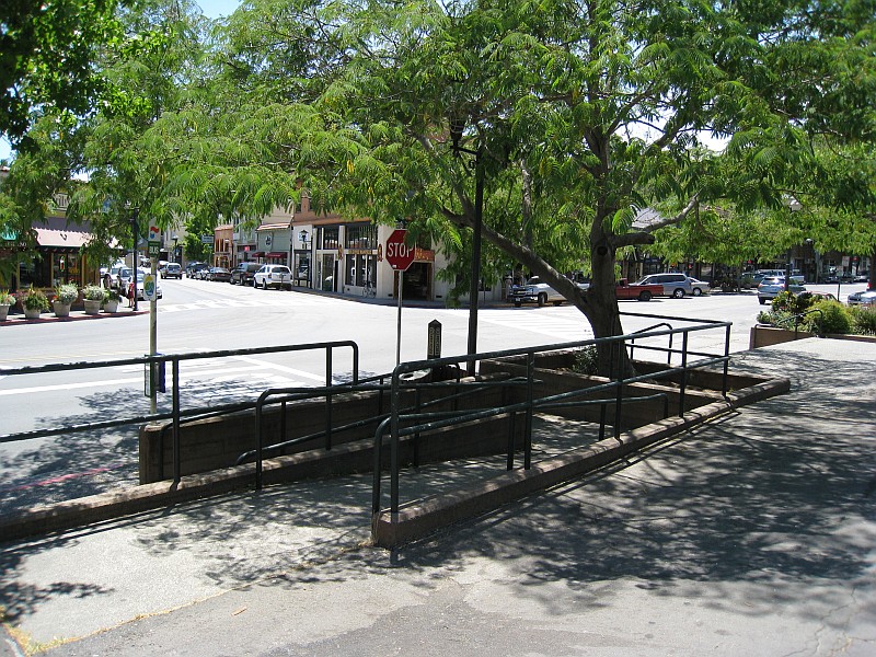 Downtown Fairfax (The Parkade) | |
 Location in Marin County, California | |
 Fairfax  Fairfax | |
| Coordinates: 37°59′14″N 122°35′20″W[1] | |
| Country | |
| State | |
| County | Marin |
| Incorporated | March 2, 1931[2] |
| Government | |
| • Town Council[3] | Barbara Coler (Mayor) Renee Goddard (Vice-Mayor) Bruce Ackerman John Reed Peter Lacques |
| • County Board | District 2 Katie Rice |
| • Town Manager | Garrett Toy |
| • Representation | Sen. Mike McGuire (D) Asm. Marc Levine (D) Rep. Jared Huffman (D)[4] |
| Area | |
| • Total | 2.23 sq mi (5.8 km2) |
| • Land | 2.23 sq mi (5.8 km2) |
| • Water | 0.00 sq mi (0.0 km2) 0% |
| Elevation | 115 ft (35 m) |
| Population (2020)[6] | |
| • Total | 7,605 |
| • Density | 3,400/sq mi (1,300/km2) |
| Time zone | UTC-8 (PST) |
| • Summer (DST) | UTC-7 (PDT) |
| ZIP codes | 94930, 94978 |
| Area codes | 415/628 |
| FIPS code | 06-23168 |
| GNIS feature IDs | 277511, 2412609 |
| Website | www |
Geography
Fairfax is in eastern Marin County, bordered to the east by San Anselmo and to the north by unincorporated Sleepy Hollow. The community lies in the valleys of San Anselmo Creek and its tributary Fairfax Creek, and climbs the surrounding hills. It is bordered to the south by the Mount Tamalpais protected watershed.
According to the United States Census Bureau, the town has a total area of 2.2 square miles (5.7 km2), all of it recorded as land.[5]
Demographics
| Historical population | |||
|---|---|---|---|
| Census | Pop. | %± | |
| 1940 | 2,198 | — | |
| 1950 | 4,078 | 85.5% | |
| 1960 | 5,813 | 42.5% | |
| 1970 | 7,661 | 31.8% | |
| 1980 | 7,391 | −3.5% | |
| 1990 | 6,931 | −6.2% | |
| 2000 | 7,319 | 5.6% | |
| 2010 | 7,441 | 1.7% | |
| 2020 | 7,605 | 2.2% | |
| U.S. Decennial Census[8] | |||
2010
At the 2010 census Fairfax had a population of 7,441. The population density was 3,376.9 inhabitants per square mile (1,303.8/km2). The racial makeup of Fairfax was 6,617 (88.9%) White, 110 (1.5%) African American, 36 (0.5%) Native American, 204 (2.7%) Asian, 4 (0.1%) Pacific Islander, 174 (2.3%) from other races, and 296 (4.0%) from two or more races. Hispanic or Latino of any race were 504 people (6.8%).[9]
The census reported that 7,419 people (99.7% of the population) lived in households, 12 (0.2%) lived in non-institutionalized group quarters, and 10 (0.1%) were institutionalized.
There were 3,379 households, 939 (27.8%) had children under the age of 18 living in them, 1,422 (42.1%) were opposite-sex married couples living together, 319 (9.4%) had a female householder with no husband present, 134 (4.0%) had a male householder with no wife present. There were 267 (7.9%) unmarried opposite-sex partnerships, and 52 (1.5%) same-sex married couples or partnerships. 1,076 households (31.8%) were one person and 320 (9.5%) had someone living alone who was 65 or older. The average household size was 2.20. There were 1,875 families (55.5% of households); the average family size was 2.77.
The age distribution was 1,436 people (19.3%) under the age of 18, 342 people (4.6%) aged 18 to 24, 1,806 people (24.3%) aged 25 to 44, 2,907 people (39.1%) aged 45 to 64, and 950 people (12.8%) who were 65 or older. The median age was 45.9 years. For every 100 females, there were 94.2 males. For every 100 females age 18 and over, there were 92.9 males.
There were 3,585 housing units at an average density of 1,626.9 per square mile, of the occupied units 2,103 (62.2%) were owner-occupied and 1,276 (37.8%) were rented. The homeowner vacancy rate was 0.9%; the rental vacancy rate was 4.9%. 4,917 people (66.1% of the population) lived in owner-occupied housing units and 2,502 people (33.6%) lived in rental housing units.
2000
At the 2000 census there were 7,319 people, 3,306 households, and 1,811 families in the town. The population density was 3,441.2 inhabitants per square mile (1,328.7/km2). There were 3,418 housing units at an average density of 1,607.0 per square mile (620.5/km2). The racial makeup of the town in 2010 was 85.4% non-Hispanic White, 1.4% non-Hispanic Black or African American, 0.3% Native American, 2.7% Asian, 0.1% Pacific Islander, 0.4% from other races, and 3.1% from two or more races. 6.8% of the population were Hispanic or Latino of any race.[10] Of the 3,306 households 27.4% had children under the age of 18 living with them, 41.2% were married couples living together, 10.0% had a female householder with no husband present, and 45.2% were non-families. 31.1% of households were one person and 7.4% were one person aged 65 or older. The average household size was 2.20 and the average family size was 2.76.
The age distribution was 19.2% under the age of 18, 4.7% from 18 to 24, 33.5% from 25 to 44, 33.1% from 45 to 64, and 9.5% 65 or older. The median age was 42 years. For every 100 females, there were 91.9 males. For every 100 females age 18 and over, there were 89.2 males.
The median income for a household in the town was $58,465, and the median family income was $68,308. Males had a median income of $51,457 versus $40,815 for females. The per capita income for the town was $34,080. About 4.3% of families and 6.5% of the population were below the poverty line, including 6.6% of those under age 18 and 7.6% of those age 65 or over.
Environmental factors
Soils in the Fairfax area mostly belong to the Tocaloma Series as classified by the U.S. Soil Conservation Service.[11] These soils consist of moderately deep, well-drained soils on uplands. These soils are typically formed from sandstone and shale and often occur on slopes ranging above 15 percent.
History
The Coast Miwok Native Americans occupied stretches along local creeks, spring and seep areas; moreover, prehistoric habitations were usually chosen near permanent and seasonal drainages, typically along flat ridges and terraces.
The town was named for Lord Charles Snowden Fairfax.[7] In 1861, Fairfax was the site of the last political duel in California. Daniel Showalter and Charles W. Piercy, both former assemblymen in the state legislature,[12] decided to settle a political dispute at the home of Lord Fairfax, a mutual friend. Although Fairfax provided lunch to both men and tried to talk them out of it, they eventually headed to an open field nearby and dueled, with Showalter killing Piercy.[13]
The first post office opened in 1910.[7] Fairfax became an incorporated town in 1931.[7]
On May 16, 1946, a B-17 Flying Fortress bomber, crashed on White's Hill just west of Fairfax.
Culture
In the mid-1960s, a softball game between Jefferson Airplane and the Grateful Dead took place at Central Field (also known as Contratti Park), a public downtown baseball field.[14][15][16]
Irving Berlin used to serenade from a treetop piano at Pastori's Hotel, formerly Bird's Nest Glen, the home of Lord Charles Snowden Fairfax, and later known as the Marin Town & Country Club.[17]
The popularity of outdoor hot tubs soared after Al Garvey designed his own redwood hot tub in July 1966, installed outside Al and Barbara Garvey's home on Scenic Road on the hillside leading up to Fairfax Manor. The Garvey hot tub was used by hundreds of people in the first few months, including jazz musician John Handy, eccentric architect Roger Somers and sex worker/feminist Margo St. James.[18][19] Barbara Garvey said, "We decided to make the hot tub a social enterprise and started throwing parties."[20] Soon, many others had hot tubs of their own. The social fashion of hot-tubbing with friends became connected with Marin County culture and style.[19]
Politics
In 2017, Fairfax had 5,602 registered voters. Of those, 3,726 (66.5%) are registered Democrats, 370 (6.6%) are registered Republicans, 1,528 (27.3%) have declined to state a political party and 155 (2.8%) are registered with the Green Party.[21] In the 2016 US presidential election, Hillary Clinton received 85.43% of the vote, and Donald Trump received 7.63% of the vote.[22]
Notable people
Births
- Polly Klaas (1981-1993), girl killed by Richard Allen Davis
- Lonnie Mayne (1944-1978), wrestler
- Virgil Shaw, musician
- Alfred Sorensen (1890-1984), writer and mystic
Deaths
- Keith Donnellan (1931-2015), philosopher and professor
- Andy Kulberg (1944-2002), musician
- Chris Michie (1948-2003), musician
- Robert Peterson (1924-2000), poet
- Charles Wesley Piercy (1833-1861), politician; killed in a duel
- David James Redford (1962-2020), filmmaker
- Archie Williams (1915-1993), athlete and Air Force officer
References
- "Fairfax". Geographic Names Information System. United States Geological Survey, United States Department of the Interior.
- "California Cities by Incorporation Date". California Association of Local Agency Formation Commissions. Archived from the original (Word) on November 3, 2014. Retrieved August 25, 2014.
- "Town of Fairfax, California - Website". Retrieved April 6, 2015.
- "California's 2nd Congressional District - Representatives & District Map". Civic Impulse, LLC. Retrieved March 8, 2013.
- "2021 U.S. Gazetteer Files: California". United States Census Bureau. Retrieved July 5, 2022.
- "P1. Race – Fairfax town, California: 2020 DEC Redistricting Data (PL 94-171)". U.S. Census Bureau. Retrieved July 5, 2022.
- Durham, David L. (1998). California's Geographic Names: A Gazetteer of Historic and Modern Names of the State. Clovis, Calif.: Word Dancer Press. p. 631. ISBN 1-884995-14-4.
- "Census of Population and Housing". Census.gov. Retrieved June 4, 2015.
- "2010 Census Interactive Population Search: CA - Fairfax town". U.S. Census Bureau. Archived from the original on July 15, 2014. Retrieved July 12, 2014.
- "U.S. Census website". United States Census Bureau. Retrieved 2008-01-31.
- "Environmental Impact Report for the Groza-Erickson Property, Ridgeway Avenue, Fairfax, California", Earth Metrics Inc, prepared for the State of California Environmental Clearinghouse, Sacramento, Ca., January, 1989
- "JoinCalifornia - Daniel Showalter". www.joincalifornia.com. Retrieved July 18, 2009.
- "Fairfax History- Page One". www.marindirect.com. Retrieved July 18, 2009.
- Rex Radio, January 1991, transcript of discussion with David Grisman and Jerry Garcia Archived January 22, 2009, at the Wayback Machine, accessed February 5, 2008
- James Sullivan, San Francisco Chronicle, October 2, 2001, "Dawg days: David Grisman's daughter makes film about his bluegrass partnership with Garcia", accessed February 5, 2008
- "The Story of "Ripple" by the Grateful Dead", accessed May 16, 2015
- William Sager, Fairfax (Images of America), Arcadis Publishing, 2006 Archived June 4, 2011, at the Wayback Machine ISBN 0-7385-3090-5, accessed February 5, 2008
- Tricia Cambron (November 19, 1999). "Far Out in Fairfax: Woodworker Al Garvey reminisces about hot tubs, cool nights and the 60's art scene". SF Gate. Retrieved February 23, 2020.
- Beth Winegarner (December 2003). "How Marin County Became Synonymous With Hot Tubs". Marinscope.
- Duncan Campbell (July 16, 2002). "From Hot Tub to Hot Water". The Guardian. Retrieved February 23, 2020.
- "Results" (PDF). elections.cdn.sos.ca.gov. 2017. Retrieved September 26, 2019.
- "Results" (PDF). elections.cdn.sos.ca.gov. 2016. Retrieved September 26, 2019.
External links
Municipalities and communities of Marin County, California, United States | ||
|---|---|---|
County seat: San Rafael | ||
| Cities and towns |  | |
| CDPs |
| |
| Unincorporated communities |
| |
| Former settlements |
| |
| ||
San Francisco Bay Area | ||
|---|---|---|
| Bodies of water |
|  |
| Counties |
| |
| Major cities | ||
| Cities and towns 100k–250k | ||
| Cities and towns 50k–99k | ||
| Cities and towns 25k–50k | ||
| Cities and towns 10k–25k | ||
| Sub-regions |
| |
| ||
Authority control | |
|---|---|
| General | |
| National libraries | |
| Other |
|
Другой контент может иметь иную лицензию. Перед использованием материалов сайта WikiSort.org внимательно изучите правила лицензирования конкретных элементов наполнения сайта.
WikiSort.org - проект по пересортировке и дополнению контента Википедии