world.wikisort.org - USA
Orinda is a city in Contra Costa County, California, United States. The city's population as of the 2020 census is estimated at 19,514 residents.[7]
City of Orinda | |
|---|---|
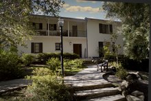
 Downtown Orinda | |
 Location in Contra Costa County and the state of California | |
 City of Orinda Location in the United States | |
| Coordinates: 37°52′58″N 122°10′47″W | |
| Country | United States |
| State | California |
| County | Contra Costa |
| Incorporated | July 1, 1985[1] |
| Government | |
| • Mayor | Dennis Fay[2] |
| • State Senator | Steve Glazer (D)[3] |
| • State Assembly | Rebecca Bauer-Kahan (D)[4] |
| • U. S. Congress | Mark DeSaulnier (D)[5] |
| Area | |
| • Total | 12.87 sq mi (33.33 km2) |
| • Land | 12.85 sq mi (33.29 km2) |
| • Water | 0.02 sq mi (0.04 km2) 0.12% |
| Elevation | 495 ft (151 m) |
| Population (2020) | |
| • Total | 19,514 |
| • Density | 1,500/sq mi (590/km2) |
| Time zone | UTC−8 (PST) |
| • Summer (DST) | UTC−7 (PDT) |
| ZIP Code | 94563 |
| Area code | 925 |
| FIPS code | 06-54232 |
| GNIS feature IDs | 1659313, 2411334 |
| Website | www |
History

Orinda is located within four Mexican land grants: Rancho Laguna de los Palos Colorados, Rancho Acalanes, Rancho El Sobrante and Rancho Boca de la Cañada del Pinole. The area was originally rural, mainly known for ranching and summer cabins. The Moraga Adobe was built in 1841, and is the oldest building in the East Bay. In the late 19th century, the land was named by Alice Marsh Cameron, probably in honor of the poet Katherine Philips, who was also known as the "Matchless Orinda".[8]
In the 1880s, United States Surveyor General for California Theodore Wagner built an estate he named Orinda Park.[9] The Orinda Park post office opened in 1888.[9] The post office's name was changed to Orinda in 1895.[9] Orinda was also the site of Bryant Station, a stop on the failed California and Nevada Railroad around the turn of the 20th century. Later, the area around Bryant Station was known as Orinda Crossroads.[9]
Orinda's popularity as a year-round residence grew after the 1937 completion of the Caldecott Tunnel, which provided easier access to the west. Bisected by California State Route 24 and framed by its rolling oak-covered hills, the city of Orinda was incorporated on July 1, 1985. Its first mayor was Richard G. Heggie. The city is served by Orinda station on the Bay Area Rapid Transit (BART) Antioch–SFO+Millbrae line.
Geography

According to the United States Census Bureau, the city has a total area of 12.7 sq mi (33 km2), of which 12.7 sq mi (33 km2) of it is land and 0.015 sq mi (0.039 km2) of it (0.12%) is water.
Climate
The area is characterized by a warm-summer Mediterranean climate (Köppen climate classification Csb) with cool, rainy winters and warm, dry summers. Because Orinda is located in a hilly area, microclimates often dominate temperature differences in short distances. The Oakland Hills often block the cool foggy conditions that can be seen in Oakland and the innerbay. In the summer, fog can spill over the Oakland hills, cooling off the area. Heatwaves from the inland areas can be felt much more in Orinda than in Oakland and the innerbay during the summer. In the winter, Orinda often sees more precipitation than surrounding areas because of its higher elevation. Snowfall is rare but not unheard of. A dusting of snow may occur in any given year because of the elevation. During stable conditions in the winter, mornings can be cold and frosty in downtown and lower-lying areas, while the higher hills surrounding the area may be several degrees warmer.
| Orinda, California | ||||||||||||||||||||||||||||||||||||||||||||||||||||||||||||
|---|---|---|---|---|---|---|---|---|---|---|---|---|---|---|---|---|---|---|---|---|---|---|---|---|---|---|---|---|---|---|---|---|---|---|---|---|---|---|---|---|---|---|---|---|---|---|---|---|---|---|---|---|---|---|---|---|---|---|---|---|
| Climate chart (explanation) | ||||||||||||||||||||||||||||||||||||||||||||||||||||||||||||
| ||||||||||||||||||||||||||||||||||||||||||||||||||||||||||||
| ||||||||||||||||||||||||||||||||||||||||||||||||||||||||||||
| Climate data for Orinda Bowman, California (1944–1960) | |||||||||||||
|---|---|---|---|---|---|---|---|---|---|---|---|---|---|
| Month | Jan | Feb | Mar | Apr | May | Jun | Jul | Aug | Sep | Oct | Nov | Dec | Year |
| Record high °F (°C) | 69 (21) |
76 (24) |
84 (29) |
88 (31) |
100 (38) |
103 (39) |
107 (42) |
109 (43) |
110 (43) |
101 (38) |
87 (31) |
77 (25) |
110 (43) |
| Average high °F (°C) | 54 (12) |
59 (15) |
61 (16) |
68 (20) |
71 (22) |
77 (25) |
82 (28) |
81 (27) |
83 (28) |
75 (24) |
65 (18) |
56 (13) |
69 (21) |
| Average low °F (°C) | 34 (1) |
37 (3) |
38 (3) |
42 (6) |
46 (8) |
49 (9) |
52 (11) |
51 (11) |
50 (10) |
44 (7) |
38 (3) |
36 (2) |
43 (6) |
| Record low °F (°C) | 15 (−9) |
18 (−8) |
23 (−5) |
28 (−2) |
32 (0) |
35 (2) |
42 (6) |
40 (4) |
32 (0) |
26 (−3) |
22 (−6) |
19 (−7) |
15 (−9) |
| Average precipitation inches (mm) | 5.99 (152) |
4.86 (123) |
4.31 (109) |
2.16 (55) |
1.22 (31) |
0.18 (4.6) |
0.02 (0.51) |
0.05 (1.3) |
0.41 (10) |
1.85 (47) |
3.24 (82) |
6.24 (158) |
30.53 (773.41) |
| Average rainy days | 11 | 9 | 10 | 5 | 4 | 1 | 0 | 1 | 1 | 4 | 7 | 11 | 64 |
| Source: Western Regional Climate Center[10][11] | |||||||||||||
Demographics
| Historical population | |||
|---|---|---|---|
| Census | Pop. | %± | |
| 1960 | 5,568 | — | |
| 1970 | 6,790 | 21.9% | |
| 1980 | 16,825 | 147.8% | |
| 1990 | 16,642 | −1.1% | |
| 2000 | 17,599 | 5.8% | |
| 2010 | 17,643 | 0.3% | |
| 2020 | 19,514 | 10.6% | |
| U.S. Decennial Census[12] | |||
The 2010 United States Census[13] reported that Orinda had a population of 17,643, The population density was 1,389.5 inhabitants per square mile (536.5/km2), The racial makeup of Orinda was 14,533 (82.4%) White-American, 149 (0.8%) African American, 22 (0.1%) Native American, 2,016 (11.4%) Asian-American, 24 (0.1%) Pacific Islander, 122 (0.7%) from other races, and 777 (4.4%) from two or more races. There were 807 people (4.6%) of Hispanic or Latino origin, of any race.
The Census reported that 17,600 people (99.8% of the population) lived in households, 6 (>0.1%) lived in non-institutionalized group quarters, and 37 (0.2%) were institutionalized.
There were 6,553 households, out of which 2,361 (36.0%) had children under the age of 18 living in them, 4,673 (71.3%) were opposite-sex married couples living together, 370 (5.6%) had a female householder with no husband present, 159 (2.4%) had a male householder with no wife present. There were 138 (2.1%) unmarried opposite-sex partnerships, and 58 (0.9%) same-sex married couples or partnerships, 1,127 households (17.2%) were made up of individuals, and 695 (10.6%) had someone living alone who was 65 years of age or older. The average household size was 2.69. There were 5,202 families (79.4% of all households); the average family size was 3.03.
The population was spread out, with 4,512 people (25.6%) under the age of 18, 729 people (4.1%) aged 18 to 24, 2,741 people (15.5%) aged 25 to 44, 6,111 people (34.6%) aged 45 to 64, and 3,550 people (20.1%) who were 65 years of age or older. The median age was 47.8 years. For every 100 females, there were 94.4 males. For every 100 females age 18 and over, there were 91.9 males.
There were 6,804 housing units, at an average density of 535.8 per square mile (206.9/km2), of which 6,553 were occupied, of which 5,876 (89.7%) were owner-occupied, and 677 (10.3%) were occupied by renters. The homeowner vacancy rate was 1.2%; the rental vacancy rate was 4.2%. 16,010 people (90.7% of the population) lived in owner-occupied housing units and 1,590 people (9.0%) lived in rental housing units.
Government

As of February 10, 2019, Orinda has 14,020 registered voters, with 6,692 (47.7%) registered as Democrats, 3,176 (22.7%) registered as Republicans, and 3,662 (26.1%) decline to state voters.[14]
Education
Orinda has four public elementary schools: Sleepy Hollow Elementary, Wagner Ranch Elementary, Glorietta Elementary and Del Rey Elementary. Orinda Intermediate School is the only middle school. Together, these five schools make up the Orinda Union School District. Orinda's high school, Miramonte High School, is a part of the Acalanes Union High School District.
Orinda is home to three private educational establishments: Orinda Academy, Holden High School, and Fountainhead Montessori School. Of these, two (OA & Holden) are private high schools, while Fountainhead Montessori School services kindergarten through fifth grade.
The Contra Costa County Library has a branch in Orinda.
Notable people
- Poul Anderson, science fiction author[15]
- Troy Auzenne, football star
- Bryan Barker, NFL football punter
- Jim Barnett, Golden State Warriors player and TV color commentator
- Theodore Temple (Ted) Beckett, football star
- Drew Bennett, former NFL wide receiver; graduated from Miramonte High School in 1996[16]
- Nicole Branagh, Olympic beach volleyball player
- Matt Cain, pitcher for San Francisco Giants
- Kirsten Costas, high school student murdered by her classmate, Bernadette Protti, in 1984
- Paul Dini, writer, cartoonist; lived in Orinda from 1963 to 1988
- Ken Dorsey, former quarterback for San Francisco 49ers and Cleveland Browns
- Patricia C. Dunn, former Chairwoman of the Board of Hewlett-Packard
- Sheila E., drummer and percussionist
- Adonal Foyle, NBA center for Golden State Warriors and Orlando Magic
- John Hammergren, CEO of McKesson; highest-paid CEO in US (2011–2013)
- John Hampton, co-founder of Toys for Tots[17]
- Sabrina Ionescu, WNBA star with the New York Liberty
- Brett Jackson, MLB player
- Robert Karplus, physicist and educator
- Hans Kelsen, one of preeminent jurists of 20th Century[18]
- Harry Arthur "Cookie" Lavagetto (1912–1990), MLB third baseman, manager and coach, and pinch-hitter
- Daniel Levitin, best-selling author, cognitive neuroscientist, musician
- David Marchick, Washington, D.C. lobbyist
- Hans Niemann, chess grandmaster
- Wayne F. Miller, photographer
- Karen Moe, Olympic swimming gold medalist
- William Penn Mott Jr., director of National Park Service from 1985 to 1989[19]
- Heather Petri, Olympic water polo player
- Susan Polk, Orinda housewife sentenced to 16-to-life for murder of husband, Felix Polk
- Gary Radnich, news broadcaster
- Julie Rubio, filmmaker
- Sam Shankland, chess grandmaster and 2018 US Chess Champion
- Dana Sparks, actress and spokesperson, Falcon Crest, Passions, L.A. Law, L'Oréal, Mercedes Benz
- Owsley Stanley, audio engineer and legendary psychedelic chemist
- Jeremy Stoppelman, Founder of Yelp.com
- Rawson Marshall Thurber, filmmaker and actor
- Nicolle Wallace, political commentator, former White House Communications Director and senior adviser to John McCain's presidential campaign[20]
- Claudell Washington, former Major League Baseball player
- Will Wright, designer of computer games such as SimCity and The Sims
- Daniel Wu, a Hong Kong actor who was raised in Orinda
See also
 San Francisco Bay Area portal
References
- "California Cities by Incorporation Date". California Association of Local Agency Formation Commissions. Archived from the original (Word) on October 17, 2013. Retrieved March 24, 2013.
- "City Council".
- "Senators". State of California. Retrieved March 24, 2013.
- "Members Assembly". State of California. Retrieved March 24, 2013.
- "California's 11th Congressional District - Representatives & District Map". Civic Impulse, LLC. Retrieved March 9, 2013.
- "2019 U.S. Gazetteer Files". United States Census Bureau. Retrieved July 1, 2020.
- "QuickFacts: Orinda, CA". Retrieved May 21, 2021.
- History of Orinda, Orinda Historical Society
- Durham, David L. (November 1998). "Part Five - San Francisco Bay Region". California's Geographic Names: A Gazetteer of Historic and Modern Names of the State. Word Dancer Press. p. 676. ISBN 978-1-884995-14-9. Retrieved 2009-07-22.
- "ORINDA BOWMAN, CALIFORNIA Period of Record General Climate Summary - Temperature". Western Regional Climate Center. Retrieved 23 January 2018.
- "ORINDA BOWMAN, CALIFORNIA Period of Record General Climate Summary - Precipitation". Western Regional Climate Center. Retrieved 23 January 2018.
- "Census of Population and Housing". Census.gov. Retrieved June 4, 2015.
- "2010 Census Interactive Population Search: CA - Orinda city". U.S. Census Bureau. Archived from the original on July 15, 2014. Retrieved July 12, 2014.
- https://elections.cdn.sos.ca.gov/ror/ror-odd-year-2019/politicalsub.pdf [bare URL PDF]
- Martin, Douglas (August 3, 2001). "Poul Anderson, Science Fiction Novelist, Dies at 74". The New York Times. ISSN 0362-4331. Retrieved November 27, 2020.
- Lefkow, Mike (2017-02-23). "Orinda: Miramonte High to induct spectacular Hall of Fame class". East Bay Times. Retrieved 2021-04-18.
{{cite web}}: CS1 maint: url-status (link) - Richards, Sam (2010-07-08). "John Hampton, co-founder of Toys for Tots, dies at 103". Contra Costa Times. Retrieved 2010-07-26.
- Michael Steven Green. "Hans Kelsen and the Logic of Legal Systems". Scholarship.law.wm.edu. Retrieved 23 January 2018.
- Daniels, Lee a (24 September 1992). "William P. Mott Jr. Is Dead at 82; Directed the National Park Service". Nytimes.com.
- "Nicolle Wallace » About Nicolle". Nicollewallace.com. Retrieved 23 January 2018.
External links
Municipalities and communities of Contra Costa County, California, United States | ||
|---|---|---|
County seat: Martinez | ||
| Cities and towns |  | |
| CDPs |
| |
| Former CDPs | ||
| Unincorporated communities | ||
| Ghost towns |
| |
| ||
| Bodies of water |
|  |
|---|---|---|
| Counties |
| |
| Major cities | ||
| Cities and towns 100k–250k | ||
| Cities and towns 50k–99k | ||
| Cities and towns 25k–50k | ||
| Cities and towns 10k–25k | ||
| Sub-regions |
| |
| ||
Authority control | |
|---|---|
| General | |
| National libraries | |
| Other | |
На других языках
[de] Orinda
Orinda ist eine Stadt im Contra Costa County im US-Bundesstaat Kalifornien, Vereinigte Staaten, mit 18.200 Einwohnern (Stand: 2004). Die geographischen Koordinaten sind: 37,88° Nord, 122,18° West. Das Stadtgebiet hat eine Größe von 32,7 km².- [en] Orinda, California
[ru] Оринда
Оринда — город в округе Контра-Коста, Калифорния, США. По версии журнала Forbes, Оринда занимала вторую строку рейтинга самых дружественных городов в США в 2012 году[2].Другой контент может иметь иную лицензию. Перед использованием материалов сайта WikiSort.org внимательно изучите правила лицензирования конкретных элементов наполнения сайта.
WikiSort.org - проект по пересортировке и дополнению контента Википедии