world.wikisort.org - USA
San Ramon (Spanish: San Ramón, meaning "St. Raymond") is a city in Contra Costa County, California, United States, located within the San Ramon Valley, and 34 miles (55 km) east of San Francisco. San Ramon's population was 84,605 per the 2020 census,[9] making it the 4th largest city in Contra Costa County, behind Richmond, Concord and Antioch.
San Ramon, California | |
|---|---|
| City of San Ramon | |
 San Ramon Waterfall Park | |
 Seal | |
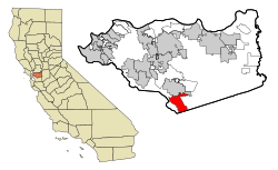 Location in Contra Costa County and the state of California | |
 San Ramon, California Location in the United States | |
| Coordinates: 37°46′48″N 121°58′41″W | |
| Country | United States |
| State | California |
| County | Contra Costa |
| Incorporated | July 1, 1983[1] |
| Government | |
| • Mayor | Dave Hudson[2] |
| • State senator | Steve Glazer (D)[3] |
| • Assemblymember | Rebecca Bauer-Kahan (D)[4] |
| • United States representatives[5] | Mark DeSaulnier (D) and Eric Swalwell (D)[6] |
| Area | |
| • Total | 18.72 sq mi (48.48 km2) |
| • Land | 18.68 sq mi (48.39 km2) |
| • Water | 0.03 sq mi (0.09 km2) 0.09% |
| Elevation | 486 ft (148 m) |
| Population (2020)[9] | |
| • Total | 84,605 |
| • Rank | 99th in California |
| • Density | 4,500/sq mi (1,700/km2) |
| Time zone | UTC-8 (Pacific) |
| • Summer (DST) | UTC-7 (PDT) |
| ZIP codes[10] | 94582, 94583 |
| Area code | 925 |
| FIPS code | 06-68378 |
| GNIS feature IDs | 1656275, 2411805 |
| Website | www |
San Ramon is home to the headquarters of Chevron Corporation, Cooper Companies, 24 Hour Fitness, the West Coast headquarters of AT&T, GE Digital, as well as the San Ramon Medical Center. Major annual events include the Art and Wind Festival on Memorial Day weekend and the Run for Education in October.
On April 24, 2001, San Ramon was designated a Tree City USA.[11]
History

This section needs expansion. You can help by adding to it. (March 2020) |
The lands now occupied by the City of San Ramon were formerly inhabited by Seunen people, an Ohlone/Costanoan group who built their homes near creeks. Sometime around 1797, they were taken by Mission San José for use as grazing land. In 1834, they were part of the Rancho San Ramon land grant to José María Amador.[12]
Amador named San Ramón (Spanish for 'Saint Raymond') not after a real saint but rather after a Native American vaquero who tended mission sheep on the land. Amador added the "San" per Spanish custom. In 1850, the first permanent American settlers, Leo and Mary Jane Norris, purchased the northwest corner of Amador's Rancho San Ramon, near the intersection of present-day Bollinger Canyon Road and Crow Canyon Road.[12]
The tracks for the San Ramon Branch Line of the Southern Pacific Railroad were laid down and completed in 1891. The line extended from San Ramon to an unincorporated area known as Avon, east of Martinez, where it connected to the Oakland/Stockton Line. On February 7, 1909, Southern Pacific extended the line south to Radum (near Pleasanton). In 1934, passenger service ended. By 1986, Contra Costa County had obtained the railroad right-of-way and the Iron Horse Regional Trail was established along its path.[12]
Geography
Mount Diablo flanks the city to the northeast and is prominently visible from almost all parts of the city. The Las Trampas Regional Wilderness borders San Ramon's extreme northwest, at the northern end of Bollinger Canyon. The smaller Bishop Ranch Regional Preserve straddles San Ramon's western border, located approximately between Interstate 680 and the Alameda County line.
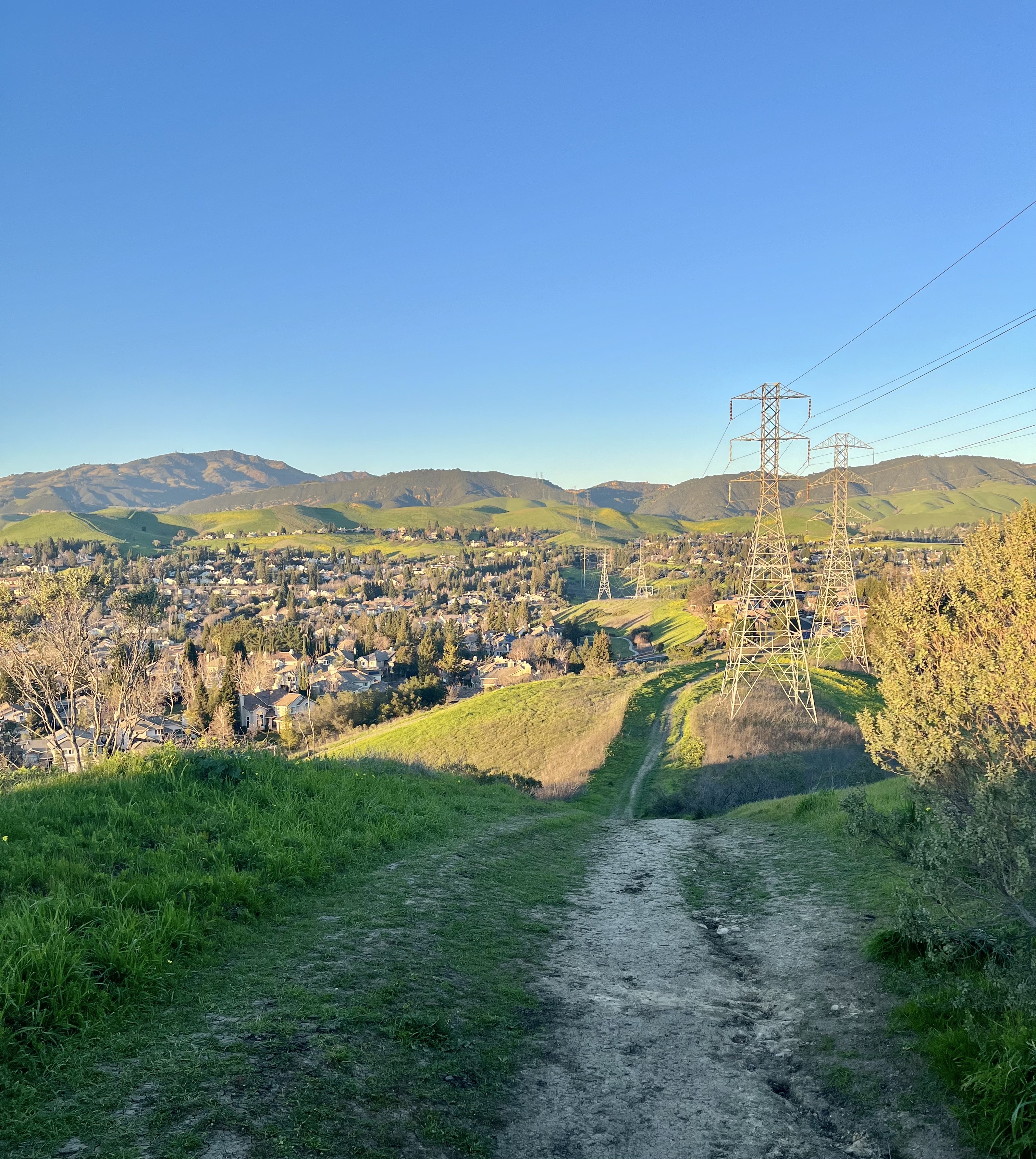
The topography of San Ramon is varied, featuring a mix of the rolling hills of the Diablo Range and the flatter basin of the San Ramon Valley. The city is predominantly urban and residential with many new housing developments; however, much of the land around the city's perimeter regions remains undeveloped, and is covered by grasslands and oak tree orchards. During the drier months the grasses are golden, but with the precipitation of winter and spring, the grasses turn green.
Climate
San Ramon's weather typifies a Mediterranean climate, seasonal, and moderate. Summers can range from warm to hot and dry, while winters are cool and wet. Its weather is similar to the adjacent cities of Danville, Dublin and Pleasanton. Fog can be infrequent but occurs normally in the western reaches of the city, at the eastern mouth of Crow Canyon, through which marine weather patterns funnel in from the San Francisco Bay via Castro Valley. It usually burns off by mid-to-late morning.
| Climate data for San Ramon, California | |||||||||||||
|---|---|---|---|---|---|---|---|---|---|---|---|---|---|
| Month | Jan | Feb | Mar | Apr | May | Jun | Jul | Aug | Sep | Oct | Nov | Dec | Year |
| Record high °F (°C) | 73 (23) |
80 (27) |
83 (28) |
97 (36) |
99 (37) |
105 (41) |
102 (39) |
107 (42) |
111 (44) |
98 (37) |
87 (31) |
76 (24) |
108 (42) |
| Average high °F (°C) | 58 (14) |
61 (16) |
63 (17) |
67 (19) |
70 (21) |
75 (24) |
80 (27) |
82 (28) |
77 (25) |
73 (23) |
65 (18) |
59 (15) |
68 (20) |
| Average low °F (°C) | 39 (4) |
43 (6) |
44 (7) |
46 (8) |
49 (9) |
52 (11) |
54 (12) |
55 (13) |
55 (13) |
52 (11) |
45 (7) |
41 (5) |
48 (9) |
| Record low °F (°C) | 26 (−3) |
26 (−3) |
29 (−2) |
30 (−1) |
35 (2) |
41 (5) |
44 (7) |
43 (6) |
41 (5) |
32 (0) |
30 (−1) |
18 (−8) |
18 (−8) |
| Average precipitation inches (mm) | 5.20 (132) |
4.80 (122) |
4.27 (108) |
1.72 (44) |
0.71 (18) |
0.15 (3.8) |
0.06 (1.5) |
0.11 (2.8) |
0.36 (9.1) |
1.55 (39) |
3.69 (94) |
3.84 (98) |
26.46 (672) |
| Source 1: The Weather Channel [13] | |||||||||||||
| Source 2: MSN Weather [14] | |||||||||||||
Demographics
This article needs additional citations for verification. (May 2011) |
| Historical population | |||
|---|---|---|---|
| Census | Pop. | %± | |
| 1880 | 75 | — | |
| 1970 | 4,084 | — | |
| 1980 | 22,356 | 447.4% | |
| 1990 | 35,303 | 57.9% | |
| 2000 | 44,722 | 26.7% | |
| 2010 | 72,148 | 61.3% | |
| 2020 | 84,605 | 17.3% | |
| U.S. Decennial Census[15] | |||
2010 census
The 2010 United States Census[16] reported that San Ramon had a population of 72,148. The population density was 3,991.1 inhabitants per square mile (1,541.0/km2). The racial makeup of San Ramon was 38,639 (53.6%) White, 2,043 (2.8%) African American, 205 (0.3%) Native American, 25,713 (35.6%) Asian, 156 (0.2%) Pacific Islander, 1,536 (2.1%) from other races, and 3,856 (5.3%) from two or more races. Hispanic or Latino of any race were 6,250 persons (8.7%).
The Census reported that 72,073 people (99.9% of the population) lived in households, 52 (0.1%) lived in non-institutionalized group quarters, and 23 (0%) were institutionalized.
There were 25,284 households, out of which 11,988 (47.4%) had children under the age of 18 living in them, 16,318 (64.5%) were opposite-sex married couples living together, 1,997 (7.9%) had a female householder with no husband present, 850 (3.4%) had a male householder with no wife present. There were 1,067 (4.2%) unmarried opposite-sex partnerships, and 187 (0.7%) same-sex married couples or partnerships. 4,682 households (18.5%) were made up of individuals, and 1,105 (4.4%) had someone living alone who was 65 years of age or older. The average household size was 2.85. There were 19,165 families (75.8% of all households); the average family size was 3.30.
The population was spread out, with 21,351 people (29.6%) under the age of 18, 3,557 people (4.9%) aged 18 to 24, 22,798 people (31.6%) aged 25 to 44, 18,815 people (26.1%) aged 45 to 64, and 5,627 people (7.8%) who were 65 years of age or older. The median age was 37.1 years. For every 100 females, there were 96.6 males. For every 100 females age 18 and over, there were 92.4 males.
There were 26,222 housing units at an average density of 1,450.6 per square mile (560.1/km2), of which 25,284 were occupied and 18,056 (71.4%) of them were owner-occupied, and 7,228 (28.6%) were occupied by renters. The homeowner vacancy rate was 1.3%; the rental vacancy rate was 4.0%. 54,705 people (75.8% of the population) lived in owner-occupied housing units and 17,368 people (24.1%) lived in rental housing units.
The median income for a household in the city was $119,297, and the median income for a family was $132,339. Males had a median income of $97,475 versus $70,083 for females. The per capita income for the city was $50,736. About 2.0% of families and 2.8% of the population were below the poverty line, including 2.9% of those under age 18 and 3.5% of those age 65 or over.
|
2000 census
As of the census[18] of 2000, there were 44,722 people, 16,944 households, and 12,148 families residing in the city. The population density was 1,491.1/km2 (3,862.0/mi2). There were 17,552 housing units at an average density of 585.2/km2 (1,515.7/mi2). The racial makeup of the city was 36.82% White, 1.93% Black or African American, 0.36% Native American, 50.94% Asian, 0.21% Pacific Islander, 2.16% from other races, and 3.58% from two or more races. 7.24% of the population were Hispanic or Latino of any race.
There were 16,944 households, out of which 37.9% had children under the age of 18 living with them, 61.8% were married couples living together, 7.0% had a female householder with no husband present, and 28.3% were non-families. 21.1% of all households were made up of individuals, and 3.6% had someone living alone who was 65 years of age or older. The average household size was 2.63 and the average family size was 3.12.
In the city, the population was spread out, with 26.3% under the age of 18, 5.8% from 18 to 24, 35.7% from 25 to 44, 26.2% from 45 to 64, and 6.1% who were 65 years of age or older. The median age was 36 years. For every 100 females, there were 97.3 males. For every 100 females age 18 and over, there were 94.6 males.
The median income for a household in the city was $95,856, and the median income for a family was $106,321. Males had a median income of $73,502 versus $50,107 for females. The per capita income for the city was $42,336. About 1.4% of families and 2.0% of the population were below the poverty line, including 1.4% of those under age 18 and 4.5% of those age 65 or over.
Economy


Bishop Ranch, a master-planned office park development, with some retail elements, began major construction in the early 1980s, and provides a healthy tax base for the city. Bishop Ranch is situated on 585 acres once owned by Western Electric, and was farmland before that. Current tenants include the corporate headquarters of Chevron Corporation (formerly ChevronTexaco), as well the West Coast headquarters of AT&T Inc. (which had been the headquarters of Pacific Bell from about 1983, when it relocated from downtown San Francisco, until the merger with SBC Communications that created the current AT&T). United Parcel Service has a regional distribution center in Bishop Ranch. Toyota[19] has a regional office and parts distribution center located there. GE Global Research started its Global Software Center in Bishop Ranch in 2011. Bishop Ranch covers the vast majority of "Central San Ramon", which is the large square formed by Freeway 680 on the west, Crow Canyon Road on the north, Iron Horse trail on the east, and Bollinger Canyon Road on the south (though several complexes are south of Bollinger). In December 2016, the Ligier EZ-10 began use in the first autonomous vehicle passenger shuttle route in North America, looping through Bishop Ranch Office Park, with on-sight operation and maintenance by First Transit.[20]
ChevronTexaco's headquarters moved from San Francisco to San Ramon in 2001 [21] but 12 years later, 800 jobs were moved to Houston, a quarter of the San Ramon workforce due to high corporate costs and to consolidate existing units in Houston.[22]
Largest employers
According to the city's 2020 Comprehensive Annual Financial Report,[23] the top employers in the city are:
| # | Employer | # of Employees | % of Total City Employment |
|---|---|---|---|
| 1 | Chevron | 4,000 | 10.70% |
| 2 | Pacific Gas & Electric | 2,346 | 6.27% |
| 3 | Bank of the West | 1,600 | 4.28% |
| 4 | Robert Half International | 1,285 | 3.44% |
| 5 | Accenture | 750 | 2.01% |
| 6 | San Ramon Regional Medical Center | 650 | 1.74% |
| 7 | Primed Management Consulting | 453 | 1.21% |
| 8 | United Parcel Service | 315 | 0.84% |
| 9 | GE Digital | 284 | 0.76% |
| 10 | Pacific Bell Telephone | 265 | 0.71% |
Downtown
In 2014, the city approved the project's design that called for an animated civic space featuring 350,000 square feet (33,000 m2) of quality shops, restaurants and a multi-screen movie theater. The city center was designed by the award-winning international architectural firm Renzo Piano Building Workshop. The grand opening was on November 8, 2018.[24]
Arts and culture

The San Ramon Library and Dougherty Station Library branches of the Contra Costa County Library and Ramona Library are in San Ramon.[25]
Forest Home Farms in San Ramon is listed on the National Register of Historic Places.
Parks and recreation
San Ramon features 58 separate parks and an 18-hole gold course, the San Ramon Golf Club.
Memorial Park

Originally, this city park, located on a hill overlooking Bollinger Canyon Road and San Ramon Valley Blvd., was to be named Alta Mesa Park.[26] During the construction of the park, the City Council voted to change the name to Memorial Park to honor Tom Burnett, a San Ramon resident, and other victims from Flight 93 killed in the September 11 attacks of 2001. A plaque was installed at the base of a lighted flagpole dedicated to those victims and the surrounding meadow is part of the city's memorial tree program dedicated to local residents who have perished. The park was dedicated on September 11, 2002.[27]
This 16-acre park includes a play area, a BMX course, a picnic area, a bocce ball court, horseshoe courts, a ball field, a dog park, rest rooms and water fountains (including a doggy water fountain). The play area has two big play structures, one for ages 2–5 and another for ages 5–12.[28][29]
Government
San Ramon is governed by a five-body City Council composed of individuals elected to four-year overlapping terms in coordination with a two-year elected mayor. Police services were provided under contract by the Contra Costa County Sheriff's Department until July 1, 2007, when the city officially took over providing police services.
As of 2020, the elected representatives are Dave Hudson (Mayor), Scott Perkins (Vice Mayor), Mark Armstrong, Sridhar Verose, and Sabina Zafar (Council members).[30]
The city of San Ramon is in Contra Costa County.
In the United States House of Representatives, the city is split between California's 11th congressional district, represented by Democrat Mark DeSaulnier and California's 15th congressional district, represented by Democrat Eric Swalwell.[6]
According to the California Secretary of State, as of February 10, 2019, San Ramon has 41,872 registered voters. Of those, 16,518 (39.4%) are registered Democrats, 8,907 (21.3%) are registered Republicans, and 12,147 (29%) have declined to state a political party.[31]
Education
San Ramon's public schools are part of the San Ramon Valley Unified School District (SRVUSD), serving approximately 32,000 students. The city has 12 elementary schools and four middle schools. The high schools are California High School and Dougherty Valley High School. An alternative K–12 school is operated by the SRVUSD to support home-schooled students: Venture Independent Study School. The district has three additional high schools outside San Ramon, including Monte Vista, Del Amigo, and San Ramon Valley.
California High School was founded in 1973 and ranked 1049th best high school in the United States by Newsweek.[32] Dougherty Valley High School was founded in 2007 and is ranked 42nd within California; it is ranked No. 158 in the national rankings and earned a gold medal.[33]
Higher education
- Diablo Valley College – San Ramon branch campus
- University of San Francisco – San Ramon regional campus
- UC Davis Graduate School of Management – the Bay Area working professional program
Transportation
Bus and rail
Local bus service in the San Ramon Valley is provided primarily by County Connection (Central Contra Costa Transit Authority, or CCCTA). The closest Bay Area Rapid Transit station is West Dublin/Pleasanton station,[34] 6 miles (9.7 km) away from San Ramon.
Roads
The major freeway in the area is Interstate 680. No US highways or California state highways run through San Ramon.
Air
San Ramon is located halfway between Buchanan Field Airport and Livermore Municipal Airport, though Buchanan Field only flies to destinations in Greater Los Angeles, and Livermore has no regularly scheduled commercial service. The closest airport with regularly-scheduled commercial service to domestic and international destinations is Oakland International Airport, though San Francisco International Airport handles the majority of international traffic to San Ramon and the rest of the Bay Area.[citation needed]
Notable people
This article needs additional citations for verification. (September 2022) |
- Mark Appel, professional baseball pitcher for the Philadelphia Phillies
- David Bingham, MLS player for San Jose Earthquakes[35][36]
- Tom Burnett, passenger on United Airlines Flight 93
- Colby Buzzell, author, blogger and former United States Army soldier
- Andrew Champion, vocalist for Screw 32, Hopelifter, End Of The World, Shadowboxer, Highwire Days, Dance Hall Crashers and Curse The Cannons
- Justin Eugene Evans, film director, cinematographer, screenwriter, producer, visual effects supervisor, inventor and college instructor
- Austin Hooper, professional football player
- Guy Houston, former member of the California State Assembly and former mayor of Dublin, California
- Marv Hubbard, retired professional American football player
- James Jones, professional football player
- Khalil Mack, professional football player
- Auston Matthews, NHL player for the Toronto Maple Leafs, first overall pick in the 2016 NHL draft
- Remi Prieur, professional soccer player
- Andre Rawls, professional soccer player, born in San Ramon
- Dennis Richmond, former news anchor for KTVU
- Tiffany Roberts, U.S. soccer player
- Tony Stewart, former professional American football player
- Maggie Steffens, gold medal-winning water polo player
- John S. Watson, former CEO of Chevron
- Andrew Wiedeman, former professional soccer player [37]
- Barbara Willis, American ceramic artist
- Max Wittek, American football quarterback, born in San Ramon
See also
- List of cities and towns in California
- List of cities and towns in the San Francisco Bay Area
References
- "California Cities by Incorporation Date". California Association of Local Agency Formation Commissions. Archived from the original (Word) on November 3, 2014. Retrieved March 27, 2013.
- "City Council". City of San Ramon. Retrieved March 29, 2021.
- "Senators". State of California. Retrieved March 27, 2013.
- "Members Assembly". State of California. Retrieved March 27, 2013.
- "Communities of Interest – City". California Citizens Redistricting Commission. Archived from the original on September 30, 2013. Retrieved September 27, 2014.
- "California's 11th Congressional District - Representatives & District Map". Civic Impulse, LLC. Retrieved March 11, 2013.
- "2019 U.S. Gazetteer Files". United States Census Bureau. Retrieved July 1, 2020.
- "San Ramon". Geographic Names Information System. United States Geological Survey, United States Department of the Interior. Retrieved November 3, 2014.
- "San Ramon (city) QuickFacts". United States Census Bureau.
- "ZIP Code(tm) Lookup". United States Postal Service. Retrieved November 23, 2014.
- "City Council Agenda". City of San Ramon. April 24, 2001. Archived from the original on August 15, 2004.
- "History of San Ramon". The City of San Ramon. Retrieved June 9, 2019.
- "Average Weather for San Ramon, CA – Temperature and Precipitation". The Weather Channel. Retrieved October 31, 2010.
- "Monthly Averages for San Ramon, California". iMap. Retrieved October 31, 2010.
- "Census of Population and Housing". Census.gov. Retrieved June 4, 2015.
- "2010 Census Interactive Population Search: CA – San Ramon city". U.S. Census Bureau. Archived from the original on July 15, 2014. Retrieved July 12, 2014.
- "City of San Ramon". Bayareacensus.ca.gov. Retrieved May 29, 2017.
- "U.S. Census website". United States Census Bureau. Retrieved January 31, 2008.
- "California". Toyota In Action. Archived from the original on December 3, 2013. Retrieved November 26, 2013.
- "First Transit Announces First Autonomous Passenger Shuttle Pilot in North America with EasyMile". First Transit. December 16, 2016. Retrieved December 18, 2016.
- "Chevron Press Release – Chevron Moving Corporate Headquarters To San Ramon, Calif". Chevron.com. September 5, 2001. Retrieved November 26, 2013.
- "Chevron relocating 800 workers from San Ramon to Texas | abc7news.com". Abclocal.go.com. December 21, 2012. Retrieved November 26, 2013.
- City of San Ramon 2020 Comprehensive Annual Financial Report Retrieved June 26, 2022
- "San Ramon: City Center Bishop Ranch is open for business". Bishop Ranch. November 9, 2018. Retrieved June 27, 2022.
- San Ramon Library Archived July 19, 2011, at the Wayback Machine. Contra Costa County Library. Retrieved on April 1, 2010.
- "General Plan 2030 Land Use, Traffic & Circulation, and Safety Elements (p. 44)" (PDF). City of San Ramon. Retrieved February 9, 2014.
- "Minutes of the City of Sam Ramon – Council Meeting". May 14, 2002. Archived from the original on August 12, 2007.
- "Memorial Park, San Ramon, California". great-kids-parks.com. Retrieved May 29, 2017.
- "City Parks". City of San Ramon. Retrieved May 29, 2017.
- "City Council". City of San Ramon. Retrieved March 29, 2021.
{{cite web}}: CS1 maint: url-status (link) - "CA Secretary of State – Report of Registration – February 10, 2019" (PDF). ca.gov. Retrieved March 12, 2019.
- "Newsweek rankings of the top US high schools". Newsweek. June 19, 2011. Archived from the original on June 23, 2011. Retrieved July 24, 2011.
- "US News Best Schools: Dougherty Valley in San Ramon, CA". U.S. News & World Report. Retrieved November 26, 2016.
- Lyman, Jeanita (April 4, 2022). "New BART districts will shift portion of San Ramon". Pleasanton Weekly. Retrieved September 1, 2022.
- "California Golden Bears". David Bingham Profile. calbears. Archived from the original on December 17, 2012. Retrieved April 29, 2013.
- "Pleasanton's David Bingham, Goalkeeper for the San Jose Earthquakes, Could be Going to 2012 Olympics". Dublin Patch. Archived from the original on June 30, 2013. Retrieved April 29, 2013.
- Eiges, Brandon (February 5, 2010). "Alumnus turns pro in soccer". The Californian. p. A1.
External links
Places adjacent to San Ramon, California | |
|---|---|
San Francisco Bay Area | ||
|---|---|---|
| Bodies of water |
|  |
| Counties |
| |
| Major cities | ||
| Cities and towns 100k–250k | ||
| Cities and towns 50k–99k | ||
| Cities and towns 25k–50k | ||
| Cities and towns 10k–25k | ||
| Sub-regions |
| |
| ||
Municipalities and communities of Contra Costa County, California, United States | ||
|---|---|---|
County seat: Martinez | ||
| Cities and towns |  | |
| CDPs |
| |
| Former CDPs | ||
| Unincorporated communities | ||
| Ghost towns |
| |
| ||
| Authority control |
|
|---|
На других языках
[de] San Ramon (Kalifornien)
San Ramon ist eine Stadt im Contra Costa County im US-Bundesstaat Kalifornien, Vereinigte Staaten, mit 84.605 Einwohnern (Stand: Volkszählung 2020).[2] Die geographischen Koordinaten sind: 37,76° Nord, 121,95° West. Das Stadtgebiet hat eine Größe von 30,0 km². Die Stadt gilt heute als Vorort von San Francisco und gehört zum Silicon Valley.- [en] San Ramon, California
[es] San Ramón (California)
San Ramón es una ciudad del condado de Contra Costa, en el estado de California (Estados Unidos). Según el censo de 2000 tenía una población de 44 722, y en 2005 contaba con 49 999 habitantes.[1][ru] Сан-Рамон (Калифорния)
Сан-Рамон — город в штате Калифорния (США). Входит в «область залива Сан-Франциско». Его население увеличилось с 22 356 человек в 1980 году до 51 027 в 2005.Другой контент может иметь иную лицензию. Перед использованием материалов сайта WikiSort.org внимательно изучите правила лицензирования конкретных элементов наполнения сайта.
WikiSort.org - проект по пересортировке и дополнению контента Википедии