world.wikisort.org - USA
Petaluma (Miwok: Péta Lúuma)[8][9] is a city in Sonoma County, California, located in the North Bay region of the San Francisco Bay Area. Its population was 59,776 according to the 2020 census.[7]
Petaluma, California | |
|---|---|
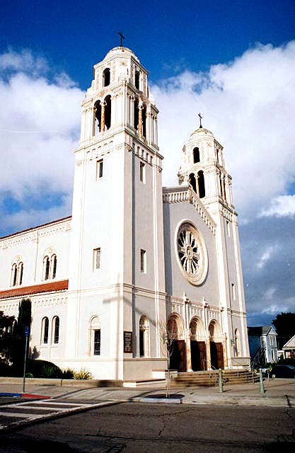
    Clockwise from top left: Rancho Petaluma; St. Vincent de Paul Church; Petaluma Historic Commercial District; Petaluma Public Library | |
| Etymology: Péta Lúuma, Coast Miwok for "Backside of the Hill" | |
 Location in Sonoma County and the state of California | |
 Petaluma Location in California  Petaluma Location in the United States | |
| Coordinates: 38°14′45″N 122°37′53″W | |
| Country | United States |
| State | California |
| County | Sonoma |
| Incorporated | April 12, 1858[1] |
| Government | |
| • Type | Council–manager |
| • Mayor | Teresa Barrett[2] |
| • Vice Mayor | Dennis Pocekay[3] |
| • City Manager | Peggy Flynn[4] |
| Area | |
| • Total | 14.52 sq mi (37.61 km2) |
| • Land | 14.41 sq mi (37.34 km2) |
| • Water | 0.11 sq mi (0.28 km2) 0.74% |
| Elevation | 30 ft (9 m) |
| Population (2020)[7] | |
| • Total | 59,776 |
| • Density | 4,100/sq mi (1,600/km2) |
| Time zone | UTC−8 (Pacific) |
| • Summer (DST) | UTC−7 (PDT) |
| ZIP code | 94952–94954 |
| Area code | 707 |
| FIPS code | 06-56784 |
| GNIS feature IDs | 277575, 2411407 |
| Website | cityofpetaluma |
Petaluma's name comes from the Miwok village named Péta Lúuma, that was located on the banks of the Petaluma River. The modern city originates in Rancho Petaluma, granted in 1834 to famed Californio statesman Mariano Guadalupe Vallejo, considered to be the founder of Petaluma.[10][11] Today, Petaluma is known for its well-preserved historic center and as a local hub for the Petaluma Valley region of Sonoma County.[12]
History


The Coast Miwok resided throughout Marin and southern Sonoma County.[13] The village of Péta Lúuma (Coast Miwok for "backside of the hill", or "sloping ridge") was east of the Petaluma River,[13] with a number of other Coast Miwok villages nearby: Wotoki was immediately to the south of Péta Lúuma, on the opposite side of the river; Etem, Likatiut, and Tuchayalin were near today's downtown; and Tulme and Susuli were just north of today's city limits.[14]
The Petaluma area was part of a 66,000-acre (270 km2) 1834 Mexican land grant by Governor Jose Figueroa to Mariano Guadalupe Vallejo called Rancho Petaluma. In 1836, Vallejo ordered construction of his Rancho Petaluma Adobe, a ranch house in Petaluma, which his family often used as a summer home, while he resided in the neighboring town of Sonoma. Vallejo's influence and Mexican control in the region began to decline after Vallejo's arrest during the Bear Flag Revolt in 1846.
Pioneers moved to Petaluma from the eastern United States after James Marshall found gold in the Sierra Nevada in 1848. The town's position on the Petaluma River in the heart of productive farmland was critical to its growth during the 19th and early 20th centuries. Sailing scows, such as the scow schooner Alma (1892), and steamers plied the river between Petaluma and San Francisco, carrying agricultural produce and raw materials to the burgeoning city of San Francisco during the California Gold Rush.
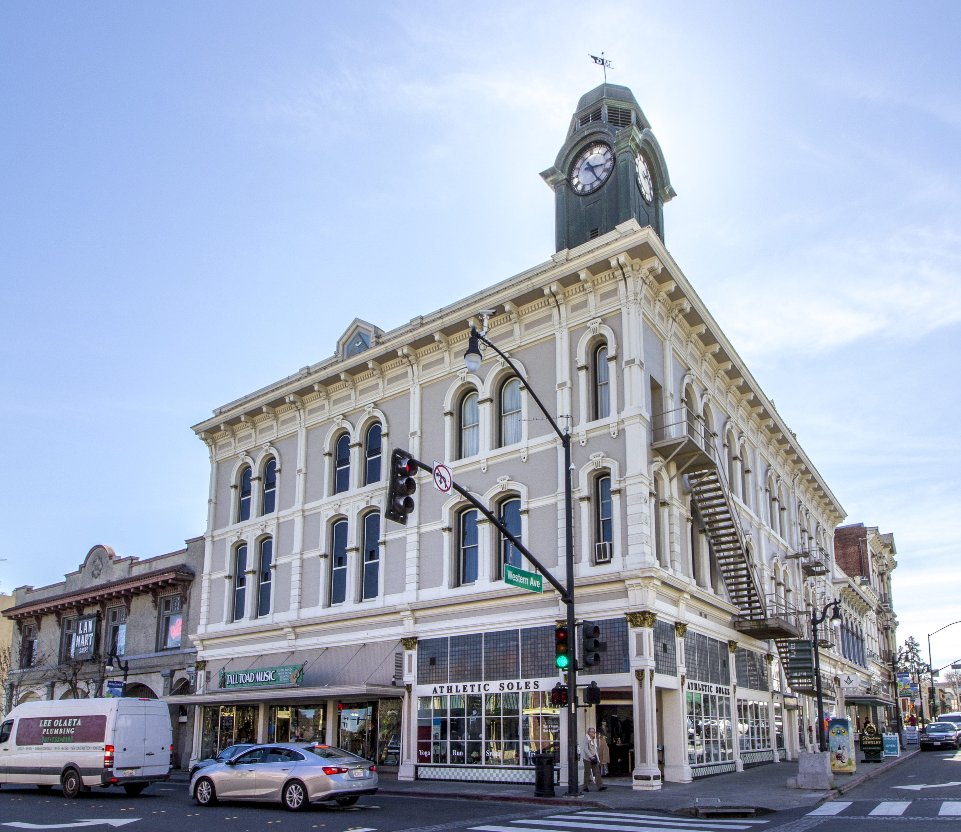
There were brothels downtown along Petaluma Boulevard,[15] which used to be the main thoroughfare until U.S. Highway 101 was constructed in the 1950s. The Petaluma Historic Commercial District is listed on the National Register of Historic Places.
The Sonoma County Bank Building was the home of the Baker Creek Heirloom Seed Company and the Petaluma Seed Bank until 2019.[16] It was built in 1926.[17]
Petaluma soon became known for its grain milling and chicken processing industries, which continue to the present as a smaller fraction of its commerce. At one time, Petaluma was known as the "Egg Capital of the World," sparking such nicknames as "Chickaluma".[18] Petaluma hosted the only known poultry drugstore and is the place where the egg incubator was invented by Lyman Byce in 1879.
One of the largest historic chicken processing plants still stands in the central area of town; this 1930s brick building is no longer used for the chicken industry, but is being evaluated for preservation and change of use. Even though it is no longer known as the Egg Capital of the World, Petaluma maintains a strong agricultural base today with dairy farms, olive groves, vineyards, and berry and vegetable farms.

According to the Army Museum at the Presidio, San Francisco, Petaluma was relatively unharmed during the San Francisco earthquake of April 18, 1906, due to significant stable bedrock underlying the region.[19] As one of the few communities in the region left standing after the earthquake, Petaluma was the staging point for most Sonoma County rescue and relief efforts.[citation needed]
Petaluma is today the location of many distinguished, well-preserved pre-1906 buildings and Victorian homes on the western side of the river.[19] The downtown area has suffered many river floods over the years[citation needed] and during the Depression commerce declined. A lack of funds prevented the demolition of the old homes and buildings.[citation needed] In the 1960s there was a counter-culture migration out of San Francisco into Marin County and southern Sonoma County, looking for inexpensive housing in a less urban environment. The old Victorian, Queen Anne and Eastlake style houses were restored. Historic iron-front buildings in the downtown commercial district were also rescued. Traffic and new home development for the most part was rerouted to the east of downtown by the construction of the 101 freeway.[citation needed]
The first official airmail flight took place in 1911, when Fred Wiseman carried a handful of mail from Petaluma to Santa Rosa, including letters from Petaluma postmaster John E. Olmstead and the mayor of Petaluma. Wiseman's plane ended up in the National Air and Space Museum.[20]


There was a substantial influx of Jewish residents to the area in the first three decades of the 20th century. Most of the settlers were secular Eastern European Jews; they founded today's B'nai Israel Jewish Center as a secular Jewish community center with no rabbi and only a small area for prayer. The community became active in the poultry industry, and some settlers joined the local labor movement and participated in leftist political organizing, leading to significant conflicts between integrationists who aimed to quietly integrate into Petaluma society and socialists who hoped to change it.[21]
With its large stock of historic buildings, Petaluma has been used as the filming location for numerous movies set in the 1940s, '50s, and '60s (see list of movies below). The historic McNear Building is a common film location.
Petaluma pioneered the time-controlled approach to development. After Highway 101 was re-aligned as a freeway in 1955, residential development permits tripled, from 300 in 1969 to 900 in 1971. Because of the region's soaring population in the sixties, the city enacted the "Petaluma Plan" in 1971. This plan limited the number of building permits to 500 annually for a five-year period beginning in 1972.[22] At the same time Petaluma created a redbelt around the town as a boundary for urban expansion for a stated number of years. Similar to Ramapo, New York, a Residential Development Control System was created to distribute the building permits based on a point system conforming to the city's general plan to provide for low and moderate income housing and divide development somewhat equally between east and west and single family and multi-family housing.
The stated objectives of Petaluma's time controlled growth management were to ensure orderly growth; to protect the city's small town character and surrounding green space; to provide a variety of housing choices; and to maintain adequate water supply and sewage treatment facilities.

The controlled development plan attracted national attention in 1975 when the city was taken to court by the Construction Industry Association. The city's restriction was upheld by the 9th Circuit Court in 1975 and the Supreme Court denied a petition for writ of certiorari in 1976. This court ruling still forms the foundation for most local growth management ordinances in California.[citation needed]
Despite this history of planned development, the Petaluma City Council voted on April 13, 2009, to eliminate the entire planning department and lay off the whole planning staff.[23] Planning Division responsibilities were subsequently contracted out to the consulting firm Metropolitan Planning Group, which re-hired some of the former planning staff and continues to operate planning services for the city.
In the late 1990s, Petaluma was also known as Telecom Valley due to the telecom startup companies that seemed to multiply from one another, and offer great riches for early stockholders and employees. Two success stories were that of Advanced Fibre Communications (AFC) (now Tellabs), and Cerent, which was purchased by Cisco. Some Cerent employees went on to purchase the Phoenix Theater, a local entertainment venue, which was once an opera house.
In 2021, Petaluma established a goal of achieving carbon neutrality by 2030. In March of that year, the city formally prohibited construction of new gas stations,[24][25][26] becoming the first municipality in the world to enact such a ban.[27][28] The city also streamlined the process of building EV charging stations and potential hydrogen filling stations.
The city has identified about two dozen buildings and districts as Petaluma landmarks.[29]
Geography


Petaluma has a total area of 14.5 sq mi (37.6 km2). 14.4 sq mi (37.3 km2) of that is land and the remaining 0.1 sq mi (0.3 km2) is water. Water is 0.74% of the total area.
It is 32 miles (51 km) north of San Francisco.[30]
Petaluma is flanked by the unincorporated communities of Penngrove to the north and Lakeville to the south.
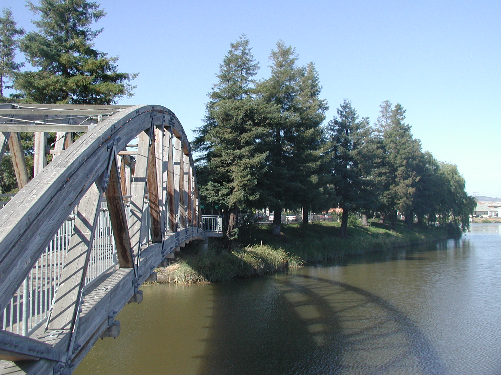
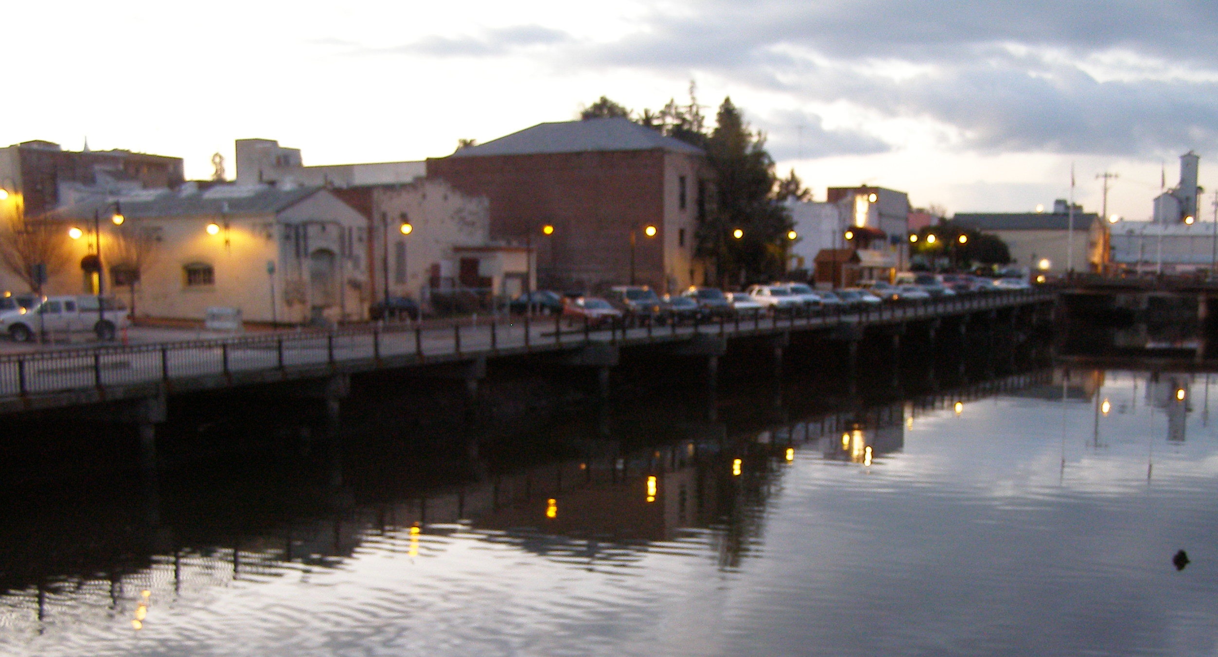
Petaluma is situated at the northernmost navigable end of the Petaluma River, a tidal estuary that snakes southward to San Pablo Bay. Pollution levels in the river, once considerable, have improved in recent years. A significant amount of the city is in the river's flood plain, which overflows its banks every few years, particularly in the Payran neighborhood.[12]
Principal environmental noise sources are U.S. Route 101, Petaluma Boulevard, Washington Street and other major arteries. The number of residents that live in a zone of noise exposure greater than 60 CNEL is approximately 4,000.[12]
Climate
Petaluma has a mild Mediterranean climate (Köppen: Csb). Its dry summer is characterized by typically warm days and cool nights with a large degree of diurnal temperature variation. Summer mornings often start out foggy and chilly, but the fog usually clears by midday or so, giving way to clear skies and warmth for the remainder of the day. August is usually the warmest month, with average daily temperatures ranging from 82 °F (28 °C) to 53 °F (12 °C). December is usually the coldest month, with average daily temperatures ranging from 57 °F (14 °C) to 39 °F (4 °C). Winter is cool and rainy, with frost occasionally occurring on clear nights.
Weather Underground's reporting station in Petaluma had a record high temperature of 111 °F (44 °C) on September 6, 2020. The record low temperature of 16 °F (−9 °C) was recorded on November 14, 1916, and December 14, 1932. The wettest year was 1998 with 45.93 inches (1,167 mm) and the driest year was 1976 with 8.29 inches (211 mm). The wettest month was February 1998 with 19.59 inches (498 mm). The most precipitation in 24 hours was 4.29 inches (109 mm) on December 27, 2004. Although snow is rare in Petaluma, 1.5 inches (38 mm) fell in January 1916, as well as about 3 inches (76 mm) in January 2002.[31]
| Climate data for Petaluma, CA (1991–2020 normals, extremes 1913–present) | |||||||||||||
|---|---|---|---|---|---|---|---|---|---|---|---|---|---|
| Month | Jan | Feb | Mar | Apr | May | Jun | Jul | Aug | Sep | Oct | Nov | Dec | Year |
| Record high °F (°C) | 85 (29) |
86 (30) |
93 (34) |
97 (36) |
101 (38) |
110 (43) |
110 (43) |
105 (41) |
109 (43) |
106 (41) |
91 (33) |
81 (27) |
110 (43) |
| Mean maximum °F (°C) | 67.4 (19.7) |
72.0 (22.2) |
77.2 (25.1) |
88.5 (31.4) |
87.7 (30.9) |
95.6 (35.3) |
96.2 (35.7) |
96.2 (35.7) |
97.1 (36.2) |
90.4 (32.4) |
77.8 (25.4) |
66.8 (19.3) |
100.6 (38.1) |
| Average high °F (°C) | 57.6 (14.2) |
61.3 (16.3) |
64.5 (18.1) |
67.8 (19.9) |
71.9 (22.2) |
78.1 (25.6) |
80.8 (27.1) |
81.2 (27.3) |
81.6 (27.6) |
76.4 (24.7) |
65.5 (18.6) |
57.9 (14.4) |
70.4 (21.3) |
| Daily mean °F (°C) | 48.3 (9.1) |
50.8 (10.4) |
53.2 (11.8) |
55.8 (13.2) |
59.6 (15.3) |
64.3 (17.9) |
66.6 (19.2) |
67.0 (19.4) |
66.5 (19.2) |
62.0 (16.7) |
53.9 (12.2) |
48.1 (8.9) |
58.0 (14.4) |
| Average low °F (°C) | 39.0 (3.9) |
40.4 (4.7) |
41.9 (5.5) |
43.8 (6.6) |
47.4 (8.6) |
50.4 (10.2) |
52.4 (11.3) |
52.8 (11.6) |
51.4 (10.8) |
47.6 (8.7) |
42.3 (5.7) |
38.4 (3.6) |
45.7 (7.6) |
| Mean minimum °F (°C) | 28.1 (−2.2) |
30.6 (−0.8) |
33.4 (0.8) |
35.6 (2.0) |
40.6 (4.8) |
44.5 (6.9) |
47.2 (8.4) |
47.6 (8.7) |
44.7 (7.1) |
39.2 (4.0) |
31.4 (−0.3) |
27.4 (−2.6) |
25.6 (−3.6) |
| Record low °F (°C) | 18 (−8) |
18 (−8) |
24 (−4) |
26 (−3) |
27 (−3) |
32 (0) |
39 (4) |
39 (4) |
31 (−1) |
25 (−4) |
20 (−7) |
16 (−9) |
16 (−9) |
| Average precipitation inches (mm) | 4.77 (121) |
5.23 (133) |
3.32 (84) |
1.68 (43) |
0.93 (24) |
0.28 (7.1) |
0.01 (0.25) |
0.05 (1.3) |
0.09 (2.3) |
1.27 (32) |
2.74 (70) |
5.19 (132) |
25.56 (649) |
| Average precipitation days (≥ 0.01 in) | 12.0 | 10.4 | 9.9 | 6.4 | 3.7 | 1.3 | 0.1 | 0.3 | 1.0 | 3.7 | 8.0 | 12.1 | 68.9 |
| Source: [32] | |||||||||||||
Demographics
| Historical population | |||
|---|---|---|---|
| Census | Pop. | %± | |
| 1880 | 3,326 | — | |
| 1890 | 3,692 | 11.0% | |
| 1900 | 3,871 | 4.8% | |
| 1910 | 5,880 | 51.9% | |
| 1920 | 6,226 | 5.9% | |
| 1930 | 8,245 | 32.4% | |
| 1940 | 8,034 | −2.6% | |
| 1950 | 10,315 | 28.4% | |
| 1960 | 14,035 | 36.1% | |
| 1970 | 24,870 | 77.2% | |
| 1980 | 33,834 | 36.0% | |
| 1990 | 43,184 | 27.6% | |
| 2000 | 54,548 | 26.3% | |
| 2010 | 57,941 | 6.2% | |
| 2020 | 59,776 | 3.2% | |
| U.S. Decennial Census[33] | |||
2010
The 2010 United States Census[34] reported that Petaluma had a population of 57,941. The population density was 3,998.9 people per square mile (1,544.0/km2). The racial makeup of Petaluma was 46,566 (80.4%) White, 801 (1.4%) African American, 353 (0.6%) Native American, 2,607 (4.5%) Asian (1.3% Chinese, 0.9% Filipino, 0.8% Asian Indian, 0.4% Japanese, 0.3% Vietnamese, 0.2% Korean, 0.1% Pakistani, 0.1% Laotian, 0.1% Thai), 129 (0.2%), Pacific Islander, 5,103 (8.8%) from other races, and 2,382 (4.1%) from two or more races. Hispanic or Latino of any race were 12,453 persons (21.5%). The Latino ethnic groups are Mexicans (16.2%), Salvadorans (1.2%), Guatemalans (0.6%), Nicaraguans (0.3%), Peruvians (0.3%), and Puerto Ricans (0.3%).
The Census reported that 57,217 people (98.8% of the population) lived in households, 361 (0.6%) lived in non-institutionalized group quarters, and 363 (0.6%) were institutionalized.
There were 21,737 households, out of which 7,541 (34.7%) had children under the age of 18 living in them, 11,392 (52.4%) were opposite-sex married couples living together, 2,257 (10.4%) had a female householder with no husband present, 1,052 (4.8%) had a male householder with no wife present. There were 1,319 (6.1%) unmarried opposite-sex partnerships, and 207 (1.0%) same-sex married couples or partnerships. 5,372 households (24.7%) were made up of individuals, and 2,366 (10.9%) had someone living alone who was 65 years of age or older. The average household size was 2.63. There were 14,701 families (67.6% of all households); the average family size was 3.14.
The population was spread out, with 13,455 people (23.2%) under the age of 18, 4,589 people (7.9%) aged 18 to 24, 15,041 people (26.0%) aged 25 to 44, 17,273 people (29.8%) aged 45 to 64, and 7,583 people (13.1%) who were 65 years of age or older. The median age was 40.3 years. For every 100 females, there were 96.3 males. For every 100 females age 18 and over, there were 93.8 males.
There were 22,736 housing units at an average density of 1,569.2 per square mile (605.9/km2), of which 14,159 (65.1%) were owner-occupied, and 7,578 (34.9%) were occupied by renters. The homeowner vacancy rate was 1.3%; the rental vacancy rate was 4.8%. 37,389 people (64.5% of the population) lived in owner-occupied housing units and 19,828 people (34.2%) lived in rental housing units.
2000

As of the census[35] of 2000, there were 54,548 people, 19,932 households, and 14,012 families residing in the city. The population density was 3,953 people per square mile (1,526/km2). There were 20,304 housing units at an average density of 1,471/sq mi (568/km2). The racial makeup of the city was 84.16% White, 1.16% African American, 0.54% Native American, 3.91% Asian, 0.17% Pacific Islander, 6.08% from other races, and 3.98% from two or more races. 14.64% of the population were Hispanic.
There were 19,932 households, out of which 36.6% had children under the age of 18 living with them, 55.3% were married couples living together, 10.6% had a female householder with no husband present, and 29.7% were non-families. 22.6% of all households were made up of individuals, and 9.1% had someone living alone who was 65 years of age or older. The average household size was 2.70 and the average family size was 3.16. The age distribution is: 26.2% under the age of 18, 7.2% from 18 to 24, 31.5% from 25 to 44, 24.1% from 45 to 64, and 11.0% who were 65 years of age or older. The median age was 37 years. For every 100 females, there were 95.6 males. For every 100 females age 18 and over, there were 91.9 males.
The median income for a household in the city was $61,679, and the median income for a family was $71,158 (these figures had risen to $68,949 and $85,513, respectively, as of a 2007 estimate[36]). Males had a median income of $50,232 versus $36,413 for females. The per capita income for the city was $27,087. About 3.3% of families and 6.0% of the population were below the poverty line, including 6.2% of those under age 18 and 7.1% of those age 65 or over.
Economy
Amy's Kitchen, Calix Inc., CamelBak, Clover Stornetta Farms, Fireman's Fund Insurance Company, Lagunitas Brewing Company, Petaluma Poultry, and Athleta Inc. are based in Petaluma. Mesa Boogie and Enphase Energy were also founded in Petaluma.
Top employers
According to the City's 2021 Comprehensive Annual Financial Report,[37] the top employers in the city are:
| # | Employer | # of Employees | % of Total City Employment |
|---|---|---|---|
| 1 | Petaluma School District | 789 | 2.49% |
| 2 | Petaluma Poultry Processors | 425 | 1.34% |
| 3 | Lagunitas Brewing Company | 399 | 1.26% |
| 4 | Petaluma Valley Hospital | 372 | 1.17% |
| 5 | City of Petaluma | 328 | 1.03% |
| 6 | Labcon, North America | 265 | 0.84% |
| 7 | Old Adobe Union School District | 260 | 0.82% |
| 8 | Clover Stornetta Farms | 181 | 0.57% |
| 9 | Hansel Auto | 162 | 0.51% |
| 10 | Sequoia Senior Solutions | 159 | 0.50% |
Military
U.S. Coast Guard
The U.S. Coast Guard operates Training Center Petaluma just outside Petaluma, near Two Rock. It operates several of its class "A" and "C" schools at TRACEN Petaluma, including the Electronics Technician (ET), Culinary Specialist (CS), Health Service Technician (HS), Information Systems Technician (IT), Operation Specialist (OS), Storekeeper (SK), and Yeoman (YN) schools.
The Coast Guard also operates the Chief Petty Officer Academy at the TRACEN.[38] Academy trains senior non-commissioned officers (Chief Petty Officers) for both the U.S. Coast Guard and the U.S. Air Force.
California National Guard
The California National Guard operates an armed forces facility in Petaluma, at 580 Vallejo Street.
Parks and recreation
Immediately to the southwest is Helen Putnam Regional Park, accessible from Chileno Valley Road. This park of 216 acres (0.9 km2) has trails for hiking, cycling and horseback riding and is one of two parks named in honor of former mayor Helen Putnam who served from 1965–1979; the other is Putnam Plaza on Petaluma Boulevard. Lying above the city of Petaluma on the northwest flank of Sonoma Mountain is the Fairfield Osborn Preserve, a nature reserve with a diversity of native plants and animals. Nearby to the southeast is Tolay Lake, the site of prehistoric seasonal settlement by Miwok and Pomo tribes.
Government

The mayor of Petaluma is Teresa Barrett,[39] who was formerly the vice mayor, and has previously served on the Petaluma City Council.[40] The other six council members are Brian Barnacle (Vice Mayor), D'Lynda Fischer, Mike Healy, Dave King, Kevin McDonnell and Dennis Pocekay.
State and federal representation
In the California State Legislature, Petaluma is in the 3rd Senate District, represented by Democrat Bill Dodd, and the 10th Assembly District, represented by Democrat Marc Levine.[41]
In the United States House of Representatives, Petaluma is split between California's 2nd congressional district, represented by Democrat Jared Huffman,[42] and California's 5th congressional district, represented by Democrat Mike Thompson.[43]
According to the California Secretary of State, as of February 10, 2019, Petaluma has 36,034 registered voters. Of those, 18,779 (52.1%) are registered Democrats, 6,124 (17%) are registered Republicans, and 9,281 (25.8%) have declined to state a political party.[44]
Education

Public schools are managed by the Petaluma City School District. There are two comprehensive high schools in Petaluma: Petaluma High School and Casa Grande High School, whose athletic teams are known as the Trojans and Gauchos respectively. Casa Grande High School has a notable Academic Decathlon team, which has represented Sonoma County for the last 27 years in the state-level competition. There is an annual football game between the two schools' teams known as the "Egg Bowl". The Game was suspended in 2011 for fights involving players and fans, but was brought back in 2017, with Petaluma winning the game over Casa Grande, 20–14. The two Petaluma public middle schools are Kenilworth Junior High School and Petaluma Junior High School.
St. Vincent de Paul High School, a Roman Catholic private school, is in Petaluma, and its athletic teams are known as the Mustangs. Santa Rosa Junior College has a second campus in Petaluma, and the campus the unaccredited art school/atelier l'Atelier aux Couleurs is located in Petaluma. Harvest Christian School is a private Christian school in Petaluma, serving grades TK-8.[45]
Infrastructure

Transportation
U.S. Highway 101 is the main freeway through town. State Route 116 also runs through town as Lakeville Highway. Other major streets include East Washington Street, North and South McDowell Boulevards, and Petaluma Boulevard.
Petaluma is served by Petaluma Transit, Golden Gate Transit and by Sonoma County Transit bus services. The Sonoma–Marin Area Rail Transit (SMART) rail line inaugurated service in August 2017 and serves Petaluma–Downtown station, adjacent to the historic Northwestern Pacific Railroad depot near Washington Street. A second station, Petaluma–North, is planned for future construction and service.
The nearest major airports are San Francisco International Airport and Oakland International Airport, Sonoma County Airport Express buses connect Petaluma with the aforementioned airports.[46] General aviation is served by the Petaluma Municipal Airport, as well as the Charles M. Schulz – Sonoma County Airport located north of Santa Rosa.
Notable people
Actors
- Winona Ryder (born 1971), actor; graduated from Petaluma High School in 1989
- Myron Healey (1923-2005), actor[47]
- Lloyd Bridges (1913-1998), actor; graduated from Petaluma High School in 1930
Artists
- David Best (born 1945), sculptor, lives and works in Petaluma, known for Burning Man creations
- Mark di Suvero (born 1933), sculptor, lived and worked in Petaluma, 1975-
- Mary Fuller McChesney (1922-2022), sculptor, lived on Sonoma Mountain, 1953-2019
- Robert P. McChesney (1913-2008), painter, lived on Sonoma Mountain, 1953-2008
Businesspeople
- Kevin Tsujihara (born 1964), former chairman and CEO of Warner Bros.
Video game designers
- Jake Rodkin, video game designer, graphic designer, podcaster
- Bill Tiller (born 1967), computer game designer, writer, and artist, known for his work at LucasArts.
- Jeff Gerstmann (born 1975), prominent video game personality known for his podcasting and work at Gamespot and Giant Bomb.
Historical figures
- Richard A. Penry (1948-1994), soldier and Medal of Honor recipient[48]
Musicians and bands
- Sean Hayes (born 1969), singer and songwriter
- Em Rossi (born 1998), singer and songwriter[49]
Sports figures
- Bruce Bochte (born 1950), baseball player
- Steven Cozza (born 1985), professional road bicycle racer
- Joe Enochs (born 1971), soccer player for VfL Osnabrück
- Jonny Gomes (born 1980), baseball player
- Duke Iversen (1920-2011), football player
- Spencer Torkelson (born 1999) baseball player
- Elijah Qualls (born 1995), football player
Writers
- Shirley Neilsen Blum (born 1932), American art historian, author, gallerist, curator, and professor; born in Petaluma.[50]
- Tobias Capwell (born c. 1973), American curator, military historian and jouster; born in Petaluma
- Pauline Kael (1919-2001), movie critic
- Karen Kilgariff (born 1970), comedian, podcaster and writer
- Bill Pronzini (born 1943), mystery writer
- Silver Tree, film writer and producer[51]
Other
- Nicole Aunapu Mann (born 1977), USMC fighter pilot and NASA astronaut.[52]
In popular culture
This section needs additional citations for verification. (October 2015) |
- The song "Petaluma Afternoons" appeared on the 1998 album Time Between Trains by folk singer Susan Werner.
- In the computer game Sim City 2000, "Petaluma" is frequently a neighboring community to the city that the player builds.
- The 2007 Michael Ondaatje novel Divisadero is partly set on a farm situated near Petaluma.
- A musical piece called And on the Seventh Day Petals Fell in Petaluma, inspired by a garden in Petaluma, was created by Harry Partch in 1963.
- Petaluma is briefly mentioned by a suitor in the 1971 comedy film Harold and Maude.
- In the episode of the television show M*A*S*H 'The Topper', character B.J. Hunnicutt mentions a "Petaluma lumberjack festival."
- In Nickelodeon's The Mighty B! a freeway overpass has a Petaluma sign on it.
- In the Peanuts comics series, Snoopy the beagle trains for an arm wrestling event in Petaluma (but is disqualified because he has no thumb).
- In an episode of the 1970s television series Emergency!, fireman Chet Kelley mentions trying out for the Arm Wrestling Championship in Petaluma, but loses to another applicant before making the trip.
- In their song The Days of the Phoenix from their September 2000 album titled The Art of Drowning, the punk rock band AFI makes reference to the Phoenix Theater on Washington Street in downtown Petaluma, a venue the band used to play on a regular basis.
- In the film One Way Passage (1932) starring William Powell, Kay Francis, Aline MacMahon, Frank McHugh, and Warren Hymer playing a police detective, Hymer tries to woo actress Aline MacMahon by telling her he wants to quit police work and retire to his fully paid for chicken ranch in Petaluma.
- California's Gold Episode 2009[53]
- 2016 film American Wrestler: The Wizard is set in Petaluma.
See also
- List of cities and towns in California
- List of cities and towns in the San Francisco Bay Area
- Petaluma Gap
- Petaluma Reservoir
- Petaluma Wildlife Museum
- United States Post Office (Petaluma, California)
References
- "California Cities by Incorporation Date". California Association of Local Agency Formation Commissions. Archived from the original (Word) on February 21, 2013. Retrieved August 25, 2014.
- "Petaluma City Council". City of Petaluma. Retrieved January 27, 2022.
- "Petaluma City Council Countil Minutes". City of Petaluma. Retrieved January 27, 2022.
- "City Manager". City of Petaluma. Retrieved November 9, 2014.
- "2019 U.S. Gazetteer Files". United States Census Bureau. Retrieved July 1, 2020.
- "Petaluma". Geographic Names Information System. United States Geological Survey, United States Department of the Interior.
- "Petaluma Quickfacts from the US Census Bureau". US Census Bureau.
- Gudde, Erwin Gustav; William Bright (1998). California Place Names: The Origin and Etymology of Current Geographical Names (Second ed.). Berkeley: University of California Press. pp. 287. ISBN 978-0-520-21316-6.
- Billiter, Bill (January 1, 1985). "3,000-Year-Old Connection Claimed : Siberia Tie to California Tribes Cited". Los Angeles Times. Los Angeles. Archived from the original on November 28, 2014. Retrieved November 28, 2014.
The similarities of the Siberian-California Indian words include some well-known places, he said. "Petaluma (a city in Northern California) would be understood in Siberia even today," he said. "It means 'flat back,' as in the flat back of a hill.
- Press Democrat - Young Mariano Vallejo was Petaluma's 'founding father'
- National Park Service - Petaluma Adobe
- Kay Ransom, C. Michael Hogan, Ballard George et al., Environmental Impact Report for the Petaluma General Plan, prepared by Earth Metrics Inc. for the city of Petaluma (1984),
- Sarris, Greg (September 30, 2016). "The Last Woman From Petaluma". KCET. Retrieved October 20, 2022.
- Peterson, Bonnie J. (1976). Dawn of the World: Coast Miwok Myths. ISBN 978-0-912908-04-5.
- "Old Chicago Pizza – Delicious Pizza Restaurant in Petaluma, California". February 27, 2019.
Aside from the pizza, you might be interested in knowing that the room you are sitting in was at one time the parlor for a house of ill-repute
- "Petaluma Seed Bank". Rareseeds.com.
- "Historic Downtown Petaluma Sites" (PDF). VisitPetaluma.com. September 28, 2019. Retrieved September 28, 2019.
- Harwood, W. S. (May 1908). "A City Of A Million Hens: How Poultry Raising Conducted As A Business Has Made Petaluma Known Over The World". The World's Work: A History of Our Time. XVI: 10207–10124. Retrieved July 10, 2009.
- "The History of Petaluma California". Petaluma.com. Retrieved November 17, 2017.
- "Fad to Fundamental: Airmail in America". Smithsonian Institution. Retrieved January 29, 2011.
- Kann, Kenneth (1993). Comrades and chicken ranchers : the story of a California Jewish community. Ithaca: Cornell University Press. pp. 1, 59, 97–98. ISBN 0-8014-2807-6. OCLC 26974588.
- Fulton, William, and Paul Shigley, Guide to California Planning, 3d edition, pp. 199-200. Point Arena, Calif.: Solano Press Books, 2005.
- Shigley, Paul, "Petaluma Eliminates Its Planning Department", California Planning & Development Report, April 14, 2009
- "Petaluma moves to ban new gas stations". Santa Rosa Press Democrat. February 24, 2021. Retrieved March 4, 2021.
- "Petaluma bans all new gas stations in push to curb emissions". www.msn.com. Retrieved March 4, 2021.
- "Petaluma becomes first city in the U.S. to ban new gas stations". KTVU FOX 2. March 2, 2021. Retrieved March 4, 2021.
- Rushe, Dominic (August 17, 2021). "This town is the first in America to ban gas stations – is the tide turning?". The Guardian. Retrieved August 17, 2021.
{{cite web}}: CS1 maint: url-status (link) - "California Towns Banning New Gas Stations". The Weather Channel. November 1, 2022. Retrieved November 2, 2022.
- "City of Petaluma: Planning Department". Archived from the original on January 7, 2019. Retrieved January 13, 2019.
- Petaluma Visitors Center. Transportation. Archived June 3, 2017, at the Wayback Machine Retrieved on July 14, 2017.
- "Central California". dri.edu.
- "NOWData - NOAA Online Weather Data". National Oceanic and Atmospheric Administration. Retrieved June 19, 2022.
- "Census of Population and Housing". Census.gov. Retrieved June 4, 2015.
- "2010 Census Interactive Population Search: CA - Petaluma city". U.S. Census Bureau. Archived from the original on July 15, 2014. Retrieved July 12, 2014.
- "U.S. Census website". United States Census Bureau. Retrieved January 31, 2008.
- Petaluma City, California - Fact Sheet - American FactFinder (Census.gov)
- City of Petaluma CAFR Retrieved December 29, 2021
- "Chief Petty Officer Academy". United States Coast Guard. Retrieved November 17, 2017.
- "City of Petaluma: City Clerk, Petaluma City Council". Retrieved January 15, 2008.
- "City of Petaluma". Retrieved July 20, 2019.
- "Statewide Database". UC Regents. Archived from the original on February 1, 2015. Retrieved December 7, 2014.
- "California's 2nd Congressional District - Representatives & District Map". Civic Impulse, LLC. Retrieved March 1, 2013.
- "Communities of Interest - City". California Citizens Redistricting Commission. Archived from the original on September 30, 2013. Retrieved September 27, 2014.
- "CA Secretary of State – Report of Registration – February 10, 2019" (PDF). ca.gov. Retrieved March 12, 2019.
- "At a Glance". Harvest Christian School Petaluma.
- Sonoma County Airport Express Website
- "Myron Healey, 82; One of the Best Badmen in Film and TV Westerns". Los Angeles Times. March 27, 2006. ISSN 0458-3035. Retrieved May 30, 2019.
- "Medal of Honor Recipients: Vietnam (M-Z)". Retrieved October 19, 2009.
- "Singing her way to a career in music". Petaluma Argus Courier. July 16, 2015. Retrieved May 29, 2019.
- "Blum, Shirley". Dictionary of Art Historians. Archived from the original on March 31, 2018. Retrieved March 3, 2020.
the couple (Hopps), along with the artist Edward Kienholz founded the Ferus Gallery in Los Angeles in 1957.
- "The Wild Bunch". Retrieved October 19, 2009.
- "Nicole A. Mann (LtCol, U.S. Marine Corps) NASA Astronaut". February 7, 2016.
- "Historic Chickens – California's Gold (2009) – Huell Howser Archives at Chapman University".
External links
- Official website

- Petaluma Downtown
- Petaluma 2004/05 General Plan
- Historical and scenic photos of Petaluma by Michael Maggid
- Bicycling map
Places adjacent to Petaluma, California | ||||||||||||||||
|---|---|---|---|---|---|---|---|---|---|---|---|---|---|---|---|---|
| ||||||||||||||||
Municipalities and communities of Sonoma County, California, United States | ||
|---|---|---|
County seat: Santa Rosa | ||
| Cities and towns |  | |
| CDPs |
| |
| Unincorporated communities | ||
| Indian reservations |
| |
| ||
| Bodies of water |
|  |
|---|---|---|
| Counties | ||
| Major cities | ||
| Cities and towns 100k–250k | ||
| Cities and towns 50k–99k | ||
| Cities and towns 25k–50k | ||
| Cities and towns 10k–25k | ||
| Sub-regions |
| |
| ||
| Authority control |
|
|---|
На других языках
[de] Petaluma
Petaluma ist eine Stadt im Sonoma County im US-Bundesstaat Kalifornien mit 55.300 Einwohnern (Stand: 2004).- [en] Petaluma, California
[ru] Петалума
Петалума — город в округе Сонома, штат Калифорния, США.Другой контент может иметь иную лицензию. Перед использованием материалов сайта WikiSort.org внимательно изучите правила лицензирования конкретных элементов наполнения сайта.
WikiSort.org - проект по пересортировке и дополнению контента Википедии