world.wikisort.org - USA
Carmel Valley is an unincorporated community in Monterey County, California, United States. The term "Carmel Valley" generally refers to the Carmel River watershed east of California State Route 1, and not specifically to the smaller Carmel Valley Village.[4][5] For statistical purposes, the United States Census Bureau has defined Carmel Valley as a census county division (CCD),[5] with an area covering approximately 189 square miles (490 km2).[4] At the time of the 2020 census the population was 6,189.[5] In November 2009, a majority of residents voted against incorporation.
Carmel Valley | |
|---|---|
Unincorporated community Census county division | |
From top down, left to right: Carmel Valley panoramio; Carmel River; Garland Ranch Regional Park; Jamesburg Earth Station | |
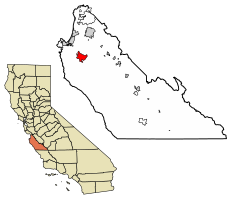 Location of Carmel Valley in Monterey County and the state of California | |
 Carmel Valley Location in California  Carmel Valley Location in the United States | |
| Coordinates: 36°28′38″N 121°44′22″W | |
| Country | |
| State | |
| County | Monterey |
| Government | |
| • Board of Supervisors | Mary Adams (politician)[1] |
| • State senator | John Laird (D)[2] |
| • Assemblymember | Mark Stone (D)[2] |
| • U. S. rep. | Jimmy Panetta (D)[3] |
| Area | |
| • Total | 189.65 sq mi (491.2 km2) |
| • Land | 189.05 sq mi (489.6 km2) |
| • Water | 0.6 sq mi (2 km2) |
| Population (2020) | |
| • Total | 6,189[5] |
| Time zone | UTC-8 (PST) |
| • Summer (DST) | UTC-7 (PDT) |
| ZIP code | 93924[6] |
| Area code | 831 |
| FIPS code | 0605390370 |
| GNIS feature ID | 270303 |


History
The earliest archaeological findings show that Carmel Valley had two separate tribes, the Esselens that lived in Upper Carmel Valley and the Rumsens lived from Mid-Carmel Valley to the mouth of Carmel Valley.[7]
The Rancho Los Laureles, a 6,625-acre (26.81 km2) Mexican land grant in present-day Monterey County, California, was given in 1839 by Governor Juan Alvarado to José M. Boronda and Vicente Blas Martínez.[8] The grant extended along the Carmel River in Carmel Valley; and encompassed present day Carmel Valley. In 1882, the Pacific Improvement Company (PIC) purchased the Rancho Los Laureles. In 1916, Samuel F.B. Morse became the manager of the PIC and his job was to liquidate the PIC holdings (10,000 acres (4,000 ha)).
The Berwick Manor and Orchard was located on Boronda Road off Carmel Valley Road in Carmel Valley. The farmstead was acquired in 1869 by Edward Berwick, a writer and educator as well as a scientific farmer. The manor and orchard was listed on the National Register of Historic Places on November 17, 1977. The Berwick Manor and Orchard was sold in 1961 and later subdivided into what is known today as the Berwick Manor Subdivision.[9][10]
In 1919, Morse formed the Del Monte Properties and acquired PIC. In 1923, the Del Monte Properties divided the land into 11 parcels. Marion Hollins bought 2,000 acres (810 ha). In 1926, developer Frank Porter bought 600 acres (240 ha). He later acquired a portion of the Hollins ranch and sold it to Byington Ford. Byington and his wife Marion used 400 acres (160 ha) as a summer ranch and named it Moon Trail Ranch. It was located at Via Las Encinas in Carmel Valley.[11]
Geography and ecology
According to the United States Census Bureau, the Carmel Valley CCD covers a total area of 189.65 square miles (491 km2), comprising 189.05 square miles (489.6 km2) of land and 0.6 square miles (1.6 km2) of water.[4] Within the CCD, the Carmel Valley Village lies on the eastern bank of the Carmel River while the community of Robles del Rio is located on the western bank. Carmel Valley Road (County Route G16) is the main route through the valley, connecting to California State Route 1 near the City of Carmel to the west.
The Carmel River drains the area of Carmel Valley. Primary ecosystems of the vicinity include California oak woodland, riparian woodland, chaparral, grassland and savanna. Dominant oak trees include Quercus agrifolia. The locale of Carmel Valley is also the northernmost range of the hybrid oak Quercus x alvordiana.[12]
The Garland Ranch Regional Park is located at 700 West Carmel Valley Road. The Monterey Peninsula Regional Park District (MPRPD) manages the Garland Ranch Regional Park.
Climate
This region experiences warm dry summers, with no average monthly temperatures above 71.6 °F (22.0 °C). With heat waves in the upper 70s to 101 degrees F. The further inland you go. According to the Köppen Climate Classification system, Carmel Valley has a warm-summer Mediterranean climate, abbreviated "Csb" on climate maps.[13]
| Climate data for Carmel Valley, California (2002–2020 normals) (records 1959–1978, 2002–present) | |||||||||||||
|---|---|---|---|---|---|---|---|---|---|---|---|---|---|
| Month | Jan | Feb | Mar | Apr | May | Jun | Jul | Aug | Sep | Oct | Nov | Dec | Year |
| Record high °F (°C) | 89 (32) |
86 (30) |
92 (33) |
98 (37) |
98 (37) |
106 (41) |
110 (43) |
107 (42) |
113 (45) |
104 (40) |
96 (36) |
84 (29) |
113 (45) |
| Mean maximum °F (°C) | 77.3 (25.2) |
77.5 (25.3) |
82.1 (27.8) |
86.2 (30.1) |
89.3 (31.8) |
93.1 (33.9) |
92.5 (33.6) |
95.4 (35.2) |
100.1 (37.8) |
94.5 (34.7) |
85.5 (29.7) |
74.6 (23.7) |
102.4 (39.1) |
| Average high °F (°C) | 63.1 (17.3) |
63.8 (17.7) |
66.9 (19.4) |
68.7 (20.4) |
71.3 (21.8) |
76.0 (24.4) |
78.5 (25.8) |
79.6 (26.4) |
80.6 (27.0) |
77.9 (25.5) |
68.8 (20.4) |
62.5 (16.9) |
71.5 (21.9) |
| Daily mean °F (°C) | 51.6 (10.9) |
52.3 (11.3) |
54.2 (12.3) |
55.8 (13.2) |
58.6 (14.8) |
62.1 (16.7) |
64.7 (18.2) |
65.1 (18.4) |
65.7 (18.7) |
62.7 (17.1) |
55.6 (13.1) |
51.0 (10.6) |
58.3 (14.6) |
| Average low °F (°C) | 40.0 (4.4) |
40.8 (4.9) |
41.5 (5.3) |
42.8 (6.0) |
45.9 (7.7) |
48.3 (9.1) |
51.0 (10.6) |
50.6 (10.3) |
50.7 (10.4) |
47.6 (8.7) |
42.4 (5.8) |
39.6 (4.2) |
45.1 (7.3) |
| Mean minimum °F (°C) | 29.6 (−1.3) |
30.7 (−0.7) |
32.6 (0.3) |
34.7 (1.5) |
37.7 (3.2) |
40.2 (4.6) |
42.3 (5.7) |
42.2 (5.7) |
42.2 (5.7) |
38.4 (3.6) |
32.8 (0.4) |
28.4 (−2.0) |
26.5 (−3.1) |
| Record low °F (°C) | 20 (−7) |
23 (−5) |
25 (−4) |
31 (−1) |
33 (1) |
33 (1) |
37 (3) |
35 (2) |
35 (2) |
26 (−3) |
27 (−3) |
21 (−6) |
20 (−7) |
| Average precipitation inches (mm) | 3.94 (100) |
3.51 (89) |
2.80 (71) |
1.36 (35) |
0.54 (14) |
0.14 (3.6) |
0.03 (0.76) |
0.06 (1.5) |
0.05 (1.3) |
0.78 (20) |
1.74 (44) |
2.99 (76) |
17.94 (456) |
| Average precipitation days | 10.5 | 10.2 | 9.9 | 7.6 | 3.8 | 1.0 | 0.2 | 0.1 | 0.8 | 2.9 | 6.7 | 12.2 | 66.7 |
| Source: NOAA[14] | |||||||||||||
Demographics
2020
At the 2020 census Carmel Valley had a population of 6,189. The racial makeup of Carmel Valley was 5,502 White, 32 African American, 57 Native American, 126 Asian, 17 Pacific Islander, 270 from other races, and 685 from two or more races. Hispanic or Latino of any race were 624.[15]
The age distribution was 1.7% under the age of 5; 16.0% under the age of 18, 84.0% 18 years and over; and 37.5% 65 or older. The median age was 58.8 years.[15]
Government
At the county level, Carmel Valley is represented on the Monterey County Board of Supervisors by Mary L. Adams, as the 5th District Supervisor.[16]
In the California State Assembly, Carmel Valley is in the 17th Senate District, represented by Democrat John Laird, and in the 29th Assembly District, represented by Democrat Mark Stone.[17] In the United States House of Representatives, Carmel Valley is in California's 20th congressional district, represented by Democrat Jimmy Panetta.[18]
Tourism
Carmel Valley has a number of wine tasting rooms, as well as several high-end hotels affiliated with the wineries. Wineries with tasting rooms in Carmel Valley include Holman Ranch, Bernardus, Boëté, Chateau Sinnet, Folktale, Galante, Georis, Heller Estate, Joullian Village, Joyce Vineyards, Parsonage, San Saba and Talbott.[19] A public bus, called the Grapevine Express Route 24 and run by Monterey-Salinas Transit, stops at most of these tasting rooms.[20]
The Monterey Wine Trolley also offers a tour on a former San Francisco trolley that makes stops at several wineries in the Monterey Peninsula and Carmel Valley.[21]
Notable sites
- The Jamesburg Earth Station, one of the world's largest tracking satellite dish antennas, is located in Carmel Valley. This telecommunication facility was used by NASA during its Apollo Moon landings. Currently it is being used by Lone Signal a crowdfunded active SETI project designed to send messages from Earth to an extraterrestrial civilization.
- Treasure was hidden somewhere in Carmel Valley by Sheriff William Roach's brother-in-law, Jerry MacMahon. MacMahon was killed in a barroom brawl before he could reveal the location of the money. Preceding the incident, Maria Encarnacion Ortega de Sanchez, the widow of a wealthy rancher, was being cheated by local authorities, including the Sheriff, William Roach, who took her fortune under the guise of guardianship. After kidnapping Roach with the help of a local gunslinger named Anastacio Garcia, they held Roach in a jail cell in Stockton until he agreed to release the widow's gold. But Roach had bribed a guard to ride to Monterey and urge Roach's family to hide the gold. Chief Justice of California David S. Terry had been interested in the 'Widow Sanchez' case.
- Stonepine Estate, a resort used to shoot the wedding of Eden Capwell and Cruz Castillo for the Santa Barbara TV series in 1988.[22]
- Carmel Valley Road-Boronda Road Eucalyptus Tree Row is located on Boronda Road off Carmel Valley Road in Carmel Valley. The unusual street side row of Eucalyptus globulus trees was planted sometime between 1874 and 1881, by Nathan Weston Spaulding, during the species' peak popularity in California for Landscaping. The landscape feature was listed on the National Register of Historic Places on January 10, 2008.[23]
Notable people
- Doris Day, American actress, singer, and animal welfare activist[24]
- Scott Fujita, retired NFL football player for New Orleans Saints[25]
- Julian P. Graham, photographer of the Monterey Peninsula[26]
- Ingemar Henry Lundquist, inventor and mechanical engineer
- Michael Nesmith, musician, songwriter and filmmaker, former member of The Monkees[27]
- Leon Panetta, former United States Secretary of Defense, former Director of the Central Intelligence Agency (2009–11), former Congressman (1977–93) and White House Chief of Staff (1994–97)
- Maurice White, founder of R&B/Soul group Earth, Wind & Fire
- Alexander Weygers, a polymath Dutch-American artist who patented the design of the discopter (the "flying saucer") in 1944
See also
- List of places in California
References
- Rahaim, Nick. "Mary Adams knocks Dave Potter off his longtime seat". Monterey County Weekly. Monterey County Weekly. Retrieved June 30, 2017.
- "Statewide Database". UC Regents. Archived from the original on February 1, 2015. Retrieved November 2, 2014.
- "California's 20th Congressional District - Representatives & District Map". Civic Impulse, LLC. Retrieved September 24, 2014.
- "2020 U.S. Gazetteer Files: California CCDs". United States Census Bureau. Retrieved April 13, 2022.
- "Carmel Valley CCD, Monterey County, California". data.census.gov. Retrieved January 22, 2022.
- "ZIP Code(tm) Lookup". United States Postal Service. Retrieved November 9, 2014.
- Barratt, Elizabeth (2009). "Carmel Valley". Arcadia Pub. Retrieved January 23, 2022.
- Ogden Hoffman, 1862, Reports of Land Cases Determined in the United States District Court for the Northern District of California, Numa Hubert, San Francisco
- Seavey, Kent L. (December 14, 1976). National Register of Historic Places Inventory -- Nomination Form: Berwick Manor & Orchard. National Park Service. Retrieved October 28, 2013.
- "Notice of Trustee's Sale". The Californian. Salinas, California. February 21, 1961. p. 14. Retrieved October 14, 2021.
- Fink, Agusta (1972). Monterey County The Dramatic Story of Its Past Monterey Bay, Big Sur, Carmel, Salinas Valley. San Francisco, California: Western Tanager Press/Valley Publishers. OCLC 272531979.
- C. Michael Hogan. 2008. Blue Oak: Quercus douglasii, GlobalTwitcher.com, ed. N. Stromberg Archived 2012-02-28 at the Wayback Machine
- "Carmel Valley, California Köppen Climate Classification (Weatherbase)". Weatherbase. Retrieved October 15, 2015.
- "NOWData - NOAA Online Weather Data". NOAA. Retrieved June 16, 2022.
- "2020: DEC Redistricting Data (PL 94-171)". US Census Bureau.
- "Monterey County Supervisors and Their Districts". Board of Supervisors, County of Monterey. Retrieved January 25, 2022.
- "Statewide Database". UC Regents. Archived from the original on February 1, 2015. Retrieved February 2, 2015.
- "California's 20th Congressional District - Representatives & District Map". Civic Impulse, LLC.
- Carmel Valley Chamber of Commerce: Wineries and Tasting Rooms Archived May 14, 2008, at the Wayback Machine
- "Route List". Monterey-Salinas Transit. Retrieved April 14, 2021.
- "The Wine Trolley". Tours Monterey. Archived from the original on March 7, 2009. Retrieved October 14, 2009.
- Roos, Henrietta. Soap Opera Super Couples: The Great Romances of Daytime Drama. Jefferson: McFarland, 2017. Amazon Kindle. 18 Dec. 2016.
- Barratt, Richard H.; Elizabeth R. Barratt (July 16, 2007). National Register of Historic Places Registration Form: Carmel Valley Road-Boronda Road Eucalyptus Tree Row. National Park Service. Retrieved November 5, 2013.
- "Box Office Queen, Singer, Doris Day Dies at 97". The Californian. Salinas, California. May 15, 2019. p. 1.
- Anderson, Mark C. (September 23, 2010). "New county resident Scott Fujita uses the game to attack everything from quarterbacks to social injustice". Monterey County Weekly. Retrieved July 30, 2013.
- "Famous Camera Artist Dies". Oakland Tribune. Oakland, California. October 15, 1963. p. 16. Retrieved February 19, 2022.
- "Secret life of Mike Nesmith, the missing Monkee". Mirror. March 5, 2011. Retrieved July 30, 2013.
External links
Monterey Bay Area | ||
|---|---|---|
| Bodies of water & submarine features |  | |
| Counties | ||
| Major cities | ||
| Cities and towns 50k-100k | ||
| Cities and towns 25k-50k | ||
| Cities, towns, and census-designated places <25k | ||
| Ghost Towns | ||
| ||
Municipalities and communities of Monterey County, California, United States | ||
|---|---|---|
County seat: Salinas | ||
| Cities |  | |
| CDPs |
| |
| Unincorporated communities |
| |
| CCDs | ||
| Ghost towns |
| |
| Footnotes | ‡This populated place also has portions in an adjacent county | |
| ||
| Authority control: National libraries |
|---|
Другой контент может иметь иную лицензию. Перед использованием материалов сайта WikiSort.org внимательно изучите правила лицензирования конкретных элементов наполнения сайта.
WikiSort.org - проект по пересортировке и дополнению контента Википедии