world.wikisort.org - USA
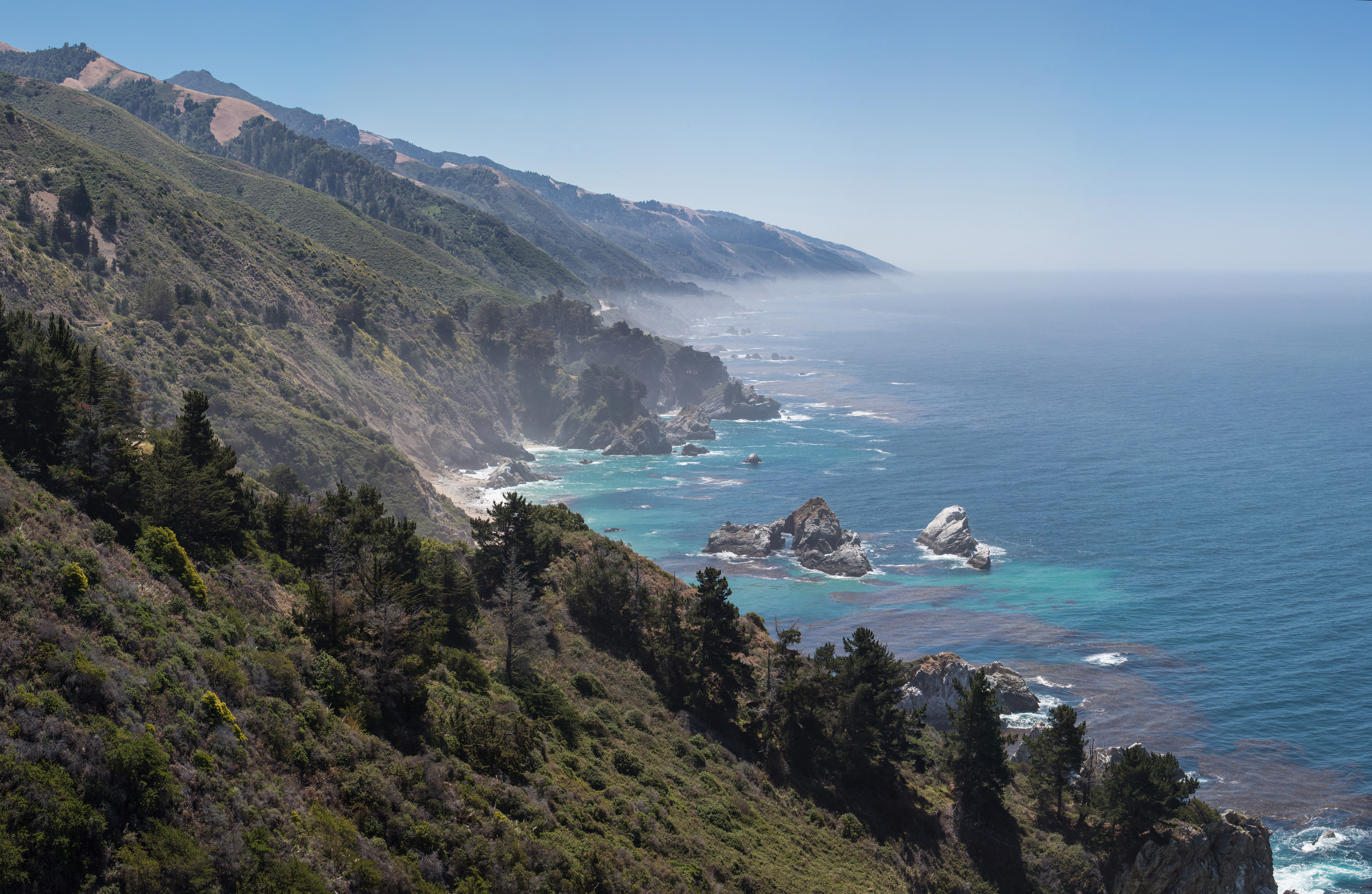
Gorda (Spanish for "Fat") is an hamlet in Monterey County, California.[1] It is located 3 mi (4.8 km) south of Cape San Martin,[2] at an elevation of 148 ft (45 m).[1] It is one of the three small settlements of filling stations, restaurants, and motels located along State Route 1 on the Big Sur coast. The ZIP Code is 93920, but mail must be addressed to Big Sur,[3] and the community is inside area code 805.
Gorda | |
|---|---|
Unincorporated community | |
 Gorda, California. | |
 Gorda Location in California | |
| Coordinates: 35°52′35″N 121°26′46″W | |
| Country | United States |
| State | California |
| County | Monterey County |
| Elevation | 148 ft (45 m) |
| ZIP code | 93920 |
| Area code | 805 |
| GNIS feature ID | 271364 |
History

The fresh springs in Gorda were used by Native American tribes. The first Europeans arrived in 1878, when a stagecoach stop was built. The settlement expanded with the Gold Rush in nearby Manchester during the 1880s.[4] A post office operated at Gorda from 1893 to 1923, moving in 1910.[2] Government surveyor James M. Hill described the town in February, 1921 as "a small ranching settlement on the coast about midway between Monterey and San Luis Obispo."
Road-side services include a small hotel and cottages, restaurant, gas station, deli, espresso bar, and convenience store.[5] In 1979, the town attracted national attention after most of the land was purchased by Kidco Limited Ventures, a corporation owned by four minor children from Ramona, California who were heirs of the family that owned the Cessna Aircraft company.[6] After funding the company, $500,000 was invested as a tax shelter to purchase the town's land. At the time, Dickie Cessna was 14 years old and the other three siblings were June (16), Bette (13) and Nene (11).[7][8] The Cessna children were paid for rights to a movie about these events and the comedy film Kidco was released by 20th Century in 1984.[9]
Mud Creek slide

On May 20, 2017, the largest slide in the Big Sur Coast Highway's history at Mud Creek buried more than a quarter-mile of Highway 1 1 mile (1.6 km) southeast of Gorda. The highway was closed for more than a year. This had a considerable negative economic impact for tourism between Monterey and Morro Bay. A CalTrans study concluded that rerouting the highway around the slide was preferred over other alternatives.[10][11] The only route in and out of Gorda beginning in the south was via a lengthy detour over the narrow, winding Nacimiento-Fergusson Road. On August 2, 2017, CalTrans decided to rebuild the highway over the slide instead of clearing it.[12] It was reopened on July 18, 2018 at a cost of $54 million.[13][14][15]
Etymology
Gorda is derived from the Spanish word for "fat" or "well-fed".[16]
High fuel prices
Gorda is occasionally mentioned as having the highest gasoline prices in the United States. This is due in part to the cost of a diesel generator that provides electricity to the gas station and town. It's also due to the limited availability of fuel in the area and the distance from suppliers, who must deliver fuel to Gorda from as far as Santa Maria and Paso Robles, from 80 to 100 miles (130 to 160 km) away.[17][18] In 2008, the price was $6.70 per gallon.[17][19][20] In October 2021, the prices were $7.59 for unleaded and $8.49 for premium gas.[18] On March 10, 2022, the price of unleaded was reported to be $9.159 and the price of premium gas was $10.159.[21]
Geography
Under the Köppen climate classification, "dry-summer subtropical" climates are often referred to as "Mediterranean". This climate zone has an average temperature above 10 °C (50 °F) in their warmest months, and an average in the coldest between 18 to −3 °C (64 to 27 °F). Summers tend to be dry with less than one-third the rainfall of the wettest winter month, and with less than 30 mm (1 in) of precipitation in a summer month.[22]
Climate
| Climate data for Gorda, CA | |||||||||||||
|---|---|---|---|---|---|---|---|---|---|---|---|---|---|
| Month | Jan | Feb | Mar | Apr | May | Jun | Jul | Aug | Sep | Oct | Nov | Dec | Year |
| Record high °F (°C) | 81 (27) |
85 (29) |
87 (31) |
98 (37) |
96 (36) |
102 (39) |
99 (37) |
101 (38) |
100 (38) |
100 (38) |
90 (32) |
75 (24) |
102 (39) |
| Average high °F (°C) | 59.7 (15.4) |
61.5 (16.4) |
63.4 (17.4) |
68.3 (20.2) |
72.6 (22.6) |
75.9 (24.4) |
75.6 (24.2) |
77.3 (25.2) |
77.1 (25.1) |
73.2 (22.9) |
64.5 (18.1) |
59.9 (15.5) |
69.1 (20.6) |
| Average low °F (°C) | 42.9 (6.1) |
43.1 (6.2) |
43.4 (6.3) |
43.5 (6.4) |
45.8 (7.7) |
48.3 (9.1) |
50.4 (10.2) |
50.0 (10.0) |
50.3 (10.2) |
47.9 (8.8) |
44.9 (7.2) |
41.9 (5.5) |
46.0 (7.8) |
| Record low °F (°C) | 27 (−3) |
29 (−2) |
27 (−3) |
30 (−1) |
35 (2) |
37 (3) |
41 (5) |
40 (4) |
39 (4) |
36 (2) |
28 (−2) |
27 (−3) |
27 (−3) |
| Average precipitation inches (mm) | 9.10 (231) |
8.65 (220) |
6.49 (165) |
3.11 (79) |
1.09 (28) |
0.24 (6.1) |
0.03 (0.76) |
0.05 (1.3) |
0.42 (11) |
2.03 (52) |
4.85 (123) |
7.62 (194) |
43.70 (1,110) |
| Average precipitation days (≥ 0.01 in) | 10.3 | 11.2 | 10.3 | 6.5 | 3.7 | 1.1 | 0.3 | 0.4 | 1.3 | 3.5 | 7.5 | 10.3 | 66.4 |
| Source: NOAA[23] | |||||||||||||
Government
At the county level, Gorda is represented on the Monterey County Board of Supervisors by Supervisor Dave Potter.[24]
In the California State Legislature, Gorda is in the 17th Senate District, represented by Democrat John Laird, and in the 30th Assembly District, represented by Democrat Robert Rivas.[25]
In the United States House of Representatives, Gorda is in California's 20th congressional district, represented by Democrat Jimmy Panetta.[26]
References
- "Gorda". Geographic Names Information System. United States Geological Survey, United States Department of the Interior. Retrieved February 2, 2015.
- Durham, David L. (1998). California's Geographic Names: A Gazetteer of Historic and Modern Names of the State. Clovis, Calif.: Word Dancer Press. p. 901. ISBN 1-884995-14-4.
- "USPS.com® - ZIP Code™ Lookup". Archived from the original on 2010-11-22.
- "Gorda Springs Resort, Big Sur, CA - California Beaches". Beachcalifornia.com.
- Resort, Gorda Springs. "Gorda Springs Resort - Lodging, Restaurant, Gas, Groceries". Welcome to Gorda Springs Resort. Retrieved 16 December 2020.
- "Life Is Mellow in a Town Owned by Four Youths; Came Here to Be Left Alone Town Bought as Tax Shelter", The New York Times, November 6, 1980, pA16
- "A Place of Their Own", photo in Pittsburgh Press, June 6, 1979, pA-6
- Kidco Isn't Kid Stuff— Children's Company Is Big Business Now", by Cilla Brown, Los Angeles Times, April 22, 1979, pI-12
- ‘Kidco’: The Right-Wing Children’s Movie That Shouldn’t Be Forgotten
- "'Mother Of All Landslides' In Big Sur Buries Section Of California's Highway 1". Npr.org. Retrieved 12 August 2018.
- "New road planned to traverse Big Sur slide". Sfgate.com. 2 August 2017. Retrieved 12 August 2018.
- Schmalz, David Caltrans announces plan to reopen Highway 1 at Mud Creek
- Reyes, Juan. "Caltrans sets new target date to reopen Highway 1 in Big Sur at Mud Creek". Monterey County Herald. Archived from the original on 3 May 2018. Retrieved 3 May 2018.
- Caltrans, State of California. "SR1 Road Information - California Highway Information". www.dot.ca.gov. Archived from the original on 26 September 2017. Retrieved 20 June 2018.
- Forgione, Mary (July 18, 2018). "It's open! The last landslide closure on Highway 1 near Big Sur reopened to traffic earlier than expected". The Los Angeles Times. Retrieved July 20, 2018.
- Gannett, Henry (1905). The Origin of Certain Place Names in the United States. Govt. Print. Off. pp. 139.
- "$5.20 a Gallon? America's Priciest Gas". ABC News. 31 March 2008. Retrieved 12 August 2018.
- Iddings, Reporter Jackie (27 October 2021). "Sky high gas prices in tiny town of Gorda make national headlines". Paso Robles Daily News. Retrieved 11 February 2022.
- "Most Stunning View in Town Is the One at the Pump", Jesse McKinley, The New York Times, March 12, 2008
- "NBCNews.com Video Player". NBC News.
- "AmeriCo Gas - 67 Cabrillo Hwy - Gorda, CA - GasBuddy.com". www.gasbuddy.com. Retrieved 17 March 2022.
- "Big Sur, California Köppen Climate Classification (Weatherbase)". Weatherbase.com.
- "NOWData - NOAA Online Weather Data". National Oceanic and Atmospheric Administration. Retrieved 2013-05-02.
- "Monterey County Supervisorial District 5 Map (North District 5)" (PDF). County of Monterey. Archived from the original (PDF) on 1 July 2012. Retrieved 21 September 2012.
- "Statewide Database". UC Regents. Archived from the original on February 1, 2015. Retrieved February 2, 2015.
- "California's 20th Congressional District - Representatives & District Map". Civic Impulse, LLC. Retrieved September 24, 2014.
| Populated Places |
|  | |||||||||||
|---|---|---|---|---|---|---|---|---|---|---|---|---|---|
| Land Use |
| ||||||||||||
| Geographical Features |
| ||||||||||||
| Attractions |
| ||||||||||||
| Events |
| ||||||||||||
| Community |
| ||||||||||||
| Trails and Roads |
| ||||||||||||
| Famous Individuals |
| ||||||||||||
| History |
| ||||||||||||
| Flora and Fauna |
| ||||||||||||
The exact boundaries of Big Sur are loosely defined. | |||||||||||||
Municipalities and communities of Monterey County, California, United States | ||
|---|---|---|
County seat: Salinas | ||
| Cities |  | |
| CDPs | ||
| Unincorporated communities |
| |
| CCDs |
| |
| Ghost towns |
| |
| Footnotes | ‡This populated place also has portions in an adjacent county | |
| ||
Другой контент может иметь иную лицензию. Перед использованием материалов сайта WikiSort.org внимательно изучите правила лицензирования конкретных элементов наполнения сайта.
WikiSort.org - проект по пересортировке и дополнению контента Википедии