world.wikisort.org - USA
Big Sur is an unincorporated community village in Big Sur, Monterey County, California. It is located along a 1-mile-long (1.6 km) stretch of Big Sur Coast Highway in the Big Sur Valley 24 miles (39 km) south of Carmel, California.[1] The village contains the largest collection of shops and visitor services along the entire 71-mile (114 km) segment of California State Route 1 between Malpaso Creek near Carmel Highlands[3] in the north and San Carpóforo Creek near San Simeon in the south.[4] The population of the entire coastal region is about 1,463.[5] The collection of small roadside businesses and homes is often confused with the larger region, also known as Big Sur.[6]: 2 On March 6, 1915, United States Post Office granted the English-speaking residents' request to change the name of their post office from Arbolado to Big Sur.[7]: 8 [8]: 7 [9] Caltrans also refers to the village as Big Sur.[10][11][12]
Big Sur Village | |
|---|---|
Unincorporated community | |
 Big Sur Lodge | |
 Big Sur Village Location in California | |
| Coordinates: 36°16′13″N 121°48′27″W | |
| Country | United States |
| State | California |
| County | Monterey County |
| Arbolado | 1889 |
| Elevation | 135 ft (41 m) |
| ZIP code | 93920[2] |
| FIPS code | 06-44427 |
| GNIS feature ID | 269849 |
Services
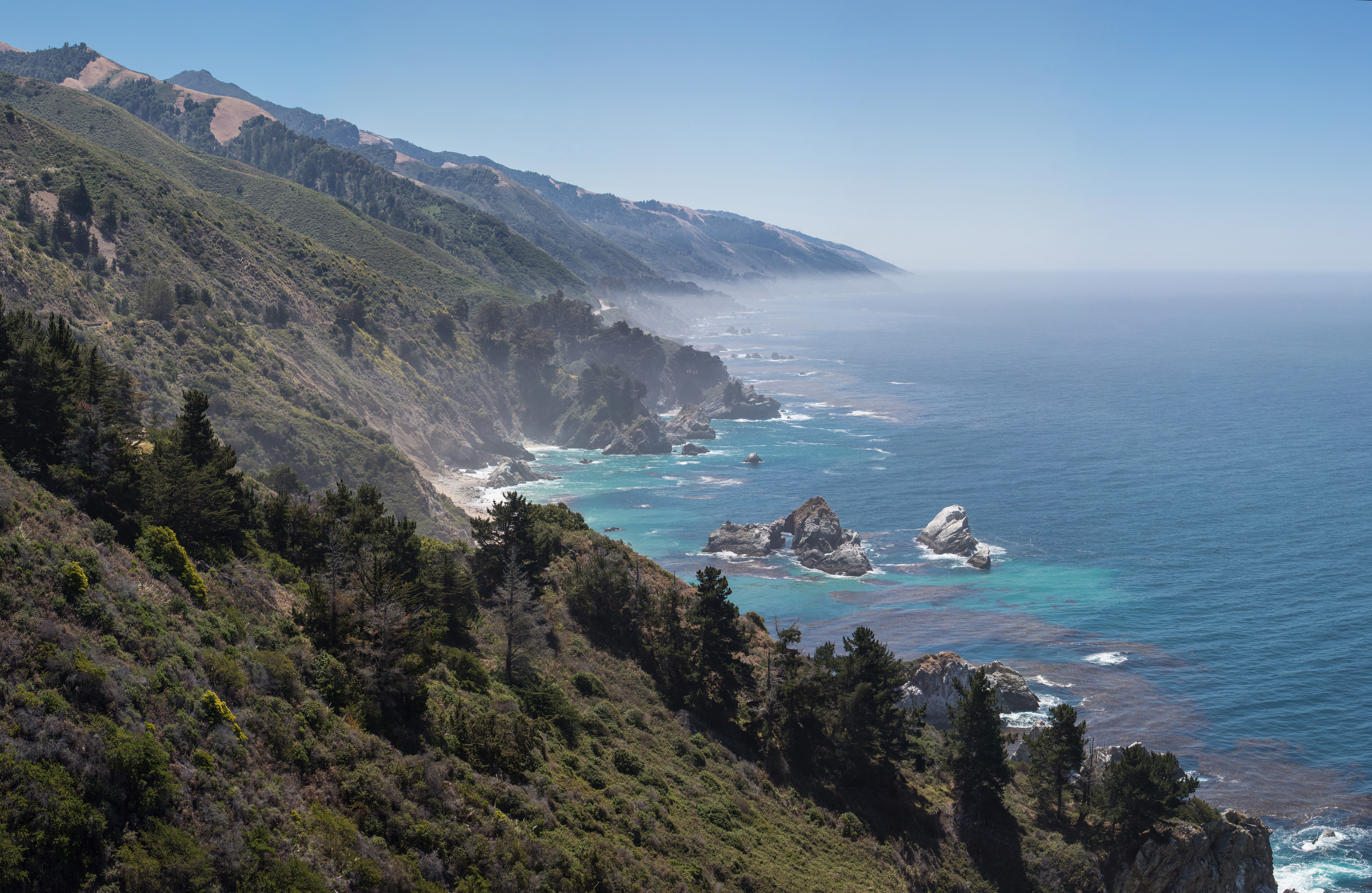
Services along about 1 mile (1.6 km) of the highway include a post office, the Big Sur Bakery, the Big Sur Lodge with 62 rooms, cafe, a bar and grill, a gallery, a pub and restaurant, yoga studio, artists studios, the Big Sur Grange Hall, a few apartments, one of three gas stations along the coast, and a visitor center with tourist information at Big Sur Station, the western terminus of the Pine Ridge Trail.[13][14] The privately owned Big Sur Campground and Cabins, Riverside Campground, Fernwood Resort, and Ripplewood Resort are nearby.[15] The Village is located in a Redwood forest bordered to the south by Pfeiffer Big Sur State Park, Los Padres National Forest on the east and west, and to the north by Andrew Molera State Park. The Captain Cooper Elementary School is nearby. The Big Sur River passes through the Village. Pfeiffer Beach is to the west at the end of Sycamore Canyon.
Transportation
Until about 1924, a rough dirt road that was often impassible in winter connected residents with Carmel and Monterey to the north. The road extended south 2.5 miles (4.0 km) to Posts and Castro Canyon, ending near the present-day location of Deetjen's Big Sur Inn.[16] The 30-mile (48 km) trip from Carmel could take three days by wagon or stagecoach.[17]: 24 The state began constructing a paved two-lane road in 1924. When completed on June 17, 1937, it was initially named the Roosevelt Highway. The road may be closed by Caltrans due to severe inclement weather. The area around the village is the only location along the coast where the highway runs inland.
Public transportation is available to and from Monterey on Monterey–Salinas Transit. The summer schedule operates from Memorial Day to Labor Day three times a day, while the winter schedule only offers bus service on weekends. Service can be interrupted by high winds and severe weather.[19] There is a single shuttle van that operates during the summer on Thursday through Sunday from the Big Sur Station to Pfeiffer Beach.[20]
Etymology

The name "Big Sur" has its origins in the area's early Spanish history. While the Portolá expedition was exploring Alta California, they arrived at San Carpóforo Canyon near present-day San Simeon on September 13, 1769. Unable to penetrate the difficult terrain along the coast, they detoured inland through the San Antonio and Salinas Valleys before arriving at Monterey Bay, where they founded Monterey and named it the provincial capital.[21]
The Spanish referred to the vast and relatively unexplored coastal region to the south of Monterey as el país grande del sur, meaning "the big country of the south". This was often shortened to el sur grande (the big south).[22][23] The two major rivers draining this portion of the coast were named El Rio Grande del Sur and El Rio Chiquito del Sur.[8]: 7
The first recorded use of the name "el Sud" (meaning "the South") was on a map of the Rancho El Sur land grant given by Governor José Figueroa to Juan Bautista Alvarado on July 30, 1834.[24]
Post office
Big Sur’s first post office, named "Posts", was in the home of W.B. Post.[25] Confusion ensued when mail intended for the Presidio was sent to Big Sur, and mail for the military post was sent to the local residents.
The homesteaders changed the name of their post office to Arbolado (Spanish for woodland) but that was confused by the post office for Alvarado, a street in Monterey. The post office operated at Posts from 1889 to 1910. The residents then petitioned the United States Post Office in Washington, D.C., to change the post office name to Big Sur, and the rubber stamp using that name was returned on March 6, 1915, cementing the name in place.[7][26]: 8 [8]: 7 [9] The ZIP Code is 93920.[2] The community is inside area code 831.[8]
History
The region was historically occupied by the Esselen and Salinan people prior to the arrival of European immigrants. The Esselen lived in the area between Point Sur south to Big Creek.[27] Archaeological evidence shows that the Esselen lived in Big Sur as early as 3500 BC, leading a nomadic, hunter-gatherer existence.[28][29] Beginning in about 1771, the Native Americans were forcibly relocated and conscripted as laborers at the Carmel Mission, where their way of life were lost to them, and their population was decimated by disease, starvation, overwork, and torture.[30][31]: 114
The first known European settler in Big Sur was George Davis, who in 1853 claimed a tract of land along the Big Sur River. He built a cabin near the present day site of the beginning of the Mount Manuel Trail.[6]: 326 In 1868, Native Americans Manual and Florence Innocenti bought Davis' cabin and land for $50. In the winter of 1869, Michael and Barbara Laquet Pfeiffer were on their way to the south coast of Big Sur when they were forced to stop for the season in the Sycamore Canyon area near present-day Big Sur Village. They liked the area so much they decided against moving south again the following spring. They brought four children with them: Charles, John, Mary Ellen, and Julia. They later had four more: William, Frank, Flora, and Adelaide. After the Homestead Act of 1862 was passed by Congress, he filed for patents on his land in 1883 and 1889.[32] The family supported themselves by ranching and beekeeping.[33][34] The Pfeiffer home became well known among travelers along the coast, and when the number of guests grew, in 1908 the Pfeiffer Ranch Resort became the first formal lodging along the coast when they began charging guests.[35] The location is now the site of the Big Sur Lodge.[36]
The Pfeiffer's son John Martin Pfeiffer and his wife Zulema Florence Swetnam built a cabin near the north bank of the Big Sur River in 1884.[35] Another of the oldest establishments along the coast is the Big Sur River Inn and Restaurant founded in 1932.[citation needed]
In August 1972, the Molera Fire burned the hills above Big Sur. The slopes above the village rise abruptly from around 135 feet (41 m) to more than 3,500 feet (1,100 m). Slopes angle from 25 to 90 degrees. During the following winter, four tributaries of the Big Sur River were struck with so much rain that on November 18, 1972, a mudflow deposited several feet of mud around the Post Office and a few other nearby buildings.[6][37][38]
Government
At the county level, Big Sur Village is represented on the Monterey County Board of Supervisors by Mary Adams.[39] In the California State Legislature, Big Sur Village is in the 17th Senate District, represented by Democrat John Laird, and in the 30th Assembly District, represented by Democrat Robert Rivas.[40] In the United States House of Representatives, the Village is in California's 20th congressional district, represented by Democrat Jimmy Panetta[41]
References
- "Big Sur". Geographic Names Information System. United States Geological Survey, United States Department of the Interior. Retrieved April 16, 2020.
- "ZIP Code(tm) Lookup". United States Postal Service. Retrieved April 16, 2020.
- Surfer Magazine (21 February 2006). Surfer Magazine's Guide to Northern and Central California Surf Spots. Chronicle Books. p. 97. ISBN 978-0-8118-4998-2. Archived from the original on 16 November 2017. Retrieved 13 January 2011.
- Chatfield, Michael (5 May 2014). "Big Sur Magic – Carmel Magazine". Carmel Magazine. Archived from the original on 28 April 2017. Retrieved 14 December 2016.
- "The Pacific Coast Highway through Big Sur". ROAD TRIP USA. Archived from the original on 1 October 2019. Retrieved 16 April 2020.
- Henson, Paul; Donald J. Usner (1993). "The Natural History of Big Sur" (PDF). University Of California Press. Archived from the original (PDF) on June 17, 2010. Retrieved 12 August 2016.
- Woolfenden, John (1981). Big Sur: A Battle for the Wilderness 1869–1981. Pacific Grove, California: The Boxwood Press. p. 72.
- Big Sur: Images of America, Jeff Norman, Big Sur Historical Society, Arcadia Publishing (2004), 128 pages, ISBN 0-7385-2913-3
- Gudde, Erwin Gustav (1998). California Place Names: The Origin and Etymology of Current Geographical Names. Bright, William (fourth, rev. and enl. ed.). Berkeley: University of California Press. p. 379. ISBN 9780520266193. OCLC 37854320. Archived from the original on 2018-01-09.
- 2008 Place Names in California Department of Transportation, State of California. February, 2009
- "Change in Big Sur Post Office retail service hours". about.usps.com. Retrieved 24 April 2020.
- "Pfeiffer's Resort, Big Sur Post Office, California Views Photo Collection". www.caviews.com. Archived from the original on 19 March 2019. Retrieved 24 April 2020.
- Cortez, Felix (5 May 2017). "The Village Shops in Big Sur close to being Sold". KSBW. Archived from the original on 25 July 2018. Retrieved 16 April 2020.
- "THE VILLAGE BIG SUR". THE VILLAGE BIG SUR. Archived from the original on 16 January 2020. Retrieved 16 April 2020.
- Bureau, Monterey County Convention and Visitors. "Big Sur Village Welcomes Visitors: Experience The Natural Wonder And Scenic Splendor Of The Rocky Coastline And Giant Redwoods Along Highway One". www.prnewswire.com. Archived from the original on 31 May 2019. Retrieved 16 April 2020.
- "About Us / California Democratic Party". California Democratic Party. Archived from the original on 13 May 2013. Retrieved 30 May 2013.
- Elliott, Analise (2005). Hiking & Backpacking Big Sur. Berkeley, California: Wilderness Press.
- "22 Big Sur – Monterey" (PDF). Monterey Salinas Transit. Archived (PDF) from the original on 14 September 2016. Retrieved 26 August 2016.
- "Monterey Ranger District". Archived from the original on 29 August 2018. Retrieved 28 August 2018.
- Bolton, Herbert E. (1927). Fray Juan Crespi: Missionary Explorer on the Pacific Coast, 1769–1774. HathiTrust Digital Library. Archived from the original on 2014-03-22.
- "History of Big Sur California". bigsurcalifornia.org. Archived from the original on 2016-08-01. Retrieved 2016-09-06.
- Jensen, Jamie Road Trip USA: Cross-Country Adventures on America's Two-Lane Highways Archived 2016-11-30 at the Wayback Machine page 146
- "Diseño del parage llamado el Sud y solicitado por Juan Bauta. Alvarado: Rancho El Sur, Calif". United States District Court (California: Southern District). Archived from the original on 2018-02-09. Retrieved 2020-04-16.
- "Bir Sur Pioneers". cdnc.ucr.edu. Vol. 142, no. 63. Oakland Tribune. 4 March 1945. p. 19. Retrieved 16 February 2022.
- Thornton, Stuart. "A Dirty Journey to the Lost City of the Santa Lucias". Archived from the original on 2018-11-20. Retrieved 2020-04-16.
- "Cultural History ]". Archived from the original on 2016-08-25. Retrieved 2020-04-16.
- Analise, Elliott (2005). Hiking & Backpacking Big Sur. Berkeley, California: Wilderness Press. p. 21.
- Pavlik, Robert C. (November 1996). "Historical Overview of the Carmel to San Simeon Highway" (PDF). Historic Resource Evaluation Report on the Rock Retaining Walls, Parapets, Culvert Headwalls and Drinking Fountains along the Carmel to San Simeon Highway. California Department of Transportation. Archived (PDF) from the original on 11 July 2012. Retrieved 17 December 2011.
- "How it all Started". Carmel Mission. Archived from the original on 27 October 2019. Retrieved 16 May 2018.
- Pritzker, Barry M. (2000). Encyclopedia: History, Culture, and Peoples. Oxford [u.a.]: Oxford Univ. Press. ISBN 978-0-19-513877-1.
- "Micheal Pfeiffer of Monterey County | 2 Land Patents". The Land Patents. Retrieved 16 April 2020.
- "Hiking in Big Sur - Oak Grove Trail Loop". HikingInBigSur.com. Archived from the original on 2019-11-24.
- Heid, Analise Elliot (2013). Hiking & backpacking Big Sur: a complete guide to the trails of Big Sur, Ventana Wilderness, and Silver Peak Wilderness (Second ed.). Wilderness Press. p. 84. ISBN 978-0899977270.
- "History | About Us | Big Sur Lodge | Big Sur Lodge". www.bigsurlodge.com. Archived from the original on 10 February 2018. Retrieved 16 April 2020.
- Welcome to Big Sur Lodge
- Zatkin, Robert. Salinan/Naciemento Amalgamated Terrane Big Sur Coast, Central California May 19–21, 2000
- "Looking back: Big Sur mudslide, 1972". Monterey Herald. 26 November 2017. Retrieved 19 April 2020.
- "Monterey County Supervisorial District 5 (North District 5)". County of Monterey. Archived from the original on April 11, 2020. Retrieved April 15, 2020.
- "Statewide Database". UC Regents. Archived from the original on February 1, 2015. Retrieved February 2, 2015.
- "California's 20th Congressional District - Representatives & District Map". Civic Impulse, LLC. Retrieved September 24, 2014.
| Populated Places |
|  | |||||||||||
|---|---|---|---|---|---|---|---|---|---|---|---|---|---|
| Land Use |
| ||||||||||||
| Geographical Features |
| ||||||||||||
| Attractions |
| ||||||||||||
| Events |
| ||||||||||||
| Community |
| ||||||||||||
| Trails and Roads |
| ||||||||||||
| Famous Individuals |
| ||||||||||||
| History |
| ||||||||||||
| Flora and Fauna |
| ||||||||||||
The exact boundaries of Big Sur are loosely defined. | |||||||||||||
Municipalities and communities of Monterey County, California, United States | ||
|---|---|---|
County seat: Salinas | ||
| Cities |  | |
| CDPs | ||
| Unincorporated communities |
| |
| CCDs |
| |
| Ghost towns |
| |
| Footnotes | ‡This populated place also has portions in an adjacent county | |
| ||
Другой контент может иметь иную лицензию. Перед использованием материалов сайта WikiSort.org внимательно изучите правила лицензирования конкретных элементов наполнения сайта.
WikiSort.org - проект по пересортировке и дополнению контента Википедии