world.wikisort.org - United_Kingdom
Scotforth is a suburb in the south of the city of Lancaster in Lancashire, England. It is home to Scotforth St Paul's Church of England Primary School [1] and St Paul's Church. The civil parish, which does not include the suburb had a population of 239 recorded in the 2001 census,[2] increasing to 321 at the 2011 Census.[3]
| Scotforth | |
|---|---|
 Scotforth Filter House | |
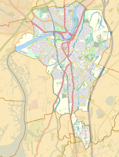 Scotforth Location of suburb in Lancaster unparished area  Scotforth Location in the City of Lancaster district  Scotforth Location within Lancashire | |
| OS grid reference | SD482593 |
| District |
|
| Shire county | |
| Region |
|
| Country | England |
| Sovereign state | United Kingdom |
| Post town | LANCASTER |
| Postcode district | LA1 |
| Dialling code | 01524 |
| Police | Lancashire |
| Fire | Lancashire |
| Ambulance | North West |
| UK Parliament |
|
Parts of Lancaster were made up of several villages; Scotforth used to be a separate village. Some of the village's original terraces can still be seen on parts of Hala Road and Scotforth Road.
Cross Fleury, in his 1891 history of Lancaster, tells the story of Bonnie Prince Charlie's search for a suitable battlefield on which to make his last stand against the Duke of Cumberland. A potential site was identified in Scotforth, and were it not for the rebel Prince's sudden change of mind and continued retreat northwards, 'The Battle of Scotforth' might easily have become the name of that great rout in British history ... as opposed to the now infamous name of Culloden.[4]
Scotforth is home to St Paul's Church of England Primary School and to Dorrington Road, which is the longest terrace of houses in Europe. Lancaster Animal Care, a local animal charity is also based there.[citation needed] The suburb has bus routes operated by Stagecoach Cumbria & North Lancashire heading towards the University in the south and Morecambe in the north.
References
- Scotforth St Paul's C of E Primary School Retrieved 15 March 2014
- UK Census (2001). "Local Area Report – Scotforth Parish (30UH026)". Nomis. Office for National Statistics. Retrieved 27 March 2021.
- UK Census (2011). "Local Area Report – Scotforth Parish (E04005203)". Nomis. Office for National Statistics. Retrieved 27 March 2021.
- Fleury 1891, p. 154
Sources
- Fleury, Cross (1891), Time-Honoured Lancaster: Historic Notes on the Ancient Borough of Lancaster, Eaton & Bulfield
External links
- Scotforth: historical and genealogical information at GENUKI.
![]() Media related to Scotforth at Wikimedia Commons
Media related to Scotforth at Wikimedia Commons
This Lancashire location article is a stub. You can help Wikipedia by expanding it. |
Другой контент может иметь иную лицензию. Перед использованием материалов сайта WikiSort.org внимательно изучите правила лицензирования конкретных элементов наполнения сайта.
WikiSort.org - проект по пересортировке и дополнению контента Википедии