world.wikisort.org - United_Kingdom
Bare is a suburb of and electoral ward in Morecambe, within the City of Lancaster district in Lancashire, England. The population of the ward as taken at the Census 2011 was 4,067.[1] Bare has a high street (Princes Crescent), and a railway station connecting it to Morecambe and Lancaster. Its name comes from Anglo-Saxon bearu meaning "grove".[2]
| Bare | |
|---|---|
 Beach and promenade | |
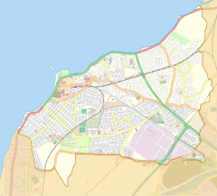 Bare Location in Morecambe  Bare Location in the City of Lancaster district  Bare Location within Lancashire | |
| Population | 4,067 (2011) |
| OS grid reference | SD452647 |
| Civil parish | |
| District |
|
| Shire county |
|
| Region |
|
| Country | England |
| Sovereign state | United Kingdom |
| Post town | MORECAMBE |
| Postcode district | LA4 |
| Dialling code | 01524 |
| Police | Lancashire |
| Fire | Lancashire |
| Ambulance | North West |
| UK Parliament |
|

Bare Hall is a Grade II listed building built around 1830 by the Lodge family[3]
References
- "Ward population 2011". Retrieved 7 June 2015.
- Ekwall, Eilert (1947). The Concise Oxford Dictionary of English Place-Names (3rd ed.). Oxford: Clarendon Press. p. 24. Retrieved 2 May 2021.
- "Bare Hall, Morecambe, Lancashire".
External links
Wikimedia Commons has media related to Bare, Lancashire.
- 1953-1955 Ordnance Survey map showing Bare (on the north edge)
Authority control | |
|---|---|
| General |
|
| National libraries | |
This Lancashire location article is a stub. You can help Wikipedia by expanding it. |
Текст в блоке "Читать" взят с сайта "Википедия" и доступен по лицензии Creative Commons Attribution-ShareAlike; в отдельных случаях могут действовать дополнительные условия.
Другой контент может иметь иную лицензию. Перед использованием материалов сайта WikiSort.org внимательно изучите правила лицензирования конкретных элементов наполнения сайта.
Другой контент может иметь иную лицензию. Перед использованием материалов сайта WikiSort.org внимательно изучите правила лицензирования конкретных элементов наполнения сайта.
2019-2025
WikiSort.org - проект по пересортировке и дополнению контента Википедии
WikiSort.org - проект по пересортировке и дополнению контента Википедии