world.wikisort.org - United_Kingdom
Foulden /ˈfaʊldən/ is a civil parish in the English county of Norfolk. It covers an area of 12.95 km2 (5.00 sq mi) and had a population of 444 in 176 households at the 2001 census,[2] including Beckett End but decreasing to a population of 430 also in 176 households at the 2011 census. For the purposes of local government, it falls within the district of Breckland.
| Foulden | |
|---|---|
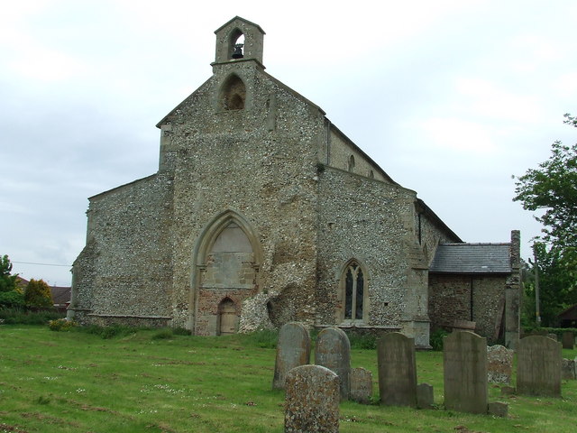 All Saints Church, Foulden | |
 Foulden Location within Norfolk | |
| Area | 12.95 km2 (5.00 sq mi) |
| Population | 430 (2011)[1] |
| • Density | 33/km2 (85/sq mi) |
| OS grid reference | TL764988 |
| Civil parish |
|
| District |
|
| Shire county |
|
| Region | |
| Country | England |
| Sovereign state | United Kingdom |
| Post town | THETFORD |
| Postcode district | IP26 |
| Police | Norfolk |
| Fire | Norfolk |
| Ambulance | East of England |
| Website | |
Foulden lies south of Gooderstone and north of Didlington. The River Wissey runs roughly west to east through the parish and the modern village sits overlooking the valley. Around the river some areas of fen (known as Borough Fen) survive and Foulden Common is a large expanse of land in the north of the parish. Some of the parish is now planted with conifers and is part of Thetford Forest managed by the Forestry Commission.
Foulden has an archaeological record stretching back to the Neolithic period. Neolithic worked flints were recorded as found in Foulden between 1923 and 1925.[3]
"Foulden" derives from the words "fowl" and "den", meaning "hill frequented by birds". It was recorded as "Fugalduna" in the Domesday Book.[4]
The village lies on the edge of Thetford Forest. Birdlife is plentiful owing to the many trees in the area, large stretches of open water, and its location near the Fens. To the north of the village is Foulden Common, a Site of Special Scientific Interest.
Local industry is primarily agricultural, including dairy farming, sugar beet and other crops.
The Salvation Army Commissioner John Lawley was born in the village in 1859.
The village hall [5] was built in the 1970s by residents of Foulden. Today a wide range of events can be enjoyed at the hall or can be hired on a private basis.
The village was struck by an F0/T1 tornado on 23 November 1981, as part of the record-breaking nationwide tornado outbreak on that day.[6]
Notes
- "Civil Parish 2011". Neighbourhood Statistics. Office for National Statistics. Retrieved 28 July 2016.
- Census population and household counts for unparished urban areas and all parishes. Office for National Statistics & Norfolk County Council (2001). Retrieved 20 June 2009.
- "Norfolk Heritage Explorer: MNF4800 - Neolithic worked flints". www.heritage.norfolk.gov.uk. Retrieved 25 March 2022.
- Eilert Ekwall, The Concise Oxford Dictionary of English Place-Names, 4th edition, 1960
- "Foulden Village Hall | NORFOLK". fouldenvillagehall.wordpress.com. Archived from the original on 10 August 2014.
- "European Severe Weather Database".
External links
![]() Media related to Foulden, Norfolk at Wikimedia Commons
Media related to Foulden, Norfolk at Wikimedia Commons
Другой контент может иметь иную лицензию. Перед использованием материалов сайта WikiSort.org внимательно изучите правила лицензирования конкретных элементов наполнения сайта.
WikiSort.org - проект по пересортировке и дополнению контента Википедии