world.wikisort.org - United_Kingdom
North Tuddenham is a civil parish in the English county of Norfolk, North Tuddenham is 3 miles (4.8 km) east of East Dereham, and is close to the A47 road.
| North Tuddenham | |
|---|---|
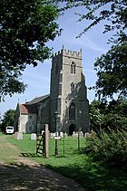
 St Mary the Virgin church, North Tuddenham | |
 North Tuddenham Location within Norfolk | |
| Area | 9.41 km2 (3.63 sq mi) |
| Population | 335 (2011)[1] |
| • Density | 36/km2 (93/sq mi) |
| OS grid reference | TG038141 |
| Civil parish |
|
| District |
|
| Shire county |
|
| Region |
|
| Country | England |
| Sovereign state | United Kingdom |
| Post town | Dereham |
| Postcode district | NR20 |
| Police | Norfolk |
| Fire | Norfolk |
| Ambulance | East of England |
The parish church is dedicated to St Mary.[2]
The villages name means 'Tuda's homestead/village'.
It covers an area of 9.41 km2 (3.63 sq mi) and had a population of 305 in 121 households at the 2001 census,[3] increasing to a population of 335 in 138 households at the 2011 Census. For the purposes of local government, it falls within the Upper Wensum Ward of Breckland District Council and the Elmham and Mattishall Division of Norfolk County Council.
RAF Tuddenham is nearby: in 1944, a USAF B24 bomber plane on a training mission crashed at North Tuddenham, killing the eight crew members. A memorial plaque is in St Mary's church. [4] The incident is also commemorated in a village flag, designed by a local school student, Esme Okan, in 2021. [5]
References
- "Civil Parish population 2011". Neighbourhood Statistics. Office for National Statistics. Retrieved 9 August 2016.
- GENUKI
- Census population and household counts for unparished urban areas and all parishes Archived 2017-02-11 at the Wayback Machine. Office for National Statistics & Norfolk County Council (2001). Retrieved 20 June 2009.
- "St Mary, North Tuddenham". American Air Museum. Retrieved 21 August 2021.
- "Flag designed by eight-year-old to fly over village". Eastern Daily Press. Retrieved 21 August 2021.
http://kepn.nottingham.ac.uk/map/place/Norfolk/North%20Tuddenham
External links
- GENUKI(tm) page
- Map sources for North Tuddenham
Другой контент может иметь иную лицензию. Перед использованием материалов сайта WikiSort.org внимательно изучите правила лицензирования конкретных элементов наполнения сайта.
WikiSort.org - проект по пересортировке и дополнению контента Википедии