world.wikisort.org - United_Kingdom
Shipdham is a village and civil parish in the Breckland district, in Norfolk, England, approximately 5 miles (8.0 km) south-south-west of Dereham. In the 2001 census the parish had a population of 2,145 in 899 households,[2] falling at the 2011 Census to a population of 2,057 in 899 households. It covers an area of 18.69 km2 (7.22 sq mi). It is also known to be the longest village in Norfolk.
| Shipdham | |
|---|---|
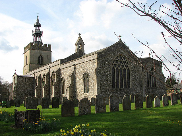 All Saints Church, Shipdham | |
 Shipdham Location within Norfolk | |
| Area | 18.69 km2 (7.22 sq mi) |
| Population | 2,057 (2011 census)[1] |
| • Density | 110/km2 (280/sq mi) |
| OS grid reference | TF958073 |
| Civil parish |
|
| District |
|
| Shire county |
|
| Region | |
| Country | England |
| Sovereign state | United Kingdom |
| Post town | THETFORD |
| Postcode district | IP25 |
| Dialling code | 01362 |
| Police | Norfolk |
| Fire | Norfolk |
| Ambulance | East of England |
| UK Parliament |
|
The villages name means 'flock of sheep homestead/village'.
The River Yare rises to the east of the village and flows east, while the River Wissey rises to the north and flows westwards.[3][4]
Shipdham Airfield (formerly RAF Shipdham) is located east of the village.
The village was struck by an F1/T2 tornado on 23 November 1981, as part of the record-breaking nationwide tornado outbreak on that day.[5]
Bibliography
- Fisher, Stuart (2013). British River Navigations. Adlard Coles Nautical. ISBN 978-1-4729-0084-5.
References
- "Civil Parish population 2011". Neighbourhood Statistics. Office for National Statistics. Retrieved 11 August 2016.
- "Neighbourhood Statistics: 2001 Census: Key Statistics: Parish Headcounts: Area: Shipdham CP (Parish)". Office for National Statistics. Retrieved 4 June 2008.
- Fisher 2013, p. 167.
- Ordnance Survey, 1:50,000 map
- "European Severe Weather Database". www.eswd.eu.
Destinations from Shipdham | ||||||||||||||||
|---|---|---|---|---|---|---|---|---|---|---|---|---|---|---|---|---|
| ||||||||||||||||
Authority control | |
|---|---|
| General |
|
| National libraries | |
This Norfolk location article is a stub. You can help Wikipedia by expanding it. |
Другой контент может иметь иную лицензию. Перед использованием материалов сайта WikiSort.org внимательно изучите правила лицензирования конкретных элементов наполнения сайта.
WikiSort.org - проект по пересортировке и дополнению контента Википедии