world.wikisort.org - United_Kingdom
Derbyshire Dales (/ˈdɑːrbiʃɪər, -ʃər/ DAR-bee-sheer, -shər) is a local government district in Derbyshire, England. The population at the 2011 Census was 71,116.[2] Much of it is in the Peak District, although most of its population lies along the River Derwent.
Derbyshire Dales District | |
|---|---|
District | |
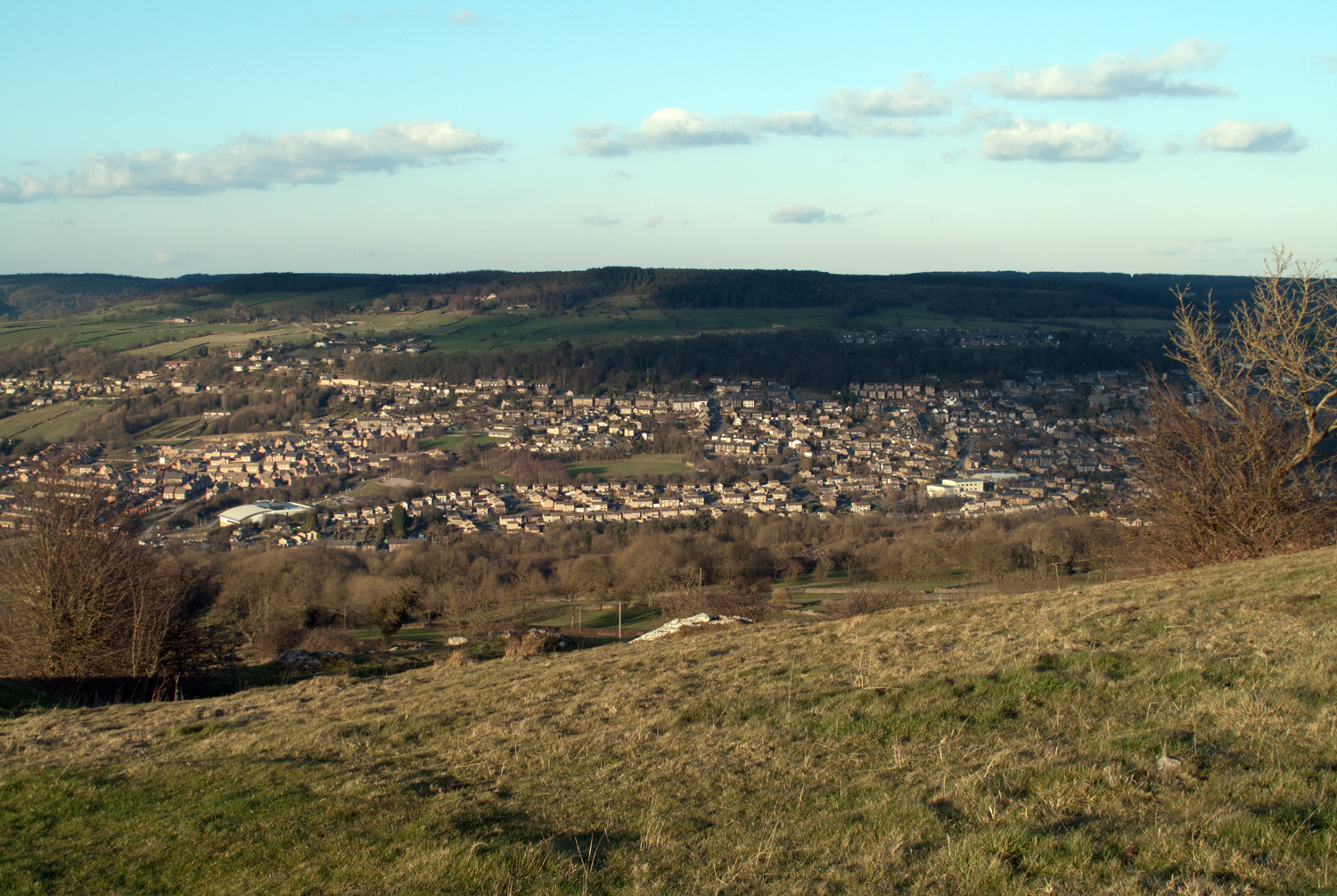 Skyline of Matlock, both the administrative centre of Derbyshire Dales and the official county town of Derbyshire | |
 Shown within Derbyshire | |
| Sovereign state | United Kingdom |
| Constituent country | England |
| Region | East Midlands |
| Administrative county | Derbyshire |
| Admin. HQ | Matlock |
| Government | |
| • Type | Derbyshire Dales District Council |
| • Leadership: | Alternative - Sec.31 |
| • Executive: | Conservative |
| • MP: | Sarah Dines |
| Area | |
| • Total | 305.9 sq mi (792.4 km2) |
| • Rank | 47th |
| Population (mid-2019 est.) | |
| • Total | 72,325 |
| • Rank | Ranked 294th |
| • Density | 240/sq mi (91/km2) |
| Time zone | UTC+0 (Greenwich Mean Time) |
| • Summer (DST) | UTC+1 (British Summer Time) |
| ONS code | 17UF (ONS) E07000035 (GSS) |
| Ethnicity | 97.8% White 0.8% .Asian[1] |
| Website | derbyshiredales.gov.uk |


The borough borders the districts of High Peak, Amber Valley, North East Derbyshire and South Derbyshire in Derbyshire, Staffordshire Moorlands and East Staffordshire in Staffordshire and Sheffield in South Yorkshire. The district also lies within the Sheffield City Region, and the district council is a non-constituent partner member of the Sheffield City Region Combined Authority. A significant amount of the working population is employed in Sheffield and Chesterfield.
The district offices are at Matlock Town Hall in Matlock. It was formed on 1 April 1974, originally under the name of West Derbyshire. The district adopted its current name on 1 January 1987.[3][4]
The district was a merger of Ashbourne, Bakewell, Matlock and Wirksworth urban districts along with Ashbourne Rural District and Bakewell Rural District. Following their review of parliamentary representation in Derbyshire, the Boundary Commission for England formed a new constituency called Derbyshire Dales.
Governance
Derbyshire Dales District Council is elected every four years, with currently 39 councillors being elected at each election. The Conservative party has had a majority on the council since 1976, apart from a four-year period between the 1995 and 1999 elections, when no party had a majority. The leader of the council since 2019 has been Garry Purdy, a Conservative. After the 2019 election, the council was composed of the following councillors:[5]
| Party | Councillors | |
| Conservative Party | 20 | |
| Liberal Democrats | 8 | |
| Labour Party | 6 | |
| Independent | 3 | |
| Green | 2 | |
The next election is due in 2023.
Places
- Alsop-en-le-Dale, Ashford-in-the-Water, Ashbourne
- Bakewell, Baslow, Beeley, Biggin, Birchover, Bonsall, Bradbourne, Bradwell, Brailsford, Brassington, Bretton
- Calver, Carsington, Chatsworth, Chelmorton, Cromford, Curbar
- Darley Dale, Doveridge
- Earl Sterndale, Edensor, Elton, Eyam
- Fenny Bentley, Foolow, Froggatt
- Great Hucklow, Great Longstone, Grindleford
- Hassop, Hathersage, Hognaston, Hartington
- Kirk Ireton, Kniveton
- Little Hucklow, Litton
- Matlock, Matlock Bath, Middleton-by-Wirksworth, Middleton-by-Youlgreave, Monyash
- Over Haddon
- Parwich
- Rowsley
- South Darley, Stanton-in-Peak, Stoney Middleton, Sudbury
- Taddington, Tansley, Thorpe, Tideswell, Tissington
- Wardlow, Wensley, Winster, Wirksworth
- Youlgreave
References
- "Resident Population Estimates by Ethnic Group (Percentages) Area: Derbyshire Dales (Local Authority)". Neighbourhood Statistics. National Office for Statistics. Retrieved 2 August 2015.
- "Local Authority population 2011". Neighbourhood Statistics. Office for National Statistics. Retrieved 23 March 2016.
- "Counties and Districts Changes 1 April 1985 to 31 March 1987" (PDF). Local Government Boundary Commission. Retrieved 22 August 2022.
- "Derbyshire Dales: It's official for the New Year". Ashbourne News Telegraph. 25 December 1986. p. 1. Retrieved 22 August 2022.
- "District Council Elections 2019". BBC News. Retrieved 4 May 2019.
Derbyshire Portal | |
| Unitary authorities | |
| Boroughs or districts | |
| Major settlements |
|
| Rivers | |
| Topics |
|
| |
Districts of the East Midlands region of England | ||
|---|---|---|
| Derbyshire |  | |
| Leicestershire | ||
| Lincolnshire | ||
| Nottinghamshire | ||
| Northamptonshire | ||
| Rutland | ||
На других языках
[de] Derbyshire Dales
Derbyshire Dales ist ein District in der Grafschaft Derbyshire in England. Der größte Teil liegt im Peak-District-Nationalpark, die Bevölkerung lebt hauptsächlich entlang des Flusses Derwent. Verwaltungssitz ist die Stadt Matlock; weitere bedeutende Orte sind Ashbourne, Bakewell, Baslow, Darley Dale, Eyam, Hathersage, Tideswell und Wirksworth.- [en] Derbyshire Dales
[ru] Дербишир-Дейлс
Дербишир-Дейлс (англ. Derbyshire Dales) — неметрополитенский район (англ. non-metropolitan district) в церемониальном графстве Дербишир в Англии. Административный центр — город Матлок.Другой контент может иметь иную лицензию. Перед использованием материалов сайта WikiSort.org внимательно изучите правила лицензирования конкретных элементов наполнения сайта.
WikiSort.org - проект по пересортировке и дополнению контента Википедии