world.wikisort.org - United_Kingdom
The Borough of Charnwood is a local government district with borough status in the north of Leicestershire, England, which has a population of 166,100 as of the 2011 census.[1] It borders Melton to the east, Harborough to the south east, Leicester and Blaby to the south, Hinckley and Bosworth to the south west, North West Leicestershire to the west and Rushcliffe in Nottinghamshire to the north. It is named after Charnwood Forest, an area which the borough contains much of.
Borough of Charnwood | |
|---|---|
Borough | |
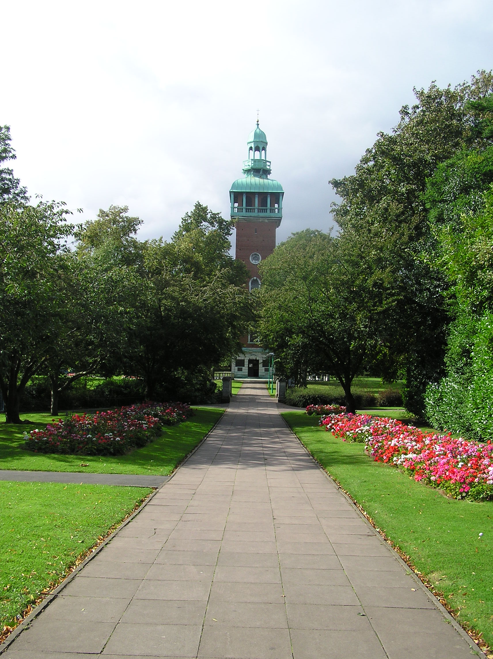 Loughborough Carillon | |
 Shown within Leicestershire | |
| Sovereign state | United Kingdom |
| Constituent country | England |
| Region | East Midlands |
| Administrative county | Leicestershire |
| Admin. HQ | Loughborough |
| Government | |
| • Type | Charnwood Borough Council |
| • Leadership: | Leader & Cabinet |
| • Executive: | Conservative |
| • MPs: | Edward Argar, Jane Hunt |
| Area | |
| • Total | 107.7 sq mi (279.0 km2) |
| • Rank | 141st |
| Population (mid-2019 est.) | |
| • Total | 185,851 |
| • Rank | Ranked 101st |
| • Density | 1,700/sq mi (670/km2) |
| Time zone | UTC+0 (Greenwich Mean Time) |
| • Summer (DST) | UTC+1 (British Summer Time) |
| ONS code | 31UC (ONS) E07000130 (GSS) |
| Ethnicity | 91.7% White |
| Website | www.charnwood.gov.uk |
The administrative centre of the borough is located in Loughborough, which is also the district's largest town and its main commercial centre. The town is also the location of Loughborough University. Other notable settlements include Shepshed, Syston, Birstall and Thurmaston.
History
The district of Charnwood was formed on 1 April 1974 as a merger of the municipal borough of Loughborough, the Shepshed urban district and the Barrow upon Soar Rural District. It was then granted borough status on 15 May 1974.[2]
The symbol of Charnwood Borough Council is the fox, historically linked with Leicestershire, and this is also the symbol used by Leicestershire County Council. Charnwood also contains Quorn, which is believed[by whom?] to be the birthplace of fox-hunting.
Geography
To the south it borders the City of Leicester, about 20 km away from Loughborough. There is a moderately urbanised A6 corridor between the two population centres and close to the River Soar, including Quorn, Barrow-on-Soar, Mountsorrel, Birstall, Sileby, Thurmaston, Syston, Queniborough and East Goscote.
To the south of the borough Birstall, Queniborough, Thurmaston and Syston, form part of the Leicester Urban Area, while Quorn and Shepshed (the second largest town in the district), amongst others, might be considered to be part of a Loughborough urban agglomeration.
The highest point is Beacon Hill (248m/814 ft) to the north of the Charnwood Forest 'area of natural beauty' extending WN-west into the National Forest
Political representation
There are two Parliamentary constituencies covering the district. Charnwood is represented by the Conservative Edward Argar MP. Loughborough is represented by the Conservative Party's Jane Hunt.
Demographics
Charnwood is the largest borough by population in Leicestershire,[3] and has the largest school population as well.
| Population growth in Charnwood | ||||||||||||
|---|---|---|---|---|---|---|---|---|---|---|---|---|
| Year | 1951 | 1961 | 1971 | 1981 | 1991 | 2001 | 2011 | 2016 | 2021 | 2031 | ||
| Population | 89,980 | 103,282 | 127,046 | 132,170 | 141,759 | 153,428 | 166,100 | 179,400 | 188,250 | 207,000 | ||
| Census [4] | ONS[5] | ONS Projections [6] | ||||||||||
Parishes
- Anstey
- Barkby, Barkby Thorpe, Barrow upon Soar, Beeby, Birstall, Burton on the Wolds
- Cossington, Cotes
- East Goscote
- Hathern, Hoton
- Mountsorrel
- Newtown Linford
- Prestwold
- Queniborough, Quorn
- Ratcliffe on the Wreake, Rearsby, Rothley
- Seagrave, Shepshed, Sileby, South Croxton, Swithland, Syston
- Thrussington, Thurcaston and Cropston, Thurmaston
- Ulverscroft
- Walton on the Wolds, Wanlip, Woodhouse, Wymeswold
Freedom of the Borough
The following People, Military Units and Organisations and Groups have received the Freedom of the Borough of Charnwood.
This list is incomplete; you can help by adding missing items. (September 2021) |
Individuals
- Paula Radcliffe MBE: 28 June 2004.
- Michael Jones: 29 September 2008.
- Lez Cope-Newman: 24 June 2019.
Military Units
- 2nd Battalion The Royal Anglian Regiment: 4 September 2006.[8]
- 203 (Loughborough) Squadron The 158 (Royal Anglian) Transport Regiment: 15 April 2010.[9]
- The Royal Logistic Corps: April 2010.[10]
Organisations and Groups
- The Leicester City Football Club: 14 September 2021.[11][12]
References
- "Borough population 2011". Neighbourhood Statistics. Office for National Statistics. Retrieved 10 June 2016.
- Charnwood Borough Council; The Mayoralty in Charnwood. Archived 20 February 2006 at the Wayback Machine Retrieved 31 January 2006.
- excluding the City of Leicester part of Ceremonial Leicestershire
- Vision of Britain through time
- mid year estimate
- ONS population projections 2014 base / projections uplifted by '21-1050/'31-1,400 given underestimation at 2016 - 1,100/
- "Freedom of the Borough". Charnwood Borough Council. Retrieved 16 September 2021.
- "FREEDOM OF ENTRY – ROYAL ANGLIAN REGIMENT" (PDF). www.charnwood.gov.uk. 4 September 2006. Retrieved 9 December 2020.
- Watkins, Amy (15 April 2010). "TA is given freedom of the borough". The Loughborough Echo. Retrieved 16 September 2021.
- "Honorary Freeman of the Borough of Charnwood" (PDF). www.charnwood.gov.uk. 2008. Retrieved 9 December 2020.
- "LCFC Granted Freedom Of The Borough Of Charnwood". Leicester City Football Club. Retrieved 16 September 2021.
- Archived at Ghostarchive and the Wayback Machine: Charnwood Borough Council (14 September 2021). "Extraordinary Council - Conferment of Freedom of the Borough to Leicester City Football Club)" – via YouTube.
External links
Towns and villages of the Borough of Charnwood | ||
|---|---|---|
| Towns |  | |
| Large villages |
| |
| Small villages | ||
| Hamlets | ||
England Portal | |
| Unitary authorities | |
| Boroughs or districts | |
| Major settlements |
|
| Topics |
|
Districts of the East Midlands region of England | ||
|---|---|---|
| Derbyshire |  | |
| Leicestershire | ||
| Lincolnshire | ||
| Nottinghamshire | ||
| Northamptonshire | ||
| Rutland | ||
На других языках
[de] Borough of Charnwood
Charnwood ist ein Verwaltungsbezirk mit dem Status eines Borough in der Grafschaft Leicestershire in England, der nach dem Wald Charnwood Forest benannt ist. Verwaltungssitz ist die Stadt Loughborough. Weitere bedeutende Orte sind Anstey, Barrow upon Soar, Birstall, Hathern, Mountsorrel, Rothley, Shepshed, Sileby, Syston, Thurmaston und Wymeswold.- [en] Borough of Charnwood
[ru] Чарнвуд
Чарнвуд (англ. Charnwood) — неметрополитенский район (англ. Non-metropolitan district) со статусом боро в графстве Лестершир (Англия). Административный центр — город Лафборо.Другой контент может иметь иную лицензию. Перед использованием материалов сайта WikiSort.org внимательно изучите правила лицензирования конкретных элементов наполнения сайта.
WikiSort.org - проект по пересортировке и дополнению контента Википедии