world.wikisort.org - United_Kingdom
The Borough of Chesterfield is a non-metropolitan district with borough status in Derbyshire, England. It is named after its main settlement of Chesterfield.
Borough of Chesterfield | |
|---|---|
Non-metropolitan district & borough | |
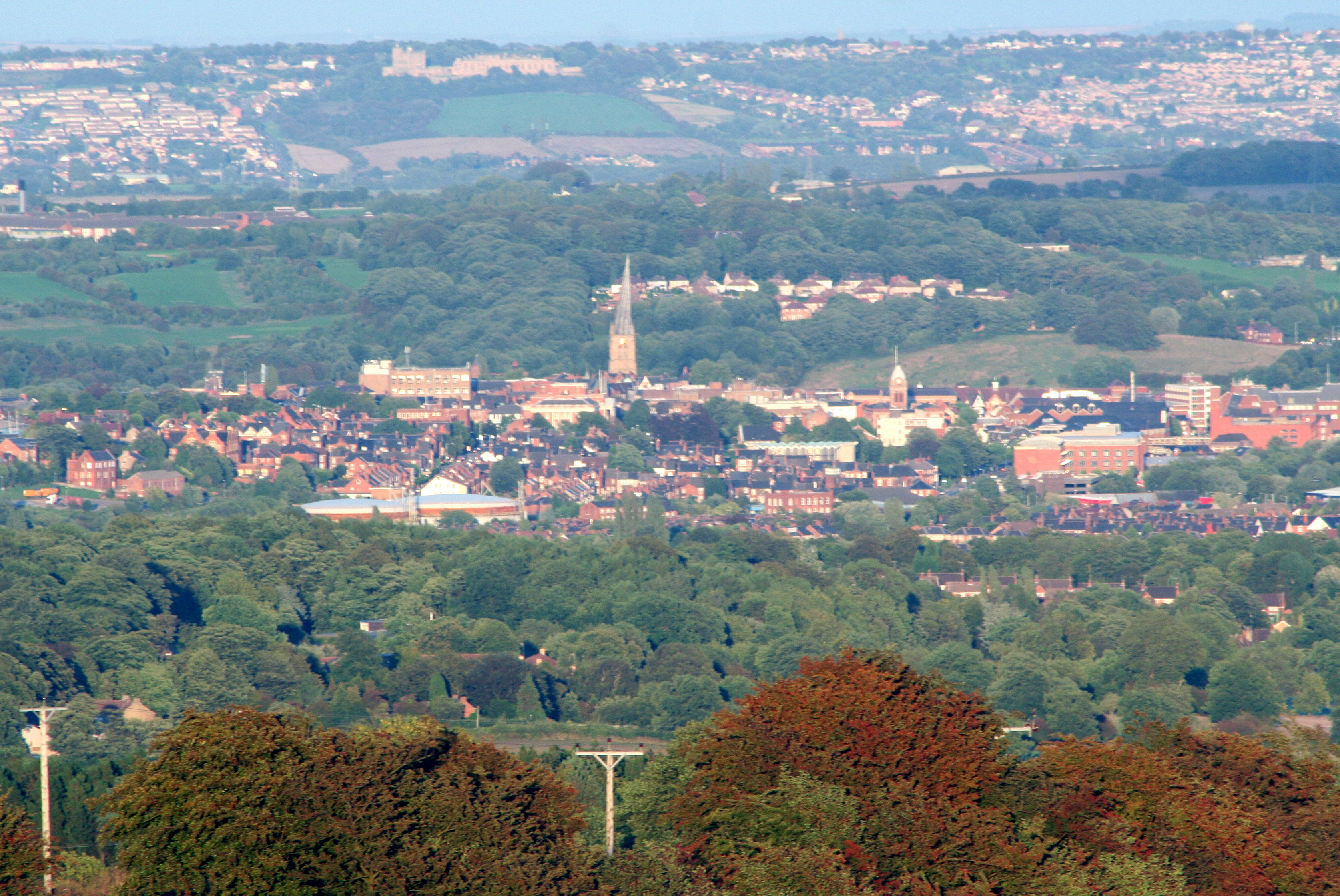 Chesterfield skyline and the Crooked Spire church of Chesterfield Parish Church. | |
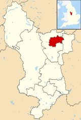 Shown within Derbyshire | |
 Borough of Chesterfield Location within England  Borough of Chesterfield Location within the United Kingdom  Borough of Chesterfield Location in Europ | |
| Coordinates: 53°14′N 1°25′W | |
| Sovereign state | United Kingdom |
| Country | England |
| Region | East Midlands |
| County | Derbyshire |
| Founded | 70–100 AD |
| Market Charter | 1204 |
| Borough status | 1204/1594 |
| Government | |
| • Type | Non-metropolitan district |
| • Local Authority | Chesterfield Borough Council |
| • Mayor | Tony Rogers (LD) |
| • Council Leader | Tricia Gilby (L) |
| • MPs | Toby Perkins (L) Lee Rowley (C) |
| Population (mid-2019 est.) | |
| • Total | 104,900 (Ranked 227th) |
| • Ethnicity | 94.9% White British |
| Time zone | UTC+0 (Greenwich Mean Time) |
| Postcode | |
| Post town | chesterfield |
| Dialling code | 01246 |
| ISO 3166-2 | GB-DBY |
| ONS code | 17UD (ONS) E07000034 (GSS) |
| OS grid reference | SK382711 |
| Demonym | Cestrefeldian |
| Website | www.chesterfield.gov.uk |
History
The district was formed on 1 April 1974, under the Local Government Act 1972, by a merger of the Municipal Borough of Chesterfield, Staveley Urban District and the Brimington part of Chesterfield Rural District.[1]
The borough's main two towns are Chesterfield and Staveley. With its geographical position, the borough offers convenient commuter links to the cities of Sheffield, Nottingham, Derby, Bradford, Wakefield, Manchester, Salford, Leeds and Lincoln, and via its mainline railway station at Chesterfield and the connections to the M1 motorway.
Geography
The borough is situated around the town of Chesterfield and includes the villages of Old Whittington, Brimington (which also has a parish council),[2] Sheepbridge and New Whittington, and the town of Staveley which maintains a town council.[3]
The borough is bordered by North East Derbyshire district to the north, west and south and Bolsover district to the east.[4] These districts include towns and villages such as Clay Cross, Wingerworth, Calow, Holymoorside, Dronfield, Mastin Moor, Barlborough, Bolsover and Grassmoor. Mansfield in Nottinghamshire is 12 miles southeast, Worksop is 20 miles northeast and Buxton is 25 miles west.
Travel to Work Areas
Chesterfield and its surrounding borough are situated around multiple travel to work areas which span from the counties of Greater Manchester, South Yorkshire, West Yorkshire and Nottinghamshire as well as Derbyshire. The cities of Nottingham, Manchester, Derby, Wakefield and Sheffield are the closest cities to Chesterfield and its surrounding borough.[5] [6]
Suburbs
Suburbs of Chesterfield include:
Governance
Chesterfield is currently overall controlled by the Labour Party. The borough is along with Bolsover District, North East Derbyshire, Derbyshire Dales and Bassetlaw District, a non-constituent member of the South Yorkshire Combined Authority.
References
- "The English Non-metropolitan Districts (Definition) Order 1972". Legislation.gov.uk. Retrieved 3 May 2021.
- "Brimington Parish Council".
- "Staveley Town Council - Home". www.staveleytowncouncil.gov.uk.
- "Councils within Derbyshire (map)" (PDF). Geopunk. Retrieved 21 November 2021.
- "YOUR GUIDE TO YORKSHIRE'S COMMUTER HUBS". Strata. Retrieved 27 August 2021.
- "Analysis of Commuter Patterns in Derbyshire 2011" (PDF). observatory.derbyshire.gov.uk. observatory.derbyshire.gov.uk. Retrieved 27 August 2021.
Sources
- Chesterfield Borough Council - Home
- Map and Details for Chesterfield Borough Council Local Authority
- chesterfield borough council Archives
- Chesterfield Borough Council
- The Borough of Chesterfield (Electoral Changes) Order 1999
- Your Councillors
- History
- Story of Chesterfield
- Our Town in History
- Chesterfield | England, United Kingdom
- Genuki: Chesterfield, Derbyshire
- History of Chesterfield: Early and medieval Chesterfield
- Chesterfield - Town
- Chesterfield (District, United Kingdom) - Population Statistics, Charts, Map and Location
- Chesterfield Registration District
- Chesterfield District – DDA
- New executive directors appointed at Chesterfield Borough Council
- Chesterfield Borough Council
- The Derbyshire (District Boundaries) Order 1988
Derbyshire Portal | |
| Unitary authorities | |
| Boroughs or districts | |
| Major settlements |
|
| Rivers | |
| Topics |
|
| |
Districts of the East Midlands region of England | ||
|---|---|---|
| Derbyshire |  | |
| Leicestershire | ||
| Lincolnshire | ||
| Nottinghamshire | ||
| Northamptonshire | ||
| Rutland | ||
Другой контент может иметь иную лицензию. Перед использованием материалов сайта WikiSort.org внимательно изучите правила лицензирования конкретных элементов наполнения сайта.
WikiSort.org - проект по пересортировке и дополнению контента Википедии