world.wikisort.org - United_Kingdom
Wirksworth is a market town in the Derbyshire Dales district of Derbyshire, England. Its population of 5,038 in the 2011 census[1] was estimated at 5,180 in 2019.[2] Wirksworth contains the source of the River Ecclesbourne. The town was granted a market charter by Edward I in 1306 and still holds a market on Tuesdays in the Memorial Gardens. The parish church of St Mary's is thought to date from 653. The town developed as a centre for lead mining and stone quarrying. Many lead mines were owned by the Gell family of nearby Hopton Hall.
| Wirksworth | |
|---|---|
 Market Place | |
 Wirksworth Location within Derbyshire | |
| Population | 5,038 (Parish, 2011)[1] |
| OS grid reference | SK2853 |
| District |
|
| Shire county |
|
| Region |
|
| Country | England |
| Sovereign state | United Kingdom |
| Post town | MATLOCK |
| Postcode district | DE4 |
| Dialling code | 01629 |
| Police | Derbyshire |
| Fire | Derbyshire |
| Ambulance | East Midlands |
| UK Parliament |
|
History
The origins of Wirksworth are thought to have related to the presence of thermal warm water springs nearby,[3] coupled with a sheltered site at the head of a glaciated valley, able to yield cereals such as oats and provide timber suitable for building.
The Wirksworth area in the White Peak is known for Neolithic and Bronze Age remains.[4]

Woolly rhino bones were found by lead miners in 1822 in Dream Cave, on private land between Wirksworth and present-day Carsington Water. A nearby cave at Carsington Pasture yielded prehistoric finds in the late 20th century.[5]
In Roman Britain, the limestone area of today's Derbyshire yielded lead, the prime site probably being Lutudarum in the hills south and west of present-day Matlock.[6] Wirksworth is a candidate for the site of Lutudarum.[3] Roman roads from Wirksworth lead to Buxton (The Street) and to Brough-on-Noe (The Portway).[7] The town has the oldest charter of any in the Peak District, dating from 835, when the Abbess of Wirksworth granted nearby land to Duke Humbert of Mercia.[3]
Wirksworth appears in the 1086 Domesday Book.[8] Outlying farms (berwicks) were Cromford, Middleton, Hopton, Wellesdene [sic], Carsington, Kirk Ireton and Callow. It gave its name to the earlier Wirksworth wapentake or hundred.
Many lead mines in Anglo-Saxon times were owned by Repton Abbey. Three of these are identified in Wirksworth's Domesday Book entry.[8] Scientists studying a Swiss glacial ice core have found that levels of lead in European air pollution between 1170 and 1216 were similar to those during the Industrial Revolution, pointing to the local lead and silver smelting around Wirksworth, Castleton etc. as the main source with a remarkable correlation.[9][10][11] There is a tiny carving in Wirksworth Church of a miner with a pick and kibble (basket). The figure is known as "T'Owd Man of Bonsall." It stood in Bonsall Church for centuries, but was moved for safekeeping during a restoration project. It was later found in a Bonsall garden and moved to Wirksworth by the vicar of the time. The ore was washed out through a sieve, whose iron wire had been drawn in Hathersage since the Middle Ages. Smelting took place in boles, hence the name Bolehill. The lead industry, the miner, the ore and the waste were also known collectively as "t'owd man".
Henry VIII granted a charter for a miners' court in the town, the Bar Moot. Anyone had a right to dig for ore wherever he chose, except in churchyards, gardens or roadways. All that was needed for a claim was to place one's stowce (winch) on the site and extract enough ore to pay tribute to the "barmaster". The present Bar Moot building dates from 1814. Within is a brass dish for measuring the levy due to the Crown. Even into the 20th century, the penalty for stealing from a mine was to have a hand nailed to the stowce, giving a miscreant the choice of tearing himself loose or starving to death. The Barmote Court is still held at the Bar Moot hall in Chapel Lane and controls all matters of lead mining.
By the 18th century there were many thousand lead mines worked individually. Daniel Defoe gives a first-hand account of such a family and the miner at work.[12] At this time, the London Lead Company was formed to provide finance for deeper mines with drainage channels, called soughs, and introduce Newcomen steam-engine pumps.
Many institutions in the area have ties with the Gell family of nearby Hopton Hall. One member, Sir John Gell, 1st Baronet, fought on Parliament's side in the Civil War. A predecessor, Anthony Gell, founded the local grammar school, and a successor, Phillip Gell, opened the Via Gellia (perhaps an allusion to the Roman Via Appia), a road from the family lead mines round Wirksworth to a smelter in Cromford. More recently he has been remembered in the name of Anthony Gell School.
The carboniferous limestone around Wirksworth has been much quarried over the town's history, resulting in several rock faces and cliffs surrounding the town. There was a workhouse from 1724 to 1829 called Babington House standing on Green Hill (grid reference SK286541) and housing 60 inmates.[13]
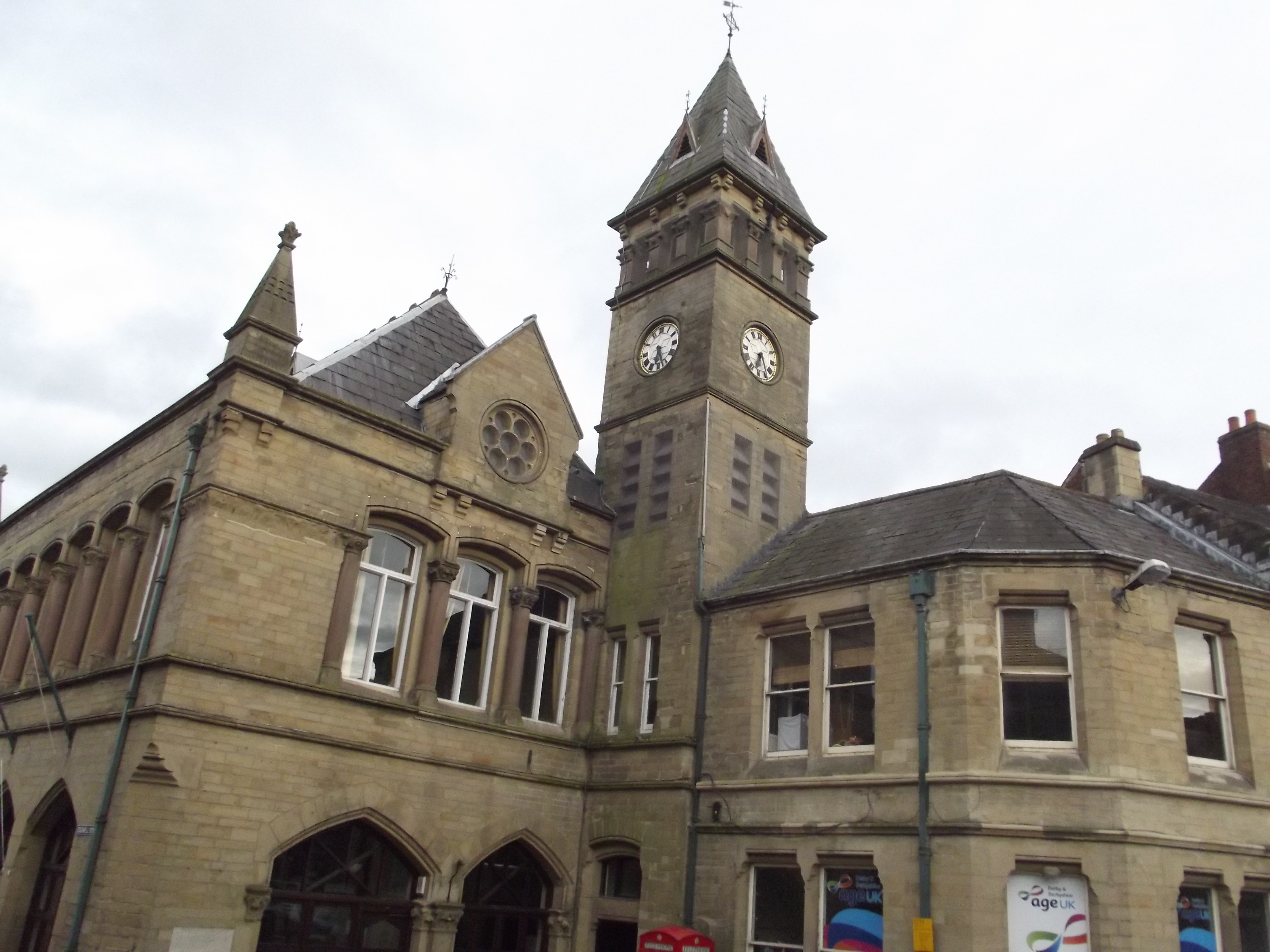
In 1777 Richard Arkwright leased land and premises for a corn mill from Philip Eyre Gell of Hopton and converted it to spin cotton, using his water frame. It was the world's first cotton mill to use a steam engine to replenish the millpond that drove its waterwheel.[14][15] The mill was adjacent to another, Speedwell Mill, owned by John Dalley, a local merchant. Arkwright's mill was sublet in 1792, when Arkwright's son, Richard, began to sell off family property and move into banking. It was named Haarlem Mill in 1815, when converted to weaving tape by Madely, Hackett and Riley, who had set up Haarlem Tape Works in Derby in 1806. In 1879 the Wheatcroft family, which produced tape at Speedwell Mill, expanded into Haarlem. The two mills together employed 230; their weekly output was said to equal the circumference of the earth; Wirksworth was the main producer of red tape for Whitehall. These mills were close together at Miller's Green next to the Derby road. Haarlem Mill now houses an art collective; Speedwell Mill has been replaced by private houses and a carpentry workshop. The growing prosperity of the town led to the development of Wirksworth Town Hall in 1871.[16]
Geography
In the 2011 census Wirksworth civil parish had 2,416 dwellings, 2,256 households and a population of 5,038.[1]
Districts of Wirksworth include Yokecliffe, Gorsey Bank, Bolehill, Mountford and Miller's Green. Bolehill, although technically a hamlet in its own right in Wirksworth's suburbs, is the oldest and most northerly part of the town, while Yokecliffe is a newer estate in the westerly area. Modern houses have been built in the Three Trees area and at the bottom of Steeple Grange (Spring Close).
Education
There are five schools in Wirksworth:[17] Church of England and county infants, and regularly combined but on two sites, Wirksworth Junior School, the Anthony Gell School and Callow Park College. Anthony Gell was a local, requested by Agnes Fearne to build a grammar school on her death. The original site is now a private house on the edge of the churchyard. The current school is an 11–18 comprehensive on a larger site by the Hannage Brook with about 800 pupils. The school's five houses are named after Fearne, Arkwright (Sir Richard Arkwright), Wright (Joseph Wright of Derby), Gell and Nightingale (Florence Nightingale). Its catchment area is the town and surrounding villages: Middleton, Carsington, Brassington, Kirk Ireton, Turnditch, Matlock Bath, Cromford and Crich. The Anthony Gell School qualifies as a Sports College.
Culture and community
Events
![Well or tap dressing in Wirksworth in the 1860s[18]](http://upload.wikimedia.org/wikipedia/commons/6/60/Well_Dressing_Wirksworth_1860s.jpg)
- Early April – The Wirksworth Book Festival, launched in 2016, is a sister event to the Wirksworth Festival, celebrating books and reading, particularly local writers.[19]
- Early June: The Wirksworth well dressing and carnival.[20] This was adapted after the arrival of piped water, so that taps as well as wells are decorated.[18]
- First Sunday after 8 September: Clipping the church is an ancient custom, where the congregation join hands to encircle the building. This occurs on the Sunday after the Feast of the Nativity, the church's dedication.
- September: Since 1995 the Wirksworth Festival has celebrated and promoted arts in the town. It features crafts, exhibitions and street theatre.[21]
- First Weekend in December: The Glee Club holds an annual pantomime.
Community facilities
Fanny Shaw's Playing Field, just beyond the centre, is the main recreation area for the north of the town. It includes a play area. In the south is the "Rec", another children's play area, along with cricket and football pitches. There are public toilets in the car park alongside the United Reformed Church in Jubilee Court.
Cultural references
Haarlem Mill has been mentioned as the possible model for the mill in George Eliot's The Mill on the Floss. The town of Snowfield in George Eliot's Adam Bede is also said to be based in Wirksworth; Dinah Morris, a character in that novel, is based on Eliot's aunt, who lived in Wirksworth and whose husband ran the silk mill, which used to house the Wirksworth Heritage Centre.
Wirksworth was the main location of ITV's Sweet Medicine in 2003, having featured as an occasional location in its forerunner, Peak Practice. More recently, some of Mobile was filmed on a train on the Ecclesbourne Valley Railway, and much of an episode of the BBC series Casualty was set in the town.
Wirksworth features in the 2015 memoir The Long Road Out of Town by author and journalist Greg Watts, who grew up there.[22]
Middle Peak Quarry, on the outskirts of Wirksworth, featured in the 2010 music video "Unlikely Hero" by the Hoosiers.
Town twinning
Wirksworth is twinned with Die in southern France and with Frankenau in the Kellerwald range south-west of the Talgang, Germany, through the Wirksworth Twinning Association.
Notable residents
In alphabetical order:
- Lawrence Beesley (1877–1967) was an English science teacher, journalist and author who was a survivor of the sinking of Titanic.
- Abraham Bennet (1749–1799) was curate of Wirksworth and did important early work in electricity, in association with Erasmus Darwin. There is a memorial plaque to him in Wirksworth Church and a portrait by an unknown artist.[23]
- Anthony Draycot (died 1571) was rector of the parish from 1535 until his imprisonment in 1560. He was the judge at the heresy trial where Joan Waste was condemned to be burnt.[24]
- D. H. Lawrence (1885–1930) lived at Mountain Cottage with his wife Frieda in 1918–1919. It stands below the B5023 road on the edge of Middleton-by-Wirksworth, about 1½ miles (2.4 km) north-west of Wirksworth. Lawrence reputedly spent time also at Woodland Cottage on the far side of New Road. While in Middleton in the bitter winter of 1918–1919, he wrote the short story "A Wintry Peacock", published in 1921.
- Frederick Treves (1853–1923), surgeon and author, was in practice in the town in 1877–1879. A house in Coldwell Street is named after him.[25]
- John Woodward, naturalist (1665–1728), may have been born here.[26]
Landmarks

Wirksworth civil parish contains 108 structures listed by Historic England for their historic or architectural interest. The Parish Church of St Mary is listed Grade I and eight structures (15 Market Place, 35 Green Hill, 1 Coldwell Street, Haarlem Mill, Wigwell Grange, the Red Lion Hotel, Gate House and the former grammar school) are Grade II*.[27]
Wirksworth Heritage Centre is next to Walkers Butchers, down the lower end of Wirksworth. The display illustrates the history of Wirksworth from its prehistoric Dream Cave and woolly rhinos, through its Roman and lead mining histories, to modern times. Other nearby attractions include the Ecclesbourne Valley Railway, the Steeple Grange Light Railway and Peak District National Park.
The study Wirksworth and Five Miles Around, written by Richard R Hackett (1843–1900), includes census information, notes on church monuments, accounts of crimes, church wardens' accounts, maps, a transcription of "Ince's pedigrees", monument inscriptions and old photographs, parish registers and wills.
References
- UK Census (2011). "Local Area Report – Wirksworth Parish (1170212845)". Nomis. Office for National Statistics. Retrieved 17 March 2018.
- City Population. Retrieved 13 January 2021.
- Wiltshire, Mary (2016). Wirksworth: A History. Chesterfield: Bannister Publications. ISBN 1909813230.
- Hart, C. R. (1984). The North Derbyshire Archaeological Survey to AD 1500. Derbyshire Archaeological Society. pp. 17–68.
- "History of Wirksworth – our little Derbyshire town on the edge of the Peak District". GoWirksworth. Retrieved 7 December 2021.
- Millward, Roy; Robinson, Adrian (1975). The Peak District. The Regions of Britain. Eyre Methuen. pp. 129–130. ISBN 978-0-413-31550-2.
- Wirksworth Archaeological Society: Reports.
- Domesday Book: A Complete Translation. London: Penguin. 2003. p. 741. ISBN 0-14-143994-7.
- Loveluck, Christopher P.; McCormick, Michael; Spaulding, Nicole E.; Clifford, Heather; et al. "Alpine ice-core evidence for the transformation of the European monetary system, AD 640–670". Antiquity. 92 (366). doi:10.15184/aqy.2018.110.
- "Alpine glacier reveals lead pollution from C12th Britain as bad as Industrial Revolution". University of Nottingham. 31 March 2020. Retrieved 8 April 2020.
- Loveluck, Christopher P.; More, Alexander F.; Spaulding, Nicole E.; Clifford, Heather; et al. (2020). "Alpine ice and the annual political economy of the Angevin Empire, from the death of Thomas Becket to Magna Carta, c. AD 1170–1216". Antiquity. 94 (374): 473–490. doi:10.15184/aqy.2019.202. Retrieved 7 December 2021.
- Defoe, Daniel (1927) [c.1724]. A tour thro' the whole island of Great Britain, divided into circuits or journies: Letter 8, Part 2: The Peak District. London: J. M. Dent and Co. Archived from the original on 8 May 2017.
- Higginbotham, P. (2007). Workhouses of the Midlands. Stroud: Tempus. p. 27. ISBN 978-0-7524-4488-8.
- Fitton, R. S. (1989). The Arkwrights: spinners of fortune. Manchester: Manchester University Press. p. 57. ISBN 978-0-7190-2646-1.
- Tann, Jennifer (July 1979). "Arkwright's Employment of Steam Power". Business History. 21 (2): 248. doi:10.1080/00076797900000030.
- "Wirksworth Town Hall". Cinema Treasurers. Retrieved 25 December 2021.
- "Wirksworth Federation Infant Schools". Wirksworth-federation-inf.ik.org. 30 April 2012. Archived from the original on 26 July 2011. Retrieved 10 October 2008.
- 1860s picture, PictureThePast, Retrieved August 2009
- "Second year for Wirksworth Book Festival". Wirksworth Festival. Retrieved 13 April 2017.
- "Home page". Wirksworth Carnival. Archived from the original on 2 September 2011.
- "Wirksworth Festival unveils packed programme of art exhibitions and live performances". Derbyshire Times. 19 August 2021. Retrieved 25 December 2021.
- Peddy, Chris (8 March 2015). "'I escaped Wirksworth but failed to become a priest', reveals Derbyshire writer Greg Watts". Derby Telegraph. Archived from the original on 21 May 2015. Retrieved 3 April 2016.
- Elliott, P. (1999). "Abraham Bennet F. R. S. (1749–1799): a provincial electrician in 18th-century England" (PDF). Notes and Records of the Royal Society of London. 53 (1): 59–78. doi:10.1098/rsnr.1999.0063. S2CID 144062032.
{{cite journal}}: CS1 maint: postscript (link)[permanent dead link] - Goodwin, Gordon (2004). "Draycot, Anthony (d. 1571)". Oxford Dictionary of National Biography. revised by Andrew A. Chibi. Oxford University Press. Retrieved 28 February 2009.
- "WIRKSWORTH-Parish Records 1608-1899-Old Photos". Wirksworth.org.uk.
- ODNB entry for John Woodward: Retrieved 14 October 2011. Pay-walled.
- "Listed Buildings in Wirksworth, Derbyshire Dales, Derbyshire". britishlistedbuildings.co.uk. Retrieved 13 April 2017.
External links
- Go Wirksworth - Community web site
- The Wirksworth Heritage Centre
- Discover Derbyshire and the Peak District: Wirksworth
- Wirksworth Parish Records 1600-1900
- Lutudarum.com - It is thought that Wirksworth is the site of the lost Roman town of Lutudarum
Derbyshire Portal | |
| Unitary authorities | Derby |
| Boroughs or districts |
|
| Major settlements |
|
| Rivers | |
| Topics |
|
| |
| Authority control |
|
|---|
На других языках
- [en] Wirksworth
[ru] Уэрксуэрт
Уэ́рксуэрт[2] (англ. Wirksworth) ― торговый город, расположенный в районе Дербишир-Дейлс в Дербишире, Великобритания. Согласно переписи 2011 года там проживало 5038 человек, в 2019 году[3] ― 5180 человек. Здесь находится исток реки Экклсборн. Город получил рыночную хартию от Эдуарда I в 1306 году. Рынок проводится по вторникам в Мемориальных садах. Считается, что приходская церковь Святой Марии датируется 653 годом. Уэрксуэрт развивался как центр добычи свинца, а затем и камня. Многие свинцовые рудники в этом районе принадлежали семье Гелл из соседнего Хоптон-Холла.Другой контент может иметь иную лицензию. Перед использованием материалов сайта WikiSort.org внимательно изучите правила лицензирования конкретных элементов наполнения сайта.
WikiSort.org - проект по пересортировке и дополнению контента Википедии