world.wikisort.org - United_Kingdom
Ripley is a town in the Amber Valley borough of Derbyshire, England. Engineers from Ripley came up with some early improvements to the railway system.
| Ripley | |
|---|---|
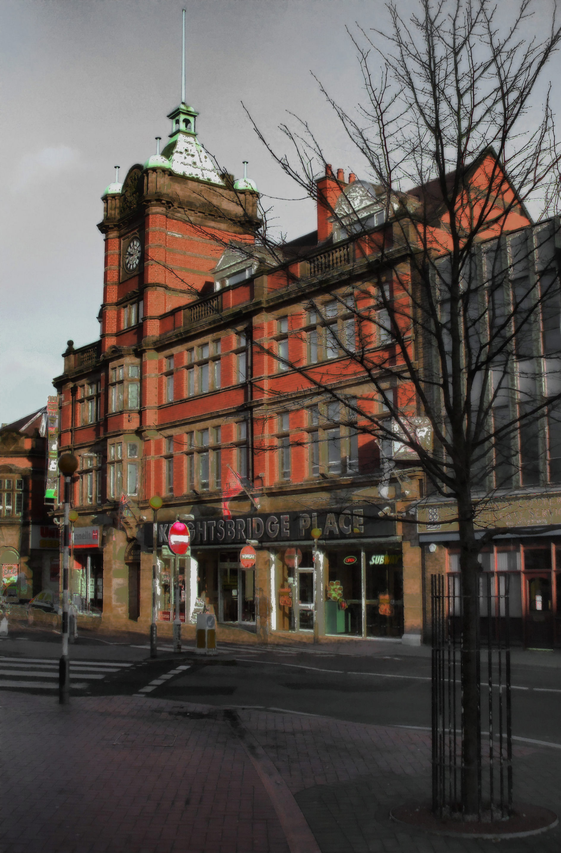 Nottingham Road, Ripley | |
 Ripley Location within Derbyshire | |
| Population | 20,807 (parish, 2011 census)[1] |
| OS grid reference | SK 39746 50502 |
| District | |
| Shire county | |
| Region | |
| Country | England |
| Sovereign state | United Kingdom |
| Post town | RIPLEY |
| Postcode district | DE5 |
| Dialling code | 01773 |
| Police | Derbyshire |
| Fire | Derbyshire |
| Ambulance | East Midlands |
| UK Parliament |
|
| Arms of Ripley Town Council | |
|---|---|
| Crest | On a Wreath of the Colours out of a Mural Crown Sable Flames proper issuant therefrom a Unicorn's Head Argent armed and crined Or charged with three Spearheads erect one and two Gules. |
| Blazon | Vert on a Chevron Or between in chief two Stags' Heads caboshed and in base a Fleur de Lys Argent a Chevronel Sable surmounted by a Tudor Rose barbed and seeded proper all within a Bordure also Argent thereon six Horseshoes also Sable. |
| Motto | Ingenium Industria Alitur (Skill Is Fostered By Diligence) |
| Granted to the urban district council on 8 April 1954.[2] | |
History
Little information remains as to when Ripley was founded, but it appears in the 1086 Domesday Book, when it was held by a man called Levenot.
In 1251 Henry III granted a charter for "one market one day a week, on Wednesday, at [the] manor of Ryppeleg: and one fair each year lasting three days, on the Vigil Day and Morrow of St Helen". Ripley Fair antedates Nottingham Goose Fair. The market day was later altered to Saturdays, with an extra market on Fridays.[3]
Medieval Ripley was just a few stone cottages and farms around a village green, with a few dwellings further afield. Corn was ground at a mill owned by the Abbot of Darley. In 1291, Ripley had "two water-mills with fish ponds".[citation needed]
The Ripley area has been industrialised since the late 18th century. One of the earliest firms to take advantage of local mineral resources was the Butterley Company. It was formed in 1790 by Benjamin Outram and Francis Beresford. Jessop and Wright joined as partners in 1791. Benjamin Outram and Jessop were pioneering engineers best known for their input into the rail industry and their engineering of the Cromford Canal. Outram developed the L-shaped flange rail and Jessop engineered the cast iron fish belly rail. The Little Eaton Gangway project was one of the engineering feats they completed. The engineering part of the company closed and the site of the Butterley Company was demolished in 2010. The company was latterly in three parts, Butterley Engineering, Butterley Brick and Butterley Aggregates (all separate companies). Over the last 200 years these have dealt with steelworks, coal mining, quarrying, railway, foundry and brickworks. One of the best-known examples of the company's work is the arched roof of St Pancras railway station in London, recently restored as an international terminal. Recent major Butterley achievements were the design and construction of the Falkirk Wheel, a canal boat-lift funded by the Millennium Commission and the Spinnaker Tower seen in Portsmouth Harbour as the focus of its regeneration.
Ripley was also a mining community, with collieries owned by the Butterley Company until the Coal Nationalisation Act of 1947. These included Ripley colliery (1863–1948), Britain colliery (1918–1946), Ormonde 1908–1970,[4] and other pits at Upper and Lower Hartshay, Whiteley, Waingroves, Bailey Brook, Exhibition, Loscoe, New Langley and Denby Hall.
Governance
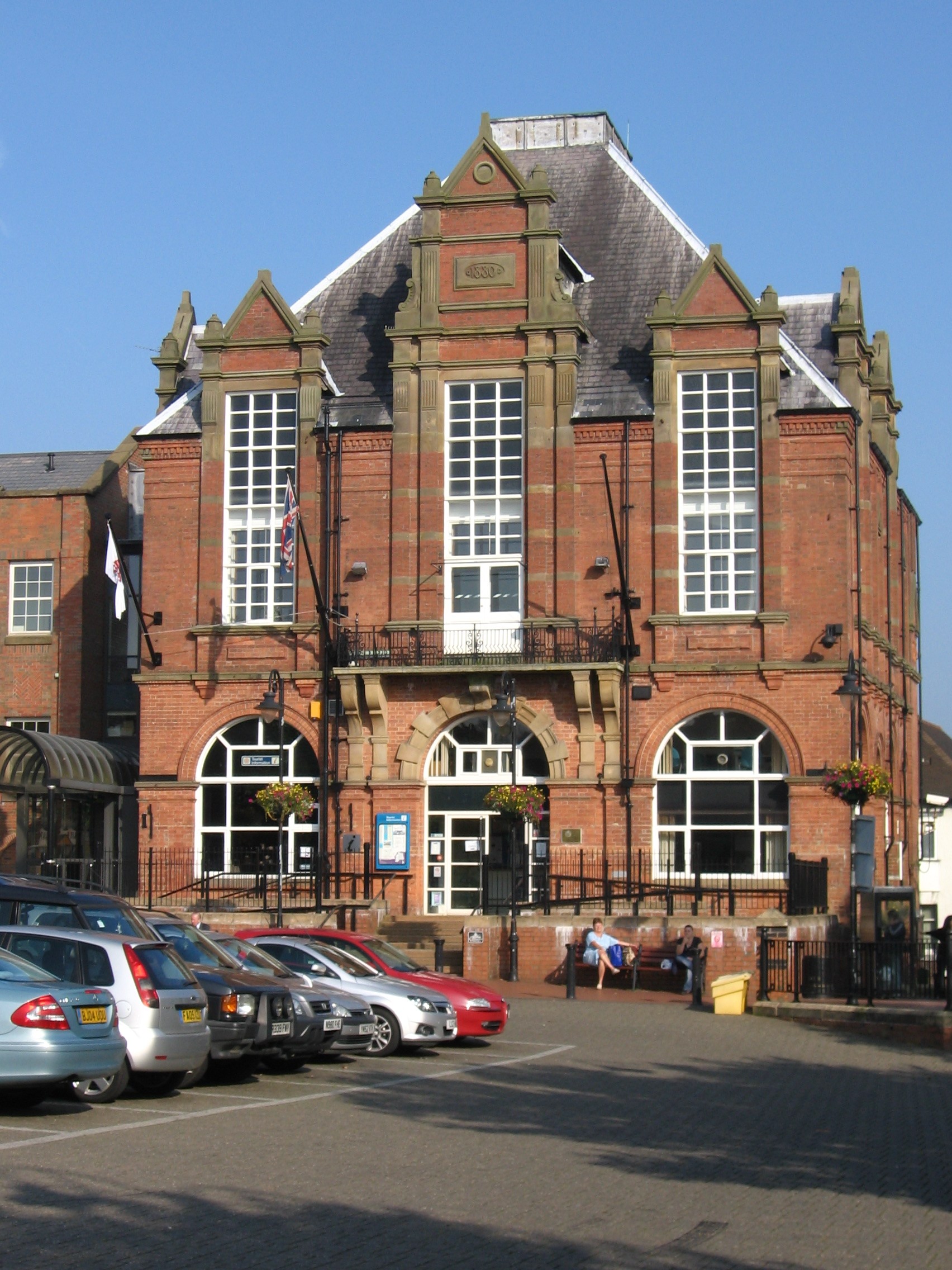
What is now Ripley Town Hall on the north side of the Market Place was erected in 1880 as a market hall. The architect was George Eyre of Codnor. It occupied the site of a much older dwelling known as The White House. The Market Hall was originally open on the ground floor. In 1907, it was converted into a Town Hall by the Urban District Council. In the 1990s, the building was much extended to the west and remodelled by Amber Valley Borough Council to form its headquarters. In 2012, the Council proposed to sell off some of the buildings under a rationalization scheme.[5]
Demography
According to research into names in Britain in 2006, Ripley has the highest proportion of people of ethnic English origin.[6] Of Ripley's inhabitants, 88.5 per cent have an English ethnic background.
Education
Primary schools
- Ripley Junior School, Poplar Avenue, DE5 3PN
- St Johns C of E Primary School, Dannah Street, Ripley
- Lons Infant School, Tavistock Avenue, Ripley
- Waingroves Primary School, Waingroves Road, Ripley
- Codnor Community Primary School, Whitegates
Secondary schools
- The Ripley Academy, Peasehill Road, Ripley
- Swanwick Hall School, Swanwick Hill, Swanwick (2 miles north on B6179 road)
- John Flamsteed School, Derby Road, Denby (2.5 miles south on B6179)
Pre-schools
- Ripley Nursery School, Sandham Lane
- Clowns Day Nursery, Cromford Road
- Clowns Day Nursery, Butterley Park, A610
- Alphabet Childminders, Ripley.

Religion
The Methodist Church in Wood Street is reputed to be the oldest church in the town that is still active. At the peak of the movement there were five Methodist churches in Ripley, but the congregations combined over the years.[7] The church was rebuilt on the same site and reopened in November 2009. See History of Methodism in Ripley Derbyshire
An outcome of the nearby Pentridge (or Pentrich) Rising of 1817 was for the Vicar of Pentrich Church to call for an Anglican church to be built in Ripley as soon as possible. All Saints' Church, Ripley was erected in 1821 by the Butterley Company.
Other places of worship include the Salvation Army hall in Heath Road, which was opened in 1911, the Springs of the Living Water housed in the former St John's Church in Derby Road, the Spiritual Church in Argyll Road, and Marehay Methodist Chapel in Warmwells Lane, Marehay.
Transport
Running under the premises of the Butterley Company is the 2,966-yard (2,712 m) Butterley Tunnel on the Cromford Canal.[8] The central section of the canal is disused, but a charitable fund has been formed to reopen it.
Ripley is the site of Midland Railway – Butterley (formerly the Midland Railway Centre), a trust dedicated to preserving railway locomotives, rolling stock and other items related to the Midland Railway.
Ripley was once served by Ripley railway station on the Midland Railway Ripley Branch. It was the northern terminus of the Nottinghamshire and Derbyshire Tramways Company and later of the Nottinghamshire and Derbyshire trolleybus system.
Media
Ripley's local radio station, Amber Sound FM, is based in the Unicorn Business Park off Wellington Street. The station broadcasts on 107.2FM in the Amber Valley and online.
Parks and natural features
Butterley Reservoir, at the bottom of Butterley Hill in the north of the town, has pairs of great crested grebe, coot, moorhens and other birds to watch, and platforms for anglers to use. There is a footpath that takes in the scenery, with the Midland Railway Trust in the background.
Wildlife and a small woodland area can be enjoyed at Carr Wood, signposted from halfway down Butterley Hill.
At the bottom of Moseley Street, next to the Red Lion pub in Ripley Town Centre, is a recreation area named after Sir Barnes Wallis, which offers views over to Crich Stand, the Sherwood Foresters Memorial. Crich Stand was built by Francis Hurt in 1778 and in 1922 dedicated to the fallen of the Sherwood Foresters Regiment (colloquially known as the Woofers) in World War I. It is now the memorial for those in the Regiment who died in all conflicts.[9]
The Pit Top is an open area with some seating and a white arch sculpture. The grassed area is the site of the original Ripley Colliery, owned by Butterley Company and worked from 1863 until 1948.[4]
Crossley Park is a few acres of grassed land opened in 1935. It is surrounded by shrubs and trees on a tract given to the town by James Crossley in 1901. It has a children's play area with a paddling pool, a paved perimeter walk, and a bandstand used as such occasionally on late Sunday afternoons in the summer.
Twin towns
Ripley is twinned with the French towns of Château-Renault and Lons-le-Saunier.
Community and facilities
The headquarters of Derbyshire Constabulary is on the outskirts of Ripley at Butterley Hall.
Ripley has a community hospital with a minor accident and emergency department that opened on 7 September 1912. The hospital was built after the death of a miner injured at Pentrich Colliery, who did not survive the road journey to Derby in time for treatment.[10] The Ripley Hospital League of Friends has been an active fund-raising group for the hospital throughout its history.
Ripley has a Scout group founded in 1914. For younger children it has two Beaver colonies and a Cub pack.[11]
Notable residents
- Gavin Butt (born 1967), an art historian based at Goldsmiths, University of London, was born in Ripley.
- Arthur Octavius Edwards (1876–1960), a civil engineer who built and managed the Grosvenor House Hotel in London, was born in Ripley.
- Agnes Elizabeth Slack, a leading temperance campaigner, was born here in 1858.[12]
- John Bamford Slack (1857–1909), Liberal MP and prominent Methodist, was born in Ripley.
- Andy Sneap (born 1969), a heavy metal record producer and thrash metal musician, whose company Backstage Productions is based in the town
- Bombardier Charles Stone (1889–1952), awarded the VC, was born in Ripley.[13]
- Sir James Outram, 1st Baronet (1803–1863), born in Ripley, fought in the Indian Rebellion of 1857 and became known as the "Bayard of India". He was buried in Westminster Abbey.[14]
- Sir Barnes Wallis (1887–1979), inventor of the "bouncing bomb", was born in Ripley. He has a town park named after him, and a pub, The Sir Barnes Wallis, until it was demolished in 2021. His house of birth bears a blue plaque. His father was a doctor at The Elms in Derby Road.
Arms
|
See also
- Listed buildings in Ripley, Derbyshire
References
- "Neighbourhood Statistics". Office for National Statistics. Retrieved 18 October 2014.
- "Ripley Town Council (Derbyshire)". Robert Young. Retrieved 31 October 2019.
- Wood, Brian (2007). Ripley, Heage and Ambergate: People, places and events. Ripley Town Council.
- Bell, David (2006). Memories of the Derbyshire Coalfields. Newbury, Berkshire: Countryside Books. ISBN 1846740037.
- Historic England. "Monument No. 1319727". Research records (formerly PastScape). Retrieved 26 April 2015.
"Ripley Town Hall". Picture The Past. Retrieved 26 April 2015.
Pevsner, Nikolaus (2002). The Buildings of England – Derbyshire. Yale University Press. p. 309. ISBN 0-300-09591-0.
Wright's Directory of Melbourne and Ripley. C. N. Wright. 1878. - "Derbyshire town named 'most English' place in the country". Evening Standard. 10 September 2006. Retrieved 24 December 2021.
- "Welcome to Ripley Methodist church". Ripley Methodist Church. Retrieved 23 December 2021.
- Witter, Robin (7 October 2002). "Butterley Tunnel – The Illustrated Report". Friends of the Cromford Canal. Archived from the original on 20 March 2009. Retrieved 24 December 2021.
- Jewell, Rod (1998). Memory Lane: Belper, Ambergate and Districts. Derby: Breedon Books Publishing Co. ISBN 185983132X.
- Buxton, David (1994). Pocket Images: Ripley and Codnor. Gloucestershire: Nonsuch Publishing Ltd. ASIN B00SLVVHXE.
- "Home page". 1st Ripley Scouts. Retrieved 24 December 2021.
- Colpus, Eve. "Slack, Agnes Elizabeth (1858–1946)". Oxford Dictionary of National Biography (online ed.). Oxford University Press. doi:10.1093/ref:odnb/103418. (Subscription or UK public library membership required.)
- Stewart, Iain. "Grave Location for Holders of The Victoria Cross in The County of: Derbyshire". The Victoria Cross: Britain's Highest Award for Gallantry. Retrieved 24 December 2021.
- Vetch, R. H. "Outram, Sir James, first baronet (1803–1863)". Oxford Dictionary of National Biography (online ed.). Oxford University Press. doi:10.1093/ref:odnb/20962. (Subscription or UK public library membership required.)
- "East Midlands Region". Civic Heraldry of England. Retrieved 22 March 2021.
External links
Derbyshire Portal | |
| Unitary authorities | |
| Boroughs or districts | |
| Major settlements |
|
| Rivers | |
| Topics |
|
| |
Authority control | |
|---|---|
| General | |
| National libraries | |
| Other | |
На других языках
- [en] Ripley, Derbyshire
[ru] Рипли (Дербишир)
Ри́пли — город в Великобритании в графстве Дербишир (регион Восточный Мидленд), административный центр района Амбер-Вэлли.Другой контент может иметь иную лицензию. Перед использованием материалов сайта WikiSort.org внимательно изучите правила лицензирования конкретных элементов наполнения сайта.
WikiSort.org - проект по пересортировке и дополнению контента Википедии