world.wikisort.org - Turkey
Çankırı, historically known as Gangra (Greek: Γάγγρα), is the capital city of Çankırı Province, in Turkey, about 140 km (87 mi) northeast of Ankara. It is situated about 800 m (2500 ft) above sea level.
This article has multiple issues. Please help improve it or discuss these issues on the talk page. (Learn how and when to remove these template messages)
|
Çankırı | |
|---|---|
Municipality | |
 General view of Çankırı | |
 Coat of arms | |
 Çankırı Çankırı | |
| Coordinates: 40°36′00″N 33°37′00″E | |
| Country | Turkey |
| Province | Çankırı |
| Government | |
| • Mayor | İrfan Dinç (AKP) |
| Area | |
| • District | 1,347.05 km2 (520.10 sq mi) |
| Elevation | 800 m (2,600 ft) |
| Population (2012)[2] | |
| • Urban | 74,192 |
| • District | 84,225 |
| • District density | 63/km2 (160/sq mi) |
| Website | www |
History

Çankırı was known in antiquity as Gangra (Greek: Γάγγρα), and later Germanicopolis (Greek: Γερμανικόπολις). The city has also been known as Changra, Kandari or Kanghari
Α town of Paphlagonia that appears to have been once the capital of Paphlagonia and a princely residence, for it is known from Strabo that Deiotarus Philadelphus (before 31 BC–5/6 AD), the last king of Paphlagonia, resided there.[3] Notwithstanding this, Strabo describes it as only "a small town and a garrison".
According to 1st-century BC writer Alexander the Polyhistor[4] the town was built by a goat herder who had found one of his goats straying there; but this origin is probably a mere philological speculation as gangra signifies "a goat" in the Paphlagonian language.
Gangra was absorbed into the Roman province of Galatia upon the death of Deiotarus in 6/5 BC. The earlier town was built on the hill behind the modern city, on which are the ruins of a late fortress, while the Roman city occupied the site of the modern city.[5]
In the writings of the 2nd-century AD Greco-Roman writer Ptolemy, the city is referred to as Germanicopolis (Greek: Γερμανικόπολις).[6][7] It was named Germanicopolis, after Germanicus or possibly the emperor Claudius, until the time of Caracalla.
In Christian times, Gangra was the metropolitan see of Paphlagonia.[5] Hypatios, bishop of Gangra, is considered a saint in the Orthodox Christian tradition. He was killed by Arians on his return from the Council of Nicaea (325 AD), in which he took part.
In the 4th century, the town was the scene of an important ecclesiastical synod, the Synod of Gangra. There is disagreement about the date of the synod, with dates varying from AD 341 to 376. The synodal letter states that twenty-one bishops assembled to take action concerning Eustathius of Sebaste[8] and his followers. The synod issued twenty canons known as the Canons of Gangra; these were declared ecumenical by the Council of Chalcedon in 451. Under these canons, the sect disowned marriage, disparaged the offices of the church, held conventicles of their own, wore a peculiar dress, denounced riches, and affected special sanctity. The synod condemned the Eustathian practices, declaring however that it was not virginity that was condemned, but the dishonouring of marriage; not poverty, but the disparagement of honest and benevolent wealth; not asceticism, but spiritual pride; not individual piety, but dishonouring the house of God.[5]
Over the centuries the settlement witnessed the hegemony of many cultures and races, such as Hittites, Persians, ancient Greeks, Parthians, Pontic Greeks, Galatians, Romans, Byzantine Greeks, up to the Seljuks and finally the Ottoman Turks. Traces from its long past are still visible throughout the city. The continuity of the city's name from ancient times across languages is of note: Hangara for the Arabs, Gagra for the Jews and Tzungra or Kângıri or Çankıri for the Turks.
Climate
Çankırı has a dry summer continental climate (Köppen climate classification: Dsa and Dsb) or a humid continental climate (Trewartha climate classification: Dca and Dcb). Other locations to the north of the city center feature more humid characteristics (Köppen climate classification: Dfa and Dfb). Summers are usually hot and dry and winters are cold and snowy. The rainiest month is May, while the driest month is July.
| Climate data for Çankırı (1991–2020, extremes 1929–2020) | |||||||||||||
|---|---|---|---|---|---|---|---|---|---|---|---|---|---|
| Month | Jan | Feb | Mar | Apr | May | Jun | Jul | Aug | Sep | Oct | Nov | Dec | Year |
| Record high °C (°F) | 15.0 (59.0) |
22.0 (71.6) |
29.0 (84.2) |
31.0 (87.8) |
35.2 (95.4) |
39.6 (103.3) |
42.4 (108.3) |
41.8 (107.2) |
39.8 (103.6) |
34.2 (93.6) |
24.4 (75.9) |
18.2 (64.8) |
42.4 (108.3) |
| Average high °C (°F) | 3.9 (39.0) |
7.0 (44.6) |
12.8 (55.0) |
18.3 (64.9) |
23.5 (74.3) |
28.0 (82.4) |
32.0 (89.6) |
32.2 (90.0) |
27.5 (81.5) |
20.9 (69.6) |
12.4 (54.3) |
5.7 (42.3) |
18.7 (65.7) |
| Daily mean °C (°F) | −0.4 (31.3) |
1.5 (34.7) |
6.0 (42.8) |
11.0 (51.8) |
15.9 (60.6) |
20.1 (68.2) |
23.4 (74.1) |
23.3 (73.9) |
18.5 (65.3) |
12.7 (54.9) |
5.5 (41.9) |
1.4 (34.5) |
11.6 (52.9) |
| Average low °C (°F) | −3.8 (25.2) |
−2.9 (26.8) |
0.1 (32.2) |
4.2 (39.6) |
8.7 (47.7) |
12.3 (54.1) |
14.7 (58.5) |
14.6 (58.3) |
10.1 (50.2) |
5.8 (42.4) |
0.2 (32.4) |
−2.0 (28.4) |
5.2 (41.4) |
| Record low °C (°F) | −25.0 (−13.0) |
−24.0 (−11.2) |
−20.5 (−4.9) |
−8.9 (16.0) |
−3.0 (26.6) |
1.6 (34.9) |
4.3 (39.7) |
4.6 (40.3) |
−2.0 (28.4) |
−6.3 (20.7) |
−19.4 (−2.9) |
−18.8 (−1.8) |
−25.0 (−13.0) |
| Average precipitation mm (inches) | 41.6 (1.64) |
31.7 (1.25) |
38.1 (1.50) |
45.2 (1.78) |
57.8 (2.28) |
45.5 (1.79) |
20.4 (0.80) |
22.9 (0.90) |
20.0 (0.79) |
32.5 (1.28) |
26.3 (1.04) |
45.9 (1.81) |
427.9 (16.85) |
| Average precipitation days | 10.40 | 9.27 | 9.90 | 11.43 | 13.40 | 11.10 | 4.83 | 5.00 | 5.17 | 7.67 | 7.13 | 10.23 | 105.5 |
| Mean monthly sunshine hours | 68.2 | 107.4 | 164.3 | 198.0 | 241.8 | 282.0 | 328.6 | 306.9 | 260.4 | 189.1 | 123.0 | 62.0 | 2,331.7 |
| Mean daily sunshine hours | 2.2 | 3.8 | 5.3 | 6.6 | 7.8 | 9.4 | 10.6 | 9.9 | 8.4 | 6.1 | 4.1 | 2.0 | 6.3 |
| Source: Turkish State Meteorological Service[9] | |||||||||||||
Economy


Agriculture
Various agricultural produce, including wheat, corn, beans, and apples is grown in the farms and fields.
Industry
Most industry is concentrated near the Çankırı city center and the town of Korgun. Other towns included in the larger industrial area of the city are Şabanözü, Çerkeş, Ilgaz, Kurşunlu, and Yapraklı.
Education
Çankırı is home to Çankırı Karatekin University, which was founded in 2007.
Notable people
- Şükrü Enis Regü (1922–1974), poet
- Refik Saydam (1881-1942), physician, politician and the fourth Prime Minister of Turkey
- Tevfik Fikret (1867-1915) educator and poet
- Ali Kemal (1869-1922) newspaper editor, poet, liberal-leaning politician, government official
See also
- Anatolian Tigers
References
- "Area of regions (including lakes), km²". Regional Statistics Database. Turkish Statistical Institute. 2002. Retrieved 2013-03-05.
- "Population of province/district centers and towns/villages by districts - 2012". Address Based Population Registration System (ABPRS) Database. Turkish Statistical Institute. Retrieved 2013-02-27.
- Strab. xii. p.564; comp. Liv. 38.26.
- Smith, W., Dictionary of Greek and Roman Biography and Mythology, vol. 3, s.v. "Stephanus" of Byzantium.
- One or more of the preceding sentences incorporates text from a publication now in the public domain: Chisholm, Hugh, ed. (1911). "Changra". Encyclopædia Britannica. Vol. 5 (11th ed.). Cambridge University Press. p. 840.
- Ptol., Geo. v. 4. § 5, but also "Gangra (Byzantium)"
- Encyclopaedia of the Hellenic World, Asia Minor http://www.ehw.gr/asiaminor/forms/filePage.aspx?lemmaId=7515
- Herbermann, Charles, ed. (1913). . Catholic Encyclopedia. New York: Robert Appleton Company.
- "Resmi İstatistikler: İllerimize Ait Mevism Normalleri (1991–2020)" (in Turkish). Turkish State Meteorological Service. Retrieved 27 June 2021.
Further reading
- Boğaç A. Ergene: "Local Court, Provincial Society and Justice in the Ottoman Empire, Legal Practice and Dispute Resolution in Çankırı and Kastamonu (1652-1744)". Studies in Islamic Law and Society, volume 17, Brill, Leiden, 2003. ISBN 90-04-12609-0.
Çankırı in Çankırı Province of Turkey | |||||||||||||||||||||||||||
|---|---|---|---|---|---|---|---|---|---|---|---|---|---|---|---|---|---|---|---|---|---|---|---|---|---|---|---|
| Districts |  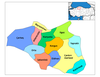 | ||||||||||||||||||||||||||
|
Metropolitan municipalities are bolded. | |||||||||||||||||||||||||||
Authority control | |
|---|---|
| General |
|
| National libraries | |
На других языках
[de] Çankırı
Çankırı (früher Qankiri oder dt. Tschankiri) ist eine türkische Stadt in Anatolien. Sie ist die Provinzhauptstadt der gleichnamigen Provinz Çankırı und Sitz des zentralen Landkreises (Merkez). Çankırı liegt etwa 125 Kilometer nordwestlich von Ankara und ist die größte Stadt der Provinz.- [en] Çankırı
[fr] Çankırı
Çankırı est une ville de Turquie, préfecture de la province du même nom.[it] Çankırı
Çankırı è una città della Turchia, capoluogo dell'omonima provincia. Si trova a circa 140 km a nord-ovest di Ankara, a 800 m circa sul livello del mare, in una valle ricca di sorgenti d'acqua.[ru] Чанкыры
Чанкыры (тур. Çankırı) — город в Турции, столица ила Чанкыры. Расположен в 140 километрах к северо-востоку от Анкары, на одном из притоков реки Кызылырмак.Другой контент может иметь иную лицензию. Перед использованием материалов сайта WikiSort.org внимательно изучите правила лицензирования конкретных элементов наполнения сайта.
WikiSort.org - проект по пересортировке и дополнению контента Википедии