world.wikisort.org - Turkey
Gölova is a town and a district of Sivas Province of Turkey. The mayor is İbrahim Yenidünya (AKP). The name "Gölova" means "lake-plain".[3] Historically known as Ağvanis, Gölova is located on top of a hill on the edge of the Refahiye plateau and also overlooking the Suşehri plain to the west.[3] To the south are small lakes where water from the Çobanlı Su's tributaries collects.[3] These lakes water a meadow area called Suşehir ("water-city"; not to be confused with the Suşehri plain to the west), which was historically a stopping place for armies and travelers in general.[3] In Kurdish the town is spelled Axvanîs.[4]
This article needs additional citations for verification. (March 2008) |
Gölova | |
|---|---|
 Gölova | |
| Coordinates: 40°03′44″N 38°36′34″E | |
| Country | Turkey |
| Province | Sivas |
| Government | |
| • Mayor | İbrahim Yenidünya (AKP) |
| • Kaymakam | Fatih Kızıltoprak |
| Area | |
| • District | 333.17 km2 (128.64 sq mi) |
| Elevation | 1,342 m (4,403 ft) |
| Population (2012)[2] | |
| • Urban | 2,197 |
| • District | 3,645 |
| • District density | 11/km2 (28/sq mi) |
| Post code | 58640 |
| Website | www.golova.bel.tr |
Gölova is likely equivalent to the ancient Roman settlement known as Olotoedariza in the Antonine Itinerary and Aladaleariza in the 4th-century Notitia Dignitatum.[3] This was the base of a cavalry unit called the Ala Rizena.[3] The etymology of both these names, along with the modern name of Ağvanis, may be from the Armenian word ełigi, meaning "marsh".[3]
See also
- Gölova Dam
References
- "Area of regions (including lakes), km²". Regional Statistics Database. Turkish Statistical Institute. 2002. Retrieved 2013-03-05.
- "Population of province/district centers and towns/villages by districts - 2012". Address Based Population Registration System (ABPRS) Database. Turkish Statistical Institute. Retrieved 2013-02-27.
- Sinclair, Thomas (2020). Eastern Trade and the Mediterranean in the Middle Ages: Pegolotti’s Ayas-Tabriz Itinerary and its Commercial Context. Routledge. pp. 978-0-429-34811-2. Retrieved 2 September 2022.
- Avcýkýran, Dr. Adem (ed.). "Kürtçe Anamnez, Anamneza bi Kurmancî" (PDF). Tirsik. p. 57. Archived from the original (PDF) on 20 June 2020. Retrieved 17 September 2022.
Gölova in Sivas Province of Turkey | |||||||||||||||||||||||||||
|---|---|---|---|---|---|---|---|---|---|---|---|---|---|---|---|---|---|---|---|---|---|---|---|---|---|---|---|
| Districts |  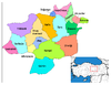 | ||||||||||||||||||||||||||
|
Metropolitan municipalities are bolded. | |||||||||||||||||||||||||||
| Authority control |
|
|---|
This geographical article about a location in Sivas Province, Turkey is a stub. You can help Wikipedia by expanding it. |
На других языках
[de] Gölova
Gölova (kurdisch: Axvanîs) ist eine Stadt und Hauptort des gleichnamigen Landkreises (İlçe) in der Provinz Sivas.- [en] Gölova
Другой контент может иметь иную лицензию. Перед использованием материалов сайта WikiSort.org внимательно изучите правила лицензирования конкретных элементов наполнения сайта.
WikiSort.org - проект по пересортировке и дополнению контента Википедии