world.wikisort.org - Turkey
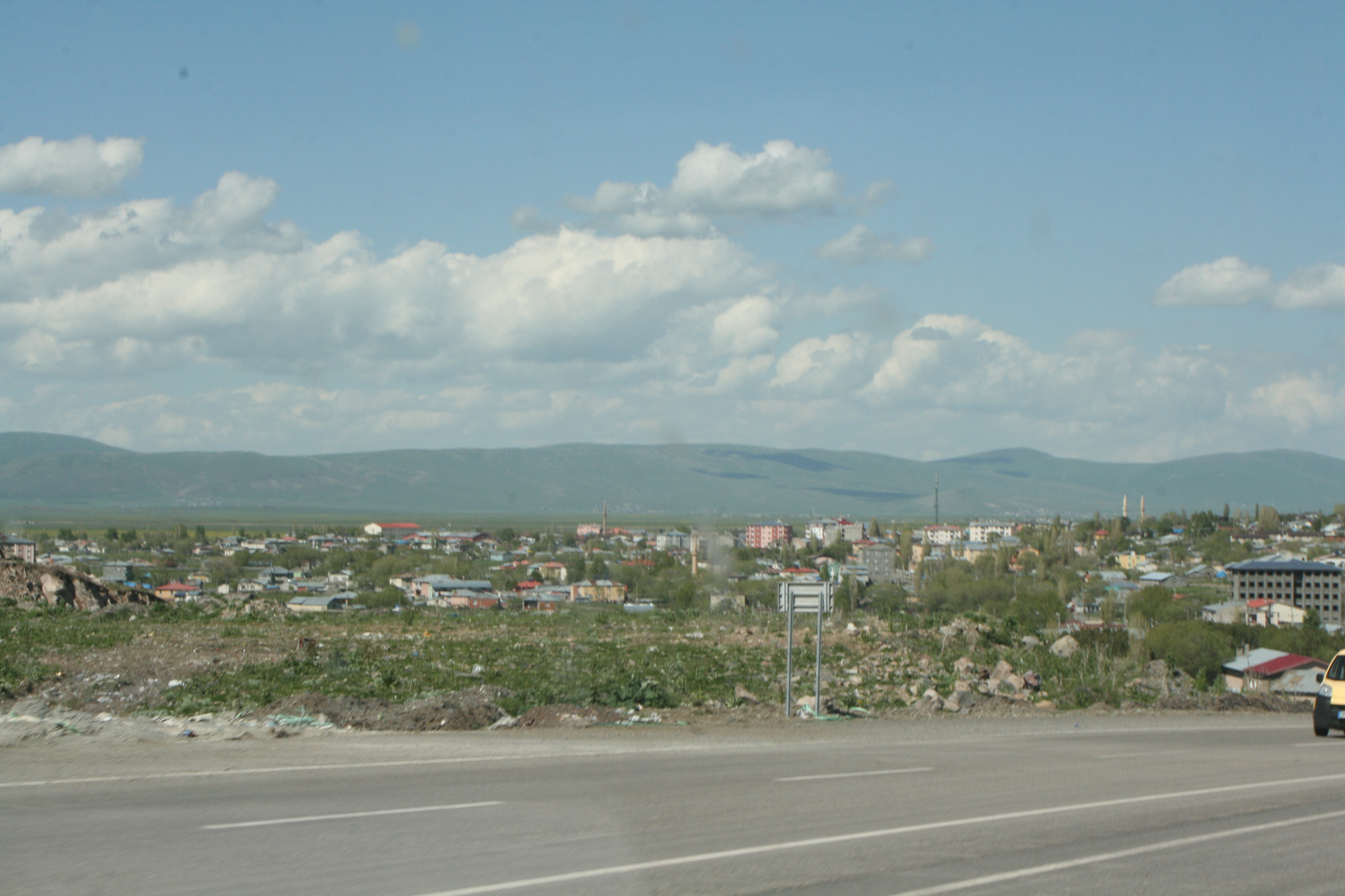
Göle (Armenian: Կող, romanized: Kogh; Georgian: კოლა, romanized: k'ola; Kurdish: Mêrdînik) is a small city and surrounding district in Ardahan Province of Turkey. The city was formerly known as Merdenik, Merdinik or Ardahan-ı Küçük ("Little Ardahan" in Ottoman Turkish).
Göle | |
|---|---|
 | |
 Göle | |
| Coordinates: 40°47′34″N 42°36′31″E | |
| Country | |
| Province | Ardahan |
| Government | |
| • Mayor | Akın İsmailoğlu (AKP) |
| • Kaymakam | Fatih özdemir |
| Area | |
| • District | 1,399.88 km2 (540.50 sq mi) |
| Elevation | 2,038 m (6,686 ft) |
| Population (2012)[2] | |
| • Urban | 7,359 |
| • District | 29,968 |
| • District density | 21/km2 (55/sq mi) |
| Post code | 75700 |
| Website | www.gole.bel.tr |
Göle is a rural district, eighty per cent of the area comprising mountain and forest, with the remainder grazing land and meadow; the local economy depends on this grazing. Göle is famous for its yellow kaşar cheese. Some crops are grown, including grains and potatoes. With the high Allahuekber mountains to the south Göle is exposed to the north resulting in cold winters.
Etymology
In Armenian, Göle is known as Kogb (Armenian: Կող), Merdenek (Armenian: Մերդենեկ), or Merrrenek (Armenian: Մեռենեկ), also being renamed to Martenik (Armenian: Մարտենիք) in 1918. In Greek, the town is known as Gkióle (Greek: Γκιόλε) or Mertenék (Greek: Μερτενέκ).[3][4][5]
History
The name derives from Armenian name—Kogh—which may, in turn, derive from ancient kingdom of Colchis. In ancient times this land was part of Urartu. In 4th century BC, it was part of Kingdom of Iberia and remained as one of the district of Duchy of Tsunda. Since 2nd century BC to 4th century AD this place was a part of Greater Armenia. During subsequent centuries it frequently changed hands between Iberians and Armenians. In the 7th century it passed to the Arab Caliphate. In 8th century it became part of Kuropalatine of Iberia in struggle against the Arab occupation. During the 10th–15th centuries, this region was a part of the united Georgian Kingdom. In the 16th century, it was within the independent Principality of Samtskhe until it was occupied and annexed by the Ottoman Empire and organized into the Childir Eyalet.

Merdenek was annexed by the Russian Empire in 1878, where it was part of the militarily administered Kars Oblast, specifically within the Gelsky uchastok (subcounty) of the Ardahan Okrug. The district included villages inhabited by various ethnic groups, including 40 Turkish and 13 Caucasian Greek villages.[6] Merdenek was briefly occupied by the Ottoman Empire by virtue of the Treaty of Brest-Litovsk, however, following their withdrawal in 1919, Armenian control prevailed until late 1920. During the Turkish–Armenian War, the town was occupied by Democratic Republic of Georgia; in 1921, it was annexed by Turkey, as confirmed by the Treaty of Kars.[7]
Places of interest to visitors include the tomb and mosque in the village of Dedeşen and the castles of Kalecik and Ugurtaşı.
Climate
Göle has a humid continental climate that has warmer overnight lows and winters than provincial capital Ardahan. Although having cold winters, Göle has warm summers and is therefore too warm by a good margin to be a subalpine climate. Ardahan has a more seasonal climate, with Göle being more moderate in its swings. During winter, Göle and Ardahan see temperature inversion, resulting in Göle at a higher elevation being milder than the colder frost hollow of Ardahan in the valley. Therefore, Ardahan is the coldest town in Turkey.
| Climate data for Göle | |||||||||||||
|---|---|---|---|---|---|---|---|---|---|---|---|---|---|
| Month | Jan | Feb | Mar | Apr | May | Jun | Jul | Aug | Sep | Oct | Nov | Dec | Year |
| Average high °C (°F) | −4.0 (24.8) |
−2.6 (27.3) |
1.7 (35.1) |
9.2 (48.6) |
14.1 (57.4) |
18.4 (65.1) |
22.7 (72.9) |
23.2 (73.8) |
19.6 (67.3) |
12.7 (54.9) |
5.5 (41.9) |
−1.7 (28.9) |
9.9 (49.8) |
| Daily mean °C (°F) | −9.4 (15.1) |
−8.3 (17.1) |
−3.4 (25.9) |
4.0 (39.2) |
8.2 (46.8) |
11.7 (53.1) |
15.4 (59.7) |
15.4 (59.7) |
11.7 (53.1) |
6.1 (43.0) |
0.3 (32.5) |
−6.3 (20.7) |
3.8 (38.8) |
| Average low °C (°F) | −14.8 (5.4) |
−13.9 (7.0) |
−8.4 (16.9) |
−1.2 (29.8) |
2.4 (36.3) |
5.0 (41.0) |
8.1 (46.6) |
7.6 (45.7) |
3.8 (38.8) |
−0.5 (31.1) |
−4.8 (23.4) |
−10.7 (12.7) |
−2.3 (27.9) |
| Average precipitation mm (inches) | 26 (1.0) |
30 (1.2) |
36 (1.4) |
57 (2.2) |
84 (3.3) |
82 (3.2) |
55 (2.2) |
46 (1.8) |
34 (1.3) |
46 (1.8) |
39 (1.5) |
30 (1.2) |
565 (22.1) |
| Source: Climate-Data.org[8] | |||||||||||||
Villages of the district
The old names of the villages are noted after in parentheses.
- Arpaşen (Ağılylu)
- Balçeşme (Lelevarginis/Lale Varkenez)
- Bellitepe (Urut)
- Budaklı (Cicor)
- Büyükaltınbulak
- Çakıldere (Orakilise)
- Çakırüzüm (Muzaret)
- Çalıdere (Mihgerek)
- Çardaklı
- Çayırbaşı (Hokam)
- Çobanköy
- Çullu
- Damlasu (Sasadel)
- Dedekılıcı (Kaşar)
- Dedeşen
- Dengeli (Abur)
- Dereyolu (Salot)
- Durançam (Hımıskar)
- Durucasu
- Dölekçayır (Pilemor)
- Esenboğaz (Kelpikor)
- Esenyayla
- Eskidemirkapı
- Filizli (Sivin)
- Gedik (Lavustan)
- Gülistan
- Günorta (Kızılkilise)
- Hoşdülbent
- Karlıyazı (Kirziyan)
- Kayaaltı (Poladik)
- Koyunlu
- Köprülü (Korehenk)
- Kuytuca (Şekki)
- Kuzupınarı (Konk)
- Küçükaltınbulak
- Meşedibi (Morofka)
- Mollahasan
- Okçu
- Samandöken (Sinot)
- Senemoğlu
- Serinçayır (Çölpenek)
- Sürügüden (Heve)
- Tahtakıran
- Tellioğlu
- Toptaş
- Uğurtaşı
- Yağmuroğlu
- Yanatlı (Varkenez/Varginis)
- Yavuzlar (Üçkilise)
- Yeleçli (Samzelek)
- Yenidemirkapı
- Yeniköy
- Yiğitkonağı (Türkeşen)
References
- "Area of regions (including lakes), km²". Regional Statistics Database. Turkish Statistical Institute. 2002. Retrieved 2013-03-05.
- "Population of province/district centers and towns/villages by districts - 2012". Address Based Population Registration System (ABPRS) Database. Turkish Statistical Institute. Retrieved 2013-02-27.
- Σάββας Καλεντερίδης, “Ανατολικός Πόντος”, 2006.
- Ισαάκ Λαυρεντίδη,“Μετοικεσία Καυκασίων 1895-1907”.
- Ιωάννης Καλφόγλου Μαρκήσιο-Φωτιάδη, “Οι Έλληνες εν Καυκάσω”, Αθήνα (1908).
- List of the Greek villages of Καρς, ΜΕΡΤΙΝΙΚ, "13 ελληνικά χωριά της Γκιόλιας" ["13 Greek villages of Giolia"], pontosworld
- "iveria". www.conflicts.rem33.com. Retrieved 2022-05-29.
- "Göle climate table - Historical Weather Data". Climate-Data.org. Retrieved 1 November 2017.
Göle in Ardahan Province of Turkey | |||||||||||||||||||||||||||
|---|---|---|---|---|---|---|---|---|---|---|---|---|---|---|---|---|---|---|---|---|---|---|---|---|---|---|---|
| Districts |   | ||||||||||||||||||||||||||
|
Metropolitan municipalities are bolded. | |||||||||||||||||||||||||||
На других языках
[de] Göle
Göle (georgisch კოლა K'ola, armenisch Մերդենեկ Merdenik, griechisch Μερτενέκ Mertenék, bis 1928 auch offiziell Merdenik) ist eine Stadt und ein Landkreis der Provinz Ardahan im Nordosten der Türkei. Göle erhielt 1926 den Status einer Belediye. Dies ist auch am Stadtsiegel erkenntlich.[2]- [en] Göle
[ru] Гёле
Гёле (тур. Göle) — город в провинции Ардахан Турции. Его население составляет 7738 человек (2009). Высота над уровнем моря — 2008 м. Название происходит от грузинского названия крупнейшего средневекового поселения Кола[1].Другой контент может иметь иную лицензию. Перед использованием материалов сайта WikiSort.org внимательно изучите правила лицензирования конкретных элементов наполнения сайта.
WikiSort.org - проект по пересортировке и дополнению контента Википедии