world.wikisort.org - Turkey
Birecik (Greek and Latin: Birtha, Βίρθα; Arabic: البيرة, romanized: al-Bīrah; Kurdish: Bêrecûk;[3] Ottoman Turkish: بيره جك; Gaziantep dialect of Turkish: Berecig[4]), formerly known as Bir, Biré, Biradjik and during the Crusades as Bile, is a town and district of Şanlıurfa Province of Turkey, on the River Euphrates.
Birecik | |
|---|---|
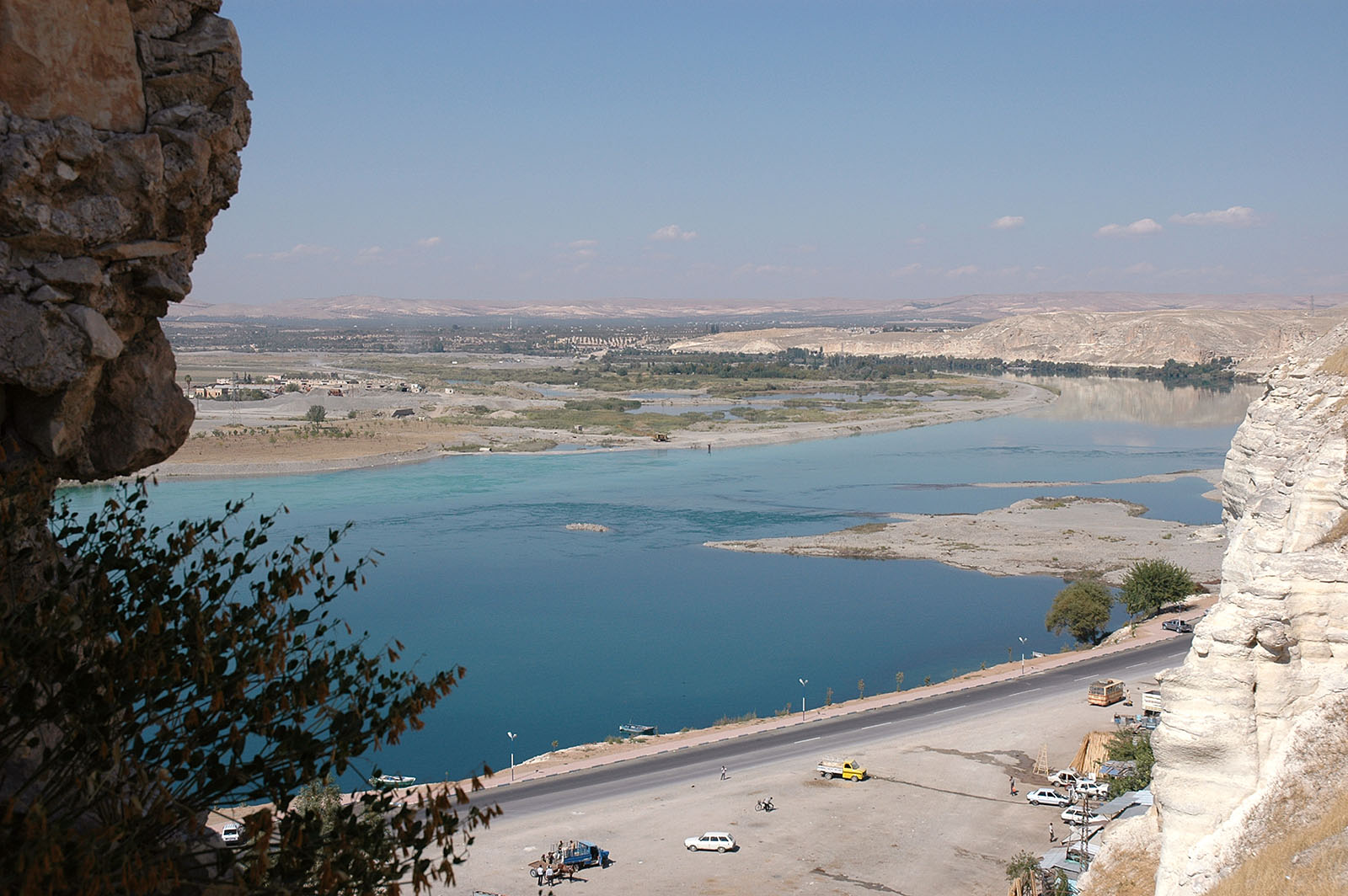
 A view of Birecik | |
 Birecik | |
| Coordinates: 37°01′30″N 37°58′37″E | |
| Country | |
| Province | Şanlıurfa |
| Government | |
| • Mayor | Mehmet Faruk Pınarbaşı (AKP) |
| • District Governor | Ozan Balcı |
| Area | |
| • District | 789.72 km2 (304.91 sq mi) |
| Elevation | 450 m (1,480 ft) |
| Population (2012)[2] | |
| • Urban | 48,706 |
| • District | 91,605 |
| • District density | 120/km2 (300/sq mi) |
| Website | www.birecik.bel.tr |
Built on a limestone cliff 400 ft. high on the left/east bank of the Euphrates, "at the upper part of a reach of that river, which runs nearly north-south, and just below a sharp bend in the stream, where it follows that course after coming from a long reach flowing more from the west".[5]
Archaeology
Birecik Dam Cemetery is an Early Bronze Age cemetery near Birecik. It was used extensively for about 500 years at the beginning of the third millennium BC. More than 300 graves were excavated here in 1997 and 1998. The site was discovered during the building of the Birecik Dam as part of the GAP project.
The cemetery was used between 3100-2600 BC.[6]
History
Ancient city
The 1911 Encyclopædia Britannica identified Birecik with ancient Apamea[7] or its suburb Seleucia[8] and described it as opposite Zeugma, with which it was connected by a bridge of boats. At the same time, it added that "the place seems to have had a pre-Seleucid existence as Birtha, a name which revived under Roman rule".[7] Later discoveries have shown that the identification with Apamea and its Zeugma (the word zeugma meant junction and referred to a junction of roads at a point where a pontoon bridge crossed a river)[9] is false: Bali, some 17 kilometres upstream is now seen as the site of Zeugma, and there may have been no bridge of boats at Birtha/Birecik until the crossings at Zeugma and at Tell-Ahmar (further down) lost popularity.[10] These, rather than the crossing at Birecik/Birtha may therefore be what the 1911 publication said "was used from time immemorial in the passage from North Syria to Haran (Charrae), Edessa and North Mesopotamia, and was second in importance only to that at Thapsacus, by which crossed the route to Babylon and South Mesopotamia."[7]
The placing of Apamea-Zeugma further upstream and the identification of Birecik with Roman Birtha was already stated in the American Journal of Archaeology in 1917;[11] and William Smith's Dictionary of Greek and Roman Geography (1854) clearly identified Birtha with Birecik, although at another point it seems to confuse it with "the Zeugma of Commagene",[5] the province on the right/west bank of the river.[5]
The name "Birtha" is found in no ancient Greek or Roman writer, although Bithra (Greek: Βίθρα) (probably meant for "Birtha")[12] appears in the account by Zosimus of the invasion of Mesopotamia by Roman Emperor Julian in AD 363.[5][7]
The Greeks at one stage called what is now Birecik by the name Macedonopolis (anglicized also as Makedonoupolis). The city represented by bishops at the First Council of Nicaea and the Council of Chalcedon is called by this name in Latin and Greek records, but Birtha in Syriac texts. A 6 AD inscription in Syriac found at Birecik contains an epitaph of Zarbian, "commander of Birtha".[10][13][14]


Timur Leng destroyed the town in the 14th century.[15]
Ottoman Birecik
| 1520 | 1536 | 1552 | 1570 |
|---|---|---|---|
| 75,000 | 180,000 | 180,000 | 200,000 |
Birecik became part of the Ottoman Empire in 1516.[16] It already had a dock at the time that was collecting tolls; the income from the tolls rose dramatically after Suleiman the Magnificent's campaign to conquer Baghdad in 1534 (see table).[16]
Meanwhile, by 1547 the Ottomans had chosen to make Birecik the site of a major imperial shipyard – the empire's first in Mesopotamia.[16] Birecik's geography made it uniquely well-suited to play such a role: by the time it reaches Birecik, the Euphrates has already descended from the Taurus foothills, and the rest of its course consists of gentle slopes and wide valleys.[16] In contrast, the Tigris has a steeper gradient at the same latitude, hindering navigation by larger ships.[16] Towns on the upper Tigris like Diyarbakır or Cizre would have therefore been less suitable for a large naval base compared to Birecik.[16] At the same time, Birecik has a wetter climate than settlements further downstream because it's closer to the Mediterranean coast in Syria, and the mountain regions nearby are able to support large mixed-growth forests to supply timber for shipbuilding.[16] The city of Basra, despite having the advantage of being much further downstream and closer to the Persian Gulf, has a drier climate and therefore lacked a consistent supply of wood.[16] The Portuguese explorer Pedro Teixeira noted this problem when he visited Basra in 1604: since importing timber was costly, locally-built ships were small and expensive.[16] Although Basra did also become an Ottoman shipyard later on, Birecik had none of these disadvantages and remained the primary Ottoman shipyard in Mesopotamia.[16]
The first reference to the Ottoman shipyard at Birecik is in June 1547, when an Arab merchant from Basra named Hajji Fayat reported to the Portuguese governor in Hormuz about it.[16] Hajji Fayat specifically referred to the abundance of timber as one of the reasons why the "large and well-populated" town of Birecik was such an advantageous shipbuilding location.[16] Around that time, the Birecik shipyard employed 45 tax-exempt workers.[16] The first documented order for ship construction at Birecik dates from July 1552, when the Ottoman Imperial Council commissioned 300 new ships to be built.[16]
In 1559, the Ottomans decided to deploy five new galliots at Basra to counter the presence of Portuguese ships near Ottoman ports, which was causing a decline in customs revenue.[16] From October 1559 until February 1560, the Imperial Council wanted to build the ships at Birecik, but ultimately the vizier Sokullu Mehmed Pasha decided to send the materials to Basra instead and assemble the galliots there.[16] The governor in Basra received the materials that summer.[16] Later, as part of an ultimately unsuccessful attempt to reconquer Baghdad in 1629, the Ottoman vizier Hüsrev Pasha ordered 100 new ships to be built at Birecik.[16]
Modern history
Birecik was the scene of an unusually cruel massacre and persecution of Armenians in 1895.[7]
Birecik Dam and hydroelectric power plant, part of the Southeastern Anatolia Project, is situated within the district. The Roman city of Zeugma is now drowned in the reservoir behind the dam. Zeugma's famous mosaics, including the 'river god', have been taken to Gaziantep Museum, but some rescued remains of Zeugma are exhibited in Birecik. With its rich architectural heritage, Birecik is a member of the Norwich-based European Association of Historic Towns and Regions (EAHTR) [17]
Bishopric
As an episcopal see, Birtha/Birecik was a suffragan of the metropolitan see of Edessa, the capital of the Roman province of Osrhoene. This is attested in a Notitia Episcopatuum of 599,[18] which assigns to it the first place among the suffragans.[15]
The names of three of its bishops are recorded in extant documents. Mareas signed the acts of the First Council of Nicaea in 325 as bishop of Macedonopolis, The chronicle of Michael the Syrian speaks of a Daniel of Birtha at the Council of Chalcedon in 451, while Giovanni Domenico Mansi calls him bishop of Macedonopolis. The Chronicle of Joshua the Stylite tells of a Bishop Sergius of Birtha who was entrusted by the Emperor Anastasius I Dicorus with refortifying the city, something that must have occurred after peace was made with the Persians in 504.[14] The work was completed by Justinian.[15]
No longer a residential bishopric, Birtha is today listed by the Catholic Church as a titular see.[19]
Demographics
Unlike much of Şanlıurfa Province, the Birecik used to be more Turkish-dominated. Likewise, the native culture and Turkish dialect spoken by the Turks of Birecik is more similar to that of Gaziantep. In fact, a portion of Birecik feels more attached to Gaziantep than the rest of Şanlıurfa to the point that in 2018, Halfeti and Birecik were requested to become a part of Gaziantep Province.[20] In 1918, Woodrow Wilson, the American president at the time, requested information on the ethnic demographics of the region. Through an urgent request from the Ministry of the Interior, in late 1918, the mutasarrifate of Urfa reported that there were roughly 26 thousand Turks, 2 thousand Kurds, 5 hundred Armenians in the kaza of Birecik, totaling to approximately 28.5 thousand people.[21] Much of the Turkish population in the town and nearby villages migrated to cities to the west, especially Gaziantep and Istanbul, and gradually, the district and the town became half Turkish and half Kurdish with Kurds having a slight majority.[22]
Gallery


See also
- Birecik Bridge
- Birecik Dam
References
- "Area of regions (including lakes), km²". Regional Statistics Database. Turkish Statistical Institute. 2002. Retrieved 2013-03-05.
- "Population of province/district centers and towns/villages by districts - 2012". Address Based Population Registration System (ABPRS) Database. Turkish Statistical Institute. Retrieved 2013-02-27.
- İbrahim Sediyani (2009). Adını arayan coğrafya. Özedönüş Yayınları. p. 187. ISBN 9786054296002.
- Minasyan, Mihran. "Antep-Fotoğrafçılar". houshamadyan. Retrieved 1 December 2021.
- William Smith, Dictionary of Greek and Roman Geography (1854)
- Sertok, K. and Ergeç, R. 1999. A New Early Bronze Age Cemetery: Excavation near the Birecik Dam, Southeastern Turkey. Preliminary Report (1997-98) Anatolica 25: 87-107
- One or more of the preceding sentences incorporates text from a publication now in the public domain: Chisholm, Hugh, ed. (1911). "Birejik". Encyclopædia Britannica. Vol. 3 (11th ed.). Cambridge University Press. p. 979.
- One or more of the preceding sentences incorporates text from a publication now in the public domain: Chisholm, Hugh, ed. (1911). "Seleucia". Encyclopædia Britannica. Vol. 21 (11th ed.). Cambridge University Press. p. 603.
- The Syrian Desert, Christina Phelps Grant, (Routledge 2013 ISBN 978-1-13619271-5), p. 41, footnote
- Christina Phelps Grant, The Syrian Desert (Routledge 2013 ISBN 978-1-13619271-5), p. 165, footnote
- American Journal of Archaeology, 1917, p. 453
- Glen Warren Bowersock, Julian the Apostate (Harvard University Press 1997 ISBN 978-0-67448882-3), p. 112
- Getzel M. Cohen, The Hellenistic Settlements in the East from Armenia and Mesopotamia to Bactria and India (University of California Press 2013 ISBN 978-0-52095356-7), pp. 81–82
- G. Levencq, v. Birtha in Dictionnaire d'Histoire et de Géographie ecclésiastiques, vol. VIII, Paris 1935, coll. 1538-1539
- Louis Petit, "Birtha" in Catholic Encyclopedia (New York 1907)
- Husain, Faisal H. (2021). Rivers of the Sultan: The Tigris and Euphrates in the Ottoman Empire. Oxford University Press. pp. 40–8. ISBN 978-0-19-754729-8. Retrieved 19 March 2022.
- "Archived copy". Archived from the original on 2008-09-10. Retrieved 2006-05-13.
{{cite web}}: CS1 maint: archived copy as title (link) - Siméon Vailhé in Échos d'Orient 1907, p. 94 and p. 145
- Annuario Pontificio 2013 (Libreria Editrice Vaticana 2013 ISBN 978-88-209-9070-1), p. 850
- "'Birecik ve Halfeti, Gaziantep'e bağlansın' talebi Şanlıurfa'yı karıştırdı". Hürriyet.com.tr. Retrieved 7 June 2022.
- Aslan, Ahmet. "URFA'DA ASAYİŞ VE GÜVENLİK (1913-1918)" (PDF). İstanbul Üniversitesi. Retrieved 7 June 2022.
- Nişanyan, Sevan. "Birecik". NişanyanYeradları. Retrieved 8 June 2022.
External links
Birecik in Şanlıurfa Province of Turkey | |||||||||||||||||||||||||||
|---|---|---|---|---|---|---|---|---|---|---|---|---|---|---|---|---|---|---|---|---|---|---|---|---|---|---|---|
| Districts |   | ||||||||||||||||||||||||||
|
Metropolitan municipalities are bolded. | |||||||||||||||||||||||||||
Authority control | |
|---|---|
| General | |
| National libraries | |
| Other |
|
На других языках
[de] Birecik
Vorlage:Infobox Ort in der Türkei/Wartung/EinwohnerOrtFehlt- [en] Birecik
[ru] Биреджик
Биреджик (тур. Birecik) — город и район на западе провинции Шанлыурфа (Турция) на реке Евфрат.Другой контент может иметь иную лицензию. Перед использованием материалов сайта WikiSort.org внимательно изучите правила лицензирования конкретных элементов наполнения сайта.
WikiSort.org - проект по пересортировке и дополнению контента Википедии