world.wikisort.org - Netherlands
Woubrugge is a village in the Dutch province of South Holland. It is located about 10 km east of the city of Leiden, in the municipality of Kaag en Braassem.
Woubrugge | |
|---|---|
Village | |
 View on Woubrugge | |
 Woubrugge Location in the province of South Holland in the Netherlands  Woubrugge Location in the Netherlands | |
| Coordinates: 52°10′N 4°38′E | |
| Country | Netherlands |
| Province | South Holland |
| Municipality | Kaag en Braassem |
| Area | |
| • Total | 1.09 km2 (0.42 sq mi) |
| Elevation | −1.8 m (−5.9 ft) |
| Population (2021)[1] | |
| • Total | 2,970 |
| • Density | 2,700/km2 (7,100/sq mi) |
| Time zone | UTC+1 (CET) |
| • Summer (DST) | UTC+2 (CEST) |
| Postal code | 2481[1] |
| Dialing code | 0172 |
| Major roads | N446 N207 |
History
The village was first mentioned in 1493 as Woubregge, and means "bridge over the Woudwetering". The Woutbroeke mentioned in 1252 is a different settlement.[3] Woubrugge started as a peat excavation settlement, but turned into a linear agricultural settlement along the Woudwetering.[4]
The Dutch Reformed church is a pseudo cruciform church between 1652 and 1653 and designed by Pieter Post. It has a twelve sided ridge turret with needle spire.[4]
Woubrugge was home to 932 people in 1840.[5] It was a separate municipality until 1991, when it became part of Jacobswoude.[6] In 2009, it became part of the municipality of Kaag en Braassem.[5]
Notable residents
- Hans Vijlbrief, born 17 August 1963, lives in Woubrugge, civil servant, economist, and State Secretary for Finance
- Henk Angenent, born 1 November 1967, lives in Woubrugge, former professional ice skater.
- Margot Boer, born 7 August 1985, professional ice skater, winner of two bronze medals on 2014 Winter Olympics.
Gallery
 Church of Woubrugge
 Canal view
 Houses in Woubrugge
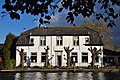 House in Woubrugge


References
- "Kerncijfers wijken en buurten 2021". Central Bureau of Statistics. Retrieved 4 May 2022.
two entries
- "Postcodetool for 2481AA". Actueel Hoogtebestand Nederland (in Dutch). Het Waterschapshuis. Retrieved 4 May 2022.
- "Woubrugge - (geografische naam)". Etymologiebank (in Dutch). Retrieved 4 May 2022.
- Ronald Stenvert & Sabine Broekhoven (2004). "Strijen" (in Dutch). Zwolle: Waanders. ISBN 90 400 9034 3. Retrieved 4 May 2022.
- "Woubrugge". Plaatsengids (in Dutch). Retrieved 4 May 2022.
- Ad van der Meer and Onno Boonstra, Repertorium van Nederlandse gemeenten, KNAW, 2011.
This South Holland location article is a stub. You can help Wikipedia by expanding it. |
На других языках
[de] Woubrugge
Woubrugge ist ein Ort in der Gemeinde Jacobswoude in der niederländischen Provinz Zuid-Holland. Woubrugge liegt nordwestlich der Stadt Alphen aan den Rijn.- [en] Woubrugge
Другой контент может иметь иную лицензию. Перед использованием материалов сайта WikiSort.org внимательно изучите правила лицензирования конкретных элементов наполнения сайта.
WikiSort.org - проект по пересортировке и дополнению контента Википедии