world.wikisort.org - Netherlands
Leimuiden is a Dutch village in the South Holland municipality of Kaag en Braassem. Leimuiden is located between the Braassemermeer, the Westeinderplassen and the Ringvaart. Leimuiden is located north of Alphen aan den Rijn.
Leimuiden | |
|---|---|
Village | |
 View on Leimuiden | |
 Leimuiden Location in the province of South Holland in the Netherlands  Leimuiden Location in the Netherlands | |
| Coordinates: 52°13′N 4°40′E | |
| Country | Netherlands |
| Province | South Holland |
| Municipality | Kaag en Braassem |
| Area | |
| • Total | 12.26 km2 (4.73 sq mi) |
| Elevation | −0.5 m (−1.6 ft) |
| Population (2021)[1] | |
| • Total | 4,500 |
| • Density | 370/km2 (950/sq mi) |
| Time zone | UTC+1 (CET) |
| • Summer (DST) | UTC+2 (CEST) |
| Postal code | 2451[1] |
| Dialing code | 0172 |
| Major roads | N207 |
History
The village was first mentioned in the first half of the 11th century as Letthemutha, and means "mouth of the Leiden river".[3] Leimuiden is a peat excavation settlement from the Middle Ages.[4]
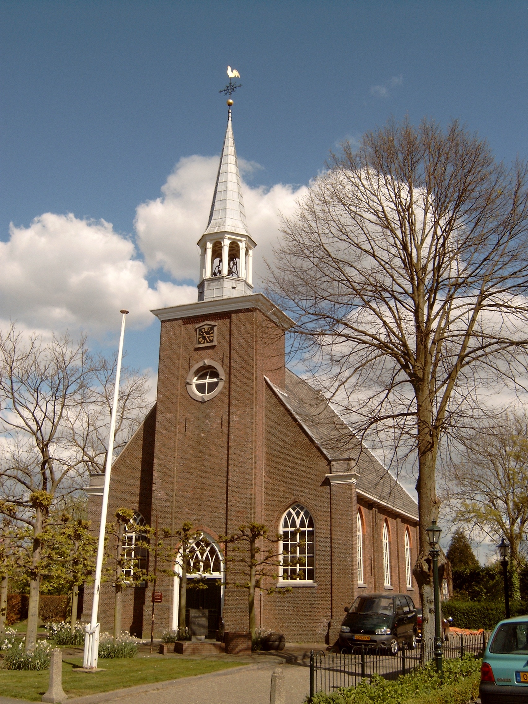
The Dutch Reformed church is an aisleless church with build-in tower with needle spire. It was built in 1805 as a replacement of the 1555 church. It was restored between 1963 and 1965, and a consistory was added.[4]
Leimuiden was home to 551 people in 1840.[5] It was a separate municipality until 1991, when it became part of Jacobswoude. The village was part of North Holland until 1865.[6] The village was bombed on 2 August 1940 by the Royal Air Force, because the Germans had established a local headquarters in Leimuiden.[5] In 2009, it became part of the municipality of Kaag en Braassem.[5]
The highest level surface of Leimuiden is located on provincial road N207, approximately level with NAP. The village "on the hill" (Noordeinde-Dokter Stapenséastraat-Burgemeester Bakhuizenlaan-Dorpsstraat) is approximately 0.5 meters below NAP. The depoldered areas are between 4.0 and 4.5 meters below NAP.
Gallery
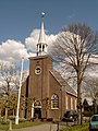 Leimuiden, church
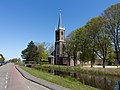 Leimuiden, church: de Johannes de Doperkerk

References
- "Kerncijfers wijken en buurten 2021". Central Bureau of Statistics. Retrieved 4 May 2022.
- "Postcodetool for 2451AA". Actueel Hoogtebestand Nederland (in Dutch). Het Waterschapshuis. Retrieved 4 May 2022.
- "Leimuiden - (geografische naam)". Etymologiebank (in Dutch). Retrieved 4 May 2022.
- Ronald Stenvert & Sabine Broekhoven (2004). "Leimuiden" (in Dutch). Zwolle: Waanders. ISBN 90 400 9034 3. Retrieved 4 May 2022.
- "Leimuiden". Plaatsengids (in Dutch). Retrieved 4 May 2022.
- Ad van der Meer and Onno Boonstra, Repertorium van Nederlandse gemeenten, KNAW, 2011.
| Authority control |
|
|---|
На других языках
[de] Leimuiden
Leimuiden ist ein Dorf in der niederländischen Provinz Südholland. Seit dem 1. Januar 2009 gehört Leimuiden zur Gemeinde Kaag en Braassem, davor zur Gemeinde Jacobswoude. Leimuiden liegt an der Landstraße (niederländisch Provinciale weg) N207 nördlich der Stadt Alphen aan den Rijn.- [en] Leimuiden
Другой контент может иметь иную лицензию. Перед использованием материалов сайта WikiSort.org внимательно изучите правила лицензирования конкретных элементов наполнения сайта.
WikiSort.org - проект по пересортировке и дополнению контента Википедии