world.wikisort.org - Netherlands
Kaag is a village in the Dutch province of South Holland. It is a part of the municipality of Kaag en Braassem, and lies about 8 kilometres (5.0 miles) northeast of Leiden.
Kaag | |
|---|---|
Village | |
 | |
 Kaag Location in the province of South Holland in the Netherlands  Kaag Location in the Netherlands | |
| Coordinates: 52°13′N 4°33′E | |
| Country | Netherlands |
| Province | South Holland |
| Municipality | Kaag en Braassem |
| Area | |
| • Total | 1.32 km2 (0.51 sq mi) |
| Elevation | −0.9 m (−3.0 ft) |
| Population (2021)[1] | |
| • Total | 465 |
| • Density | 350/km2 (910/sq mi) |
| Time zone | UTC+1 (CET) |
| • Summer (DST) | UTC+2 (CEST) |
| Postal code | 2159[1] |
| Dialing code | 0252 |
The village of Kaag lies on an island called Kagereiland in the Kager Lakes (Kagerplassen). To reach De Kaag, a ferry can be taken from Buitenkaag all year or Zevenhuizen in the summer months.
De Kaag is also part of an area called the Duin- en Bollenstreek ("Dune and Bulb Region").
The village is conventionally referred to as "De Kaag", but the name reported on both English and Dutch maps is just "Kaag".
History
The village is first mentioned in 1308, called "Kaghe", meaning "lands outside the dike".[3][4] Kaag developed as a dike village on the island Kagereiland in the Kagermeer.[4] Until the end of the 16th century De Kaag was the largest settlement in the Alkemade area.[5] The island received its current shape between the Haarlemmermeer was poldered in 1852.[4]
Gallery
 Church in the village.
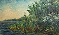 Historic view of Kagerplassen by Marinus Heijnes
 Farm on Kaag
 Ferry between Haarlemmermeer (left) and Kaag (right)


References
- "Kerncijfers wijken en buurten 2021". Central Bureau of Statistics. Retrieved 4 May 2022.
- "Postcodetool for 2159BA". Actueel Hoogtebestand Nederland (in Dutch). Het Waterschapshuis. Retrieved 4 May 2022.
- "Kaag - (geografische naam)". Etymologiebank (in Dutch). Retrieved 4 May 2022.
- Ronald Stenvert & Sabine Broekhoven (2004). "Kaag" (in Dutch). Zwolle: Waanders. ISBN 90 400 9034 3. Retrieved 4 May 2022.
- "Kaag". Plaatsengids (in Dutch). Retrieved 4 May 2022.
| Authority control |
|
|---|
This South Holland location article is a stub. You can help Wikipedia by expanding it. |
На других языках
[de] Kaag (Kaag en Braassem)
Kaag, auch De Kaag, ist ein Ort (Dorf) im Kaagerpolder in der niederländischen Provinz Südholland. Verwaltungsmäßig gehört der Ort zur Gemeinde Kaag en Braassem. Das Dorf liegt etwa 8 km nordöstlich von Leiden auf dem Kaagerpolder im See Kagerplassen, der früher vor der Trockenlegung mit dem Haarlemmermeer direkt verbunden war. Im Jahr 2020 hatte Kaag 465 Einwohner.[1] Die Insel ist nur mit der Fähre von Buitenkaag oder Oud Ade aus zu erreichen.[2]- [en] Kaag
Другой контент может иметь иную лицензию. Перед использованием материалов сайта WikiSort.org внимательно изучите правила лицензирования конкретных элементов наполнения сайта.
WikiSort.org - проект по пересортировке и дополнению контента Википедии