world.wikisort.org - Iran
Mazandaran Province (![]() pronunciation (help·info), Persian: استان مازندران, romanized: Ostân-e Mâzandarân; Mazanderani: مازرون, romanized: Mâzerun), is an Iranian province located along the southern coast of the Caspian Sea and in the adjacent Central Alborz mountain range, in central-northern Iran.[6]
pronunciation (help·info), Persian: استان مازندران, romanized: Ostân-e Mâzandarân; Mazanderani: مازرون, romanized: Mâzerun), is an Iranian province located along the southern coast of the Caspian Sea and in the adjacent Central Alborz mountain range, in central-northern Iran.[6]
Mâzandarân Province
استان مازندران | |
|---|---|
Province | |
 Counties of Mazandaran Province | |
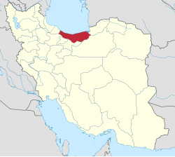 Location of Mazandaran Province in Iran | |
| Coordinates: _type:adm1st 36.5656°N 53.0588°E | |
| Country | Iran |
| Region | Region 1[1] |
| Capital | Sari |
| Counties | 20 |
| Government | |
| • Governor-general | Mahmoud Hosseinipour |
| Area | |
| • Total | 23,833 km2 (9,202 sq mi) |
| Population (2011)[3] | |
| • Total | 3,073,943 |
| • Density | 130/km2 (330/sq mi) |
| Time zone | UTC+03:30 (IRST) |
| • Summer (DST) | UTC+04:30 (IRST) |
| ISO 3166 code | IR-02 |
| Main language(s) | Mazandarani(Tabari)[4] |
| HDI (2017) | 0.845[5] very high · 4th |


Mazandaran Province is one of the most densely populated provinces in Iran[7] and has diverse natural resources, notably large reservoirs of oil and natural gas.[8] The province's four largest counties are Sari, Amol, Nur, and Tonekabon.[9] It was founded in 1937.[10]
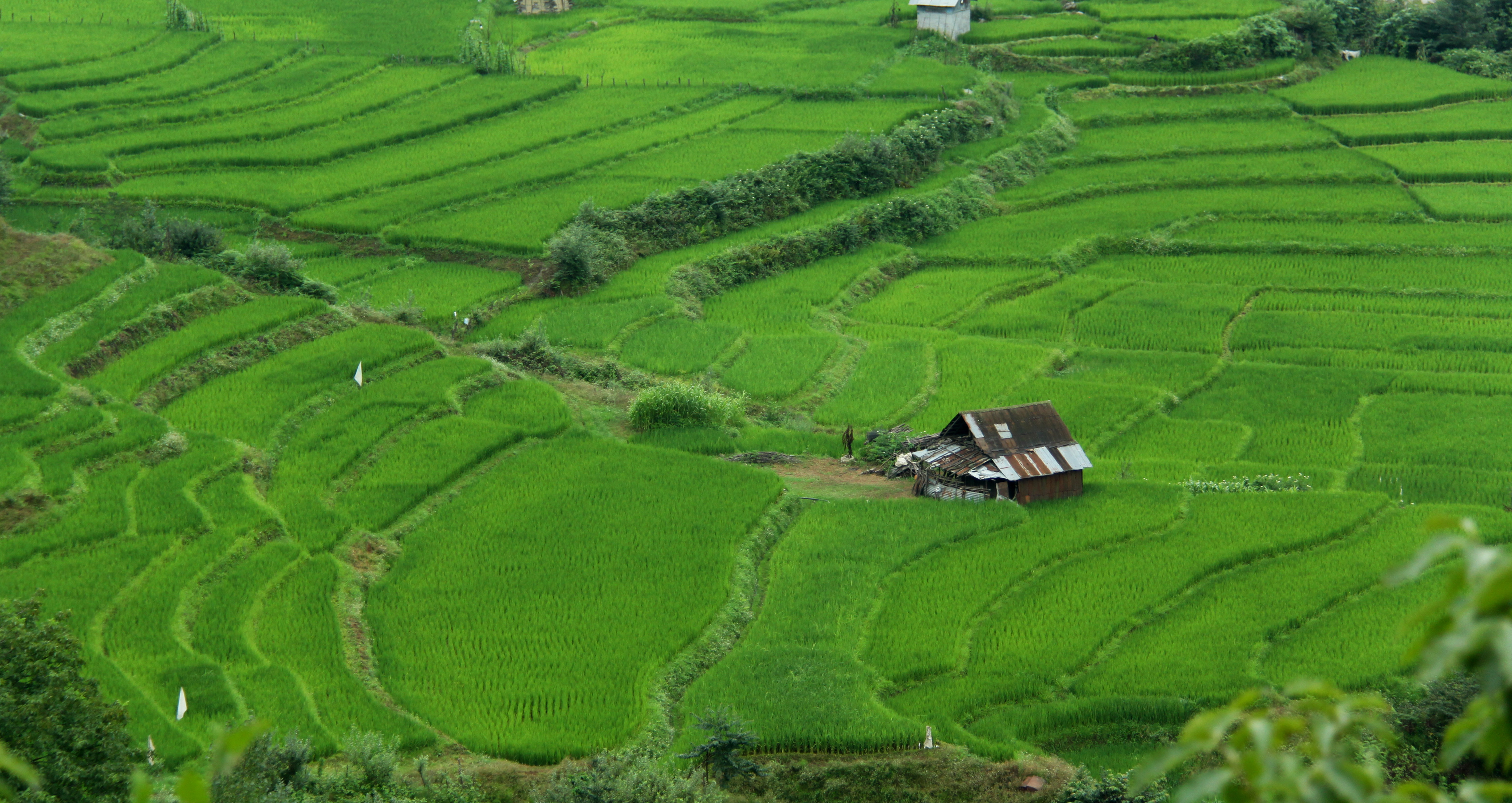
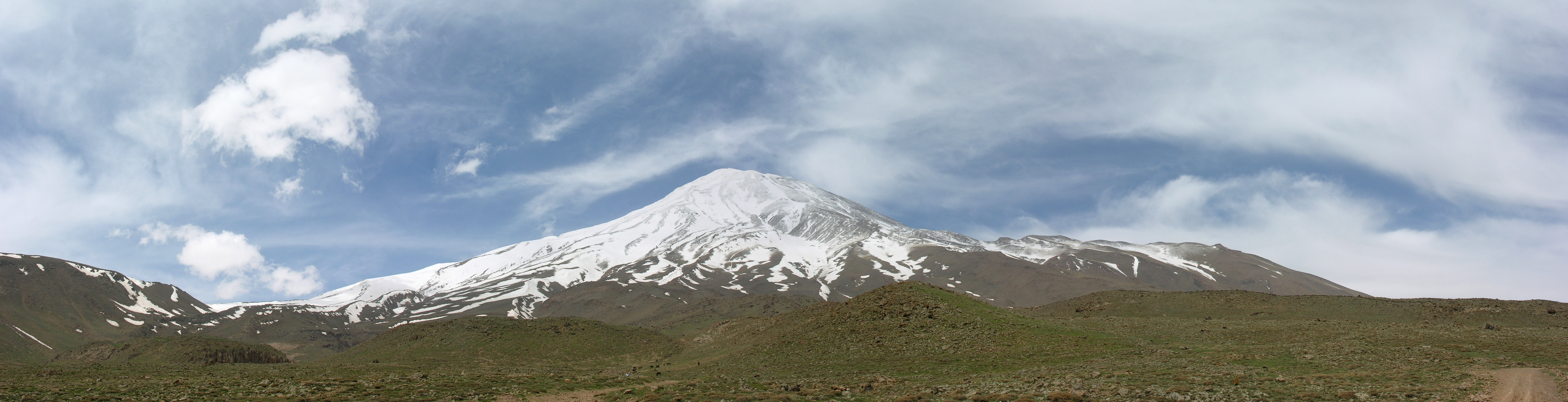
The diverse natural habitats of the province include plains, prairies, forests and rainforest[11] stretching from the sandy beaches of the Caspian Sea to the rugged and snowcapped Alborz sierra,[12] including Mount Damavand, one of the highest peaks and volcanoes in Asia.[13]
Mazandaran is a major producer of farmed fish,[14] and aquaculture provides an important economic addition to traditional dominance of agriculture.[15] Another important contributor to the economy is the tourism industry, as people from all of Iran enjoy visiting the area.[16] Mazandaran is also a fast-growing centre for biotechnology.[8] Mazandaran is the most proud province of Iran in the Olympics. Mazandaran is the most literate province in the country, and according to the available statistics, it has twofold the national average of elites, many of whom are elite in several scientific fields. Every year Mazandaran ranks at the highest level of life expectancy for men and women in the country. Mazandaran is one of the industrial provinces of the country and has the first rank for Tourism in Iran.
Etymology
Literally "the gate or the valley of the giants" from مازن (mâzan) + در (dar) + ـان (ân), from Avesta (Avestan: 𐬨𐬀𐬰𐬀𐬌𐬥𐬌𐬌𐬀, romanized: mazainiia, lit. 'giant'). The name has been used in Shahnameh to refer to a land inhabited by divs or (daevas) and sorcerers and is difficult to conquer. In Mazandaran, there are places named Div Asiyab, Div Cheshmeh, Div kela, Div hamam, etc.
Administrative divisions
The province covers an area of 23,842 km2.[17] Sari is the capital city of the province.
Mazandaran is divided into 22 counties (shahrestan in Persian). All the shahrestans are named after their administrative center, except Savadkooh.

History

Human habitation in the area dates back at least 75,000 years.[18] Recent excavations in Gohar Tape in Rostamkola provide proof that the area has been urbanized for more than 5,000 years, and the area is considered one of the most important historical sites of Iran.[19] It has played an important role in cultural and urban development of the region.[20] Mazandaran is one of the oldest areas without a significant nomadic heritage, thus culturally sedentary. Indigenous peoples of the region include the ethnic Mazanderanis,[21] who speak an Iranian language which most closely resembles Gilaki and Sangiseri language, but also has phono-typical similarities to several Caucasian languages, reflecting the history of the region and its peoples. In the early 20th century, Reza Shah connected northern Elbourz to the southern slopes by constructing seven new roads and railways, the provinces of Mazandaran and Gilan became known as Shomal by all Iranians (meaning "the North" in Persian). Mazandaran is a Caspian province in the north of Iran.[22] Located on the southern coast of the Caspian Sea, it is bordered clockwise by Russia (across the sea), Golestan, Semnan, Tehran, Alborz, Qazvin, and Gilan provinces. Sari is the largest city and the capital of Mazandaran province.
Mazandaran Province was made part of the First Region upon the division of the provinces into five regions solely for coordination and development purposes on June 22, 2014.[1]


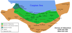
Pre-Islamic history
| Part of a series on the History of Tabaristan |
|---|
 |
|
|
Before the arrival of the Iranian-speakers to Iran, native people of this area were subsistence hunters and cattle herders. Archaeological studies in caves belt and Hutu man in Behshahr in the Mazandaran date to ca. 9500 BCE. The Amard were a tribe living along the mountainous region bordering the Caspian Sea, including current day Amol. Tapuri[23] were a tribe in the Medes south of the Caspian Sea mentioned by Ptolemy and Arrian.[24] Ctesias refers to the land of Tapuri between the two lands of Cadusii and Hyrcania.[25]

The territory known as Mazandaran has changed hands among various dynasties from early in its history. There are several fortresses remaining from the Parthian Empire and Sasanian Empire, and many older cemeteries scattered throughout the province. During this era, Mazandaran was part of Hyrcania, which was one of the important provinces. In 662 CE, ten years after the death of Yazdegerd III the last Sasanian emperor, a large Muslim army under the command of Hassan ibn Ali invaded Tabarestan.
With the advent of the Sasanian Empire, the King of Mazandaran (Tabaristan and Padashkhwargar) was Gushnasp,[26] whose ancestors had reigned in the area (under the Parthian empire) since the time of Alexander the Great. In 529–536, Mazandaran was ruled by the Sasanian prince Kawus, son of Kawadh.[26] Anushirawan, the Sasanian king, defeated Zarmihr, who claimed his ancestry from the legendary blacksmith Kaveh.[26] This dynasty ruled the area till 645 AD, when Gil Gilanshah (a descendant of the Sasanian king Jamasp and a son of Piruz) joined Mazandaran to Gilan.[26]
In 651 the Sasanid Empire fell, and all of the Sasanid domains gradually came under Arab control, except for the Caspian region of Iran (among which Tabaristan).
Islamic history
Tabaristan maintained an existence independent of the Umayyad Caliphate which supplanted the Sasanian Empire in the early seventh century, with independent Zoroastrian houses like the Bavand and Karen fighting an effective guerilla warfare against Islam. A short-lived Alid Shiite state collapsed before the subsequent take-over by the Ziyarid princes. Mazandaran, unlike much of the rest of the Iranian Plateau maintained a Zoroastrian majority until the 12th century, thanks to its isolation and hardy population which fought against the Caliph's armies for centuries. During the post-Islamic period the local dynasties fell into three classes: local families of pre-Islamic origin; the ʿAlid sayyid; and local families of secondary importance.[26]
The Bawandids, who claimed descent from Kawus, provided three dynasties.[26] The first dynasty (665–1007) was overthrown on the conquest of Tabaristan by the Ziyarid Kabus b. Wushmgir.[26] The second dynasty reigned from 1073 to 1210, when Mazandaran was conquered by 'Ala al-Din Muhammad Khwarzamshah.[26] The third ruled from 1237 to 1349 as vassals of the Mongols.[26] The last representative of the Bawandids was killed by Afrasiyab Chulawi.[26]

The Karinids claimed descent from Karin, brother of Zarmihr who was the pre-Islamic ruler under the Sasanians.[26] Their last representative Mazyar was put to death in 839.[26]
The Paduspanids claimed descent from the Dabuyids of the north.[26] They came to prominence around 660 and during the rule of the ʿAlids were their vassals. Later, they were vassals of the Buyids and Bawandids, who deposed them in 1190.[26] The dynasty, restored in 1209–10, survived until the time of Timur; the branch, claiming descent from Kawus the son of Kayumarth reigned until 1567 and the other, that of Iskandar the son of Kayumarth, until 1574.[26]
In the 9th-11th century AD, there were repetitively military raids undertaken by the Rus' between 864 and 1041 on the Caspian Sea shores of Iran, Azerbaijan, and Dagestan as part of the Caspian expeditions of the Rus'.[27] Initially, the Rus' appeared in Serkland in the 9th century traveling as merchants along the Volga trade route, selling furs, honey, and slaves. The first small-scale raids took place in the late 9th and early 10th century. The Rus' undertook the first large-scale expedition in 913; having arrived on 500 ships, they pillaged the westernmost parts of Gorgan as well as Mazandaran and Gilan, taking slaves and goods.
In the Safavid era Mazandaran was settled by very large numbers of Georgians, Circassians, Armenians, and other Peoples of the Caucasus, whose descendants still live or linger across Mazandaran. Towns, villages and neighbourhoods in Mazandaran still bear the name "Gorji" (i.e., Georgian) in them, although most of the large amounts of Georgians, Armenians, and Circassians are already assimilated into the mainstream Mazandaranis. The history of Georgian settlement is described by Iskandar Beg Munshi, the author of the 17th century Tarikh-e Alam-Ara-ye Abbasi, and both the Circassian and Georgian settlements by Pietro Della Valle, among other authors.[28]
Before the reign of Nader Shah, the province was briefly occupied by the Russian army in the aftermath of the Russo-Persian War (1722–23) and returned to Persia in 1735. Following the outcomes of the Russo-Persian War (1804–13) and the Russo-Persian War (1826–28) northern Iran, especially Mazandaran and Gilan, as well as, to a certain extent, Tehran, fell under a growing Russian sphere of influence.[citation needed]
Modern era
During the reign of Fath-Ali Shah Qajar, the verdant region of Mazandaran was paid due attention as a recreational area. Tapuria remained independent until 1596, when Shah Abbas I, Mazandarani on his mother's side, incorporated Mazandaran into his Safavid empire, forcing many Armenians Circassians, Georgians, to settle in Mazandaran. Pietro della Valle, who visited a town near Firuzkuh in Mazandaran, noted that Mazandarani women never wore the veil and didn't hesitate to talk to foreigners. He also noted the extremely large amount of Circassians and Georgians in the region, and that he had never encountered people with as much civility as the Mazandaranis.
Today, Persia proper, Fars, Mazanderan on the Caspian Sea and many other lands of this empire are all full of Georgian and Circassian inhabitants. Most of them remain Christian to this day, but in a very crude manner, since they have neither priest nor minister to tend them.
— Pietro della Valle
After the Safavid period, the Qajars began to campaign south from Mazandaran with Agha Mohammad Khan who already incorporated Mazandaran into his empire in 1782. On 21 March 1782, Agha Mohammad Shah proclaimed Sari as his imperial capital. Mazandaran was the site of local wars in those years, which led to the transfer of the capital from Sari to Tehran by Fath Ali Shah. In Modern era at Mazandaran make new house and bridge in Amol and Sari. In along the beach and in the forest built Villa and modern settlements.
The top provincial official referred to the existence of three international airports and three major sea ports in the province and the visit of millions of Iranian and foreign tourists to Mazandaran, including health tourists.
Geography and population
Geography
Mazandaran is located on the southern coast of the Caspian Sea. It is bordered clockwise by Golestan, Semnan and Tehran provinces.[29] This province also borders Qazvin and Gilan to the west. Mazandaran province is geographically divided into two parts: the coastal plains, and the mountainous areas. The Alborz Mountain Range surrounds the coastal strip and the plains abutting the Caspian Sea like a huge wall. Due to the prevailing sea breeze and local winds of the southern and eastern coasts of the Caspian Sea, sandy hills are formed, causing the appearance of a low natural barrier between the sea and plain. There is often snowfall in the Alborz regions, which run parallel to the Caspian Sea's southern coast, dividing the province into many isolated valleys. The province enjoys a moderate, subtropical climate with an average temperature of 25 °C in summer and about 8 °C in winter. Although snow may fall heavily in the mountains in winter, it rarely falls at sea level.
 Caspian Sea coast at Noor
 Shalizar (Rice Fields)
 Pasturage
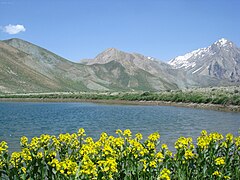 Aseman kuh (peak in Alborz range) viewed from Kahrizak Dare (lake), Lar.
 Kafer Keli rock-cut dwellings, Larijan, Mount Damavand
 Dyvasyab Mineral springs, Dasht-e Lar, Mount Damavand
 Karaj Chalus Road
 Javarom Forest Park
 Damavand Mountain, The West Face, Mazandaran Province, Iran
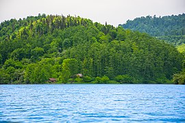 Alborz Dam Lafoor
 Forest in Mazandaran


Ecoregions:
- Caspian Hyrcanian mixed forests
- Elburz Range forest steppe
The total wood production from these forests is estimated at 269,022 cubic metres (9,500,400 cu ft). Golestan National Park and Shastkolateh forest watershed are located in Golestan Province and Mazandaran Province (the total area of the Hyrcanian forest is estimated at 965,000 ha (2,380,000 acres). From these forests, 487,195 ha (1,203,890 acres) are used commercially, 184,000 ha (450,000 acres) are protected and the rest are regarded as forest lands or over-used forests. The total of the forest woods used in this province is estimated at 770,551 cubic metres (27,211,800 cu ft). The Kojoor, Dohezar and Sehezar forest watersheds are located in Mazandaran province. The Elburz Range forest steppe ecoregion is an arid, mountainous 1,000-kilometer arc south of the Caspian Sea, stretching across northern Iran from the Azerbaijan border to near the Turkmenistan border. It covers 63,300 square kilometres (24,400 sq mi) and encompasses the southern and eastern slopes of the Alborz Mountains as well as their summits. The Caspian Hyrcanian mixed forests ecoregion, with its lush green mountainsides and plains that receive moisture from the Caspian Sea, forms this ecoregion's northern border. The vast Central Persian desert basin ecoregion forms its southern border. The Alborz range is composed of a granite core overlain with sedimentary rock including limestones, shales, sandstones, and tuffs. Metamorphic rocks such as schists, marbles, and amphibolite are also widely found.[30] The climate is arid with annual precipitation varying from 150 mm to 500 mm, falling mostly as winter snow.
Environment
The now extinct Caspian tiger and the Caspian horse are two of the animals of Mazandaran province.
The 1971 Ramsar Convention on Wetlands of International Importance especially as Waterfowl Habitat was held in Mazandaran in the city of Ramsar.
Places adjacent to Mazandaran province | ||||||||||||||||
|---|---|---|---|---|---|---|---|---|---|---|---|---|---|---|---|---|
| ||||||||||||||||

Unlike the rest of Iran, Mazanderan is watered by numerous rivers, or mountain torrents, all running from the mountains to the sea. The German traveller Samuel Gottlieb Gmelin, who visited this country in 1771, says that in the space of eight miles, on the road from Resht to Amot, 250 of such streams are to be seen, many of them being so exceedingly broad and deep, that the passage across is sometimes impracticable for weeks together.
Climate

Mazandaran province naturally comes under the influence of the geographical latitude, the Alborz mountain range, elevation from sea level, distance from the sea, and the southern barren areas of Turkmenistan, local and regional air currents, and versatile vegetation cover. These conditions result in the climatic division of the province into three types: (1) Moderate Caspian weather with hot, humid summers and mild, humid winters, (2) moderate mountainous weather with long, cold and freezing winters and mild and short summers, and (3) cold mountainous weather with long freezing winters and short cool summers. There is often snowfall during most of the seasons in the latter region, which continues till mid-summer.
The western and central plains of the province, up to the northern foothills of the Alborz Mountain Range, experience the mild climate of the Caspian region. In altitudes of 1,500 to 3,000 meters, a moderate mountainous climate with long, cold winters, and short, mild summers is prevalent. In this region, snow covers parts of the province even into the middle of the warm season. In fact, snow can be observed in this region even in the warmest months of the year.
Demographics
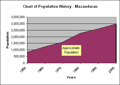
The population of the province has been steadily growing during the last 50 years. The following table shows the approximate province population, excluding the Golestan province, which has separated as an independent province in 1998.
The population is overwhelmingly Mazandarani, with a minority of Gilaks, Azerbaijanis, Georgians, Armenians, Circassians, Turkmen and others.
Mazandarani people have a background in Tabari ethnicity and speak Mazandarni. Their origin goes back to Tapuri people. So their land was called Tapuria, the land of Tapuris. Tapuris were made to migrate to the south coast of the Caspian Sea during the Achaemenid dynasty.[24][31][32]
The native people of Sari, shahi, babol, Amol, Nowshahr, Chalus, and Tonekabon are Mazandarani people and speak the Mazandarani language.[33][34]
The eastern Gīlakī dialect is spoken in the entire valley of the Čālūs river, though some Kurdish tribes were established in the yeylāq of Kojūr and Kalārdašt in the Qajar period.[35]
The Mazandarani inhabit the majority of the province. The closely-related others form the largest minority and are concentrated in Ramsar,[36][37] Tonekabon.[38]
In recent years the region has seen an influx of Iranians from other regions of Iran, many of them attracted by its nature and seaside.
Total population
| Year | 1956 | 1966 | 1976 | 1986 | 1996 | 2006 | 2011 | 2016[3] |
|---|---|---|---|---|---|---|---|---|
| Approximate population | 835,000 | 1,250,000 | 1,596,000 | 2,275,000 | 2,602,000 | 2,922,000 | 3,073,943 | 3,283,582 |
Most Populous Cities
The following sorted table, lists the most populous cities in Mazandaran.
| Rank | City | County | Population |
|---|---|---|---|
| 1 | Sari | Sari | 347,402 |
| 2 | Babol | Babol | 250,217 |
| 3 | Amol | Amol | 238,528 |
| 4 | Qaem Shahr | Qaem Shahr | 204,953 |
| 5 | Behshahr | Behshahr | 94,703 |
| 6 | Chalus | Chalus | 65,196 |
| 7 | Ramsar | Ramsar | 74,179 |
| 8 | Neka | Neka | 60,991 |
| 9 | Babolsar | Babolsar | 59,966 |
| 10 | Tonekabon | Tonekabon | 55,434 |
| 11 | Nowshahr | Nowshahr | 49,403 |
Transportation

Train
The Mazandaran train station is the city's first modern rail station and it dates from the Pahlavi dynasty.
Roads
Mazandaran is connected to Tehran by Haraz road (Amol-Rudehen), Kandovan road (Chalus-Karaj), and Firoozkooh road (Savadkuh).
Airports
Dasht-e Naz Airport, serving the capital Sari, Noshahr Airport, and Ramsar International Airport are the domestic airports that connect the province to the other parts of the country.
Railway
Iran North Railway Dept. | ||||||||||||||||||||||||||||||||||||||||||||||||||||||||||||||||||||||||||||||||||||||||||||||||||||||||||||||||||||||||||||||||||||||||||||||||||||||||||||||||||||||||||||||||||||||||||||||||||||||||||||||||||
|---|---|---|---|---|---|---|---|---|---|---|---|---|---|---|---|---|---|---|---|---|---|---|---|---|---|---|---|---|---|---|---|---|---|---|---|---|---|---|---|---|---|---|---|---|---|---|---|---|---|---|---|---|---|---|---|---|---|---|---|---|---|---|---|---|---|---|---|---|---|---|---|---|---|---|---|---|---|---|---|---|---|---|---|---|---|---|---|---|---|---|---|---|---|---|---|---|---|---|---|---|---|---|---|---|---|---|---|---|---|---|---|---|---|---|---|---|---|---|---|---|---|---|---|---|---|---|---|---|---|---|---|---|---|---|---|---|---|---|---|---|---|---|---|---|---|---|---|---|---|---|---|---|---|---|---|---|---|---|---|---|---|---|---|---|---|---|---|---|---|---|---|---|---|---|---|---|---|---|---|---|---|---|---|---|---|---|---|---|---|---|---|---|---|---|---|---|---|---|---|---|---|---|---|---|---|---|---|---|---|---|
| ||||||||||||||||||||||||||||||||||||||||||||||||||||||||||||||||||||||||||||||||||||||||||||||||||||||||||||||||||||||||||||||||||||||||||||||||||||||||||||||||||||||||||||||||||||||||||||||||||||||||||||||||||
Mazandaran is served by the North Railway Dept. of the Iranian Railways. The department connects the province to Tehran to the south and Gorgan to the east. The cities of Sari, Qaemshahr, and Pol Sefid are major stations of the department. The Trans-Iranian Railway was a major railway building project started in 1927 and completed in 1938, under the direction of the Iranian monarch, Reza Shah, and entirely with indigenous capital. It links the capital Tehran with the Persian Gulf and Caspian Sea.
Language

Mazanderani or Tabari is a Northwestern Iranian language. Various Mazandarani dialects exist which are spoken in Mazandaran province and the neighbor province Golestan such as Mazanderani, and Gorgani and possibly Qadikolahi (Ghadikolahi) and Palani. Today, Mazandaranis also use Persian (Western Persian).[4] The educated can communicate and read Persian well.[39]
Mazandarani people have a background in Tabari ethnicity and speak Mazandarni. Their origin goes back to Tapuri people. So their land was called Tapuria, the land of Tapuris. Tapuris were made to migrate to the south coast of the Caspian Sea during the Achaemenid dynasty.[24][31][32]
The native people of Sari, shahi, babol, Amol, Nowshahr, Chalus, and Tonekabon are Mazandarani people and speak the Mazandarani language.[33][34]
The people residing in Chalus speak Mazanderani language. The dialect of Kalarestaqi[40] is spoken in the west of Chalus and the dialect of Kojuri[41] in the east.
The people residing in Nowshahr speak the Kojuri-dialect of Mazanderani language.[41]
The closely-related Gilaks form the largest minority in Mazandaran. They speak the Gilaki language and are concentrated in Ramsar,[36][37] and Tonekabon.[38] The native people in Ramsar are Gilaks although there are also Mazandarani people living there. They speak the Gilaki language although the style they speak has been influenced by the Mazandarani language, making it slightly different than the Gilaki spoken in Gilan.
The eastern Gīlakī dialect is spoken in the entire valley of the Čālūs river, though some Kurdish tribes were established in the yeylāq of Kojūr and Kalārdašt in the Qajar period.[35]
A dialect of Azeri is spoken in the town of Galoogah.[42]
In literature
In the Persian epic, Shahnameh, Mazandaran is mentioned in two different sections. The first mention is implicit, when Fereydun sets its capital in a city called Tamishe near Amol:
بیاراست گیتی بسان بهشت.................... به جای گیا سرو گلبن بکشت
از آمل گذر سوی تمیشه کرد .............. نشست اندر آن نامور بیشه کرد
And when Manuchehr is returning to Fereydun's capital, Tamisheh in Mazandaran (known as Tabarestan), after his victory over Salm and Tur.[43]
In the second section, a region called Mazandaran is mentioned in the Kai Kavoos era; it is an area which is mostly inhabited by Div (demons). The legendary Iranian Shah Kaykavoos, as well as the Iranian hero Rostam, each take turn to go to Mazandaran in order to battle the demons.
In a verse from Shahnameh, Zal tells Kai Kavoos: "I heard troubling news that the king is planning to go to Mazandaran".
However, this Mazandaran is not considered identical to the modern province of Mazandaran, and is instead a land to the west of Iran. The current province was simply considered a part of Tabaristan; the name Mazandaran is a later development, perhaps based upon local terminology.[44]
In Gaston Leroux's The Phantom of the Opera, one of the characters was formerly the daroga (chief of police) of Mazanderan.
Nowruz
The Tabarian New Year, or Neowrez, occurs in the pintek days of the Tabarian Calendar. In the Mazandarani language of Iran in the Mazanderani calendar, the year is divided into 12 thirty-day months and one pentad of days, often beginning on March 21. Neowrez Khani is one of the strongest and most popular traditions of the Mazanderani people.[citation needed]
Ceremonies and events
Tirgan is a mid summer Iranian festival, celebrated annually on Tir 13 (July 3, 4, or 5). It is performed by splashing water, dancing, reciting poetry, and serving traditional foods such as spinach soup and shole-zard. The custom of tying rainbow-colored bands on wrists, which are worn for ten days and then thrown into a stream, is also a way to rejoice for children. Other famous events like, Varf chal, traditional ceremony with almost 800 years old as one of the unique rituals of Mazandaran associated with water was held in the village of Ab Ask and Lochu Wrestling game in different time.
Music and dance
Music in this region relates to the lifestyle of the inhabitants, and the melodies revolve around issues such as the forests, cultivation or farming activities and herding. The most famous dance of this area is the Shomali dance, not forgetting the stick dance that the men perform. Popular music in the province, known as the Taleb and Zohre, Amiri Khani and Katuli.
Tourism
Over 15 million Iranian and some 400,000 foreign tourists visit the province annually. More than 800 registered historical and cultural sites, 338 kilometers of shorelines, mineral springs in jungles and mountains, waterfalls, and caves are among the major tourism attractions in the Mazandaran province.
Filband, a village near the northern Iranian city of Babol in Mazandaran Province, is famous for its skies which are full of interconnected cumulus clouds, especially in springtime.[45] Mazandaran has been picked as the tourism capital of Economic Cooperation Organization (ECO) members states in 2022.[46]
Historical and natural tourist attractions


- Mount Damavand
- Abbas Abad Garden, Behshahr
- Mausoleum of Mir Bozorg
- Kandolus[47]
- largan[47]
- Tomb of Haydar Amuli
- Safi Abad Palace
- Ramsar Palace
- Malek Bahman Castle
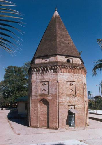
- Lajim Tower, Savadkuh
- Miankaleh peninsula
- Veresk Bridge
- Castle Poolad Baladeh
- Davazdah Cheshmeh Bridge
- Moalagh Bridge, Amol
- Shapour Bridge, Juybar
- Bathroom Vaziri, Sari
- Tomb Darvish Fakhruddin Babol
- History Museum Amol
- Museum of Babol
- Larijan Hot Spring
- Shah Neshin Castle
- Lake Valasht
- Gerdkooh ancient hill
- Gohar Tapeh
- Lar Dam
- Alam-Kuh
- Lar National Park
- Badab-e Surt
- Tomb of Imamzadeh Abbas
- Kandolus Museum Nowshahr
- Fire Temple of Amol
- Farahabad Complex
- Safi Abad Palace
- Bagh Shah, Behshahr
- Imamzadeh Ebrahim Amol
- Imamzadeh Ebrahim Babolsar
- Imamzadeh Yahya Sari
- Imamzadeh Qasem Babol
- See Sangan Jungle
- Alendan lake
- Watch Tower Babol
- Abpari Waterfall
- Cave Zangian Qaemshahr
- Alimastan Village
- Cheshmeh Kileh Bridge, Tonekabon
- Shahrak-e Namak Abrud
- Huto and Kamarband Caves
- Cemetery Sefid Chah
- Cheshmeh Kileh Bridge Tonekabon
- Resket Tower
- Shapur Place, Babol
- Waterfall Tircan
- Nassereddin Shah relief
- Jameh Mosque of Amol
- Jameh Mosque of Sari
- Elburz Range forest steppe
- Bridge Felezi of Babolsar
- Imam Hassan Askari Mosque
- Chai Khoran Palace, Chalus
- Lake Miansheh
- Forest Park Nur
- Clock tower Sari
- Haraz River
- Gerdkooh ancient hill
- Mount Takht-e Suleyman
- Waterfall Sangeno
- Heshtel Towers
- Amoloo Mineral Water Spring
- Harijan Village Chalus
- Tamishan Palace Noor
- Div Sefid Cave
- Cemetery Ispe Chah
- Alasht Village
- Cemetery Ispe Chah
- Zangian Cave
- Cheshmeh Imarat Behshar
- Mohammad Hassan Khan Bridge, Babol
- Haft Abshar Waterfall, Babol
- Hill Qlaya Ghale Kety
- Bathroom Vaziri, Sari
- House Kalbadi, Sari
- House Manouchehri, Amol
- Palace of Shapur
- Temple Kowsan
- Cave rostam Kola
- Garden Chehelsotoon
- Mansion Municipal Tonekabon
- Kangelo Castle, Savadkuh
- Tower Shervin Bavand
- Church sourkh Abad
- Watchtower of Babol
- Tomb Shah baloo zahid Amuli
- Heshtel Tower
- Mosque Jameh of Babol
- Mosque Mohadesin
- Tomb of Ibn-e Shahr Ashoob
- Imamzadeh Sayyid Ali kia Sultan
- Tomb of Seyed Mohammad Zarrin Nava
- Herijan Waterfall
- Deryouk Waterfall
- Espe-o Waterfall
- Kiasar Waterfall
- Takieh Taker
- Tower Shervin Bavand
- Lake Sahon
- Mohaddesin Mosque of Babol
- Tomb Soltan Mohammad-e Taher
- Tomb of Ibn Shahrashub
- Forest Park Chaldareh
- Forest Park Shahid Zare
- Forest Park Mirza Kuchik Khan Haraz
- Forst Park Kashpel
- Javarem Forest park
- Tamishan Palace
- Div Sefid Cave
- Marko Summit
- Forst Park Dalkhani
- Do hezar Village
- Abe ask Village
- Shahrak-e Darya Kenar
- Lavij Village
- Sheikh Musa Village
- Forest Sange no, Neka
- Amoloo mineral water Springs
- Ramsar mineral water Springs
- Pahlavi Hotel Qaem Shahr
- Band-e Borideh River
- Bazaar of Amol
- Ramsar Palace
- Ramsar Parsian Hotel
- Clock Tower of Sari
- Waterfall Sangeno
- Cellar Kafer Keli
- Imamzadeh Hashem Amol
- Shahandasht Waterfall
- Shoormast Lake, Savadkuh
- Figure King Haraz
- Kelardasht
- Ramedani Historical House, Sari
- Estakhr-e-Posht Lake
- Paband National Park
- Mal Khast Village
- Kiasar National Park
- Heyrat Village
- Sarandoon and Balandoon
People
People from and/or active in Mazandaran Province or its historical region include:
Authors
- Muhammad ibn Jarir al-Tabari (838-923), was a Tabari world historian and theologian (the most famous and widely influential person called al-Tabari).
- Espahbod Sa'ad ad-Din Varavini[48] who wrote the book called Marzuban-nama, and also a Divan of poetry in the Ṭabarí dialect, known as the Níkí-nama.
- Ibn Isfandiyar, historian, author of a history of Tabaristan (Tarikh-i Tabaristan).
- Mírzá Asadu’llah Fádil Mázandarání (1880–1957), Iranian Bahá'í scholar.
- Musa ibn Khalil Mazandarani, 19th century Mazandarani scribe and scholar.
- Zahir al-Din Mar'ashi
- Manouchehr Sotoudeh
- Parviz Natel-Khanlari
- Ali Yachkaschi
Poetry
Music
- Gholam Hossein Banan
- Benyamin Bahadori
- Abdolhossein Mokhtabad
- Delkash
- Bijan Mortazavi
- Mohammad Donyavi
- Afshin
- Benyamin Bahadori
- Farhang Sharif
- Parisa
- Simin Ghanem
- Majid Akhshabi
- Mehdi Rajabian
Architecture
- Omar Tiberiades (Abû Hafs 'Umar ibn al-Farrukhân al-Tabarî Amoli) (d.c.815), Persian astrologer and architect.
- Abolhassan Sadighi
Cinema
- Shahab Hosseini
- Davoud Rashidi
- Khosrow Sinai
- Kambiz Dirbaz
- Ladan Mostofi
- Mostafa Zamani
- Mohammad Ali Sadjadi
- Anahita Hemmati
- Roya Nonahali
- Irene Zazians
- Reza Allamehzadeh
- Abbas Amiri
- Saba Kamali
- Mohammad Hossein Mahdavian
- Ardalan Shoja Kaveh
- Parinaz Izadyar
- Maryam Kavyani
- Leyli Rashidi
- Amrolah Saberi
- Hossein Gil
- Zinat Pirzadeh
- Hossein Rajabian
Portraiture
- Mokarrameh Ghanbari
- Kourosh Sotoodeh
- Towhidi Tabari
- Abolhassan Sadighi
- Ahmad Esfandiari
Scholars
- Sadegh Hedayat
- Mohammad Taqi Danesh Pajouh
- Ahmad Ghahreman
- Ali Yachkaschi
- Esfandiar Esfandiari
- Rahimberdi Annamoradnejad
History
- Arash
- Maziar
Science
- Ali ibn Sahl Rabban al-Tabari His stature was eclipsed by his more famous pupil, Muhammad ibn Zakarīya Rāzi.
- Abul Hasan al-Tabari, a 10th-century Iranian physician.
- Abu'l Tayyeb Tabari[49] was jurisconsult, judge (qāżī), and professor of legal sciences; he was regarded by his contemporaries as one of the leading Shafeʿites of 5th/11th century Baghdad.
- Ali Yachkaschi
- Moslem Bahadori
- Iraj Malekpour
- Alireza Mashaghi
- Pooran Farrokhzad
- Shahrokh Meskoob
- Al-Tabarani
Philosophy
- Fakhr al-Din al-Razi Theologian and philosopher.
- Farhad Rachidi
Physicians and astrologers
- Muhammad ibn Mahmud Amuli
- Abū Sahl al-Qūhī
- Al-Nagawri
- Sahl ibn Bishr
- Muhammad ibn Ayyub Tabari
- Yahya ibn Abi Mansur
- Al-Nagawri
- Tunakabuni
- Al-Natili
- Haseb-i Tabari
Athletics
- Abdollah Movahed
- Imam-Ali Habibi
- Behdad Salimi
- Ghasem Rezaei
- Hassan Rangraz
- Reza Yazdani
- Hassan Yazdani
- Reza Soukhteh-Saraei
- Askari Mohammadian
- Mehdi Taghavi
- Komeil Ghasemi
- Morad Mohammadi
- Ahmad Mohammadi
- Mehdi Hajizadeh
- Masoud Esmaeilpour
- Ezzatollah Akbari
- Ali Asghar Bazri
- Bashir Babajanzadeh
- Reza Simkhah
- Mohammad Reza Khalatbari
- Farhad Majidi
- Rahman Rezaei
- Mehrdad Oladi
- Mohsen Bengar
- Peiman Hosseini
- Rahman Ahmadi
- Hossein Tavakkoli
- Hanif Omranzadeh
- Hadi Norouzi
- Adel Gholami
- Alireza Firouzja
- Mojtaba Mirzajanpour
- Sheys Rezaei
- Morteza Pouraliganji
- Mojtaba Abedini
- Sohrab Entezari
- Farshid Talebi
- Mousa Nabipour
- Shahab Gordan
- Noshad Alamiyan
- Sousan Hajipour
- Mahmoud Fekri
- Peyman Hosseini
- Ramin Rezaeian
- Bahador Molaei
- Maysam Baou
- Omid Ebrahimi
- Morteza Mehrzad
- Shoja Khalilzadeh
- Omid Alishah
- Hamed Kavianpour
- Abbas Hajkenari
- Kianoush Rahmati
- Ebrahim Taghipour
- Mohsen Yousefi
- Javad Asghari Moghaddam
- Manouchehr Boroumand
- Jasem Delavari
- Behnam Ehsanpour
- Mehrdad Pooladi
- Majid Torkan
- Mohsen Karimi
- Hamed Kavianpour
- Farzan Ashourzadeh
- Ahmad Mohammadi
- Ali Alipour
- Javad Manafi
- Nima Alamian
- Mohammad Reza Barari
- Ramezan Kheder
- Abbas Dabbaghi
- Reza Simkhah
- Hassan Rahnavardi
- Babak Nourzad
- Ali Asghar Bazri
- Sousan Hajipour
- Anoushiravan Nourian
- Farshid Talebi
- Allahyar Sayyadmanesh
- Ahmad Mohammadi
- Mohsen Karimi
Royalty


- Reza Shah Pahlavi He was the Shah of Iran (Persia) from 15 December 1925 until he was forced to abdicate by the Anglo-Soviet invasion of Iran on 16 September 1941.
- Mohammad Reza Pahlavi
- Dowlatshah
- Khayr al-Nisa Begum
- Khurshid of Tabaristan
Military
- Ali Akbar Shiroodi
- Abbas Mirza
- Ahmad Keshvari
- Manouchehr Khosrodad
- Al-Mu'ayyad Ahmad
- Sardar Rafie Yanehsari
- Mohammad Rouyanian
- Iskandar-i Shaykhi
- Hossein Khalatbari
- Bahram Aryana
- Ahmad Keshvari
- Massoud Monfared Niyaki
- Jahangir IV
- Abdollah Khajeh Nuri
Politics
- Ali Larijani
- Mohammad Vali Khan Tonekaboni
- Manuchehr Mottaki
- Ehsan Tabari
- Majid Rahnema
- Hossein Ghods-Nakhai
- Noureddin Kianouri
- Ali-Akbar Davar
- Esfandiar Rahim Mashaei
- Reza Salehi Amiri
- Hamid Reza Chitgar
- Sadeq Larijani
- Mohammad-Javad Larijani
- Bagher Larijani
- Ali Akbar Nategh-Nouri
- Mirza Aqa Khan Nuri
- Morteza Gholi Khan Hedayat
- Ahmad Tavakoli
- Davoud Hermidas-Bavand
- Sam Dastyari
- Reza-Qoli Khan Hedayat
- Hossein Rajabian
- Ali Kordan
- Ahmad Moshir al-Saltaneh
- Elaheh Koulaei
- Abdul Karim Hashemi Nejad
- Reza Sheykholeslam
- Shamseddin Hosseini
- Hassan Ghashghavi
- Mirza Shafi Mazandarani
- Sheikh Khalifa Mazandarani
- Gholam Hossein Sadighi
- Mirza Hassan Khan Esfandiary
- Davoud Hermidas-Bavand
- Haji Washington
- Hossein Dadgar
- Mirza Hassan Khan Esfandiary
- Ali Gholi Khan Mokhber-ol Doleh
- Musa Nuri Esfandiari
- Ali Khan Kamal-Hedayat
- Zeinolabedin Rahnama
- Morteza Gholi Khan Hedayat
- Mehdi Qoli Hedayat
- Abdol-samad Mirza Ezz ed-Dowleh Saloor
- Mehdi Qoli Hedayat
- Hossein Shah-Hosseini
- Fazel Larijani
- Musa Nuri Esfandiari
- Javad Saeed
- Farhad Dejpasand
- Anoushiravan Mohseni Bandpei
- Kamal Hedayat
- Abdol Amir Rashidi Haeri
Christianity
- Hossein Fallah Noshirvani
Islamic scholars
- Hassan Hassanzadeh Amoli
- Abdollah Javadi-Amoli
- Mirza Hashem Amoli
- Abd al-Qahir al-Jurjani
- Muhammad Taqi Amoli
- Haydar Amuli
- Ibn Furak
- Ali Asghar Mazandarani
- Mirza Husain Noori Tabarsi
- Mohammad Taghi Falsafi
- Ibn Shahr Ashub
- Shaykh Tabarsi
- Imad al-Din al-Tabari
- Rustam al-Tabari
- Abul-Abbas Qassab Amoli
- Yasubedin Rastegar Jooybari
- Mulla Ali Kani
- Mohaddes Nouri
- Mirza Muhammad Taqi Noori Tabarsi
- Yasubedin Rastegar Jooybari
- Mohammad Salih al-Mazandarani
- Ibn al-Sheikh
- Molla Mohammad Saleh Mazandarani
Other religion
- Baháʼu'lláh- The founder of the Baháʼí Faith was born and grew up in Nur, Mazandaran
- Mírzá ʻAbbás Núrí - father of Baháʼu'lláh
- ʻAbdu'l-Bahá - son of Baháʼu'lláh
- Daniel al-Kumisi
- Quddús
- Subh-i-Azal
Master
- Kourosh Mansory
- Gholam-Ali Soleimani
- Farshid Moussavi
- Maria Khorsand
- Behdad Esfahbod
- Hossein Fallah Noshirvani
Medical
- Moslem Bahadori
Mazandaran today
Food

The cuisine of the province is very rich in seafood due to its location by the Caspian Sea, and rice is present in virtually every meal. Mazandarani cuisine is diverse between regions; the cuisine of coastal regions is different from mountainous regions, as people in the Alborz usually use the indigenous herbs and coastal people use the dishes of fish and Caspian Mazandaran rice with vegetables.
Economy

The province is one of the 5 wealthiest in Iran. Oil wealth has stimulated industries in food processing, cement, textiles, cotton, and fishing (caviar). Iran's Cultural Heritage Organization lists close to 630 sites of historical and cultural significance, many of which are tourist attractions. Rice, grain, fruits, cotton, tea, tobacco, sugarcane, Flower, Mineral water, caviar, Dairy product, Meat industry and silk are produced in the lowland strip along the Caspian shore. Oil wealth has stimulated industries in food processing, cement, textiles, cotton, and fishing (caviar). Mazandaran, with 230,000 hectares of paddies, produces about one million tonnes of rice a year, or 42 percent of the country's total.[citation needed] Over 70 kinds of agricultural produce are grown in Mazandaran that meets 40% of domestic demand for rice and 50% of citrus fruits. The province is also the sole domestic supplier of kiwi.[50] Mazandaran has 3,500 industrial and production units.
Export
Germany, Russia, Iraq, France Turkey, Kazakhstan, India, Malaysia, United Arab Emirates, Afghanistan, Belarus, Italy, Bahrain, Pakistan, Switzerland Ukraine, United States, Spain, Netherlands and Central Asian countries were Mazandaran's main export destinations during the period. The province in 2017 exported close to $800 million worth of goods. In the previous year totally about 800 million dollars of non-oil goods produced in Mazandaran were exported, half of which were exported from customs outside the province.[51] In 2017 year main exports from the province consisted of dairy products (57%), food products (12%), industrial commodities (10%), pipes and profiles (8%) and cement (7%).[52]
Station
Mazandaran is also a fast-growing centre for tourist, innovation, biotechnology and civil engineering.
Gas and oil
From 1951 to 1978, and particularly after the formation of National Iranian Oil Company (NIOC), the first exploration well was spudded. Up to 1970, 16 wells had been drilled near mud volcanoes. All these wells produced only natural gas and technical studies showed that continuation of these operations would be uneconomical. 10 thousand tons export oil and Uncertain amount of gas exported to Asian countries from Mazandaran.
Statistics
- 9th rank industrial units Iran
- 5th rank general industry Iran
- 4th rank tooling machines Iran
- 2nd rank coal Iran
- 1st rank livestock and agricultural products Iran
- 1st rank granite Iran
- 1st rank fluorine Iran
- 1st rank flowers and ornamental plants Iran
- 1st rank citrus exports Iran
- 1st rank food products exports Iran
Colleges and universities

Main universities of Mazandaran:
- University of Mazandaran, Babolsar
- Mazandaran University of Medical Sciences, Sari
- Babol Noshirvani University of Technology, Babol
- Babol University of Medical Sciences, Babol
- Sari Agricultural Sciences and Natural Resources University, Sari
- Shomal University, Amol
- Allameh Mohaddes Nouri University, Nur
- Imam Khomeini Naval University, Nowshahr
- University of Science and Technology of Mazandaran, Behshahr
- Iran University of Science and Technology, Nur
Sports
For the past several years Mazandaran has generated a consistent stream of wrestlers.[53] Football and volleyball are two other popular sports that have a lot of players in the Premier League and the national team. Weightlifting, Taekwondo, table tennis, boxing, kickboxing, kung fu, karate, rally car are other successful sports in the province. Kalleh Mazandaran VC, Shamoushak Noshahr F.C. and F.C. Nassaji Mazandaran are three famous teams in the province. Kalleh have twice won the Iranian Volleyball Super League Championship and once the AVC Championship.
Gallery
 Mazandaran Coast
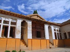 Nima House at Nour
 Ramsar Palace
 Safarud Jungle and River
 Riding a watercraft in Ramsar
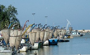 Babolsar Pleasure
 Fire Temple of Amol
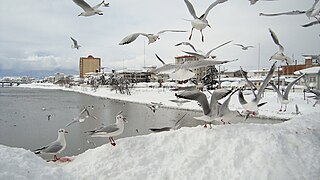 Snow in Tonekabon
 Marals at Semes Kandeh Animal Shelter
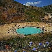 Div Asiyab spring at Larijan
 Glacial lake in Alam Kuh Kelardasht
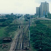 Neka Railway
 Museum of Reza Shah Pahlavi at Alasht
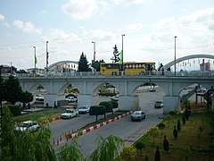 Davazdah Cheshmeh Bridge
 Elimalat Lake
 Coast Beach
 Badab Sort springs
 Filband Village
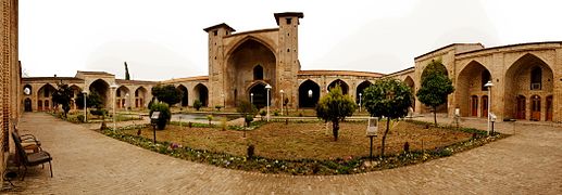 Farah Abad Complex
 Nassereddin Shah relief
 Fazeli House
 Imamzadeh Abbas
 Sefid Chah
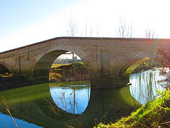 Jomeh Bazaar bridge


Sister provinces
 Astrakhan
 Marche
 Dar es Salaam
 Issyk-Kul
 Mekong Delta
See also
- Tapurian people Mazandarani people.
- List of Mazanderanis
- Amardi
- Sasanian dynasty
- Maziar
- Tabaristan
- Dabuyid dynasty
- Pahlavi dynasty
- Alborz (Elburz) mountain range topics
References
- "همشهری آنلاین-استانهای کشور به ۵ منطقه تقسیم شدند". Archived from the original on 2014-06-23. Retrieved 2014-06-23.
- "Province of Mazandaran". Iran Chamber Society. Archived from the original on 2 February 2017. Retrieved 11 September 2016.
- Statistical Centre of Iran
- Maryam Borjian - Bilingualism in Mazandaran: Peaceful Coexistence With Persian. Archived September 21, 2006, at the Wayback Machine
- "Sub-national HDI - Area Database - Global Data Lab". hdi.globaldatalab.org. Archived from the original on 2018-09-23. Retrieved 2018-09-13.
- Based on Maz or Mazan Term: Mazanderani: مازرون Mâzerun, Persian: مازندران, Russian: Мазендеран.
Based on Tapur Term: English: Tapuria, Arabic: طبرستان Ṭabaristan, from Middle Persian Tapuristân
Mazandarani: Tapurana. (not prevalent)
Ancient Greek: Hyrcania came from local name Vergana (Persian Gorgan), Caspia from local name Kaspi, See Caspian Sea. Ferdowsi called the Caspian region Mazandaran, so people refer to Caspian provinces as Gilan.
Note: It was also known as Al-Jannat by the Arabs, meaning paradise, during the 7–8th centuries - Statistical Centre, Government of Iran. See: "General Characteristics of Ostans according to their administrative divisions at the end of 1383 (2005 CE)" [dead link], "Population estimation by urban and rural areas, 2005"[permanent dead link]
- University of Mazanderan Archived October 3, 2008, at the Wayback Machine
- Census Results, 2006: Sari: 490.830, Babel: 464.535, Amel: 343.747, Shahi: 293.721.
Iranian 2006 Census Website, Information File Archived June 1, 2007, at the Wayback Machine (in Persian) - "Natural attractions of Mazandaran in IRIB". Archived from the original on 2017-03-06. Retrieved 2016-11-27.
- Springer Netherlands; July 10, 2005; Contributions to the knowledge of the useful plants and plant raw materials of Iran; ISSN 0921-9668
- Mazandaran, Geography & History Archived February 28, 2008, at the Wayback Machine
- Encyclopædia Britannica, Entry for Elburz Archived May 3, 2008, at the Wayback Machine
- Freshwater Fishes of Iran Archived March 3, 2016, at the Wayback Machine; Revised: 12 July 2007
- Encyclopædia Britannica, Entry for Mazandaran
- [permanent dead link] (Persian)
- http://www.sci.org.ir/content/userfiles/_sci_en/sci_en/sel/year85/f1/CS_01_4.HTM%5B%5D
- IRAN Daily Caspian Region Archived September 12, 2007, at the Wayback Machine
- Parthia News, November 6, 2005.
- Payvand, 400 Historical Sites Discovered within 7 Days in Mazandaran Archived March 4, 2016, at the Wayback Machine
- "CHN Page for Mazandaran". Archived from the original on 2007-02-14. Retrieved 2007-02-14.
- Keddie, N. R.; 1968; The Iranian villages before and after land reform. Journal of Contemporary History, 3(3), 69–78.
- Tapuri. The mountains inland from the coast of Hyrcania are called the “Tapurian mountains” by Arrian, after the people there, settled in the mountains between the Derbices and the Hyrcanii (Str., 11.9.1, 11.11.8). They are spread toward the Caspian Gates and Rhaga in Media (Ptol., 6.2.6).These western Tapuri could have resulted from a tribal division north of the Sarnius/Atrak river—another, perhaps ancestral, group, the Tapurei, is located by Ptolemy (6.14.12) in Scythia. The remainder moved south and east into Margiana (“between the Hyrcani and the Arii,” Str., 11.8.8; Ptol., 6.10.2) along the Ochus/Arius (mod. Tejen/Hari-rud) river into Aria (cf. Polyb., 10.49). The Tapuri on the Caspian could, alternatively, represent a later westward migration along the main east-west highway from Margiana. These Tapuri furnished 1,000 cavalry for the battle of Gaugamela (Curt., 3.2.7), apparently aligned with the Hyrcanii (the “Topeiri,” Arr., An. 3.8.4). Alexander later subdued them (Arr., An. 3.23.1-2; Polyb., 5.44.5; Curt., 6.4.24-25). A separate satrap administered them at the time of Alexander’s arrival, and this official was assigned the Caspian Mardi as well (Arr., An. 3.22.7, 24.3; 4.18.2)., IRANICAONlINE IRAN v. PEOPLES OF IRAN (2) Pre-Islamic
- "Dictionary of Greek and Roman Geography, illustrated by numerous engravings on wood. William Smith, LLD. London. Walton and Maberly, Upper Gower Street and Ivy Lane, Paternoster Row; John Murray, Albemarle Street. 1854. ,TAPU´RI". www.perseus.tufts.edu. Retrieved 2021-02-04.
- Of the lands which lie on the sea and of the others which border on these, Ninus subdued Egypt and Phoenicia, then Coele-Syria, Cilicia, Pamphylia, and Lycia, and also Caria, Phrygia, and Lydia; moreover, he brought under his sway the Troad, Phrygia on the Hellespont, Propontis, Bithynia, Cappadocia, and all the barbarian nations who inhabit the shores of the Pontus as far as the Tanais; he also made himself lord of the lands of the Cadusii, Tapyri, Hyrcanii, Drangi, of the Derbici, Carmanii, Choromnaei, and of the Borcanii, and Parthyaei; and he invaded both Persis and Susiana and Caspiana, as it is called, which is entered by exceedingly narrow passes, known for that reason as the Caspian Gates. 4 Many other lesser nations he also brought under his rule, about whom it would be a long task to speak. But since Bactriana was difficult to invade and contained multitudes of warlike men, after much toil and labour in vain he deferred to a later time the war against the Bactriani, and leading his forces back into Assyria selected a place excellently situated for the founding of a great city.. Diodorus Siculus, Library 1-7 (2.2.3)
- Minorsky, V.; Vasmer, R. "Mazandaran" Encyclopaedia of Islam. Edited by: P. Bearman, Th. Bianquis, C.E. Bosworth, E. van Donzel and W. P. Heinrichs. Brill, 2007. Brill Online.
- Logan (1992), p. 201.
- Pietro Della Valle, Viaggi, 3 vols. in 4 parts, Rome, 1658–63; tr. J. Pinkerton as Travels in Persia, London, 1811.
- Gwillim Law, Statoids website. "Provinces of Iran" Archived October 22, 2016, at the Wayback Machine. Retrieved on 2007-08-28
- "Elburz Range forest steppe". Terrestrial Ecoregions. World Wildlife Fund.
- Borjian, Habib (2004). "Māzandarān: Language and People". Iran & the Caucasus. Brill. 8 (2): 291. doi:10.1163/1573384043076045. JSTOR 4030997.
- Potts, Daniel (2014). Nomadism in Iran: From Antiquity to the Modern Era. Oxford University Press. p. 110. ISBN 9780199330799. Retrieved 2021-12-15.
- "Spoken L1 Language: Mazanderani". Glottolog 4.6.
- Windfuhr, G. L. (1989). "New Iranian languages: Overview". In Rüdiger Schmitt (ed.). Compendium linguarum Iranicarum. Wiesbaden: L. Reichert. p. 490.
- "ČĀLŪS". Encyclopaedia Iranica.
- سفرنامه ملگونوف به سواحل جنوبی دریای خزر، صفحهٔ ۵۷
- سفرنامه یاسنت لویی رابینو، صفحهٔ ۴۶
- «تنکابن». دانشنامه جهان اسلام. دریافتشده در ۲۰۱۷-۰۷-۰۷.
- Gordon, R.G., Jr. (2005). Ethnologue: Languages of the World, 15th edition. (Dallas, TX: SIL International). Online version "Ethnologue: Languages of the World". Archived from the original on 2016-11-07. Retrieved 2009-11-12.
- "KALĀRESTĀQ i. The District and Sub-District". Encyclopaedia Iranica.
- "KOJUR i. Historical Geography". Encyclopaedia Iranica.
- Lars Johanson, Éva Csató, Eva Agnes Csato. The Turkic Languages. Taylor & Francis, 1998. ISBN 0-415-08200-5; p. 274
- Shahnameh/Book of Kings by Abu'L Ferdawsi, edited by Jalal Khaleghi-Motlagh "ریرا". Archived from the original on 2014-04-03. Retrieved 2008-08-20.
- Iran Chamber Society: Geography of Iran: Ancient Iran’s Geographical Position in Shah-Nameh Archived March 3, 2016, at the Wayback Machine
- "Iran's Beauties in Photos: Scenic Village of Filband". IFPNews.com. 23 April 2018. Archived from the original on 2018-04-23. Retrieved 2018-04-23.
- "Mazandaran Named Tourism Capital of ECO Countries in 2022". IFPNews.com. 6 October 2019. Retrieved 2019-10-06.
- "جاذبه های گردشگری مازندران insulation". irib. Archived from the original on 2019-07-23. Retrieved 2019-07-23.
- AN ABRIDGED TRANSLATION OF THE HISTORY OF ṬABARISTÁN BY MUHAMMAD B. AL-ḤASAN B. ISFANDIYÁR
- Encyclopedia Iranica http://www.iranica.com/newsite/index.isc Archived 2008-12-17 at the Wayback Machine
- Mazandaran Citrus Exports to Reach 20,000 Tons / Financial Tribune
- "Mazandaran non-oil export rises 14%". 16 August 2018. Archived from the original on 2018-10-31. Retrieved 2018-10-31.
- Mazandaran Customs Revenues Up
- "Mazandaran Capital Wrestling". Archived from the original on 2017-05-10. Retrieved 2016-11-27.
Further reading
- W. Barthold (1984). "Gilan and Mazandaran". An Historical Geography of Iran. Translated by Svat Soucek. Princeton University Press. pp. 230–242. ISBN 978-1-4008-5322-9.
External links
- Official website
- mazendron on instagram
- Mazandaran Cultural Heritage Organization
- Official website of Mazandaran TV
- Houchang E. Chehabi (ed.). "Regional Studies: Mazandaran". Bibliographia Iranica. USA: Iranian Studies Group at MIT. (Bibliography)
- Registration Mazandaran
- A Mazandarani folk-song sung by Shusha Guppy in the 1970s: Darling Dareyne
| Capital | |
|---|---|
| Counties and cities | |
| Sights |
|
| populated places |
|
Provinces of Iran | ||
|---|---|---|
| ||
На других языках
[de] Mazandaran
Mazandaran, auch Masanderan, Masandaran und Mazanderan (persisch مازندران, DMG Māzandarān, masanderanisch .mw-parser-output .Arab a,.mw-parser-output a bdi.Arab{text-decoration:none!important}.mw-parser-output .Arab{font-size:120%}مازرون DMG .mw-parser-output .Latn{font-family:"Akzidenz Grotesk","Arial","Avant Garde Gothic","Calibri","Futura","Geneva","Gill Sans","Helvetica","Lucida Grande","Lucida Sans Unicode","Lucida Grande","Stone Sans","Tahoma","Trebuchet","Univers","Verdana"}Māzerūn oder مازندرون, DMG Māzanderūn), ist eine iranische Provinz in Nord-Iran. Sie ging aus der alten Provinz Tabaristan hervor. Die Hauptstadt ist Sāri.- [en] Mazandaran province
Другой контент может иметь иную лицензию. Перед использованием материалов сайта WikiSort.org внимательно изучите правила лицензирования конкретных элементов наполнения сайта.
WikiSort.org - проект по пересортировке и дополнению контента Википедии