world.wikisort.org - Iran
Savadkuh County (also Savadkooh and Savadkouh) (Persian: Ŝahrestāne Sawādkuh) is a county in Mazandaran province in Iran. At the 2006 census, the county's population was 66,430, in 17,918 families.[2] The county has one district: the Central District. The county has three cities: Zirab, Alasht, and Pol Sefid.
Savadkuh County
Ŝahrestāne Sawādkuh Savadkouh | |
|---|---|
County | |
 Counties of Mazandaran Province | |
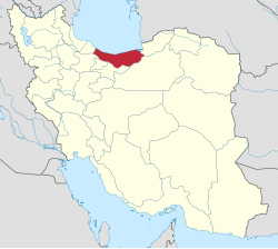 Location of Mazandaran Province in Iran | |
| Coordinates: 36°04′N 52°56′E | |
| Country | Iran |
| Province | Mazandaran |
| Capital | Pol Sefid |
| Bakhsh (Districts) | Central District, Shirgah District |
| Area | |
| • Total | 2,078.00 km2 (802.32 sq mi) |
| Population (2006) | |
| • Total | 66,430 |
| • Density | 32/km2 (83/sq mi) |
| Time zone | UTC+3:30 (IRST) |
| • Summer (DST) | UTC+4:30 (IRDT) |
| Website | lindi.ir |
| Savadkuh County can be found at GEOnet Names Server, at this link, by opening the Advanced Search box, entering "9207257" in the "Unique Feature Id" form, and clicking on "Search Database". | |


The county of North Savadkuh was formed in 2013 from the former Shirgah and Narenjestan Districts of Savadkuh County, including the city of Shirgah and the village of Leford.[3]
Covering an area of 2,441 square kilometres (942 sq mi), Savadkuh is at the centre of Mazandaran Province. It is limited northwestward by North Savadkuh County, westward by Babol County, eastward by Sari County, southward by the Alborz mountain range and Tehran province, and southeast by Semnan province. The main part of this county is located in a valley, in the central Alborz region, where the Tâlâr river passes through it.
The tallest summit of Savadkuh, is Khero-Naru, with a height of 3,620 metres (11,880 ft). The most important rivers flowing in this city are Tâlâr and Babol-rud, which originate from the Alborz mountain range standing southeast and southwest of Savadkuh. These rivers irrigate the farmlands in Babol, Babolsar and Qaemŝahr. Including two areas of mountain in the north and foothill in the south, the mountainous area has a temperate and humid climate, and the weather in the south is dry and cold.
Savadkuh is the birthplace of Reza Shah Pahlavi, the founder of the Pahlavi dynasty
Human Geography
Savadkuh consists of three cities, Pol Sefid, Zirab, and Alasht; one district Central District (Savadkuh County); and four rural districts, Kaseliyan Rural District, Rastupey Rural District, Sorkhkola Rural District, and Valupey Rural District. Having 250 seasonal and permanent villages, the language spoken in Savadkuh is Mazandarani. Its native inhabitants are Shiite Muslims.
The farmlands in Savadkuh are limited because of its large forests and mountainous areas. So the farmers use their crops themselves, including rice, wheat, barley and sugar cane. According to geographical features, the economy of this city is based on apiculture and animal husbandry, more than agriculture.
Historical background
Darius I, the great Achaemenian monarch in his famous inscription in Behistun, mentions Pâtišvâreš as one of the territories under his rule. This Old Persian form subsequently became Middle Persian Pateŝxârgar and, following the Arab conquest, Perso-Arabic Faršavâdjar. The Greek historiographer Strabo records this name as Prâxovâtrâs.
In his inscription at Ka'ba-ye Zartosht, the second Sassanid monarch Shapur I, refers to the region as Pâdešxâr. In the Book of Deeds of Ardashir, Son of Babag, it is Patešxâr again. Ibn Isfandiyar and Mir Zahir al-Din Mar'ashi – the old geographers of Mazandaran – give its name as Patešxârgar as a large area in present-day Mazandaran, including Azerbaijan, Gilan, Tabaristan, Kumesh and Damghan.
Mohammad Hassan Khan (Etemad Saltaneh's Tadvin Fi Ahval Jebal Shervin, History of Savadkuh) mentions it as the old name of the ancient area of Savâdkuh. They believe that the word "Savad" was distorted and changed to Faršavât. Savadkuh enjoyed great importance in the history of Tabaristan and even in Iran.
Its tall mountains were the feudal seats of the Bavand dynasty, with which the Karan-Vands were allied. They defended the area against the invasions of the Amawid and Abbasids and tried to preserve their Zoroastrian religion and culture. The existence of numerous fortresses and military fortifications that date to the 8th–10th centuries vindicate this claim. In addition, Lajim tower with its 10th century brick-face inscription in Pahlavi script demonstrates the attention of the Savâdkuhs to the script, language and customs of their ancestors. The population of this region composed many poems, describing the heroic efforts and bravery of their notables.
Language
The languages spoken in Savadkuh are Mazandarani and Persian, for the major part; and Mazandarani and Persian for the inhabitants of the villages.
Natural attractions
The most important natural attractions of Savadkuh are: Ŝur Mast lake, near a village by the same name, Gazu waterfall in Lafur hamlet, waterfalls of Shirga and Gaduk, the mountains of Arfa Kuh, Sangar and Qadamgah, in Rassto Pei hamlet and Shervin mountain in Valu Pei hamlet; and Alasht city.
Historical sites and landmarks


Veresk Bridge
The Veresk Bridge is a masonry arch bridge in northern Iran. It was constructed mostly by Austrians before World War II by leadership of an engineer named Walter Aigner, constructed during the reign of Reza Shah.[4] It is located in the Veresk district of Savadkuh County, in Mazandaran province.[5][6]
During World War II, it was known as the Pol-e Piroozi ("The bridge of victory").[7] The bridge stands 110 metres (360 ft) tall and its arch measures 66 metres (217 ft) long. The bridge serves the Trans-Iranian Railway network in Northern Iran. The Veresk bridge connects the railway between Tehran and the Caspian Sea region. It is located in Mazandaran Veresk district of Savadkuh, 85 kilometers south of Ghaemshahr and connects two of the mountains in the Abbas Abad region. The bridge is one of the masterpieces of the Danish engineering firm Kampsax, (consisting of Danish, German and Austrian engineers) serving the Trans-Iranian Railway network in Northern Iran.[8] The construction of this bridge included craftsmen of many nationalities, including many Italian. The Master Carpenter for the construction of the lumber concrete forms was Giacomo Di Marco, from the Friuli region of Italy, and detailed in the book he authored. It has been said after finishing the bridge, people had a fear that the train wouldn't be able to pass the narrow bridge and that it would break. As a result, the engineer and his family stood under it when the first train passed the bridge (local accounts claim that Reza Shah had asked them to do so anyway).[9]
Lajim Tower
Lajim Tower, also known as Tomb Tower of Lajim,[10] is a tall cylindrical tower in the village of Lajim[11] in the province of Mazandaran, Iran. The tower was built around AD 1022.[10] The Lajim inscriptions includes the first documented example of the word qubba referring to the domed structure of the building.[11] There is no doubt that the Lajim Tower was the mausoleum of an unknown Persian prince of Tabaristan.[11]
Kangelo Castle
Kangelo Castle is a historical fortress located in the Savadkuh and in the village of Kangelo. The Kangelo Castle during the time The Sassanian Empire was built. According to historians, the castle of Kangelo was used as a place to worship the mirta.
Espahbod Khorshid Cave
This cave is located between the railway station of Pol-e-Sefid and Surkh Abad, in the vicinity of Do Ab. It was discovered in the year 1956. The cave has a simple area or hall, with a ceiling 80 m. in width and height, and is considered spectacular in the world. Near this cave is a remnant of a ruined castle and tower, which was once a beautiful structure of stone and mortar. This cave is also known as Dej-e-Afsanehie, and this was most probably the defense center of the House of Ispahbudhan of Mazandaran in the past.
Balu Bridge
Located along the Shirgah-Zirab road, near Talar river, it was made of fired bricks and mortar. The main part of this bridge was destroyed because of breaking, and now two herring-bone-shaped arches remained intact. One of them is 3 metres (9.8 ft) wide and 4.75 metres (15.6 ft) high, and another is 4.5 metres (15 ft) wide and 5.50 metres (18.0 ft) high. According to its architectural features, it probably dates back to before the Safavid dynasty.
Urim Rudbar Church
This monument was built, following the erection of the northern Iranian railway. It was used for religious ceremonies by foreign personnel. The church consists of a chamber, measuring 4.20 by 5.20 metres (13.8 by 17.1 ft). With a height of 4 metres (13 ft), it houses a prayer niche and four cement candlesticks. The construction was made of stone and cement.
References
- Management and Planning Organization of Mazandaran, 2006
- "Census of the Islamic Republic of Iran, 1385 (2006)" (Excel). Statistical Center of Iran. Archived from the original on 2011-11-11.
- "شهرستان سوادکوه شمالی ایجاد شد" [The county of North Savadkuh was created]. Iranian Students' News Agency. April 9, 2013. Retrieved April 10, 2020.
{{cite web}}: CS1 maint: url-status (link) - Veresk Bridge, the Born of the World War
- Veresk Bridge / SeeIran
- Veresk bridge in Mazandaran / Mehr News Agency
- Veresk Bridge / itto
- Fritz Leonhardt: Brücken. Deutsche Verlags-Anstalt, Stuttgart 1982, ISBN 3-421-02590-8; Marcel Prade: Les grands ponts du monde. Deuxième partie, Hors d'Europe. Brissaud à Poitiers, ISBN 2-902170-68-8
- Veresk Bridge Safe auf FinancialTribune.com
- Michailidis, Melanie (2003). "Tomb Tower of Lajim". Aga Khan Visual Archive.
- Blair, Sheila (1992). The Monumental Inscriptions from Early Islamic Iran and Transoxiana. pp. 88–90.
External links
| Capital | |||||||||||||||||||||||||||||||||||||||||||
|---|---|---|---|---|---|---|---|---|---|---|---|---|---|---|---|---|---|---|---|---|---|---|---|---|---|---|---|---|---|---|---|---|---|---|---|---|---|---|---|---|---|---|---|
| Counties and cities |
| ||||||||||||||||||||||||||||||||||||||||||
| Sights |
| ||||||||||||||||||||||||||||||||||||||||||
| populated places |
| ||||||||||||||||||||||||||||||||||||||||||
| Capital | |
|---|---|
| Districts | |
Другой контент может иметь иную лицензию. Перед использованием материалов сайта WikiSort.org внимательно изучите правила лицензирования конкретных элементов наполнения сайта.
WikiSort.org - проект по пересортировке и дополнению контента Википедии