world.wikisort.org - India
Mahabubnagar is a city[3] in Mahabubnagar District of the Indian state of Telangana named after the 6th Nizam, Mir Mahabub Ali Khan. It is the headquarters of Mahbubnagar mandal in Mahabubnagar revenue division.[4] The city is also the largest in the district with an area of 39.64 km2 (15.31 sq mi) and 7th most populous in the state.[5]
Mahabubnagar
Palamuru, Rukmammapeta | |
|---|---|
City | |
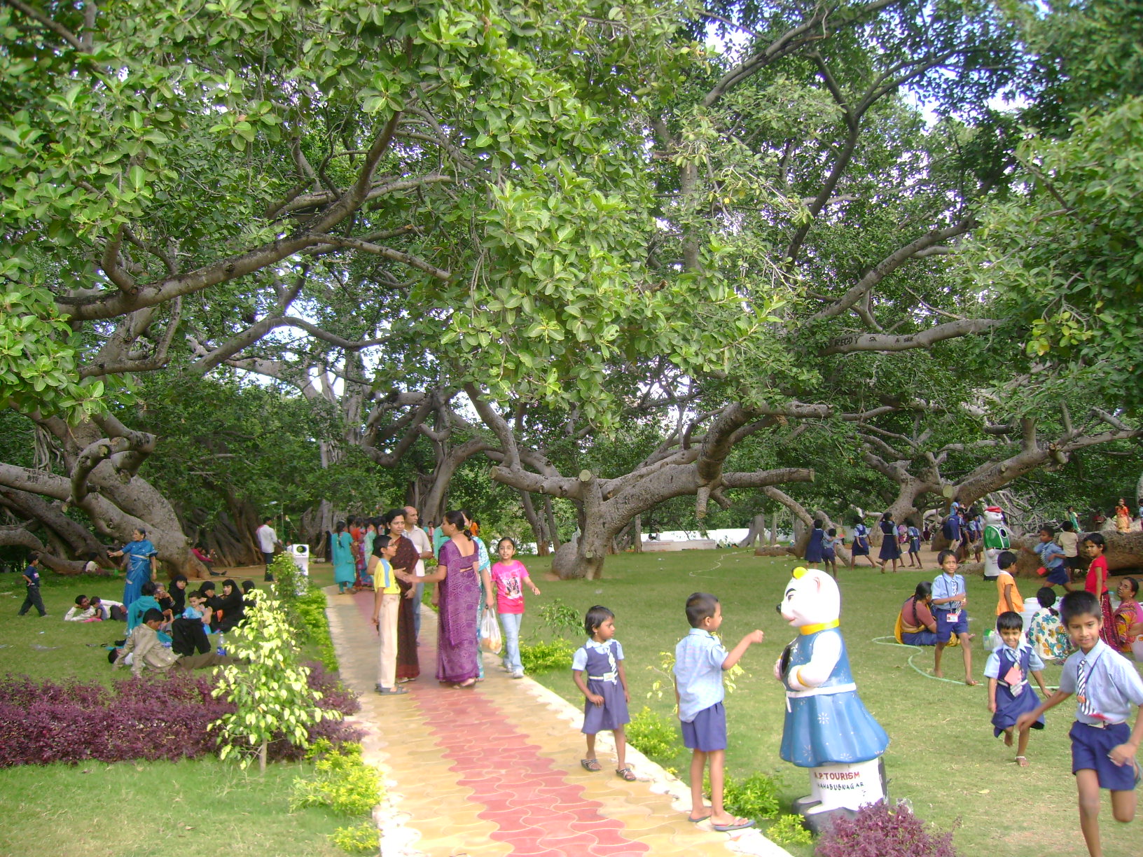 The biggest banayan tree Pillalamarri, symbol of the district | |
 Mahabubnagar  Mahabubnagar | |
| Coordinates: 16.75°N 78.00°E | |
| Country | |
| State | |
| Region | Deccan |
| District | Mahabubnagar |
| Named for | Mahabub Ali Khan, Asaf Jah VI |
| Government | |
| • Body | Mahabubnagar Municipal Council |
| • Municipal Chairman | Koramoni Narsimulu |
| • MLA | Srinivas Goud (TRS) |
| • MP | Manne Srinivas Reddy (TRS) |
| Elevation | 498 m (1,634 ft) |
| Population (2011)[1] | |
| • City | 222,573 |
| • Density | 4,803/km2 (12,440/sq mi) |
| • Metro | Urban Agglomeration 300,000 |
| Languages | |
| • Official | Telugu & Hindi |
| Time zone | UTC+5:30 (IST) |
| PIN | 509001 |
| Telephone code | 08542 |
| Vehicle registration | TS-06[2] |
| Planning Agency | Mahabubnagar Urban Development Authority |
| Lok Sabha constituency | Mahabub Nagar |
Etymology
Mahabubnagar is also known with the name, Palamooru. The city also has an older name "Rukmammapeta."[6]
Geography
Mahbub Nagar is located at 16.73°N 77.98°E.[7] It has an average elevation of 498 metres (1633 feet). The city of Mahbub Nagar is located at a distance of 98 km from Hyderabad 130 km from Kurnool and 105 km from Raichur.
Climate
| Climate data for Mahbubnagar (1981–2010, extremes 1952–2010) | |||||||||||||
|---|---|---|---|---|---|---|---|---|---|---|---|---|---|
| Month | Jan | Feb | Mar | Apr | May | Jun | Jul | Aug | Sep | Oct | Nov | Dec | Year |
| Record high °C (°F) | 36.8 (98.2) |
40.3 (104.5) |
41.8 (107.2) |
45.3 (113.5) |
44.9 (112.8) |
44.8 (112.6) |
37.4 (99.3) |
37.5 (99.5) |
39.4 (102.9) |
39.1 (102.4) |
35.9 (96.6) |
36.0 (96.8) |
45.3 (113.5) |
| Average high °C (°F) | 30.7 (87.3) |
33.6 (92.5) |
37.0 (98.6) |
39.2 (102.6) |
39.7 (103.5) |
34.8 (94.6) |
31.7 (89.1) |
30.5 (86.9) |
31.5 (88.7) |
31.6 (88.9) |
30.9 (87.6) |
30.0 (86.0) |
33.4 (92.1) |
| Average low °C (°F) | 17.1 (62.8) |
19.3 (66.7) |
22.7 (72.9) |
25.6 (78.1) |
27.0 (80.6) |
24.7 (76.5) |
23.5 (74.3) |
22.9 (73.2) |
22.9 (73.2) |
21.5 (70.7) |
19.2 (66.6) |
17.0 (62.6) |
22.0 (71.6) |
| Record low °C (°F) | 9.1 (48.4) |
11.6 (52.9) |
12.5 (54.5) |
16.1 (61.0) |
18.3 (64.9) |
20.4 (68.7) |
18.6 (65.5) |
20.0 (68.0) |
18.5 (65.3) |
13.4 (56.1) |
11.3 (52.3) |
11.0 (51.8) |
9.1 (48.4) |
| Average rainfall mm (inches) | 4.5 (0.18) |
4.4 (0.17) |
6.5 (0.26) |
20.9 (0.82) |
38.1 (1.50) |
109.9 (4.33) |
154.6 (6.09) |
171.2 (6.74) |
155.8 (6.13) |
88.2 (3.47) |
12.9 (0.51) |
3.7 (0.15) |
770.8 (30.35) |
| Average rainy days | 0.3 | 0.3 | 0.7 | 1.4 | 2.6 | 7.0 | 11.0 | 11.2 | 9.0 | 4.9 | 1.4 | 0.4 | 50.2 |
| Average relative humidity (%) (at 17:30 IST) | 42 | 36 | 33 | 32 | 36 | 55 | 66 | 71 | 69 | 63 | 52 | 45 | 50 |
| Source: India Meteorological Department[8][9] | |||||||||||||
Demographics
In 2011, Mahbub Nagar had a population of 222,573[10] It is the 9th largest city of south India by number of auto rickshaws, and 2nd in Telangana after Hyderabad.[citation needed]
Governance
Mahbub Nagar municipality is the civic body of the city, which was constituted in 1942 as a third grade municipality. It was upgraded to second grade in 1959, to first grade in 1983 and finally to Special grade municipality in 2004.[5] It is spread over an area of 98.64 km2 (38.09 sq mi).[11] Mahbub Nagar urban agglomeration consists of Mahbub Nagar municipality, census towns of Boyapalle, Yenugonda and the out growths of Mahbub Nagar (rural) (full), Yedira (part) village.[4]
Transport

The city is connected to major cities and towns by means of road, railway and airway. National and state highways that pass through the city are NH 44 and NH 167, State highway 20 and 23. TSRTC operates buses to various destinations from Mahbub Nagar bus station of the city.[12] The city has rail connectivity with the presence of Mahbub Nagar Main Station, Mahbub Nagar Town, Yenugonda Station and Diviti Pally Stations. Rajiv Gandhi International Airport is only 75 kms from the city.
Notable people
- Jaipal Reddy – Outstanding Parliamentarian , Former leader of Opposition in Rajya Sabha
- Burgula Ramakrishna Rao – First elected Chief Minister of Hyderabad State
- Pramod Mahajan – Former Union Minister
- Revanth Reddy – politician
- Mallikarjun Goud – Former Union Minister
- D. K. Aruna – BJP National Vice President , Ex-Minister of state
- Venkatarama Reddy – kotwal
- J. Rameshwar Rao – Former MP ,Diplomat , Orient Longman Publishers founder
- Chitlem Narsi Reddy – Former Deputy Speaker of AP Assembly
- Jupally Krishna Rao – Former Minister
- A. P. Jithender Reddy – Former MP , businessman
- C. Laxma Reddy – Former Minister
- Gona Budda Reddy[13] – Poet and king (13th Century)
- Nagam Janardhan Reddy – Former Minister
- Ravula Chandra Sekar Reddy – politician
- Ravula Ravindranath Reddy – politician
- Singireddy Niranjan Reddy – Lawyer and politician
- Suravaram Pratapa Reddy – freedom fighter and writer
- Goreti Venkanna – writer and singer
- Tejaswini Manogna – Miss Earth India 2019
- Manda Jagannath – Former MP
- Kapilavai Lingamurthy – Poet and writer
References
- "Basic Information". Official website of Mahabubnagar Municipality. Archived from the original on 30 June 2016. Retrieved 19 May 2016.
- "District Codes". Government of Telangana Transport Department. Retrieved 4 September 2014.
- "Cities having population 1 lakh and above, Census 2011" (PDF).
- NAGAR.pdf "District Census Handbook – Mahabubnagar" (PDF). Census of India. pp. 12–13. Retrieved 25 December 2015.
{{cite web}}: Check|url=value (help) - "Mahabubnagar Municipality". Municipal Administration & Urban Development Department. Archived from the original on 25 November 2015. Retrieved 26 December 2015.
- "About Mahabubnagar". Official website of Mahabubnagar Municipality. Retrieved 19 May 2016.
- "redirect to /world/IN/02/Mahbubnagar.html". fallingrain.com.
- "Station: Mahbubnagar Climatological Table 1981–2010" (PDF). Climatological Normals 1981–2010. India Meteorological Department. January 2015. pp. 459–460. Archived from the original (PDF) on 5 February 2020. Retrieved 18 February 2020.
- "Extremes of Temperature & Rainfall for Indian Stations (Up to 2012)" (PDF). India Meteorological Department. December 2016. p. M12. Archived from the original (PDF) on 5 February 2020. Retrieved 18 February 2020.
- "Census of India Website : Office of the Registrar General & Census Commissioner, India". www.censusindia.gov.in. Retrieved 8 January 2019.
- "Basic Information of Municipality". Municipal Administration & Urban Development Department. Government of Telangana. Archived from the original on 22 May 2015. Retrieved 24 December 2015.
- "Bus Stations". TSRTC. Retrieved 20 May 2016.
- C.Chandra Kanth Rao. "Encyclopedia in Telugu (Gona Buddha Reddy)". cckraopedia.blogspot.in.
External links
Capital: Hyderabad | |
| Topics |
|
| Dynasties |
|
| Districts |
|
| Commissionerates |
|
| Major cities | |
| Tourism |
|
| Municipal corporations |
|
| Related lists |
|
Authority control | |
|---|---|
| General | |
| National libraries | |
На других языках
[de] Mahbubnagar
Mahbubnagar ist eine Stadt im indischen Bundesstaat Telangana.- [en] Mahbubnagar
[ru] Махбубнагар
Махбубнагар (англ. Mahbubnagar) — город в индийском штате Телангана. Административный центр округа Махбубнагар. Средняя высота над уровнем моря — 497 метров. По данным всеиндийской переписи 2001 года, в городе проживало 130 849 человек, из которых мужчины составляли 51 %, женщины — соответственно 49 %. Уровень грамотности взрослого населения составлял 74 % (при общеиндийском показателе 59,5 %). Уровень грамотности среди мужчин составлял 80 %, среди женщин — 67 %. 12 % населения было моложе 6 лет.Другой контент может иметь иную лицензию. Перед использованием материалов сайта WikiSort.org внимательно изучите правила лицензирования конкретных элементов наполнения сайта.
WikiSort.org - проект по пересортировке и дополнению контента Википедии