world.wikisort.org - France
Joinville-le-Pont (French pronunciation: [ʒwɛ̃vil lə pɔ̃] (![]() listen)) is a commune in the southeastern suburbs of Paris, France. It is located 9.4 km (5.8 mi) from the center of Paris.
listen)) is a commune in the southeastern suburbs of Paris, France. It is located 9.4 km (5.8 mi) from the center of Paris.
Joinville-le-Pont | |
|---|---|
Commune | |
 The bridge of Joinville-le-Pont | |
 Coat of arms | |
 Paris and inner ring departments | |
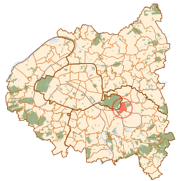
Location of Joinville-le-Pont  | |
 Joinville-le-Pont  Joinville-le-Pont | |
| Coordinates: 48°49′17″N 2°28′22″E | |
| Country | France |
| Region | Île-de-France |
| Department | Val-de-Marne |
| Arrondissement | Nogent-sur-Marne |
| Canton | Charenton-le-Pont |
| Intercommunality | Grand Paris |
| Government | |
| • Mayor (2020–2026) | Olivier Dosne[1] |
| Area 1 | 2.42 km2 (0.93 sq mi) |
| Population | 19,652 |
| • Density | 8,100/km2 (21,000/sq mi) |
| Time zone | UTC+01:00 (CET) |
| • Summer (DST) | UTC+02:00 (CEST) |
| INSEE/Postal code | 94042 /94340 |
| Elevation | 33–61 m (108–200 ft) |
| 1 French Land Register data, which excludes lakes, ponds, glaciers > 1 km2 (0.386 sq mi or 247 acres) and river estuaries. | |
History
The commune was created in 1791 under the name La Branche-du-Pont-de-Saint-Maur (literally "The Branch of Saint-Maur's Bridge") by detaching its territory from the commune of Saint-Maur-des-Fossés. The commune was renamed Joinville-le-Pont (literally "Joinville the Bridge") on 29 August 1831. Under Louis-Philippe of France, the Redoute de Gravelle was built in the commune.
In 1929, the commune of Joinville-le-Pont lost more than a third of its territory when the city of Paris annexed the Bois de Vincennes, a part of which belonged to Joinville-le-Pont.
Geography
Climate
Joinville-le-Pont has a oceanic climate (Köppen climate classification Cfb). The average annual temperature in Joinville-le-Pont is 12.9 °C (55.2 °F). The average annual rainfall is 654.0 mm (25.75 in) with December as the wettest month. The temperatures are highest on average in July, at around 21.3 °C (70.3 °F), and lowest in January, at around 5.2 °C (41.4 °F). The highest temperature ever recorded in Joinville-le-Pont was 42.5 °C (108.5 °F) on 25 July 2019; the coldest temperature ever recorded was −15.6 °C (3.9 °F) on 17 January 1985.
| Climate data for Joinville-le-Pont (1991−2020 normals, extremes 1981-present) | |||||||||||||
|---|---|---|---|---|---|---|---|---|---|---|---|---|---|
| Month | Jan | Feb | Mar | Apr | May | Jun | Jul | Aug | Sep | Oct | Nov | Dec | Year |
| Record high °C (°F) | 17.3 (63.1) |
22.5 (72.5) |
27.5 (81.5) |
31.0 (87.8) |
33.4 (92.1) |
38.9 (102.0) |
42.5 (108.5) |
41.0 (105.8) |
35.5 (95.9) |
31.0 (87.8) |
22.5 (72.5) |
17.2 (63.0) |
42.5 (108.5) |
| Average high °C (°F) | 7.9 (46.2) |
9.5 (49.1) |
13.7 (56.7) |
17.6 (63.7) |
21.0 (69.8) |
24.3 (75.7) |
26.8 (80.2) |
26.5 (79.7) |
22.5 (72.5) |
17.4 (63.3) |
11.7 (53.1) |
8.1 (46.6) |
17.3 (63.1) |
| Daily mean °C (°F) | 5.2 (41.4) |
6.0 (42.8) |
9.2 (48.6) |
12.4 (54.3) |
15.8 (60.4) |
19.1 (66.4) |
21.3 (70.3) |
21.1 (70.0) |
17.4 (63.3) |
13.3 (55.9) |
8.7 (47.7) |
5.6 (42.1) |
12.9 (55.2) |
| Average low °C (°F) | 2.5 (36.5) |
2.5 (36.5) |
4.7 (40.5) |
7.1 (44.8) |
10.6 (51.1) |
13.9 (57.0) |
15.8 (60.4) |
15.6 (60.1) |
12.4 (54.3) |
9.3 (48.7) |
5.6 (42.1) |
3.1 (37.6) |
8.6 (47.5) |
| Record low °C (°F) | −15.6 (3.9) |
−12.1 (10.2) |
−6.6 (20.1) |
−2.5 (27.5) |
1.0 (33.8) |
4.8 (40.6) |
7.5 (45.5) |
6.8 (44.2) |
4.0 (39.2) |
−1.0 (30.2) |
−6.8 (19.8) |
−9.5 (14.9) |
−15.6 (3.9) |
| Average precipitation mm (inches) | 52.0 (2.05) |
47.1 (1.85) |
46.3 (1.82) |
45.4 (1.79) |
62.9 (2.48) |
54.2 (2.13) |
59.1 (2.33) |
55.9 (2.20) |
49.9 (1.96) |
56.2 (2.21) |
59.2 (2.33) |
65.8 (2.59) |
654.0 (25.75) |
| Average precipitation days (≥ 1.0 mm) | 11.7 | 10.7 | 10.2 | 9.2 | 9.2 | 9.0 | 7.7 | 8.2 | 7.9 | 10.2 | 11.3 | 12.5 | 118.0 |
| Source: Météo-France[3] | |||||||||||||
Transport
Joinville-le-Pont is served by Joinville-le-Pont station on Paris RER line A.
Population
| Year | Pop. | ±% p.a. |
|---|---|---|
| 1968 | 17,467 | — |
| 1975 | 17,608 | +0.11% |
| 1982 | 16,934 | −0.56% |
| 1990 | 16,657 | −0.21% |
| 1999 | 17,117 | +0.30% |
| 2007 | 17,303 | +0.14% |
| 2012 | 18,020 | +0.82% |
| 2017 | 19,133 | +1.21% |
| Source: INSEE[4] | ||
Education
Public schools include:
- Preschools/nurseries (maternelles): Centre, Jean de la Fontaine, Polangis, P’tit Gibus[5]
- Elementaries: Palissy, Parangon, Polangis, and Eugène Voisin[6]
- Junior high schools (collèges): Jean Charcot and Jules Ferry[7]
There is a private school, Groupe Scolaire A.P.E.P., which runs from preschool to senior high school/sixth-form college (lycée).[8]
See also
References
- "Répertoire national des élus: les maires" (in French). data.gouv.fr, Plateforme ouverte des données publiques françaises. 13 September 2022.
- "Populations légales 2019". The National Institute of Statistics and Economic Studies. 29 December 2021.
- "Fiche Climatologique Statistiques 1991-2020 et records" (PDF). Météo-France. Retrieved August 24, 2022.
- Population en historique depuis 1968, INSEE
- "Écoles maternelles." Joinville-le-Pont. Retrieved on September 10, 2016.
- "Écoles élémentaires." Joinville-le-Pont. Retrieved on September 10, 2016.
- "Collèges." Joinville-le-Pont. Retrieved on September 10, 2016.
- "Établissements privés." Joinville-le-Pont. Retrieved on September 10, 2016.
External links
- Home page (in French)
Authority control | |
|---|---|
| General | |
| National libraries | |
| Other | |
This Val-de-Marne geographical article is a stub. You can help Wikipedia by expanding it. |
На других языках
[de] Joinville-le-Pont
Joinville-le-Pont (kurz Joinville genannt) ist eine französische Stadt mit 19.652 Einwohnern (Stand 1. Januar 2019) im Département Val-de-Marne in der Region Île-de-France. Die Einwohner werden Joinvillais genannt.- [en] Joinville-le-Pont
[fr] Joinville-le-Pont
Joinville-le-Pont est une commune française située dans le département du Val-de-Marne en région Île-de-France. La commune est créée en 1790, par démembrement de l’ancienne paroisse de Saint-Maur (actuellement Saint-Maur-des-Fossés), sous le nom de La Branche-du-Pont-de-Saint-Maur, avant d'être renommée Joinville-le-Pont en 1831.Другой контент может иметь иную лицензию. Перед использованием материалов сайта WikiSort.org внимательно изучите правила лицензирования конкретных элементов наполнения сайта.
WikiSort.org - проект по пересортировке и дополнению контента Википедии