world.wikisort.org - France
Barbery (French pronunciation: [baʁbəʁi] (![]() listen)) is a commune in the Calvados department in the Normandy region of north-western France.[2]
listen)) is a commune in the Calvados department in the Normandy region of north-western France.[2]
Barbery | |
|---|---|
Commune | |
 The old Cistercian Abbey of Notre-Dame | |
 Coat of arms | |
Location of Barbery  | |
 Barbery  Barbery | |
| Coordinates: 49°00′38″N 0°21′09″W | |
| Country | France |
| Region | Normandy |
| Department | Calvados |
| Arrondissement | Caen |
| Canton | Le Hom |
| Intercommunality | Cingal-Suisse Normande |
| Government | |
| • Mayor (2020–2026) | Guy Pislard |
| Area 1 | 8.6 km2 (3.3 sq mi) |
| Population | 824 |
| • Density | 96/km2 (250/sq mi) |
| Time zone | UTC+01:00 (CET) |
| • Summer (DST) | UTC+02:00 (CEST) |
| INSEE/Postal code | 14039 /14220 |
| Elevation | 77–193 m (253–633 ft) (avg. 285 m or 935 ft) |
| 1 French Land Register data, which excludes lakes, ponds, glaciers > 1 km2 (0.386 sq mi or 247 acres) and river estuaries. | |
The inhabitants of the commune are known as Barberigeois or Barberigeoises.[3]
Geography

Barbery is located some 18 km south by south-east of Caen and 10 km east by north-east of Thury-Harcourt. Access to the commune is by the D131 road from Croisilles in the south-west which passes through the heart of the commune and the village before continuing north-east to Urville. The D23 comes from Cesny-Bois-Halbout in the south and passes through the village before continuing north to join Route nationale N158 at Saint-Aignan-de-Cramesnil. The D156A goes south-east from the village to Moulines. The D237 branches off the D131 in the east of the commune and goes south-east to join the D167 east of the commune. Apart from the village there are the hamlets of L'Abbaye, Faverolles, Le Londel, and Le Mesnil Touffray. The commune is entirely farmland.[4][5]
The Ruisseau du Val Clair rises north of the village and flows north to join the Laize at Bretteville-sur-Laize. The Ruisseau de Corneville also rises north of the village, east of the Ruisseau du Val Clair, and flows north to join the Laize at Les Écluses.[4]
Neighbouring communes and villages[4] | |
|---|---|
History
During early medieval times Barbery and its abbey were under the control of the de Livet family.[6]
Barbery appears as Barbery on the 1750 Cassini Map[7] and the same on the 1790 version.[8]
Heraldry
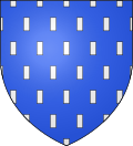 |
Blazon: Azure, semy of billety Argent.
|
Administration
This list is incomplete; you can help by adding missing items. (April 2021) |
List of Successive Mayors[9]
| From | To | Name |
|---|---|---|
| 1997 | 2001 | Ferdinand Lecouvey |
| 2001 | 2014 | Alain Crocqueville |
| 2014 | 2026 | Guy Pislard |
Demography
In 2017 the commune had 825 inhabitants.
|
| ||||||||||||||||||||||||||||||||||||||||||||||||||||||||||||||||||||||||||||||||||||||||||||||||||||||||||||||||||
| Source: EHESS[10] and INSEE[11] | |||||||||||||||||||||||||||||||||||||||||||||||||||||||||||||||||||||||||||||||||||||||||||||||||||||||||||||||||||
Culture and heritage
Civil heritage
The commune has many buildings and sites that are registered as historical monuments:
- The Petite-Abbaye Industrial Cheese Factory (20th century)
 [12]
[12] - Farmhouses (19th century)[13]
- A Chateau at Mesnil-Aumont (18th century)[14]
- A Manor/Chateau at Mesnil-Touffray (15th century)[15]
- The Old Abbey Manor at Faverolles (12th century)[16]
Religious heritage

The commune has several religious buildings and structures that are registered as historical monuments:
- The old Cistercian Abbey of Notre-Dame of Barbery (12th century) founded by Robert Marmion in 1181.[17]
- The Parish Church of Saint Peter (13th century).[18] The Church contains many items that are registered as historical objects:
- A Presbytery (18th century)[25]
- The Parish Church of Saint Martin at Mesnil-Touffray (13th century).[26] The Church contains many items that are registered as historical objects:
See also
References
- "Populations légales 2019". The National Institute of Statistics and Economic Studies. 29 December 2021.
- INSEE commune file
- Inhabitants of Calvados (in French)
- Barbery on Google Maps
- Barbery on the Géoportail from National Geographic Institute (IGN) website (in French)
- Mémoires By Société des antiquaires de Normandie, 1837
- Barbery on the 1750 Cassini Map
- Barbery on the 1790 Cassini Map
- List of Mayors of France (in French)
- Des villages de Cassini aux communes d'aujourd'hui: Commune data sheet Barbery, EHESS. (in French)
- Population en historique depuis 1968, INSEE
- Ministry of Culture, Mérimée IA00051643 Petite-Abbaye Industrial Cheese Factory (in French)
- Ministry of Culture, Mérimée IA00000144 Farmhouse/Mill at Moulin de Roinet IA00000143 Farmhouse at La Giblonnière IA00000142 Farmhouse at Le Tremblay IA00000141 Chateau Farmhouse at Mesnil-Aumont IA00000136 Louvre Farmhouse IA00000132 Houses and Farms (in French)
- Ministry of Culture, Mérimée IA00000140 Chateau at Mesnil-Aumont (in French)
- Ministry of Culture, Mérimée IA00000138 Manor/Chateau at Mesnil-Touffray (in French)
- Ministry of Culture, Mérimée IA00000134 Old Abbey Manor at Faverolles (in French)
- Nichols, John (1786). Some account of the alien priories, and of such lands as they are known to have possessed in England and Wales. London: J. Nichols.
- Ministry of Culture, Mérimée IA00000137 Parish Church of Saint Peter (in French)
- Ministry of Culture, Palissy IM14000960 Virgin and child (No. 2) IM14000959 Saint Benoît IM14000958 Virgin and child (No. 1) (in French)
- Ministry of Culture, Palissy IM14000957 Green Sofa, Armchair, and 2 Chairs (in French)
- Ministry of Culture, Palissy IM14000956 Stoup (in French)
- Ministry of Culture, Palissy IM14000955 Baptismal font (in French)
- Ministry of Culture, Palissy IM14000954 Altar and Tabernacle (in French)
- Ministry of Culture, Palissy IM14000953 4 Stained glass windows (in French)
- Ministry of Culture, Mérimée IA00000135 Presbytery (in French)
- Ministry of Culture, Mérimée IA00000139 Cistercian Parish Church of Saint Martin at Mesnil-Touffray (in French)
- Ministry of Culture, Palissy PM14000037 Virgin and child IM14000972 Nicolas Poret IM14000971 Virgin and child (in French)
- Ministry of Culture, Palissy IM14000970 Pulpit (in French)
- Ministry of Culture, Palissy IM14000968 Baptismal font (in French)
- Ministry of Culture, Palissy IM14000967 Altar, Tabernacle, and Retable (in French)
- Ministry of Culture, Palissy IM14000965 Gauquelin Family (2) IM14000964 Poret Family (3) IM14000963 Clacy Family IM14000962 Charles de Lalongny(in French)
- Ministry of Culture, Palissy IM14000961 Monument to Charles de Lalongny (in French)
На других языках
[de] Barbery (Calvados)
Vorlage:Infobox Gemeinde in Frankreich/Wartung/abweichendes Wappen in Wikidata- [en] Barbery, Calvados
[ru] Барбери (Кальвадос)
Барбери́ (фр. Barbery) — коммуна во Франции, находится в регионе Нижняя Нормандия. Департамент коммуны — Кальвадос. Входит в состав кантона Бретвиль-сюр-Лез. Округ коммуны — Кан.Другой контент может иметь иную лицензию. Перед использованием материалов сайта WikiSort.org внимательно изучите правила лицензирования конкретных элементов наполнения сайта.
WikiSort.org - проект по пересортировке и дополнению контента Википедии