world.wikisort.org - Croatia
Beli Manastir is a town in eastern Croatia. It is the principal town of the Croatian part of Baranja, located in the Osijek-Baranja County.
Beli Manastir | |
|---|---|
Town | |
| Grad Beli Manastir Town of Beli Manastir | |
      Beli Manastir | |
 Coat of arms | |
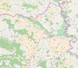 Beli Manastir Location of Beli Manastir in Croatia  Beli Manastir Beli Manastir (Croatia) Beli Manastir Beli Manastir (Europe) | |
| Coordinates: 45°46′N 18°36′E | |
| Country | |
| Region | Baranya (Podunavlje) |
| County | |
| Government | |
| • Mayor | Tomislav Rob (HDZ) |
| • City Council | 15 members |
| Area | |
| • Town | 55 km2 (21 sq mi) |
| Elevation | 100 m (300 ft) |
| Population (2011)[1] | |
| • Town | 10,068 |
| • Urban | 8,049 |
| Time zone | UTC+1 (CET) |
| • Summer (DST) | UTC+2 (CEST) |
| Postal code | 31300 Beli Manastir |
| Area code(s) | (+385) 31 |
Name
The name means "white monastery" in Serbo-Croatian. Originally called Monoštor, the current name was adopted in 1923. It is also known as Pélmonostor in Hungarian, and Manoster in German.
Other names formerly used for the town were: Pél, Bell, and Monostor. All names are connected with monasteries that existed in history at this location. The first monastery was built in the 9th century during the rule of Slavic duke Kocelj but was later razed, and all that remained of it was pil (obelisk in English), hence the later Hungarian name Pél, which was a version of the Slavic word.
History
This section does not cite any sources. (December 2016) |
In the 9th century, this area was part of the Slavic Principality of Lower Pannonia and a Slavic monastery was situated here. The monastery was founded during the visit of Cyril and Methodius, who spread Christianity among Slavs. After Methodius died, his students were expelled and the monastery was razed.
After the arrival of the Hungarians in the 10th century, this area was included in the newly founded Hungarian state and the settlement was built at this locality. The town was first mentioned in 1212 under name Pél. During Hungarian administration, another monastery was built here (in the 13th century), but it was destroyed by the Mongols in 1241. It was later rebuilt, but was again destroyed during the Ottoman conquest in the 16th century. Between 11th and 16th centuries, the area administratively belonged to the Baranya county.
In the 16th–17th century, the area was part of the Ottoman Empire and administratively belonged to the Sanjak of Mohaç. Since the end of the 17th century, the area was part of the Habsburg monarchy and administratively belonged to the Baranya county, which was part of the Habsburg Kingdom of Hungary.
Until the end of World War II, the Inhabitants was Danube Swabians, also called locally as Stifolder, because there Ancestors once came around 1720 from Fulda (district).[2] Mostly of the former German Settlers was expelled to Allied-occupied Germany and Allied-occupied Austria in 1945-1948, about the Potsdam Agreement.[3]
Since 1918, the town was part of the Kingdom of Serbs, Croats and Slovenes (later renamed to Yugoslavia). From 1918 to 1922, it was part of the Novi Sad county, from 1922 to 1929 part of the Bačka Oblast, and from 1929 to 1941 part of the Danube Banovina. From 1941 to 1944, it was occupied by Hungary and was administratively included into Baranya county. It was returned to Yugoslav control in 1944 and was administratively part of Vojvodina until 1945, when it was transferred to the People's Republic of Croatia.
During the Croatian War of Independence (1991–1995), Beli Manastir was occupied by Serbian paramilitaries and incorporated along with some other towns into the Republic of Serbian Krajina. It was returned to Croatian control after the war, following the short period of UN administration (1996–1998). Beli Manastir is an underdeveloped municipality which is statistically classified as the First Category Area of Special State Concern by the Government of Croatia.[4]
Town of Beli Manastir
Geography
The Town of Beli Manastir is composed of 4 settlements:[1]
- Beli Manastir, population 8,049
- Branjin Vrh, population 993
- Šećerana, population 540
- Šumarina, population 486
Demographics
1910
According to the 1910 census, the town had 2,447 inhabitants, of which:[5]
- Germans – 1,496 (61.1%)
- Serbs – 478 (19.5%)
- Hungarians – 443 (18.1%)
- Croats – 6 (0.24%)
- others – 24 (0.98%)
1929
In 1929 the population was made of:
- Hungarians – 33.8%
- Germans – 32.6%
- Croats – 18.8%
- Serbs – 12%
1981
53,409 total
- Croats – 19,136 (35.83%)
- Serbs – 12,857 (24.07%)
- Hungarians – 9,920 (18.57%)
- Yugoslavs – 8,850 (16.57%)
- Slovenes – 353 (0.66%)
- Montenegrins – 276 (0.52%)
- Romani – 262 (0.49%)
- Muslims – 82 (0.15%)
- Albanians – 56 (0.11%)
- Macedonians – 45 (0.08%)
2001
The town had a population of 8,671, while total municipality population was 10,986. Ethnic composition of Beli Manastir municipality by 2001 census was:[6]
- Croats = 6,085 (55.39%)
- Serbs = 2,920 (26.58%)
- Hungarians = 933 (8.49%)
- Romani = 153 (1.39%)
- Germans = 122 (1.11%)
Buildings and structures
In 1966, a broadcasting mast standing 202 metres high was erected.[7]
Economy
Beli Manastir is home to the STARCO Beli steel wheel factory.
Beli Manastir (settlement)
Parts of settlement (hamlets)
Beli Manastir, Beli Manastir-Planina, Haljevo and Palača. Till 1991. part of settlement was also Sudaraž which is now independent settlement.
Population
| population | 1393 | 1532 | 1475 | 1584 | 1612 | 2306 | 2892 | 3093 | 3191 | 3520 | 4804 | 7206 | 9118 | 10146 | 8671 | 8049 |
| 1857 | 1869 | 1880 | 1890 | 1900 | 1910 | 1921 | 1931 | 1948 | 1953 | 1961 | 1971 | 1981 | 1991 | 2001 | 2011 |
Ethnic composition, 1991. census
| Beli Manastir |
|---|
| 1991 |
total: 10,146 Serbs 3,770 (37.15%) Croats 3,262 (32.15%) Yugoslavs 1,303 (12.84%) Hungarians 865 (8.52%) Montenegrins 146 (1.43%) Germans 86 (0.84%) Slovenes 78 (0.76%) Muslims by nat. 58 (0.57%) Albanians 55 (0.54%) Slovaks 18 (0.17%) Roma 11 (0.10%) Macedonians 10 (0.09%) Ukrainians 9 (0.08%) Romanians 8 (0.07%) Czechs 5 (0.04%) Russians 5 (0.04%) Poles 4 (0.03%) Bulgarians 2 (0.01%) Ruthenians 2 (0.01%) Greeks 1 (0.00%) Italians 1 (0.00%) others 11 (0.10%) ethnically undecl. 369 (3.63%) regionally declared 11 (0.10%) unknown 56 (0.55%)
|
Austria-Hungary 1910. census
| Beli Manastir | |
|---|---|
| Population by ethnicity | Population by religion |
total: 2,447 Germans 1,496 (61.1%) Serbs 478 (19.53%) Hungarians 443 (18.10%) Croats 6 (0.24%) others 24 (0.98%)
|
total: 2,447 Roman Catholics 1,871 (76.46%) Eastern Orthodox 478 (19.53%) Lutherans 40 (1.63%) Jewish 34 (1.38%) Calvinists 21 (0.85%) Eastern Catholics 2 (0.08%) Unitarians 1 (0.04%)
|
- In 1910. census together with settlement Sudaraž.
See also
- Osijek-Baranja County
- Baranya
- Baranya County (former)
References
- "Population by Age and Sex, by Settlements, 2011 Census: Beli Manastir". Census of Population, Households and Dwellings 2011. Zagreb: Croatian Bureau of Statistics. December 2012.
- https://www.feked.hu/etc/Stifolder_tortenet.pdf. [bare URL PDF]
- "Die Vertreibung – Landsmannschaft der Deutschen aus Ungarn".
- Lovrinčević, Željko; Davor, Mikulić; Budak, Jelena (June 2004). "Areas of Special State Concern in Croatia - Regional Development Differences and the Educational Characteristics". Ekonomski pregled, Vol.55 No.5-6. Archived from the original on 18 August 2018. Retrieved 25 August 2018.
- "Talma Kiadó". Talmakiado.hu. Archived from the original on 14 January 2017. Retrieved 22 December 2016.
- "SAS Output". Dzs.hr. Retrieved 22 December 2016.
- Nicolas Janberg (22 July 2014). "Beli Manastir TV Tower (Beli Manastir, 1966) | Structurae". En.structurae.de. Retrieved 22 December 2016.
- Naselja i stanovništvo Republike Hrvatske 1857.-2001., www.dzs.hr Archived 5 May 2012 at the Wayback Machine
Literature
- Book: "Narodnosni i vjerski sastav stanovništva Hrvatske, 1880–1991: po naseljima, autor: Jakov Gelo, izdavač: Državni zavod za statistiku Republike Hrvatske, 1998., ISBN 953-6667-07-X, ISBN 978-953-6667-07-9;
External links
| Wikimedia Commons has media related to Beli Manastir. |
Subdivisions of Osijek-Baranja County | ||
|---|---|---|
| Cities and towns |  | |
| Municipalities |
| |
Cities and towns of Croatia by population | ||
|---|---|---|
| 100,000+ |  | |
| 35,000+ | ||
| 10,000+ |
| |
Authority control | |
|---|---|
| General |
|
| National libraries | |
На других языках
[de] Beli Manastir
Beli Manastir (ungarisch Pélmonostor, serbisch-kyrillisch Бели Манастир) ist eine Stadt in der kroatischen Region Baranja. Sie zählt 6.525 Einwohner (Stand: 2021) und gehört zur Gespanschaft Osijek-Baranja.- [en] Beli Manastir
[es] Beli Manastir
Beli Manastir (en húngaro, Pélmonostor) es una ciudad ubicada al este de Croacia en el Condado de Osijek-Baranya, cerca del límite con Hungría.[ru] Бели-Манастир
Бе́ли-Манасти́р (хорв. Beli Manastir, венг. Pélmonostor) — город в восточной части Хорватии. Расположен в Славонии, в регионе Баранья, в непосредственной близости от границ с Венгрией (на север от города) и Сербией (на восток).Другой контент может иметь иную лицензию. Перед использованием материалов сайта WikiSort.org внимательно изучите правила лицензирования конкретных элементов наполнения сайта.
WikiSort.org - проект по пересортировке и дополнению контента Википедии