world.wikisort.org - Croatia
Petlovac (Hungarian: Baranyaszentistván, German: Sanktivan, Serbian Cyrillic: Петловац)[3] is a village and municipality in the western part of Baranja, which comprise the northern part of Osijek-Baranja County in Croatia. Petlovac is underdeveloped municipality which is statistically classified as the First Category Area of Special State Concern by the Government of Croatia.[4]
Petlovac | |
|---|---|
Municipality | |
| Municipality of Petlovac Općina Petlovac | |
 | |
 Flag  Coat of arms | |
 Petlovac Location of Petlovac in Croatia  Petlovac Petlovac (Croatia) Petlovac Petlovac (Europe) | |
| Coordinates: 45°45′31″N 18°31′41″E | |
| Country | |
| County | |
| Government | |
| • Municipal mayor | Milan Knežević |
| Area | |
| • Total | 93.31 km2 (36.03 sq mi) |
| Elevation | 90 m (300 ft) |
| Population (2011 census) | |
| • Total | 2,405[2] |
| Time zone | UTC+1 (CET) |
| • Summer (DST) | UTC+2 (CEST) |
| Postal codes | 31321 Petlovac |
| Area code(s) | (+385) 31 |
Until the end of World War II, the majority of the Inhabitants was Danube Swabians, also called locally as Stifolder, because there Ancestors once came at the 17th century and 18th century from Fulda (district).[5] Mostly of the former German Settlers was expelled to Allied-occupied Germany and Allied-occupied Austria in 1945-1948, about the Potsdam Agreement.[6]
Name
Its name derived from the word "petao" (which means "rooster" in English).
Municipality of Petlovac
Population
| population | 3734 | 4328 | 4181 | 4294 | 4784 | 4803 | 4605 | 4765 | 5607 | 5153 | 5303 | 4930 | 3949 | 3785 | 2743 | 2405 |
| 1857 | 1869 | 1880 | 1890 | 1900 | 1910 | 1921 | 1931 | 1948 | 1953 | 1961 | 1971 | 1981 | 1991 | 2001 | 2011 |
Municipality of Petlovac has 2,405 inhabitants (2011 census), including:
- 73.22% Croats
- 13.72% Hungarians
- 5.07% Serbs
- 4.53% Romani
Geography
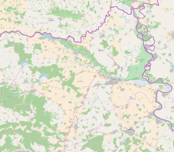
It is located between border with Hungary in the north-west, Baranja municipalities of Beli Manastir and Jagodnjak in the east and Slavonia region in the south-west.
The municipality of Petlovac include following settlements:
- Petlovac
- Baranjsko Petrovo Selo
- Luč
- Novi Bezdan
- Novo Nevesinje
- Sudaraž
- Širine
- Torjanci
- Zeleno Polje
Petlovac (settlement)
History
Till 1991. part of settlement was Zeleno Polje which is now independent settlement.
Population
| population | 820 | 864 | 846 | 882 | 927 | 962 | 1196 | 1244 | 869 | 906 | 1167 | 1000 | 940 | 1012 | 801 | 714 |
| 1857 | 1869 | 1880 | 1890 | 1900 | 1910 | 1921 | 1931 | 1948 | 1953 | 1961 | 1971 | 1981 | 1991 | 2001 | 2011 |
Ethnic composition, 1991. census
| Petlovac |
|---|
| 1991 |
total: 1,012 Croats 843 (83.30%) Serbs 51 (5.03%) Yugoslavs 37 (3.65%) Hungarians 25 (2.47%) Slovenes 11 (1.08%) Montenegrins 7 (0.69%) Germans 5 (0.49%) ethnic Muslims 1 (0.09%) ethnically undeclared 15 (1.48%) unknown 17 (1.67%)
|
Austria-Hungary 1910. census
| Petlovac | |
|---|---|
| Population by ethnicity | Population by religion |
total: 962 Germans 927 (96.36%) Hungarians 28 (2.91%) Serbs 4 (0.41%) others 3 (0.31%)
|
total: 962 Roman Catholics 944 (98.12%) jewish 10 (1.03%) eastern orthodox 5 (0.51%) calvinists 3 (0.31%)
|
- In 1910. census together with settlement Zeleno Polje.
References
- "Općine na područjima posebne državne skrbi Republike Hrvatske" (PDF). Croatian Chamber of Economy. Retrieved 15 April 2020.
- "Population by Ethnicity, by Towns/Municipalities, 2011 Census: County of Osijek-Baranja". Census of Population, Households and Dwellings 2011. Zagreb: Croatian Bureau of Statistics. December 2012.
- "Archived copy" (PDF). Archived from the original (PDF) on 29 October 2013. Retrieved 8 March 2013.
{{cite web}}: CS1 maint: archived copy as title (link) - Lovrinčević, Željko; Davor, Mikulić; Budak, Jelena (June 2004). "AREAS OF SPECIAL STATE CONCERN IN CROATIA- REGIONAL DEVELOPMENT DIFFERENCES AND THE DEMOGRAPHIC AND EDUCATIONAL CHARACTERISTICS". Ekonomski pregled, Vol.55 No.5-6. Archived from the original on 18 August 2018. Retrieved 25 August 2018.
- https://www.feked.hu/etc/Stifolder_tortenet.pdf. [bare URL PDF]
- "Die Vertreibung – Landsmannschaft der Deutschen aus Ungarn".
- Naselja i stanovništvo Republike Hrvatske 1857.-2001., www.dzs.hr
- Naselja i stanovništvo Republike Hrvatske 1857.-2001., www.dzs.hr
Literature
- Book: "Narodnosni i vjerski sastav stanovništva Hrvatske, 1880–1991: po naseljima, autor: Jakov Gelo, izdavač: Državni zavod za statistiku Republike Hrvatske, 1998., ISBN 953-6667-07-X, ISBN 978-953-6667-07-9;
Subdivisions of Osijek-Baranja County | ||
|---|---|---|
| Cities and towns |
|  |
| Municipalities |
| |
This Osijek-Baranja County geography article is a stub. You can help Wikipedia by expanding it. |
Другой контент может иметь иную лицензию. Перед использованием материалов сайта WikiSort.org внимательно изучите правила лицензирования конкретных элементов наполнения сайта.
WikiSort.org - проект по пересортировке и дополнению контента Википедии